CFHC Talkback For News Story #59:
Newest Talkback: 05:38 PM 07-25 EDT

Goes M Is Up
08:15 AM EDT - 23 July 2001

Yesterday the new GOES M satellite was launched, which is the last of that "generation" satellite, which will help track storms across the globe. Find out more on the
GOES Web Site.

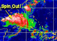
This weekend we had a little rain. Which is chipping away at our drought conditions, and actually start to get our lakes back up. This stalled front, though caused a low to develop west of us. But the conditions were (and still are not) favorible for development.

It didn't stop it from trying, however, and the west coast had a windy day and plenty of rain.

Spinout
I don't see it becoming anything.

Development Potential for Gulf Low
(forget it) 0 1 2 3 4 5 6 7 8 9 10 (sure thing)
           [--*-------------------]

Otherwise, not much happening, and I'm still going for the no named storms in July goal.

NRL Monterey Marine Meteorology Division Forecast Track of Active Systems (Good Forecast Track Graphic and Satellite Photos)

NASA GHCC Interactive Satellite images at:
[NAtl visible] (visible -- Daytime Only) [NAtl infrared] (infrared), and [NAtl water vapor] (water vapor)--Nasa source.
Defiant Visible Infrared More...
Other commentary at: Mike Anderson's East Coast Tropical Weather Center - Accuweather's Joe Bastardi - SCOTTSVB's Hurricane Update Center - Jim Williams' Hurricane City - Gary Gray's Millennium Weather - Even More on our Links Page

Some Forecast models: (NGM, AVN, MRF, ECMWF, ETA)
DoD weather models (NOGAPS, AVN, MRF)
AVN, ECMWF, GFDL, NOGAPS, UKMET

- [jc]


Show All Comments

Displaying Talkbacks #1 - #137 (of 137 total)

maybe further west? (#1)
Posted by: Shawn Location: houston,tx
Posted On 08:47AM 23-Jul-2001 with id (RPWNRQXNRSVNSV*)


now that the low around tampa has spun itself out,i have noticed storms are starting to build more in the central and western gulf.is there a chance of another surface low forming more to the west in the central or western gulf?it looks like there is still plenty of moisture left out there.

Tropical/ Non-Tropical Low (#2)
Posted by:
Colleen Location: Lakeland, FL
Posted On 10:21AM 23-Jul-2001 with id (RPUNQXXNQYUNQYS*)


Just one comment...yesterday's NHC discussion did say that the system off the west Florida coast is "non-tropical" as of right now, they also mentioned that it could take on tropical characteristics IF the system persisted. It did not say that it would never turn tropical.

Now...the question is this. We now have Test 95L (which is from this system) so we will have to wait and see what the 11:00am TWO says. The 8:00am TWD barely mentioned it. We will see what happens, if anything, within the next few hours.

Colleen :-)

Windy and Rainy (#3)
Posted by: Joe Location: St.Petersburg, FL
Posted On 11:02AM 23-Jul-2001 with id (RQVNSNQXRNQWP*)


Winds have been up this morning with sustained winds at 22 mph and gusts to 25 and 26 mph around 9 am this morning here at my house. Airports have had similar. Its also been rainy, as bands of showers move in. None the less good rains...

next TS (#4)
Posted by: scottsvb (
http://communities.msn.com/HURRICANEUPDATECENTER) Location: tampa
Posted On 11:12AM 23-Jul-2001 with id (QRNWWNQSXNQR*)


Well the system in the gulf has been
hamperd by it being a trough with means
it has no High pressure aloft to strengthen
the system. This wasnt a upper low or mid
level one to bring it to the surface casue
it already is. Anyways if it did this would
have been a TS as it will move up and into
N florida near Cedar key by Tues morning.
Expect heavy rains, thundershowers,but only
little lightning. Winds will be breezy but
not over 40 mph. There is though a small chance
for a tornado over W and SW florida today and
tonight.
The next depression should form Weds or Thurs
off africa and be a storm this weekend. 6/10
chance. scottsvb

Local Weather (#5)
Posted by:
Colleen Location: Lakeland, FL
Posted On 11:19AM 23-Jul-2001 with id (RPUNQXXNRPPNQTX*)


Well...whatever it is out there, it sure is giving us some good gusts of winds. It is now raining, so I assume that some of the bands have now reached our area. From the radar I saw before out of Miami/Naples area, the storms there are very strong with lots of rain, wind and lightning.

Strong wind gusts (#6)
Posted by: Joe Location: St.Petersburg, FL
Posted On 11:51AM 23-Jul-2001 with id (RQVNSNQXRNQWP*)


At 11:30am I had gusts around 30 mph and sustained near 25 mph. Lot of light to moderate rain blowing around. Some small branches and palm frons have broken around here. Elsewise plain old windy...Coastal flooding is also accuring....

hunch! (#7)
Posted by: Shawn Location: houston,tx
Posted On 11:58AM 23-Jul-2001 with id (RPWNRQXNRSWNQVW*)


i have a hunch we are not done with this whole mess in the gulf.i know 99.9% of you are gonna think i'm nuts for saying this but i think,just a gut feeling i have,that a new low may form a little west of the one we have now.now,i'm just going with a weird feeling i have so i'm sure i'll be dead wrong,but i got to go with it anyway.there is still way too much energy out there for this thing to go away quietly.

Shawn..... (#8)
Posted by:
Colleen Location: Lakeland, FL
Posted On 12:42PM 23-Jul-2001 with id (QURNQVSNQYTNQWY*)


who knows? You could be right or you could be wrong. That ranks you right up there with the rest of us. :-) Usually....your gut instincts are right. I will say this: I had this weird feeling while I was outside this morning, and I couldn't pin it down. Later on, I realized it was the same kinda feeling in the air that I had last year as the weak TS approached Tampa Bay. Same kind of weather, etc. Just weird. My thoughts are this: the NHC are keeping open the possibility that this could turn tropical, and I don't doubt their reasoning. Now..my question is this: could we be looking at a non-tropical system such as Allison out there that is only called at the last minute? I think that's a possibility. I don't know if that will happen or not. But it sure looks familiar.

Colleen

Winds getting stronger!!! (#9)
Posted by: Joe Location: St.Petersburg, FL
Posted On 12:48PM 23-Jul-2001 with id (RQVNSNQXRNQWP*)


The airports in pinellas are reporting sustained at 32 with a gusts of 42mph at st.pete. Cleawater sustained at 29 and gusting to 39mph. Here I'am reporting sustained at 30 mph and gusts just a bit higher than the sustained wind.

colleen (#10)
Posted by: Shawn Location: houston,tx
Posted On 12:56PM 23-Jul-2001 with id (RPWNRQXNRSTNQQU*)


thanks for not calling me stupid.i did notice a second ago when i looked at the latest satellite image that there does seem to be some sort of small rotation in the central gulf around 89 or 90w.take a look at it and see if you notice it too.i also noticed that if this is the case than it looks like we may have 3 different systems pulling moisture.there is the one that looks to be around the georgia coast that is pulling energy from the gulf;there's the one around your area;and there could be this one in the central gulf.if you notice there are three seperate trails of moisture,all going to each individual system.at least that is what i see with my four eyes anyway.what do you see?

Shawn... (#11)
Posted by:
Colleen Location: Lakeland, FL
Posted On 01:14PM 23-Jul-2001 with id (QURNQVSNQYTNQYW*)


First of all, I would never call anyone stupid for posting their thoughts. That's what the forum is here for..so don't be afraid to say whatever it is that's on your mind. Now..to the pix. Yes, I see what you're talking about. It doesn't appear that the NHC is going to classify this as tropical yet, and maybe never because it isn't really tropical. However...I just got this Breaking News Alert from a Tampa Bay news channel:

GULF BOULEVARD ECONOLODGE'S ROOF BLOWN OFF DUE TO HEAVY WINDS.

Can I ask this? How strong would winds have to be to blow off roofs? Pretty darn strong if you ask me. Also..I believe that they have closed Gulfshore Blvd because of coastal flooding. Hm. We'll see what happens.


Winds (#12)
Posted by: Joe Location: St.Petersburg, FL
Posted On 01:26PM 23-Jul-2001 with id (RQVNSNQXRNQWP*)


Very strong winds and yes they would have been strong to blow a roof off. Theses winds are very strong. I don't know but storms appear to be wrapping around the center again. I'am still keeping a close eye on it.

Pinellas County (#13)
Posted by: Cane Man
Posted On 01:28PM 23-Jul-2001 with id (RPXNUQNQQVNQTV*)


I live in Pinellas County and the winds with this appaer to be as strong as what we rec'd from hurricane Gordon last year. Quite an interesting system. Reports of flooding in many areas. Leaves stripped from trees, small signs knocked down as well as palm forms, small to mid size branches and leaves getting stripped off of trees.

www.nexrad.com (#14)
Posted by: Cane Man
Posted On 01:34PM 23-Jul-2001 with id (RPXNUQNQQVNQTV*)


Looks like on this sight that the low level circ is almost completely wrapped. When you go to that site scroll down to Tampa and you will see for yourself. Still wonder if this will get classified.

eastern gulf low-No Name 2001 (#15)
Posted by:
doug Location: tampa
Posted On 01:38PM 23-Jul-2001 with id (VUNSTNVTNQTR*)


the question is, from radar, is the low trying to close up? The latest and current Radar suggests it is located about 50 miles w of pasco county and it is closing off somewhat...Certainly we are currently experiencing no name 2001 in west central florida.

eastern gulf low-No Name 2001 (#16)
Posted by:
doug Location: tampa
Posted On 01:42PM 23-Jul-2001 with id (VUNSTNVTNQTR*)


the question is, from radar, is the low trying to close up? The latest and current Radar suggests it is located about 50 miles w of pasco county and it is closing off somewhat...Certainly we are currently experiencing no name 2001 in west central florida.

radar (#17)
Posted by:
Rich Byett (http://www.stormwarn2000.com) Location: Gloucester, England, UK
Posted On 01:43PM 23-Jul-2001 with id (RQSNQRRNSXNQV*)


Just checked the latest radar imagery for the region, and noticed that the circulation appears to be wrapping up to the northwest of Tampa, with a good strong band of storms to be found south and east of the centre, possibly wrapping around the north too. This could get very interesting soon!

where exactly is the center? (#18)
Posted by: Shawn Location: houston,tx
Posted On 01:47PM 23-Jul-2001 with id (RPWNRQXNRSTNQQU*)


i'm pretty much new at this so bear with me,but it looks to me that the center of this system on satellite seems to be swirling up further west than where it was last night.could someone who knows more about this than me verify exactly where you see the center actually forming;and from what you all say it IS forming.

Classify (#19)
Posted by: Cane Man
Posted On 01:47PM 23-Jul-2001 with id (RPXNUQNQQVNQTV*)


Give the amoutn of rain, winds and high surf, I believe it should be classified. In addition, looking at raar it is nearly 80% wrapped. Would at least let people to know to keep an eye out. What does everybody else think?

Circulation (#20)
Posted by: Bill Location: Crystal River,Fl.
Posted On 02:00PM 23-Jul-2001 with id (RTNYRNRWNSW*)


I dont believe it will be long before this is classified--the weather channell seems to be getting more concerned as of the 1:50 tropical report--The circulation is def. trying to close off.

Direction (#21)
Posted by: jimmy
Posted On 02:15PM 23-Jul-2001 with id (QVTNQQQNYSNXV*)


Where did TWC say this thing may be headed. It looks like it may be drifting a little west of due north. This will put it inland long before it can strengthen into a Storm. Also, looking at the Sat pics, and buoy data, there appears to be another circulation centered well south of Biloxi in the central Gulf. The bouys to the north show an east wind while those to the west show the northerly wind. The pressure is still real high, but that could change.

location (#22)
Posted by:
doug Location: tampa
Posted On 02:16PM 23-Jul-2001 with id (VUNSTNVTNQTR*)


Radar has changed quickly in the past hour...filling in near ocala and west...the returns from several sources suggest the location is about 50 milew w of the pasco-hernando line and a drift west is noted?

Agree (#23)
Posted by: Joe Location: St.Petersburg, FL
Posted On 02:18PM 23-Jul-2001 with id (RQVNSNQXRNVT*)


I think it should be this is got to a depression if not a storm with sustained winds near 33 mph with gusts near 40 mph here at my house in St.Petersburg. I can't belive it wasn't classified earlier. Heavy rain flooding are all going on with system as it now spins off the coast of Baypot in Hernando County. What are they waiting for, that is TPC. Tree branches, palm leaves, patio chairs, and potted plants being blow around and branches broken. We shall see....

where is center???? (#24)
Posted by: Nick Location: clearwater beach
Posted On 02:25PM 23-Jul-2001 with id (QURNQVSNQYTNQXY*)


someone tell us rookies where the center is?? thank you...keep up the good work everyone.

Center (#25)
Posted by: Joe Location: St.Petersburg, FL
Posted On 02:29PM 23-Jul-2001 with id (RQVNSNQXRNVT*)


Its just offshore from Bayport in Hernando County. I would say 30 or 40 miles offshore.

Watches/Warnings (#26)
Posted by:
Colleen Location: Lakeland, FL
Posted On 02:37PM 23-Jul-2001 with id (QURNQVSNQYTNQYY*)


They may have done this already, but honestly, I have not looked at the latest local wx forecasts. The least they should do is put up "high wind" advisories, in my opinion. I can almost understand the NHC's reasoning with not putting up Tropical-type warnings because of the fact that if they did and nothing happened, the public would be saying, "See? Nothing ever happens." I think that generally speaking, when people look at a TS warning, they think 'DANGER, DANGER' and when nothing more than a couple of strong wind gusts reach them...well, you know the rest. Anyway, that's my own opinion on why they might be hesitant to put up any warnings...yet.

Colleen ;-)

center?? (#27)
Posted by: Nick Location: clearwater beach
Posted On 02:38PM 23-Jul-2001 with id (QURNQVSNQYTNQXY*)


can you give coordinates


colleen (#28)
Posted by: cajun
Posted On 02:40PM 23-Jul-2001 with id (QRNTPNSPNQQV*)


Very well said colleen. I think that is good reasoning.

Center (#29)
Posted by: Joe Location: St.Petersburg, FL
Posted On 02:46PM 23-Jul-2001 with id (RQVNSNQXRNVT*)


I would say 83w and 28.5n. Thats my best guess.

Movement (#30)
Posted by: Bill Location: Crystal River,Fl.
Posted On 02:51PM 23-Jul-2001 with id (RTNYRNRWNSW*)


Is it moving at all? From radar it doesnt look like it is,if so very little!

Don't Look For..... (#31)
Posted by:
Colleen Location: Lakeland, FL
Posted On 02:53PM 23-Jul-2001 with id (QURNQVSNQYTNQYY*)


classification from NHC. I just read their TWD at 2:05pm, and although they talked more about it, they don't seem to be very concerned about it at all. As for the local forecasts, Miami, Jax and another one refer to this system as a "vertically stacked" low pressure area. No high wind warnings in effect at this time from any of them. Ok, fine then.

I know it's windy, you guys know it's windy. Do they know it's windy

Center (#32)
Posted by: Joe Location: St.Petersburg, FL
Posted On 02:53PM 23-Jul-2001 with id (RQVNSNQXRNVT*)


Tpc has it at 27n 83w

drought in Florida will now be flooding. (#33)
Posted by:
Rick Shade Location: Mobile/ AL
Posted On 02:55PM 23-Jul-2001 with id (QRNYVNRQRNSP*)


This thing will grow to at least tropical storm strength, and since it is floating out there...it may inundate Florida and the northern coast. What are the prevailing thoughts on where it might go? It looks like it is blossoming to me. I am no weather scientist...but I sure do think this could become an Allison. Whenever they don't reach hurricane strength...they tend to deposit LOTS of rain. I bet that's what this does. If it happens to stall out there...it could easily form into a hurricane...

I have seen them go from nothing to a three in less than a coupla days...

sooooo confused!!! (#34)
Posted by: Shawn Location: houston,tx
Posted On 03:09PM 23-Jul-2001 with id (RQVNQRNRRRNQRS*)


i'm confused!!! you all are saying the center is around 83w but i keep staring at the pix and it seems to me it is around 86 or 87w.i must not know near as much about weather as i thought i did.i'm glad you all do though so that i can continue to stay informed.all of you do a great job reporting.

Try Using the Visibles, Shawn (#35)
Posted by:
Colleen Location: Lakeland, FL
Posted On 03:16PM 23-Jul-2001 with id (QURNQVSNQYTNQYY*)


Sometimes it's easier to spot the center (especially with a storm like this) by watching the visible satellites instead of the IR. Write down the position that NHC has the center at, and try looking there. It usually works for me. Let me know if that helps any.....

Colleen :-)

This system (#36)
Posted by:
Mike C. (http://flhurricane.com) Location: Orlando, FL (Currently)
Posted On 03:19PM 23-Jul-2001 with id (VVNRPNQQXNYV*)


Aye, it's looking interesting, but still I don't think it'll have enough to become a proper tropical system. Still folks along the coast will want to watch the gustyness.

Our colocation provider is having problems with another server on the network hogging all the bandwidth. Sorry for the slowness again (packetloss high latency). Trying to get that resolved.

Shawn (#37)
Posted by: StormHound (
http://stormhound.homestead.com) Location: Orlando
Posted On 03:25PM 23-Jul-2001 with id (QRNSUNRRNQTP*)


This is a tough one to spot the center on because it is not well developed enough. The center on TD's tends to wander around sometimes. Often there can be more than one center, as this one seemed to have last night. If/when it strengthens closer to TS status, you'll be able to pick out the center pretty easily.

5pm classification? (#38)
Posted by: HankFrank Location: Aiken, SC
Posted On 03:37PM 23-Jul-2001 with id (RPTNQQVNQVNYT*)


i'm not sure why the nhc hasnt issued an update advisory making this thing into td 3 or barry. a closed low with no frontal association is just west of florida generating winds near gale force... that usually gets classified in a heartbeat. sure it isnt a very traditional looking symmetric system; does it have to be?
95L is causing such a ruckus that other areas are getting ignored.. looks like another little trough low is in the central gulf. watch to see if that sucker sticks around, cause it probably wont be moving a whole lot.

Agreed HankFrank (#39)
Posted by: Cane Man
Posted On 03:42PM 23-Jul-2001 with id (RPXNUQNQQVNQTV*)


It may not look pretty but the facts are the facts. As much trouble as this thing is causing it should be classified.

movement (#40)
Posted by:
doug Location: tampa
Posted On 03:48PM 23-Jul-2001 with id (VUNSTNVTNQTR*)


The whole mess is moving pretty deliberately N...the low is still open to the nw and w...
a secondary area appears to be effecting extreme sw fla and the east coast...thus the area effecting w central fla today seems to be sitting on the trough line and is moving along with it to the N? winds in TPA have definitely relaxed since 1:00p.m.

STORMY WEATHER (#41)
Posted by: ROBERT Location: WEST PALM BEACH, FL
Posted On 03:48PM 23-Jul-2001 with id (RPUNQXXNQYRNQXW*)


In the last hour,the Dade, Broward, and Palm Beach county areas have had 2 tornado warnings, 2 severe thunderstorm warnings, and a flood warning all issued. A STORMY DAY!!!!!

movement (#42)
Posted by:
doug Location: tampa
Posted On 03:49PM 23-Jul-2001 with id (VUNSTNVTNQTR*)


The whole mess is moving pretty deliberately N...the low is still open to the nw and w...
a secondary area appears to be effecting extreme sw fla and the east coast...thus the area effecting w central fla today seems to be sitting on the trough line and is moving along with it to the N? winds in TPA have definitely relaxed since 1:00p.m.

NHC/Local Weather Discussions/Forecasts, Etc. (#43)
Posted by:
Colleen Location: Lakeland, FL
Posted On 03:51PM 23-Jul-2001 with id (QURNQVSNQYTNQYY*)


Allright. I agree. This is just ridiculous. There are tree limbs down all around my house, on the road, flying through the air. Why not even a HIGH WIND ADVISORY? This is just sorry forecasting to me and there is no excuse for it.

BTW...check out the latest WV loops. Look at the huge "blob" of red. Or...is that the one system you were talking about, Hank?

ok (#44)
Posted by: scottsvb (
http://communities.msn.com/HURRICANEUPDATECENTER) Location: tampa
Posted On 03:53PM 23-Jul-2001 with id (QRNWWNQSXNQTS*)


well the system is easy still
for us meteorology people. Every
thing is happening in my previous
post.
When a system is weak like this and
its weak, many smaller swirls happen.
Now you might see a mid level low in the
gulf more w of the main 1009mb low
that is w of hernado county.
In any affect its not a tropical
system,but has tropical moisture.
The NHC can call it a subtropical
depression, but its not a normal one
since the strongest winds are not near
the center of the low. They are in the
feeder bands. Anyways it should draw
up north but a piece of energy may
stay behind with the mid level low
in the central gulf. Im glad I had
a chance to tell everyone the chance
of tornados before the weather channel
did to give ya some ahead warnings.
Expect the rain to be more concentrated
now from south to North thre tomorrow and
Tampa should still expect heavy rain bands
tomorrow, with some fair skys.

hank and colleen (#45)
Posted by: Shawn Location: houston,tx
Posted On 03:57PM 23-Jul-2001 with id (RPWNRQXNRQWNQUW*)


could the "big blob" in the central gulf that you both are referring to be the same thing i've been seeing all day?

nope (#46)
Posted by: scottsvb (
http://communities.msn.com/HURRICANEUPDATECENTER) Location: tampa
Posted On 04:00PM 23-Jul-2001 with id (QRNWWNQSXNQTS*)


nothing much there

Come On (#47)
Posted by: Joe Location: St.Petersburg, FL
Posted On 04:04PM 23-Jul-2001 with id (RQVNSNQXRNUW*)


They should make this a tropical system. Or a very least a subtropical depression. Just saw the weather channel tropical update and Hurricane expert was saying how it was taking on tropical Features except on the north side. Well they should call this something. If not call it the no name storm of 2001.

What "Meteorology" People? (#48)
Posted by:
Colleen Location: Lakeland, FL
Posted On 04:13PM 23-Jul-2001 with id (QURNQVSNQYTNQYY*)


Who here is a "meteorologist?" I'm not. But for crying out loud, I'm smart enough to know that when the winds are gusting over 45mph (as stated in the 2:35pm local Tampa discussion) that the least they should do is put up "high wind" advisories. We get those even with strong storms that do not have any features at all that are tropical in the winter. Gimme a break. I think the whole thing boils down to 1 simple fact: they are waiting for the models to tell them what it's gonna do, and the models don't know so we have nothing.

Just keep using your eyes.

2 lows (#49)
Posted by: jimmy
Posted On 04:25PM 23-Jul-2001 with id (QVTNQQQNYSNXV*)


Look at the bouy data. there are definitely two lows in the gulf. The bouys in the northeast gulf are under the influence on our current low. The bouys in the central and southeatern and northcentral are under the influence of another low. The pressures are dropping at all of the bouys in the central, southeast and northcentral gulf. This will be the focal point by tomorrow.

activity growing (#50)
Posted by:
Rick Shade Location: Mobile/ AL
Posted On 04:29PM 23-Jul-2001 with id (QRNYVNRQRNSP*)


good posts. I am quite the novice when i read everyone else's posts. But one thing for sure...both areas are exploding and a persistent thunderstorm activity is a prerequisite for development. Now the big question is whether it will all get taken over by a low more out into the gulf. It certainly could. and of course...being out in the open water...well, we all know....what are the SST's...? and is there a high pressure ridge on top? Are conditions favorable? I would think so....there was already a discussion earlier about good outflow in one area. I wouldn't be suprised if this thing suprises us all. Making a prediction is just a guess....
keep up the posts....I am learning more every year....

Yes, I've Noticed That.. (#51)
Posted by:
Colleen Location: Lakeland, FL
Posted On 04:30PM 23-Jul-2001 with id (QURNQVSNQYTNQYY*)


Thanks for pointing that out, Jimmy. Obviously, something is going on out there. Didn't we have SD-1 last year? I think I remember that very clearly because we didn't know what it meant. I'm pretty sure that was last year.

Colleen

Agree Colleen (#52)
Posted by: Joe Location: St.Petersburg, FL
Posted On 04:30PM 23-Jul-2001 with id (RQVNSNQXRNUW*)


A wind advisory should have been issued earlier today but winds have dropped down as of the 4 PM observations. But there where winds 25 to 39 mph sustained today which fits right in with the advisory which includes 40 mph wind gusts which we had near the coast today.

jimmy (#53)
Posted by: Shawn Location: houston,tx
Posted On 04:32PM 23-Jul-2001 with id (RPWNRQXNRSTNQXP*)


could it be that maybe you have seen and been paying attention to what i have all day?

storm chasers or ? (#54)
Posted by: Gary B Location: Hernando Beach
Posted On 04:35PM 23-Jul-2001 with id (RTNQVTNVNYY*)


I was just outside and there is a jet flying around at low levels I can't see it but I would guess 5k or so. Jets don't fly in cloud banks so who is it. Hurricane hunters or the pixie dusters. Time is 4:28 est. If this falls apart we'll Know. Ps I live in hernando co. on the gulf and the tide is about two feet above normal and windy.

Shawn (#55)
Posted by: jimmy
Posted On 04:36PM 23-Jul-2001 with id (QVTNQQQNYSNXV*)


Yes. I have been watching it since you brought it to my attention. It looks to be much more broad than the other low, but it could easily spin up out of nowhere. The SST's are in the mid 80's and obviously the moisture is still there. keep an eye on that area.

Weather (#56)
Posted by:
Colleen Location: Lakeland, FL
Posted On 04:47PM 23-Jul-2001 with id (QURNQVSNQYTNQXT*)


Well...Joe's right. The weather here in Tampa has calmed down somewhat, but we are now having rain with wind gusts (although not as strong as before). Could it be that maybe this system has just stopped moving and is repositioning itself? Could Gary be right and there are jets checking it out? Just in time for the 5:00 update? Who knows...boy, is this fun or what? ;-) Let's see what they say at the 4:50pm WC Storm Center.

don't stop now!! (#57)
Posted by: Shawn Location: houston,tx
Posted On 04:52PM 23-Jul-2001 with id (RPWNRQXNRSTNQXP*)


it looks like we have alot of people staying on top of everything in the gulf.let's not stop now;looks like things are just getting started up out there in the gulf.these next few days are going to be very interesting,to say the least.

TWC (#58)
Posted by: Nick Location: clearwater beach
Posted On 04:59PM 23-Jul-2001 with id (VTNQRNQPUNQUR*)


colleen...can you update what the weather channel says at 4:50. i'm at work and can't get cable...much appreciated. thank you

Um....I would except..... (#59)
Posted by:
Colleen Location: Lakeland, FL
Posted On 05:04PM 23-Jul-2001 with id (QURNQVSNQYTNQXT*)


that I missed it. Sorry. Apparantly, the time on my computer is off by 10 minutes. Oops. Will have to change that right now. Sorry, Nick. However...I do know that the Tampa Bay NWS Discussion said at 2:35pm that the center of the low pressure area (be it non-tropical, sub-tropical or just plain tropical) was 50 to the NW of Clearwater Beach. And they weren't buying the models advice that it would be gone by tomorrow. For what that's worth. Not sure what they meant, but that's what they said.

weather channel update (#60)
Posted by: cajun
Posted On 05:07PM 23-Jul-2001 with id (QYXNWWNQQVNUX*)


Dr Lyons said the same thing he said on the earlier update. Tropical to the south nontropical to the north. Nonethe less should move north very slowly. Said nothing about central gulf.

up (#61)
Posted by: scottsvb (
http://communities.msn.com/HURRICANEUPDATECENTER) Location: tampa
Posted On 05:25PM 23-Jul-2001 with id (QRNWWNQTSNRRV*)


I have meteorology degree at FSU. High
wind warnings are for winds SUSTAINED
over 30mph. Currently on in squalls
near the beachs have experienced that
but generally 15-25 mph. This system is
not a depression or should be.

wow (#62)
Posted by: leo
Posted On 05:32PM 23-Jul-2001 with id (VTNQRNQPUNQUR*)


hey scott if you are so good why aren't you working for the NHC

n/a (#63)
Posted by: scottsvb (
http://communities.msn.com/HURRICANEUPDATECENTER) Location: tampa
Posted On 05:35PM 23-Jul-2001 with id (QRNWWNQTSNRRV*)


I applied, didnt get in.not enough experience
yet.

Scott (#64)
Posted by:
Colleen Location: Lakeland, FL
Posted On 05:42PM 23-Jul-2001 with id (RPUNQXXNQYUNQTX*)


Sorry, I forgot you had a degree in Meteorology. What year did you graduate? I had some friends that went there. Couldn't you try for an internship at NHC? Or even at the NWS in Ruskin?


jimmy (#65)
Posted by: Shawn Location: houston,tx
Posted On 05:43PM 23-Jul-2001 with id (RPWNRQXNRSUNUT*)


any new updates on the pressures in the central gulf?are they still falling?

High Wind Warning Definition (#66)
Posted by: ROBERT Location: WEST PALM BEACH, FL
Posted On 05:47PM 23-Jul-2001 with id (RPUNQXXNQYRNQXW*)


Actually by definition, A High Wind Warning is for sustained winds over 40 mph. A Wind Advisory is for sustained winds over 30 mph and/or frequent gusts of 46-57 mph.

It seems like it's dying (#67)
Posted by: Gary B Location: Hernando Beach
Posted On 06:19PM 23-Jul-2001 with id (RTNQVTNVNYY*)


I guess the gel works

nothing,again (#68)
Posted by: Shawn Location: houston,tx
Posted On 06:23PM 23-Jul-2001 with id (RPWNRQXNRSUNUT*)


looks like all the excitement is gone,again.does anyone else agree?

It's Raining Very Heavy Here Right Now.... (#69)
Posted by:
Colleen Location: Lakeland, FL
Posted On 06:48PM 23-Jul-2001 with id (VTNQRNQPSNRR*)


as of this moment in time, it's raining very hard outside and the winds are once again blowing very hard.

BTW, Robert....thanks for the correct definition of warnings/advisories. Much appreciated.

Colleen :-)

anyone's opinion on this (#70)
Posted by: Shawn Location: houston,tx
Posted On 06:59PM 23-Jul-2001 with id (RQVNQRNRRRNQV*)


with the low around the florida coast now moving north it will break free from the low trying to form in the central gulf.that may be exactly what the one in the central gulf needs to be able to get its act together.it still looks like it is getting better organized by the minute.the system seems to be tightening up a bit.this may be the one to watch now.what do ya'll think?

2 Lows for Shawn (#71)
Posted by: Steve Location: Old Metairie, LA
Posted On 07:00PM 23-Jul-2001 with id (VSNQWNQWNWW*)


Dr. Lyons just drew in a possible second low about 175-200 miles S of the LA coast which he said "might form" but isn't an official closed low yet. He said T-storms are firing up around the (potential center) area of low pressure. I still see 36-48 hours of NE shear over the N-Central Gulf, so what could happen here is anyone's guess. The pressures were still falling around 3:00 when I checked the bouys, but I'm probably not going to have time to check again until after 8ish. This site has a decent link to bouys. Also, you can check wwltv.com, click weather, click marine weather and they have the interactive plots of all the NW gulf bouys (the ones that aren't failures/crash victims).

Steve

Colleen (#72)
Posted by: Steve Location: Old Metairie, LA
Posted On 07:04PM 23-Jul-2001 with id (VSNQWNQWNWW*)


You've got to love it. There's nothing like a modestly nasty tropical day to break up the summer heat. Allison's effects on us were pretty similar. I posted my 'blow by blow' on the "forum" but I guess I'm the only one who ever goes over there. I've got to admit to being a little envious!

Steve

Well.... (#73)
Posted by:
Colleen Location: Lakeland, FL
Posted On 07:21PM 23-Jul-2001 with id (RPUNQXXNQYUNQYY*)


I guess it was a feeder band because it's stopped now. If you look at the sat pix, you could clearly see it as being a feeder. Also...another note on what Dr. Steve said. He mentioned the fact that Cedar Key is reporting sustained winds of 30mph with gusts as high as 44mph in the last HOUR. Watching the sat pix, you can easily pick out the center. It even looks more concentrated now than it did a few hours ago. And it does not look as though it has moved much. Also..the pressures in Cedar Key have fluctuated greatly. Although the last report was at 5pm. Tap, tap, tap goes my foot. *grins*

on the bubble (#74)
Posted by: HankFrank Location: Aiken, SC
Posted On 07:23PM 23-Jul-2001 with id (RPTNQQVNQVNXR*)


it's pretty fuzzy to say whether 95L is a depression or not. doesnt have the classic tropical signature, but meets lots of the criteria. pressure around the system has been rising all afternoon and the wind field is becoming garbled around the low.. which is still there but looking no better organized this evening. it'll be on the shore pretty soon, gonna have to rally fast to become a named system. getting doubtful.

ride the roller coaster!!! (#75)
Posted by: Shawn Location: houston,tx
Posted On 07:35PM 23-Jul-2001 with id (RPWNRQXNRSTNRPP*)


what a day!!!up and down.the way it is looking,we might do it all over again.hope you guys are ready.hey,florida people,you all did a great job today reporting what you saw and the conditions you saw.if this thing in the central gulf does spin up,please keep your comments commin'.

Ok....I'm Not Hallucinating BUT (#76)
Posted by:
Colleen Location: Lakeland, FL
Posted On 07:50PM 23-Jul-2001 with id (RPUNQXXNQYUNQYY*)


Some friends of mine in PA are telling me that a METEOR may have struck somewhere near Pittsburgh? One guy is listening to a police scanner; they are saying there are a lot of reports of people seeing a fireball coming out of the sky; houses shaken and things have fallen off the walls. One woman in NJ says that she saw a ball of fire streak by her car. This happened around 6:30pm.

More Information about the "Thing" that I was talking about... (#77)
Posted by:
Colleen Location: Lakeland, FL
Posted On 08:12PM 23-Jul-2001 with id (RPUNQXXNQYUNQYY*)


just so you know I'm not making this up:

Possible Meteor Startles Commuters
Look! Up in the sky! It's a bird, It's a plane...It's a Bolide!

At about 6:20 p.m., afternoon commuters from all over the WTOP Radio listening area were startled to see a HUGE ball of fire streak across the sky. One listener called the station and described it as "glowing blue and orange and a quarter of a mile tail on it."

WJLA's Chief Meteorologist, Doug Hill, says the object was probably a bolide. The term is generic term used to describe anything from a rocky or metallic asteroid, to an icy comet. A "meteorite" is a chunk that impacts the earth. Hill says that since this object was seen in full sun and blue skies, it was probably fairly large; much larger than the usual aspirin-sized meteors we think of as shooting stars.

Given the range of calls here to WTOP Radio, from Frederick to Fredericksburg, Hill estimates the boloid was travelling between 30 and 50 miles above the surface of the earth.

The National Weather Service says Dulles International Airport officials saw the object from the tower, but they cannot confirm any impact of the earth.

There are no reports of damage.


(WTOP Radio, 2001)


Ok. There it is. I didn't make it up.


Quite Windy Here (#78)
Posted by:
k___g Location: Orlando
Posted On 08:16PM 23-Jul-2001 with id (RTNRWNRRSNUS*)


Not much rain here today...however, the winds have really increased during the past hour. It appears that the high to our east and low to our west are creating a nice pressure gradiant.

The activity in the Gulf is becoming quite interesting to watch.

Low Now (#79)
Posted by:
Mike C. (http://flhurricane.com) Location: New Smyrna Beach, FL
Posted On 08:21PM 23-Jul-2001 with id (RPYNQUVNRTPNR*)


This rogue system is interesting. It's causing a steady 15-20MPH wind on the east coast here. If it does do something strange, tomorrow will be the day to watch for it.


Hey colleen, Got gel? (#80)
Posted by:
gary Location: jacksonville, florida
Posted On 08:31PM 23-Jul-2001 with id (VTNQRNQPTNRX*)


Hey , have you seen any planes spraying any green gel over there? Ha ha :) Boy we could have fun with that again...

me & the central gulf again (#81)
Posted by: Shawn Location: houston,tx
Posted On 08:44PM 23-Jul-2001 with id (RQVNXXNWYNV*)


it's starting to look like storms are trying to form around the center of the low in the central gulf.there still looks to bealot of dry air on the north side of it though.does anyone know if that will subside?what are the chances of it coming our way here in texas?calling on you experts out there to help me with this one.

Oh Sheesh!!! (#82)
Posted by:
Colleen Location: Lakeland, FL
Posted On 08:55PM 23-Jul-2001 with id (RPUNQXXNQYUNQYY*)


Not the green gel again...lol...no, I have not seen any planes. I am busy right now reading/watching the coverage of this "meteorite" falling...apparantly, three pieces have actually HIT the earth, and explosions and fires are now being reported in N Central PA. Even CNN is/was covering it. Weird.

Test Post (#83)
Posted by: StevieB
Posted On 09:04PM 23-Jul-2001 with id (RQVNYWNRQSNVT*)


Is this thing on?

WARNINGS FROM MIAMI NWS (#84)
Posted by: ROBERT Location: WEST PALM BEACH, FL
Posted On 09:29PM 23-Jul-2001 with id (RPUNQXXNQYRNQUT*)


Today, The Weather Service Office in Miami has issued an amazing 35 warnings for tornadoes, severe thunderstorms, floods and special marine advisories. WOW!!!!
http://iwin.nws.noaa.gov/iwin/fl/allwarnings.html

gulf? (#85)
Posted by: Shawn Location: houston,tx
Posted On 09:50PM 23-Jul-2001 with id (RQVNQRNRRSNQQY*)


does anyone know the newest on the gulf?it looks more like the concerns are starting to shift more west.alot of storms out there.

Warnings (#86)
Posted by:
Rick D (http://www.flhurricane.com/rad/) Location: St. Petersburg, FL
Posted On 09:50PM 23-Jul-2001 with id (VUNSTNYRNWY*)


Yes, the weather radio has been going off consistently here . I see a further drift to the north . One more day of rain here in St Pete. Very interesting reports around town. Took a cruise to the local beach , higher than normal tides 2 to 3 ft above astronomical, minor flooding, alot of debris about . Finally PC is back up so the cam is operational again !

zzzzzzz? (#87)
Posted by: Shawn Location: houston,tx
Posted On 11:00PM 23-Jul-2001 with id (RQVNQRNQYTNQQR*)


did everyone go to sleep?

central gulf (#88)
Posted by: cajun Location: southwest LA
Posted On 11:13PM 23-Jul-2001 with id (RPWNQYQNQSNWU*)


Im still awake shawn. I thought the TW outlook was rather interesting at 11:00. Good Call. you called 12 hours before the Hurricane Center. A little info for all you guy's. On the morning that Allison was named the meterologist from the The national weather office from Lake Charles actually is the one that got the ball rolling that morning reporting to the hurricane center 60 mph winds on offshore platforms. The NHC were oblivious to the fact that there was a TS in the gulf. Interesting isn't. I was told this by the forecaster that made the call to the NHC.

cajun (#89)
Posted by: Shawn Location: houston,tx
Posted On 11:42PM 23-Jul-2001 with id (RQVNQRNQYTNQQR*)


looks like if this thing is going to form it has a long way to go.i'm trying to find anything in the satellite pix that would give me cause to stay up a while,but i don't see it as of yet.do you or anybody else see any sort of wrapping around or an increase in the activity associated with it?

swirls (#90)
Posted by: Kimmie Location: Baton Rouge. LA
Posted On 12:02AM 24-Jul-2001 with id (RPYNRQUNXTNV*)


Shawn and Cajun---TWC did not have much to say just now.....on the satellite pix you could see the swirl, but on the radar there was very little rain.....I guess time will tell. Tomorrow should be an interesting day.

gulf enigma (#91)
Posted by: HankFrank Location: Aiken, SC
Posted On 12:22AM 24-Jul-2001 with id (RPTNQQVNQVNXW*)


95L looks pretty diffuse tonight. whatever it had earlier has come undone. couple of models have been seeing another low forming in the central gulf along what part of the trough hasnt been filling, yet the environment looks rough. that one has a long way to go. save a late inning rally by 95L nothing will develop in the short term. colleen's meteor is a better story.
one more week of nothing and we get 3 consecutive stormless julys.

Here's the deal.... (#92)
Posted by: Steve Location: Old Metairie, LA
Posted On 12:26AM 24-Jul-2001 with id (VSNQWNQWNSW*)


If anything was forming S or SSE of here, we'd have North winds and falling pressures. The pressure is up to about 28.88 and rising, and the winds have been 3-10 out of the SE. That's something to look at later tonight and tomorrow, but for now, nothing is happening.

An interesting note was that both local weather reports I saw mentioned the building Bermuda High and major Atlantic pattern shift. Bastardi was talking about that the past few days on his web site. The further west the B-high nudges, the more likely waves will move along its periphery and also the more likely that the TX, LA and MS coasts are likley to return to a normal summertime flow with 40% afternoon thunderstorms and sea breeze fronts. Having an Eastern ridge will go further toward eliminating the drought in the Northern Gulf.

Steve

Oops.. (#93)
Posted by: Steve Location: Old Metairie, LA
Posted On 01:01AM 24-Jul-2001 with id (VSNQWNQWNVT*)


typo - that's 29.88. IR shows some developing cloudtops in the central gulf. If they blossom, SE LA will be on the wet side of that part of the new low tomorrow.

Steve

it's over!!! (#94)
Posted by: Shawn Location: houston,tx
Posted On 07:54AM 24-Jul-2001 with id (RPWNRQXNRQWNQP*)


looks like the excitement is over.i don't see anything that is going to happen today, or for a while.it will be just as boring today as it was interesting yesterday.well,it was fun while it lasted.

Not that boring.... (#95)
Posted by: Steve Location: Old Metairie, LA
Posted On 08:17AM 24-Jul-2001 with id (VSNQWNQWNQPT*)


We've got new storms developing off the coast here. Also, look down at Cuba. There is a wave moving w or wnw. Thundestorms are blowing up both north and south of the island. This will probably continue to track around the edge of the Bermuda high and could easily slip into the Gulf in a day or two.

Steve

steve (#96)
Posted by: Shawn Location: houston,tx
Posted On 08:36AM 24-Jul-2001 with id (RPWNRQXNRQWNQP*)


i don't see any kind of a circulation anywhere out in the gulf.i did notice storms building around your area but i was thinking it was just moisture that was being streamed up and sucked into the low moving inland in the panhandle of florida.please let me know if i'm wrong.also,does it look like that the wave around cuba has a circulation because i thought the part in the caribbean also had a seperate circulation.i just got up though,so i could be seeing things.

System North of Cuba (#97)
Posted by: cane man Location: Clearwater Beach, Fl.
Posted On 09:10AM 24-Jul-2001 with id (VSNSVNWSNXQ*)


The system North of Cuba loks pretty interesting. NHC is calling it a Tropical Wave. Any chances for develepoment?

System North of Cuba (#98)
Posted by:
Mike C. (http://flhurricane.com) Location: Orlando, FL (Currently)
Posted On 09:21AM 24-Jul-2001 with id (VVNRPNQQXNUY*)


Yep, that does look a little interesting. I'm Gonna look around more before I do an update this morning. It's a big mess around there now. The Gulf system is looking horrible this morning, though.

Server (#99)
Posted by:
Mike C. (http://flhurricane.com) Location: Orlando, FL (Currently)
Posted On 09:28AM 24-Jul-2001 with id (VVNRPNQQXNUY*)


Bandwidth saturation on the network the flhurricnae server is on is back to normal. (Ie should be very fast today). Hopefully it won't degrade again. Still trying to work with them on a fix, but at the moment I'm typing this. It's very fast.

storms building again!! (#100)
Posted by: Shawn Location: houston,tx
Posted On 10:26AM 24-Jul-2001 with id (RPWNRQXNRRYNVP*)


it looks like storms are building again in the gulf.if this trend continues,is there enough time for anything to organize before it makes it into land?

comments? (#101)
Posted by: Shawn Location: houston,tx
Posted On 11:42AM 24-Jul-2001 with id (RPWNRQXNRRYNVP*)


wow!there was about 90 comments yesterday but I bet there won't be more than 10 today at the most.

System North of Cuba (#102)
Posted by:
Keith Location: orlando
Posted On 12:02PM 24-Jul-2001 with id (VTNQRNQPQNQUQ*)


It seems the system North of Cuba is still looking strong. The other interesting aspect is that it gained a lot of it's convection in the overnight hours. The central Atlantic also looks like it's starting to show signs of life.

System North of Cuba (#103)
Posted by:
Keith Location: orlando
Posted On 12:14PM 24-Jul-2001 with id (VTNQRNQPQNQUQ*)


It seems the system North of Cuba is still looking strong. The other interesting aspect is that it gained a lot of it's convection in the overnight hours. The central Atlantic also looks like it's starting to show signs of life.

System North of Cuba (#104)
Posted by:
Keith Location: orlando
Posted On 12:20PM 24-Jul-2001 with id (VTNQRNQPQNQUQ*)


It seems the system North of Cuba is still looking strong. The other interesting aspect is that it gained a lot of it's convection in the overnight hours. The central Atlantic also looks like it's starting to show signs of life.

Keith...Just a Coupla Questions (#105)
Posted by:
Colleen Location: Lakeland, FL
Posted On 01:14PM 24-Jul-2001 with id (VTNQRNQPSNTT*)


You think the system north of Cuba is still looking strong? What about the central Atlantic?

Heeheehee....just joshing with ya!

Colleen :-)

forget cuba!! (#106)
Posted by: Shawn Location: houston,tx
Posted On 01:17PM 24-Jul-2001 with id (RPWNRQXNRSVNQQX*)


if any of you think that the stuff around cuba will do anything i think you might be wrong.it looks to me that the moisture from the system around cuba will be drawn northward by the low that pushed inland in the florida panhandle.the gulf looks to be a mess right now.storms are firing up left and right but there doesn't seem to be any organization to them at all.the nhc says this is all going to weaken throughout the day any way.looks like we are in a dead time again for a while.

Cuba et all (#107)
Posted by:
Mike C. (http://flhurricane.com) Location: Orlando, FL (Currently)
Posted On 01:30PM 24-Jul-2001 with id (VVNRPNQQVNQRQ*)


I'm thinking the stuff above Cuba won't do anything, and neither the Gulf stuff. It's almost time to start looking elsewhere.

Gonna hold off on the update today until something happens.

GULF! (#108)
Posted by: Shawn Location: houston,tx
Posted On 03:20PM 24-Jul-2001 with id (RPWNRQXNRRRNR*)


IS IT ME OR DOES THERE SEEM TO BE A HUGE CIRCULATION TRYING TO FORM IN THE GULF?NEED SOME RESPONSE TO THIS BECAUSE MAYBE I'M JUST WISHING THERE WAS SOMETHING THERE.

NO CIRCULATION (#109)
Posted by: Shawn Location: houston,tx
Posted On 04:10PM 24-Jul-2001 with id (RPWNRQXNRRRNR*)


it was just me;no circulation in the gulf.i am watching the caribbean though.there is circulation there and it looks as though it is coming back to life around the center of it.i feel like i've been talking to myself today on this site.maybe things will pick up later on.

Shawn, look south of Cuba (#110)
Posted by: Kimmie Location: Baton Rouge
Posted On 04:15PM 24-Jul-2001 with id (VSNQPPNQUYNRTV*)


Shawn, look south of Cuba, there is definitely something there. Something to watch anyway! Looks like La. may be in for some rain soon!

shearing? (#111)
Posted by: Shawn Location: houston,tx
Posted On 04:55PM 24-Jul-2001 with id (RPWNRQXNRRRNR*)


the system south of cuba looks good except for the southern part of it which looks to be having troubles with shearing.the center certainly looks like it's coming back to life and the northern part has storms building as well.does anyone know when the shearing will let up so this system can further develop and we'll all have something to talk about again?

gulf (#112)
Posted by: matt
Posted On 05:09PM 24-Jul-2001 with id (SXNSQNQTYNQXV*)


it's interesting to look at the bouy information coming out of the gulf. the winds show that there is some sort of circulation off the coast of la. any thoughts

gulf (#113)
Posted by: matt
Posted On 05:09PM 24-Jul-2001 with id (SXNSQNQTYNQXV*)


it's interesting to look at the bouy information coming out of the gulf. the winds show that there is some sort of circulation off the coast of la. any thoughts

what about caribbean? (#114)
Posted by: Shawn Location: houston,tx
Posted On 05:21PM 24-Jul-2001 with id (RPWNRQXNRQXNQQS*)


can anyone explain to me why the nhc didn't even mention the system in the caribbean in their 5:30 update?since they didn't i guess we shouldn't be concern with it,right

You have to take the NHC with a grain of salt sometimes... (#115)
Posted by: Steve Location: Old Metairie, LA
Posted On 05:31PM 24-Jul-2001 with id (RPXNRTXNRSQNUX*)


They obviously have their own agendas. It's one thing to be a weather geek, but it's another altogether to be a weather bureaucrat. YUK.

But I don't see a whole lot happening south of LA. All of the cloud tops are cooling significantly. It's my opinion that if the storms get cooking tomorrow, they'll be forming right over us here in SE LA and we'll see some nasty weather. They peaked out today between 10 and 2. I'd suppose that would logically hold for tomorrow.

Steve

caribbean system becoming stronger (#116)
Posted by: Shawn Location: houston,tx
Posted On 07:02PM 24-Jul-2001 with id (RPWNRQXNRQXNQQS*)


the caribbean system looks like it is getting a bit stronger each minute.it went through a stage today where it was losing its storms but now it is regaining it back from the inside,or center, out.is this a good sign for further intensification?the main question will be if it can continue this building through the night.the only problem i see is that it seems to be taking dead aim for the yucatan which would kill anything.any chance of this taking the smooth route through the open strait and into the central gulf?

caribbean falling apart,too (#117)
Posted by: Shawn Location: houston,tx
Posted On 07:55PM 24-Jul-2001 with id (RPWNRQXNRQXNQQS*)


doesn't look like it will make it through the night.

which (#118)
Posted by: scottsvb (
http://communities.msn.com/HURRICANEUPDATECENTER) Location: tampa
Posted On 09:28PM 24-Jul-2001 with id (QRNWWNQTSNUT*)


shawn which is it that you feel? one post
you say its getting stronger, then 50min
later you say it wont make it through the night.
Well when it crosses into the SW Gulf it could
thurs or fri, also I still say off africa in 48hrs
be depressions.

Tropics Could Be heating Up Soon (#119)
Posted by: Steve H.
Posted On 09:51PM 24-Jul-2001 with id (QURNQVSNRPQNWW*)


There are several areas of disturbed weather in the Caribbean and the Atlantic. We are approaching the time of year when development is becoming imminent. The eastern Atlantic definitely has possibilities. We should have Barry before the end of the Month. Maybe by Saturday. Cheers!!

beginner!! (#120)
Posted by: Shawn Location: houston,tx
Posted On 10:06PM 24-Jul-2001 with id (RPWNRQXNRQXNQQS*)


well,scott,as i have said before,i am new at this.i know a little bit about weather from watching the weather channel while growing up.at the same time,i never studied it in school or have a degree in it.i just try to go by gut feelings and satellite pix.if you go back to my comments from yesterday,i think i did pretty well.i'm just here to learn more about it.there does seem to be alot of people who share their comments on this site who do know what they are talking about.i hope to be one of you all some day.

let's see what tonight brings (#121)
Posted by:
Keith Location: orlando
Posted On 12:03AM 25-Jul-2001 with id (QURNQVSNRPVNRQS*)


First I want to apologize for my 3 consecutive posts earlier in the day. I am still a novice and I deserve the ribbing (thanks Colleen). I am glad we can have fun on this sight. Well I will be interested to see what everything looks like tomorrow morning. One note on the stupid gel thing. Isn't the reason for tropical cyclones to act as a cooling mechanism for the tropics? It's natures way of not overheating. So if we decide to try to stand in natures way I am afraid to see the natural reaction to this, For each action there is an equal and opposite reaction. That's just my take. I am looking forward to spending the next 3 months sharing this forum with everyone. I am glad I found this sight.

Thanks, Keith

Northern Gulf ... (#122)
Posted by: Steve Location: Old Metairie, LA
Posted On 12:59AM 25-Jul-2001 with id (VSNQWNQWNTW*)


The lowest land pressure I could find and hour or so ago was in Amelia/Morgan City - 29.80. Most of the central and upper TX coast was at 29.83 or 29.84. Almost all winds in SE LA and buoys are S, SE or SSE and fairly light (some of the buoys sustained in the upper teens) Radar is starting to pick up showers near the coast.

Tomorrow in N.O. will be tropical but it's hard to say exactly how much rain we're going to get. Squalls and bands could sweep through between dawn and say 3 or 4 pm bringing 2-4" total. Or if the trof itself is slow to pass through the area mid-am, storms could form directly overhead causing ANY amount of rain (2-10"). If the heaviest lines form north or west of here, we'll probably see 2 or 3 periods of rain and maybe 1-2". Then we move into a very tropical SE flow with cool looking skies. Hey! At least LA's getting something out of this system. :)

L8R,

Steve

guess the Cane (#123)
Posted by: Robert
Posted On 02:56AM 25-Jul-2001 with id (RTNTXNQUQNV*)


1:eduardo,96
2:fran,96
3:floyd,99
4:felix,95

Well arent I dumb (#124)
Posted by: Robert
Posted On 02:58AM 25-Jul-2001 with id (RTNTXNQUQNV*)


I fell like i dumb ass the awnser is on the photo

Lets Try It Agin "Guess That Cain (#125)
Posted by: Robert
Posted On 03:05AM 25-Jul-2001 with id (RTNTXNQUQNV*)


1.Eduardo ,96
2.Georges ,98
3,Dora ,99 East Pacific
4,Adolph ,01 East Pacific

Lets Try It Agin "Guess That Cain (#126)
Posted by: Robert
Posted On 03:07AM 25-Jul-2001 with id (RTNTXNQUQNV*)


1.Eduardo ,96
2.Georges ,98
3,Dora ,99 East Pacific
4,Adolph ,01 East Pacific

Lets Try It Agin "Guess That Cain (#127)
Posted by: Robert
Posted On 03:07AM 25-Jul-2001 with id (RTNTXNQUQNV*)


1.Eduardo ,96
2.Georges ,98
3,Dora ,99 East Pacific
4,Adolph ,01 East Pacific

Lets Try It Agin "Guess That Cain (#128)
Posted by: Robert
Posted On 03:08AM 25-Jul-2001 with id (RTNTXNQUQNV*)


1.Eduardo ,96
2.Georges ,98
3,Dora ,99 East Pacific
4,Adolph ,01 East Pacific

Lets Try It Agin "Guess That Cain (#129)
Posted by: Robert
Posted On 03:08AM 25-Jul-2001 with id (RTNTXNQUQNV*)


1.Eduardo ,96
2.Georges ,98
3,Dora ,99 East Pacific
4,Adolph ,01 East Pacific

can of corn (#130)
Posted by: HankFrank Location: Aiken, SC
Posted On 04:14AM 25-Jul-2001 with id (RPTNQQVNQVNWX*)


that gulf low on monday really tricked me. i figured it would be one of those twelve hour wonder systems that becomes a marginal t.s. and then comes ashore. came about as close as they can to being a classified system without making it. the leftovers of that thing is up in north georgia now raining out. leaves the basin pretty dull, nothing else remarkable. something has been evolving though.. as the bermuda high built back to the east coast, it stopped shoving all of that subsidence down into the cape verde breeding ground. in response the itcz is further north.. the approaching african wave lineup looks pretty healthy. ssts are still marginal. something to look for.. but i dont hear anyone arguing with the nhc outlook.. 'no development is expected through thursday'.

Shawn & Keith (#131)
Posted by:
Colleen Location: Lakeland, FL
Posted On 09:16AM 25-Jul-2001 with id (VTNQRNQPUNQVR*)


First things first. Like you say, you are both novices. And things can look different from one post to another especially when you get a new sat pic in there. So, if you see something you might think is different, you could be absolutely right. Keith, I'm glad you know I was just kidding you....it seems like the system may be "hiccuping" when you post something, and then it comes up multiple times because you didn't think it got posted.

One more thing. I for one am tired of the sarcastic and biting remarks by some here in response to questions or posts. People come to this site to learn and join in with other weather followers. Let's treat EVERYONE with the respect and dignity here that we would want to be treated with. It's not that hard.

Colleen

thanks (#132)
Posted by: Shawn Location: houston,tx
Posted On 09:50AM 25-Jul-2001 with id (RPWNRQXNRSWNVV*)


is the low south of cuba at the mid levels, and if it is,can the low reach the surface?also,is it moving at all?it seems to be in the same place it was yesterday at this time.it does look like from satellite pix that the storms are picking up again around the center.if this continues,how long would it take for it to become a surface low?

MEXICO (#133)
Posted by: NICK Location: ORLANDO FL
Posted On 10:33AM 25-Jul-2001 with id (VTNQRNQPQNQUX*)


Well the system below cuba is looking good/ but what about the system emerging off the mexican coast , looks to have a circulation, any thoughts

Shawn (#134)
Posted by:
Colleen Location: Lakeland, FL
Posted On 10:40AM 25-Jul-2001 with id (VTNQRNQPSNUS*)


You can read the NHC's daily TWD (Tropical Weather Discussions) if you click on the link to the left on this site. There they will give you a synopsis of all the goings-on/not goings on out there. If you want practice as to plotting them, the Sun-Sentinel has a great on-line plotting map that you can use to plug in the coordinates that the NHC gives you. (I have saved it in my Favorite Places on AOL). Here's what the NHC had to say this morning about this system (well, part of it, anyway):
TROPICAL WAVE PREVIOUSLY ALONG 78W IS NOW ALONG 80W SOUTH OF 23N MOVING W 15 KT. SCATTERED MODERATE CONVECTION IS LOCATED FROM
18N-22N BETWEEN 80W-82W. SOME OF THIS CONVECTION MIGHT BE RELATED TO WEAKENING UPPER LEVEL CYCLONIC CIRCULATION CENTER NEAR 22N80W
OVER CENTRAL CUBA.

As far as it reaching the surface, yes, any system can do that with the right ingrediants. It doesn't happen every time, though. There are many factors involved such as wind shear, water temperature, dry air, etc. that could inhibit it's development. As for how long it takes, there isn't a given time frame for a system to develop into a surface low. It all depends on the variables that go along with any particular system.
Hope that helps!

Colleen :-)

cuba comments (#135)
Posted by: Shawn Location: houston,tx
Posted On 11:29AM 25-Jul-2001 with id (RPWNRQXNRSWNVV*)


any more comments about the low south of cuba.is it getting weaker?stronger?since i'm a beginner,i can't seem to tell right at the moment.the nhc said in their discussion this morning that it is a weakening low.hmmm!

help!!! (#136)
Posted by: Shawn Location: houston,tx
Posted On 01:01PM 25-Jul-2001 with id (RPWNRQXNRSWNVV*)


the low south of cuba seems to be wrapping up around the center better and better but the storm activity is weakening more and more.does this mean something?does this happen when a mid level low tries to work its way down to the surface?i don't know if this thing is trying to intensify or trying to fall apart or maybe neither.please help!!!

Anxious? (#137)
Posted by: Steve Location: Old Metairie, LA
Posted On 01:38PM 25-Jul-2001 with id (RPXNRTXNRSQNUX*)


Shawn,

I'm not sure. It well may have to do with the diurnal nature of that particular storm. You'll have to wait a day or two on that storm.

Oh, and I gotta give props out to myself. Surges of tropical moisture have been coming through the area all day. Nothing's been particularly heavy, but as predicted, the storms really started intensifying around 10:00. Most of the heavy rain is offshore of the LA Coast. If it doesn't move in on us by early afternoon, I'm guessing we won't see all that much until tomorrow.

Steve


Show All Comments


Return to Central Florida Hurricane Center Main Page