MikeC
Admin
Reged:
Posts: 4544
Loc: Orlando, FL
|
|
6:30AM EDT Update
Hurricane Watches are up for Hannah from North Edisto Beach in South Carolina to Surf City, North Carolina.
Tropical Storm Watches extend southward to Altamaha sound in Georiga.
11:30PM EDT Update
Hanna's north northwest track continues, track still takes it toward the Carolinas.
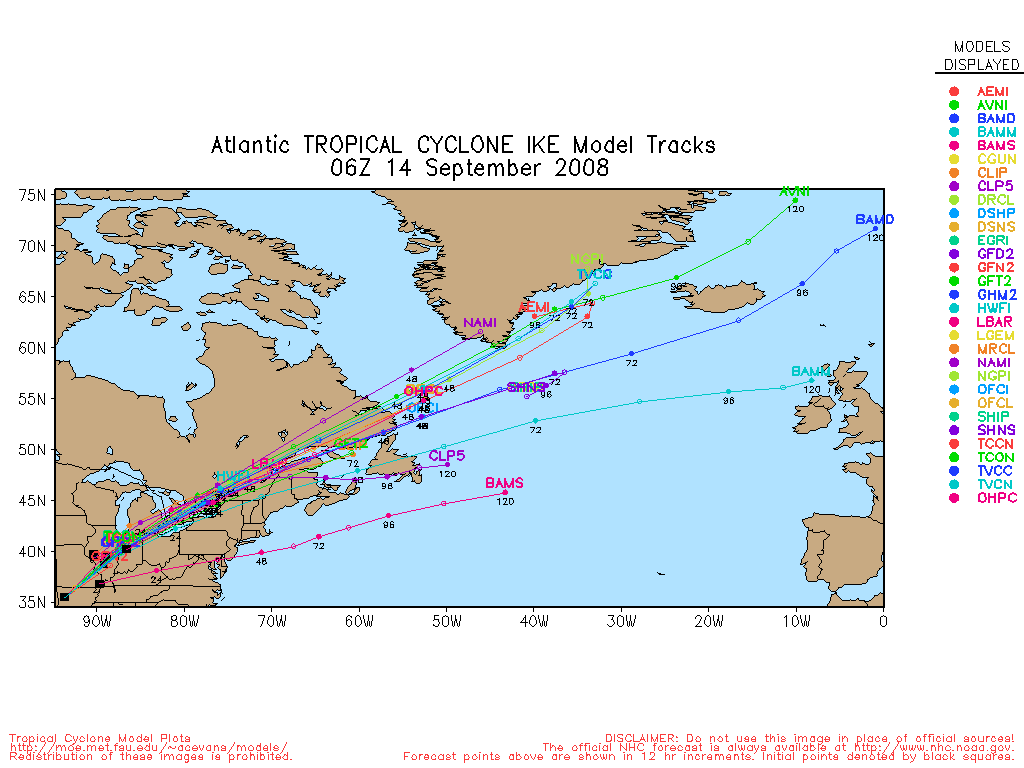
Ike has strengthened to a Category 4 hurricane. It will likely fluctuate in strength as it moves westward. Plenty of time to watch this one, and much too early to specify where/when Ike may go. If it were to approach the Southeast, it would be Around Wednesday of next week. The Bahamas will want to watch as early as Sunday/Monday, however.

6:30PM EDT Update
Hanna is now on the move, generally north or just west of north, and will start to move much quicker than it has been as it shoots to the north. Florida is out of the cone on this one, but the Carolinas will want to watch. It is also entirely possible Hanna doesn't make landfall after all.
Ike has become a Hurricane, and long range projections will keep it worth watching over the next few days, watching the model trends to see if it hooks Ike more up and out to sea or flattens it out to head westward.
Original Update
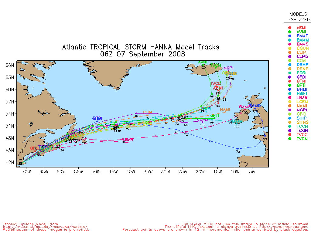
The busy tropics continue, Tropical Storm Hanna, still being sheared, is near Hati, and it looks like it may finally start to move toward the north and northwest late today. The system has weakened a bit more overnight because of the unrelenting shear, but it still is keeping together as a tropical storm.

The future track takes it maybe 100 miles east of the Central Florida coast, which may give some rain (the west may be relatively dry because of all the shear) to the coastal regions of Florida on Friday, and eventually move close to the Carolinas. Because of the angle of approach all in the cone will need to watch it. Of course, this also means it may never make landfall too, but that isn't as likely. Until a definitive motion is made, there is just no way to pinpoint it. Most models keep Hanna east of Florida.
Ike is still generally moving west, and toward the end of the forecast run things get a bit more complicated, the situation that will eventually cause Hanna to move north will not be there when Ike arrives, so it could go south of Florida (the most likely situation currently), into Florida, or Recurve, in other words, it needs to be watched. (Ike Lounge is here)
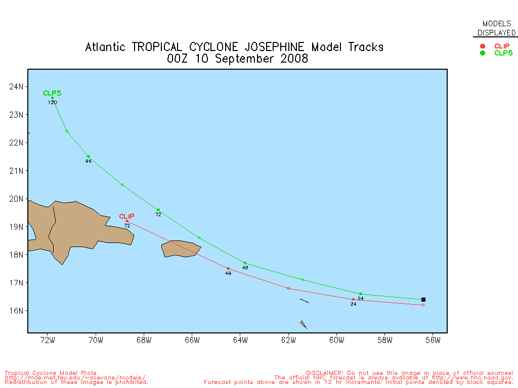
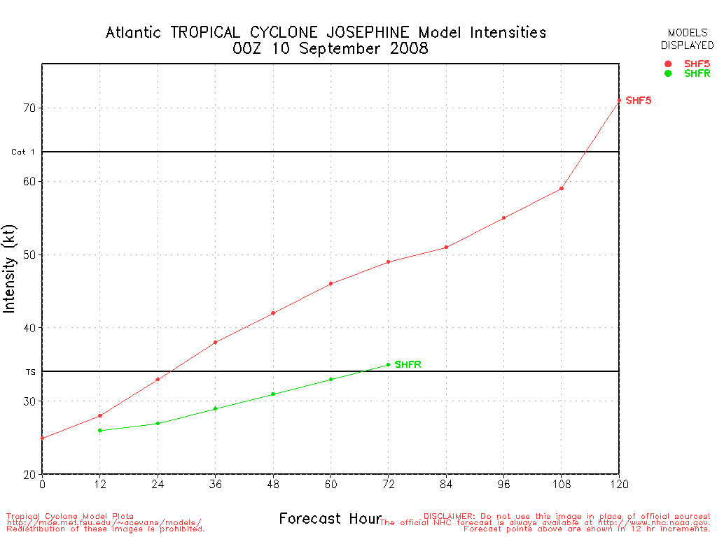
Josephine continues to show the signs of a fish spinner that will curve out to sea well before land areas.
Beyond Josephine a wave about to exit the African coastline also has a chance to become tropical later this week.
Color Sat of Gulf
RAMSDIS high speed visible Floater of Storms
Spaghetti Style model plots from Colorado State University
Forecast Discussions for (Show All Locations)
Charleston, SC
Wilmington, NC
Morehead City, NC
Emergency Management:
North Carolina Emergency Management
South Carolina Emergency Management
Southeast Radar Composite (loop)
Google Plot of Hanna, Ike, and Josephine
Caribbean Islands Weather Reports
|
LoisCane
Veteran Storm Chaser

Reged:
Posts: 1236
Loc: South Florida
|
|
Hanna is moving east as of 8 AM... near a whole 5 mph but not a drift any longer.
She is on the right side of the diving V shaped trough and the ULL there is scooping her up a bit
http://www.ssd.noaa.gov/goes/flt/t2/sloop-wv.html
Not sure how she could go west yet so imagine once she does bounce north it will be a hard bounce up as the models indicate.
I'm wondering really when this feature lifts out as Ike continues steadily west... possibly also with some southerly component later in the forecast period from the strong high.
When is this feature controlling Hanna since she was born, before when she was but an invest going to move out I ask??
--------------------
http://hurricaneharbor.blogspot.com/
|
catadjuster
Registered User
Reged:
Posts: 1
|
|
First post from a long time lurker. This may be a dumb question, but If Hanna remained an unorganized TS, what effect would the moisture have on Ike if he were to make contact with Hanna? Would it be more likely that the moisture from Hanna would fuel Ike, or would it be more likely that the cool water (that was stired up by Hanna) have a negative effect on Ike? Just curious.
|
MikeC
Admin
Reged:
Posts: 4544
Loc: Orlando, FL
|
|
The center of Hanna is getting harder to find, and may be just doing a lot of relocating (probably further north), the large Upper Level Low is still taking its toll, along with the shearing to the northwest. It could wind up Hanna not making landfall after all, it's still "stuck" in a corner it seems.
I'm not sure what, if any, impact hanna and Ike will have on each other, they are separate right now. Ike is hitting 4.0 t numbers, so it may become a hurricane pretty soon.
|
Lee-Delray
Weather Master

Reged:
Posts: 429
|
|
Looking at the models, it seems that they are starting to warm up to the idea that Ike might follow in Hanna's footsteps. Going to be a lot of sleepless nights along the coast for awhile.
|
LoisCane
Veteran Storm Chaser
Reged:
Posts: 1236
Loc: South Florida
|
|
Massive ball of convection to the north where you mentioned. On the funktop it's bright red. The ULL is ventilating it I imagine or relocating or it should or could relocate.
WV loop shows it about to be scooped up but where will it go and how does it go west as much as the models show is what I would like to understand.
Imagine 11 am discussion will explain it all.
How does it get NW is my question?
http://weather.unisys.com/satellite/previous/sat_wv_east-12.html
--------------------
http://hurricaneharbor.blogspot.com/
|
ftlaudbob
Storm Chaser

Reged:
Posts: 828
Loc: Valladolid,Mx
|
|
Tropical force winds with Hanna extend 290 miles,so why is there not a tropical watch or warning for the east coast of Florida?The same conditions should be in place when Ike gets to this neck of the woods,so one would think that the east coast of Florida could be under the gun with Ike in a few days.So much action to watch out for.
--------------------
Survived: 10 hurricanes in Rhode Island,Florida and the Yucatan of Mexico .
|
MikeC
Admin
Reged:
Posts: 4544
Loc: Orlando, FL
|
|
Mainly because most of the convection is to the north, east, and south, very little is on the western side. Also, Florida is out of the cone at 11AM, but then again it's almost in the cone for Ike. If Hanna were to lean more toward the western edge of the Cone, it sure is possible. But if warnings or watches are issued I would not expect it until late tonight or tomorrow.
|
LoisCane
Veteran Storm Chaser
Reged:
Posts: 1236
Loc: South Florida
|
|
I think the biggest news from the 11 was not direction which we can see but comments by the on the growing size of the clouds associated with Hanna. IF this storm intensifies as they say and banding forms on the north and east side of the storm she will be a big system. South Florida would still be on the weak SW side so don't think watches are needed yet... but as you said we are on the cusp of the Cone for Ike.
I'd prefer Hanna ...
--------------------
http://hurricaneharbor.blogspot.com/
|
Raymond
Weather Guru
Reged:
Posts: 112
Loc: Germany
|
|
I would say, that the Low Level Center is moving NE. At least I could see it on the high resolution visible loop of Tropical RAMSDIS doing so for some frames. So the cyclonic loop indicated by the may be correct. But with this weak center future reformations under stronger convection should be likely too. It´s still completely open, what comes out of this mess, at least only a weak Hanna.
|
Ed in Va
Weather Master
Reged:
Posts: 489
Loc:
|
|
You're right. Ike is certainly better organized, but Hanna takes up a lot of real estate and could be pretty formidable if she gets her act together.
http://www.ssd.noaa.gov/goes/east/tatl/vis.jpg
--------------------
Survived Carol and Edna '54 in Maine. Guess this kind of dates me!
|
kromdog
Weather Hobbyist
Reged:
Posts: 66
Loc:
|
|
It looks like Ike may be nearing the Florida Straights by early Monday as a major hurricane. The ENTIRE peninsula of Florida needs to keep an eye on Ike.
http://weather.myfoxtampabay.com/maps/WTVT/custom/storms/ike_track.html
|
ftlaudbob
Storm Chaser
Reged:
Posts: 828
Loc: Valladolid,Mx
|
|
Quote:
It looks like Ike may be nearing the Florida Straights by early Monday as a major hurricane. The ENTIRE peninsula of Florida needs to keep an eye on Ike.
http://weather.myfoxtampabay.com/maps/WTVT/custom/storms/ike_track.html
I am also starting to get a little concerned with Ike.The shear ahead of him looks to be minimal,and there maybe a "tunnel"that could curve Ike towards Florida.Still need to see if Hanna will have any affect on Ike.
--------------------
Survived: 10 hurricanes in Rhode Island,Florida and the Yucatan of Mexico .
|
Raymond
Weather Guru
Reged:
Posts: 112
Loc: Germany
|
|
If I look on the track forecast of the last modell runs, it becomes more and more possible, that the remains of Hanna won´t see the US coast at all ( at least the center).
So Ike is certainly potentially more dangerous as Hanna! We`ll see ... .
|
KimKeyWest
Registered User
Reged:
Posts: 4
Loc:
|
|
Very interesting graphic. I'm comforted by the fact that Ike is more than 5 days away but the track and forecasted category 3 are unsettling. Threading the needle of the straits seems improbable and, hopefully, unlikely.
|
scottsvb
Weather Master
Reged:
Posts: 1184
Loc: fl
|
|
Its too early to say anything more on Ikes movement after the bahamas. Models diverge on the speed of Ike and the movement due to the strength and orientation of the ridge over the western Atlantic later Sunday into Monday. All we know is that Ike will be in the SE Bahamas by Sunday or Sunday night. Movement after that will be determined by what is said above or by something we dont see yet.
|
doug
Weather Analyst
Reged:
Posts: 1006
Loc: parrish,fl
|
|
Re: Ike (do we like Ike, yet?)That media outlet relies heavily on and models, and that one appears to be .
On Hanna: by all accounts to the untrained eye interpreting visual data Hanna should be caught up in that flow around the large ULL to its north and summarily thrust NE out to sea. It is very hard to discern any progress in that ridge against the cyclonic flow over the western Atlantic.
Hanna certainly takes up a great deal of ocean surface, and IF the core could deepen such that it controls all of it, then it may be capable of becoming a "monster" as Bastardi characterized its potential two days ago.
Needless to say I am somwhat bafled by the dynamic surrounding Hanna which does not really lend itself to easy intrepretation.
--------------------
doug
|
LoisCane
Veteran Storm Chaser
Reged:
Posts: 1236
Loc: South Florida
|
|
The movement of Ike in some ways will depend on his strength as he approaches this area. A strong hurricane as forecast would barrel through whereas Hanna who never got her act together totally wasn't able to.
Again...where will the upper level low be and how strong can Hanna get.
It's a symbiotic relationship out there between storms, upper level lows and the ridge.
A strong Cat 3 can in theory go anywhere it wants within reason.
--------------------
http://hurricaneharbor.blogspot.com/
|
doug
Weather Analyst
Reged:
Posts: 1006
Loc: parrish,fl
|
|
Hanna may have re-organized somewhat north of the last fix. I like Hanna at about 22.4/71.8 or beneath the growing ball of convection just north and east of the Bahamas. Everything seems to be coming together around that point and the whole sense of disorganization is now more consistent with a developing system again.
--------------------
doug
|
LoisCane
Veteran Storm Chaser
Reged:
Posts: 1236
Loc: South Florida
|
|
If she re-organized rather than moved what does that do to her forecasted track and forward movement?
Makes a big difference I would say. Waiting to see if this is true movement and how she moves in relationship to the models and track guidance.
Still find it odd she is sitting on one of Ike's future forecasted cords..
--------------------
http://hurricaneharbor.blogspot.com/
|


 Threaded


