12PM ET Update 16 November 2018
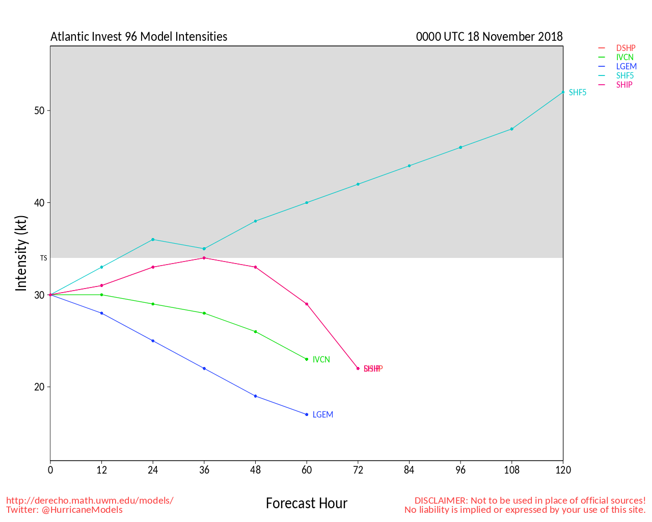
96L has been greenballed (reactivated for tracking), and is rapidly organizing into a well-defined area of low pressure today, centered at roughly 24N 74.5W as of 1500z. If current trends continue would likely issue an update by the regularly scheduled 7PM .
Additional tracking info and speculation on 96L is also available in the 96L Lounge.
Original Entry

Above: Visible satellite of two areas of interest early morning Nov 10. Base map courtesy Weathernerds.org
A couple of unseasonably impressive waves in the Tropical Atlantic have the potential for some development next week, with steering currents that could push one or more near or over portions of the Greater Antilles, Bahamas and/or Bermuda.
The most impressive wave is presently located about 700 miles east of the Lesser Antilles, and has caught the attention of as well as several of the better models for development - now at 40% within 5 days per
Another feature, a trough centered about halfway between the above referenced wave and the Lesser Antilles, is not presently flagged by for potential, but could be. Although models analyze conditions as less ideal for TC genesis than for the wave to its east, it is looking very impressive, suggesting that this disturbance is more vigorous and/or the environment is more conducive than models think.
Both of these features are likely to produce moderate to heavy showers and strong, gusty winds over populated portions of the SW Atlantic regardless of development.
This post will be updated with any Invest tags and TC numbers as warranted.
Edited by cieldumort (Fri Nov 16 2018 05:32 PM)


 Threaded


