| tpratch |
| (Moderator) |
| Fri Jul 08 2005 06:09 PM |

|
|
|
Quote:
If you go back to my earlier thread,you will see I said eastern or central Cuba.And it is NOT western Cuba is it?
Sorry I missed your reply earlier.
I believe this shows that it is projected to wrap up the crossing in what is undeniably western cuba. (images from the latest visible and infrared loop with the track coming from actual and forecast points).
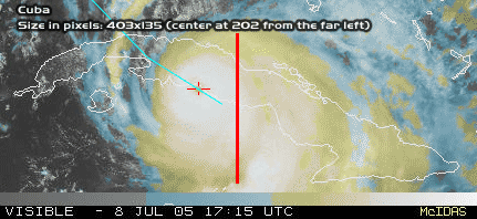
Sorry that it's quick and dirty but back to my question - how does a crossing of Western Cuba support a South Florida hit?
I just want to understand where you're coming from.