CFHC
|
| () |
| Mon Sep 16 2002 07:00 PM |

|
|
|
Update 11am EDT, 17 Sept 2002:
Tropical Depression # 10 is back! Advisories have restarted as of 11am EDT.
---
Original Post:
Tropical Depression 10 was downgraded to an open wave by the National Hurricane Center, and it is causing a lot of controversy. A recon aircraft was sent out today but could not find the LLCC (lower level circulation center). So this system officially still remains an open tropical wave. Although looking at visual satellite photos of the system it appears to have some sort of circulation, in any case this system is in a very favorable area for intensification and storm development and must be monitored. So we will be keeping a close eye on this one.
In the comments section (Forums) everyone is doing a great job in tracking this storm. Thank you and keep up the good work.
Caribbean Hurricane Page - includes reports from individuals scattered across the Caribbean islands
NRL Monterey Marine Meteorology Division Forecast Track of Active Systems (Good Forecast Track Graphic and Satellite Photos)
NASA GHCC Interactive Satellite images at:
North Atlantic Visible (Daytime Only), Infrared, Water Vapor
Some forecast models:
NGM, AVN, MRF, ETA ECMWF
DoD Weather Models (NOGAPS, AVN, MRF)
AVN, ECMWF, GFDL, MM5, NOGAPS, UKMET
Other commentary at Mike Anderson's East Coast Tropical Weather Center, Accuweather's Joe Bastardi, Hurricane City, Gary Gray's Millennium Weather, Barometer Bob's Hurricane Hollow, Snonut, Ed Dunham and Jason M in our Storm Forum Even more on the links page.
- [john@flhurricane.com]
| Robert |
| (Weather Analyst) |
| Mon Sep 16 2002 07:18 PM |

|
|
|
I was thinking the orginal forcast called for this to be here on tues/wendsday then thur/frin ow fri/sat.I was wondering what evryone's thought on it just going through the bahamas seeing the dead line keeps getting pushed back, That trough wont wait forever. Im not saying i think this will happen just thought id throw that possibilty out there?
| scottsvb |
| (Weather Master) |
| Mon Sep 16 2002 07:32 PM |
|
|
Current conditions show SW sheer inhibiting any rapid intensification of the carribean system. No LLC found by recon means no watches for Jamaica but will be informed on TS winds that will affect the island late tonight thru Thurs. Currently there is a weak LLC near 15.8N and 75.8W moving just north of west at 280' at 18 mph. Due to the moderate sheer, rapid speed, and weak low pressure in the system it can not intensify quickly. Alot of heavy showers are off to the east and northeast of the center. This will continue to spread over the Haiti area and Jamaica tonight.
For Track and intensity I will say there is a weak LLC and it will begin to slow just a bit and move to the NW later tonight into Tues. The system should be namedlater when the NEXT recon goes in or when ship and buoy reports come out of the system with any kind of W wind. Tuesday the sheer will dominish some but will still be there. I dont expect alot of strengthning to a hurricane until later Weds or that night if at all. First we want to close this thing. Track will take this SW of Jamaica by later tuesday and very near the Grand Cayman island early weds. With a upper anticyclone to the NE of the system and lowering heights in the central g-o-m a more turn to the NNW will take shape later Weds night with land fall near 81W early on Thurs and as a posible hurricane then. After about 6-8 hours of crossing the small area of Cuba it should re enter the Fla straits late Thurs or night. The forcast then is for more strengthning and a N motion Thurs night and a slow NNE or NE turn to take shape. Friday - Friday night should be a landfall. The areas of concern are wide spread this far out. Areas from N of Tampa all the way around the state to Miami's SE area could be in direct line. The turn to the NNE or NE is what it all comes down to. Cant make the exact point yet. As for intensity, right now going just under the GFDL with a Cat 2-3. Some sheer might again be felt of the system on Friday ahead of the strong trough and cold front to its NW. So expect LLC to form overnight, TS on Tuesday to move close to G Cayman later on weds to cross w central Cuba very late Weds night or most likely Thurs as strong TS or weak hurricane, move N and threaten Key west early Friday and the SW florida area but very wide area indeed later that day. Tampa-Miami. Nogaps is best model for this and GFS. Avn is next. Ill post more later in detail on Tues if and when this devolps. scottsvb
| StormHound |
| (Weather Guru) |
| Mon Sep 16 2002 07:32 PM |
|
|
Based on the latest satellite photos, there is little doubt in my mind that TS Isidore has been born, or soon will be. He is wrapping up tightly. Bastardi mentioned that there would be storms in the outflow during birth, but these would give way to high cirrus clouds as she closes off. That is what I'm seeing over the last couple of hours.
He seems to have slowed down now, but Cuba and Florida certainly are under the gun. Because of the angle of attack, guessing anywhere other than the Keys is going to be very difficult. A little wobble could mean the difference between West or East coast of FL. If I have to make a call now, I'd say Isidore gets far enough W to come up the W side, say between Sarasota and Tampa. I'm thinking strong Cat 2, but we should be watching this one very closely.
| Kevin |
| (Weather Master) |
| Mon Sep 16 2002 07:35 PM |

|
|
|
My thinking is that the Bahamas may feel very little effect from this system. I'm still thinking it should keep moving towards the wnw at 10-15 mph for at least the next 36h.
Analog storms: I've picked out some storms that seem to be at least somewhat similar to this one. Although some formed in different places, I believe with one of the storms the outcome may be the same as with this one.
http://weather.unisys.com/hurricaen/atlantic/1944/11/track.gif
This track looks like the most similar to this storm at this time. This storm was never a quick mover and effected western Cuba as a hurricane but then weakened as it went over. When it emerged over water, it was moving slowly but it re-intensified into a category 3 hurricane. Looks quite similar to this one.
http://weather.unisys.com/hurricane/atlantic/1953/FLORENCE/track.gif
This one formed in a similar place to the 1944 storm but tracked further west. This has a much lower chance of being similar to our current storm than the 1944 one does. The trough that should effect this system looks to be very sharp. Shouldn't allow this one to get up to the Florida Panhandle.
Of course, there could be some variations in intensity. Another thing I wanted to point out: It seems whenever we have a tropical wave producing tropical storm forced winds but with no closed circulation we eventually see development. It also seems that these storms don't tend to stop developing when they hit land. With Erin in 1995, it was a rainmaker for the Florida Peninsula but when it hit the Florida Panhandle wind damage was far greater than with Erin's first hit. Wil this storm be the same way? Rainfall a main threat in Cuba with wind being the main threat in Florida. Time will tell.
Also, in years similar to this one where activity is pushed closer to the US and more numerous in the GOMEX it seems Florida always get a cat.2 or cat.3 from the south. Just a trend I noticed from some years.
Kevin
| ShawnS |
| (Storm Tracker) |
| Mon Sep 16 2002 07:42 PM |
|
|
Get out of town, we are talking western gulf with this one, if anything at all!
| troy2 |
| (Storm Tracker) |
| Mon Sep 16 2002 07:48 PM |
|
|
Nice thorough and detailed forecast Scott!
BTW what is the link to your website?
| Cycloneye |
| (Storm Tracker) |
| Mon Sep 16 2002 07:51 PM |
|
|
Wow Scott that was a very complete anaylisis of all the possibilities with this system that looks like it has the look of a major cane but of course to early to say that with authoritie but this system covers a big area and systems like that big are the most ones to be formidble canes.
| Unregistered User |
| (Unregistered) |
| Mon Sep 16 2002 07:54 PM |
|
|
saw lyons on twc band coming around center is pushing keeping away shear. could be close to path of donna 1960. also is very close to where gilbert was when it exploded. will be cat.3 in a few days.
| Robert |
| (Weather Analyst) |
| Mon Sep 16 2002 07:57 PM |
|
|
|
|
well the shadow of darkness is prevailing and i am going to what i should have done last and turn off the comp early. I dont excpect a whole lot tonight maby more organization nothing that wont be there tommorow morning when vis comes back. Well nice tracking with you this afternoon and good night
| Kevin |
| (Weather Master) |
| Mon Sep 16 2002 08:04 PM |
|
|
|
|
Good night Robert, had a great time tracking this stuff with you today. Indeed, a lot of fun. Now onto the storm structure at this point. All I can say is BANG! This afternoon the storm had an elongated look, but now it is a nice round ball. It is becoming "incubated", as Joe Bastardi says. A track to Donna in 1960 is also a possibilty. Didn't throw that in with the analogs due to the fact it was a Cape Verde storm. I also agree with a category three storm...this one seems destined for that as long as it can develop a closed LLC. I see that happening overnight. Tomorrow will be a big day for this system, no doubt in my mind.
Kevin
| ShawnS |
| (Storm Tracker) |
| Mon Sep 16 2002 08:11 PM |
|
|
I think you all are making too much of it right now. It is not even classified yet. I remember going through this last year with these systems. There were at least a couple of them that we all thought would really pop and they never did for some reason or another. The same could happen here and that might be the reason the NHC is holding off on any reclassification right now. The longer it goes without getting its act together, the greater the chances of it either totally falling apart or at least moving further west than anticipated. I'm not saying that it WON"T happen but I think I'll wait until we get an official notice from the NHC that this thing is for real before I go any further. Who's to say that it won't make it to the western gulf,IF it does re-form. How many times has a high pressure not built in as deep as it was suppose to or moved a little east or west of where it should have? How many times has a trough not dug as far south as forecasted or not been able to "pick up" a system because the storm decided to slow down or even stall out. The point I'm trying to make is that it is anyone's guess on what may happen with this thing. It could go anywhere from just falling apart to being a major hurricane, and anything and everything in between. Saying that, we ALL need to just keep an eye open to the possibilities that exist..... ALL the possibilities.
| Unregistered User |
| (Unregistered) |
| Mon Sep 16 2002 08:12 PM |
|
|
this one was also a cape verde system. i think gilbert was 1988, is that right kevin. mark
| Unregistered User |
| (Unregistered) |
| Mon Sep 16 2002 08:12 PM |
|
|
that thing in the gulf had a name and this thing dont
| Bruce |
| (Weather Guru) |
| Mon Sep 16 2002 08:14 PM |
|
|
I think it will be called "SOMETHING" By 11PM, 5AM Max. TWC Talking like its a TS.
| Joe |
| (Storm Tracker) |
| Mon Sep 16 2002 08:20 PM |
|
|
Cold tops still cold and holding its own. Should be intresting when Recon goes in tomorrow when they find possibly a strong TS. As far as future track it looks to be headed for FL, East/West coast? who knows. Its all going to be a timing thing with the trough movement and tropical disturbance or should I say Isidore.
| troy2 |
| (Storm Tracker) |
| Mon Sep 16 2002 08:20 PM |
|
|
Gilbert is a good example of how fast a storm can intensify.
went from 960mb to 888mb in just 24 hours. Granted it was already well on its way before that and already a strong Hurricane.
troy
| Unregistered User |
| (Unregistered) |
| Mon Sep 16 2002 08:21 PM |
|
|
people are just giving their ideas. conditions will favor strengthning, high 80 water temps, and as lyons said what little shear there is is moving west away. plus forward speed is slowing down alot. and water temps are very high also near fla. straits. ridge is expected to weaken some so going west is unlikely.
| Kevin |
| (Weather Master) |
| Mon Sep 16 2002 08:21 PM |
|
|
|
|
This system orgininated from an African that was very disorganized while going across the Atlantic. It was never classifed during that time, so it wasn't a Cape Verde system. Gilbert DID develop in the Atlantic, making it a Cape Verde system.
Shawn: It may not have an official entity tonight but I'm nearly 100% certain it will tomorrow. This system has major potental, starting tomorrow and especially after 36 hours. Given it regenerates it also has a good chance of effecting Florida late this week. Floridians (like myself) must keep an eye on this. Not even an issue for Texas unless something majorly unexpected occured.
Maybe one more post tonight, otherwise I'm done for today.
Kevin
| Unregistered User |
| (Unregistered) |
| Mon Sep 16 2002 08:26 PM |
|
|
it was a wave that came from africa and passed thru cape verdes.
| Joe |
| (Storm Tracker) |
| Mon Sep 16 2002 08:27 PM |
|
|
Current shear or what very little there is will pull west towards Yucatan and GOM. The area over this system will be "very" favorable for development. This may strengthen quickly in next 24hrs or so as other posters have mentioned.
| Unregistered User |
| (Unregistered) |
| Mon Sep 16 2002 08:29 PM |
|
|
I am registered but I can't log in correctly. i think it's my computer. Anyway Kingston has reported winds up to 29 mph. Thats fine BUT they also reported pressure at 1007mb. Now if "recon" only got 1010 does that confirm that they truly were in the wrong place? Just thought I would mention that. Everyone on this board has some excellent posts. I really enjoy them. Keep up the outstanding work...nickd
| Unregistered User |
| (Unregistered) |
| Mon Sep 16 2002 08:32 PM |
|
|
I thought this was also interesting...TPC discussion 8:05pm
TROPICAL WAVE...REMNANTS OF T.D. TEN...PREVIOUSLY ALONG 74W/75W
IS NOW ALONG 75W/76W SOUTH OF 26N MOVING WEST 20 KT. THE LAST
FEW AVAILABLE IMAGES OF VISIBLE IMAGERY INDICATE THAT A LOW
LEVEL CIRCULATION MAY BE TRYING TO FORM APPROXIMATELY 130NM SE
OF ERN JAMAICA WITH LOW LEVEL CLOUD ELEMENTS BEGINNING TO WRAP
BACK AROUND TO THE E NEAR 15N76W. EXTRAPOLATED INFLOW TO THE SE
OF THE MAIN CONVECTION ALSO INDICATES THAT A SECOND LOW/MID
LEVEL CENTER MAY BE TRYING TO FORM JUST S OF HISPANIOLA. WHETHER
THIS SYSTEM REGENERATES INTO A TROPICAL CYCLONE OR NOT...AREAS
OF HISPANIOLA...JAMAICA...AND ERN CUBA CAN EXPECT SEVERAL INCHES
OF RAIN AND STRONG GUSTY WINDS AS THE SYSTEM APPROACHES.
NUMEROUS STRONG CONVECTION S OF HISPANIOLA FROM 14N TO 18N
BETWEEN 71W AND 75W WITH ADDITIONAL WIDELY SCATTERED MODERATE
CONVECTION ALONG HISPANIOLA AND ERN CUBA.
| Joe |
| (Storm Tracker) |
| Mon Sep 16 2002 08:34 PM |
|
|
Heres a link to some caribbean land observations....
http://www.srh.noaa.gov/sju/caribm.html
| Unregistered User |
| (Unregistered) |
| Mon Sep 16 2002 08:54 PM |
|
|
latest sat. photos from twc convection getting bigger stronger probably already a strong t.s. rapid strengthining could be tomorrow. shear in photos is moving away to the west.
| HanKFranK |
| (User) |
| Mon Sep 16 2002 09:11 PM |

|
|
|
been obvious all afternoon that an llc ran out ahead of the main convective mass. that thing is toast, running out there alone. if there is a secondary center forming in the convection.. thats the real deal. if it forms in the mid levels, also dont have to worry about it running away with the low level westerly flow.. you get a deeper system.
anyway no way to tell for sure, but with that kind of very deep convection firing and re-firing south of haiti youve got to think something cyclonic is trying to get going.
we'll know for sure if it starts getting a less amorphous signature and T numbers start going up. unless the sun rises first.
by the way, the fact that the convection hasnt moved has allowed it to distance itself from the upper trough ahead somewhat.. it IS in ideal development shape now. this is obvious by the outflow cirrus shield extending away from the convective mass in all direction.
got EVERYTHING it needs for sure, except an llc.
by the way for future track.. synoptic pattern favors it to track wnw originally, then turning nw and north with time. whether it turns up in the bahamas or in the yucatan channel will make all the difference.
if this thing develops, it will not be a sissy storm, by the way. put a low level center with convective feedback in that environment for two or three days and youve got a major hurricane.
better hope it goes goofy and cant organize.. if it does somebody gets whacked.
HF 0104z17september
| Unregistered User |
| (Unregistered) |
| Mon Sep 16 2002 09:21 PM |
|
|
has it stopped?
| Unregistered User |
| (Unregistered) |
| Mon Sep 16 2002 09:31 PM |
|
|
yes its stoped may head north then east fish man
| WXMAN RICHIE |
| (Weather Master) |
| Mon Sep 16 2002 09:55 PM |

|
|
|
The tropical envelope is coming together. All the clouds in the entire carribbean area are coming together in a swirl around our storm. The clouds from the bahamas, cuba, hispanola, and all the windward and leeward islands. The larger envelope is beginning to feed the storm. This is an important ingredient in the formation of a major hurricane. Locations in the Keys and SE Florida may have TS Warnings and a Hurricane Watch as early as tomorrow 11am.
| Unregistered User |
| (Unregistered) |
| Mon Sep 16 2002 10:05 PM |
|
|
Looks as though the storm is starting to spin up on the IR i was looking at. I think it will soon start rapidly intensifying. By later tom. it will be at least a cat 1 hurricane. only i see taht could impede development is some dry air in front of it. it probably wont affect the system much though. Can someone give me some reasons why the storm wont hit the panhandle cuz i think it has a chance. i need an explantion please thanks.
| medic8ed |
| (Registered User) |
| Mon Sep 16 2002 10:10 PM |
|
|
Okay, so I've got an out-o'-town relative flying into Tampa this Saturday -- what do you think -- do I tell them to try again later or that they should come on down?
| WXMAN RICHIE |
| (Weather Master) |
| Mon Sep 16 2002 10:16 PM |
|
|
|
|
Everytime my brother from NY goes somewhere, a major weather event occurs. Sometimes a hurricane, sometimes a blizzard, sometimes a flood. He goes to Hilton Head and Hugo comes. He goes to the midwest and the floods of 93 arrive. Thursday, he comes to Florida. Guess where Isidore is going.
| Unregistered User |
| (Unregistered) |
| Mon Sep 16 2002 10:18 PM |
|
|
remember last week we said when hanna first started it would go east never went east went north be ready these things always play a trick
| Unregistered User |
| (Unregistered) |
| Mon Sep 16 2002 10:56 PM |
|
|
no name at ten still wave looks hard to believe but they no best were is it going they said it has slowed down
| Unregistered User |
| (Unregistered) |
| Mon Sep 16 2002 10:57 PM |
|
|
I live in Miami. Does anyone have any credible evidence or theories that the storm will impact here? If so, will it be a Cat 1,2,3 or higher? Just curious. I survived Andrew and I am not interested in another!
| Unregistered User |
| (Unregistered) |
| Mon Sep 16 2002 11:06 PM |
|
|
The most interesting thing about this, is that NONE of us have a real clue what this will do by tomorrow. However, that being said....these posts are excellent, and they are helping me learn more about these fascinating storms. Well, to be sure, if this one develops, it will be a nail biting gig, for sure. My thoughts are this...it is extremely south of where most of them ever come in at...has plenty of caribbean to get it's act together...and if it shoots through the Yucatan, and gets in the gulf...we may have a bigeeeeee on our hands....it feels like we are due for a bad one.......when i looked at the water vapor loops...(ohio state site)....it looks ominously perfect for things to real go bang...
we will see...
| 57497479 |
| (Weather Master) |
| Mon Sep 16 2002 11:16 PM |

|
|
|
At the 11pm update on the TWC , they of course are still talking about an open wave. The comment was made that the thunder storms were getting stronger because the wave was creating its own environment. Did I hear him correctly and if so is it possible for an open wave to create its own environment? Please comment! Toni
| StormHound |
| (Weather Guru) |
| Mon Sep 16 2002 11:22 PM |
|
|
I haven't seen a whole lot of open waves create their own environment, but I guess anything is possible. Am I seeing the LLCC popping out at 16N 75W? Or is this just my imagination?
http://www.ssd.noaa.gov/PS/TROP/DATA/RT/float-ir4-loop.html
| troy2 |
| (Storm Tracker) |
| Mon Sep 16 2002 11:32 PM |
|
|
another view of that same loop time
http://www.wunderground.com/global/Region/g2/2xpxIRSatellite.html
| StormHound |
| (Weather Guru) |
| Mon Sep 16 2002 11:35 PM |
|
|
Nice picture, Troy!
| troy2 |
| (Storm Tracker) |
| Mon Sep 16 2002 11:44 PM |
|
|
I thought it was from a slightly different view, but it was the same only different color.
It does appear that there is a spin where you said. if its a LLC i dont know. one can sligly make out a rotation in the center of all that convection, just east of where the recent flair up is.
need the visibles
| troy2 |
| (Storm Tracker) |
| Mon Sep 16 2002 11:52 PM |
|
|
the link i posted refreshes as new images are up. check it out now.
looks like a wrapping may be starting where Stomrhound pointed out
| RBL |
| (Verified CFHC User) |
| Mon Sep 16 2002 11:53 PM |
|
|
I n the last SAT. frames looks like is now start to move more NW.
| StormHound |
| (Weather Guru) |
| Mon Sep 16 2002 11:54 PM |
|
|
There certainly appears to be rotation. I not totally sold on where the center is, however. I'm thinking the new convection would be closing it off.
| Unregistered User |
| (Unregistered) |
| Mon Sep 16 2002 11:54 PM |
|
|
off the topic,,,does anyone here have direct tv??? A bad storm came through and I lost my pic and only have sound over the last 4 hours. I just got Direct tv,this sucks. Anyone know how to get the picture back> reply plz asap.
| troy2 |
| (Storm Tracker) |
| Mon Sep 16 2002 11:57 PM |
|
|
as long as we are off topic, switch back to cable
my neighbor has Direct TV and whenever it rains it goes out.
Ruins the fun when a storm needs to be tracked.
| Unregistered User |
| (Unregistered) |
| Tue Sep 17 2002 12:08 AM |
|
|
so for how long,,isnt there anyways to correct the pic>?
| Unregistered User |
| (Unregistered) |
| Tue Sep 17 2002 12:32 AM |
|
|
Been staring at the IR loops till my eyes have about popped out... Is it just me and my blood-shot eyes or is there an LLC trying to form or formed at 17N 73W (give or take a tiny bit)? With that new blob of convection blowing up to the west maybe its time....just maybe...
| Unregistered User |
| (Unregistered) |
| Tue Sep 17 2002 12:35 AM |
|
|
I had that happen once to my direct tv system...make sure its aimed correctly and try the obvious unplugging it/plugging it back in trick...which I tried and it didn't work -- turned out to be the LNB (the thingy on the dish that looks important) needed replaced.
| HanKFranK |
| (User) |
| Tue Sep 17 2002 12:48 AM |
|
|
|
|
sort of funny how they had a recon tasked for last night, then cancelled it.. then again tonight.. cancelled. finally some cyclonic signature in the cloud movements, but could just be a trick. btw, have noticed that the mass of the system has jogged nnw since this afternoon. organizational jog or what i dont know. deep layer flow should steer it mostly west to start out with.
had about enough of this finicky thing for now. will check back tomorrow. very unsure of its status and no way to investigate any further.
HF 0441z17september
| doug |
| (Weather Analyst) |
| Tue Sep 17 2002 05:33 AM |
|
|
When recon goes in today it should find a closed low centered roughly near 14/74 according to the sat pics this AM. We'll see, but that's where the system seems to be trying to organize...still weak circulation on the south with a weak west wind, but that seems to be coming...good views on the Floater loop
| Domino |
| (Weather Guru) |
| Tue Sep 17 2002 05:50 AM |
|
|
I certainly see the center you're referring to..overnight it looked like it was trying to decide what to do all over the place, but this finally looks like it has made up its mind...I think...
| 57497479 |
| (Weather Master) |
| Tue Sep 17 2002 06:26 AM |
|
|
|
|
The system does look better over night.I think it is trying it's best to become better organized. Can't see the spin at 14 but it sure looks like its turning at around 17 and 75. Hopefully recon can find something this AM and put this guessing game to rest.
One of our local mets said last night that it was now moving North and that it was a real long shot that it would even affect Florida.He said possibly S. Fl. but not likely. He said just use your eyes...... Toni
| BabyCat |
| (Weather Guru) |
| Tue Sep 17 2002 06:36 AM |
|
|
Down here they are saying that Thurs/Fri may be flooding days.
The NWS statement this morning still has this thing going W-NW but who knows...
The ULL to the west of the storm *seems* to be pulling back west so maybe...
But like you said, the plane is on the way.
Maybe the southern tip/west coast of Florida????
| Unregistered User |
| (Unregistered) |
| Tue Sep 17 2002 06:50 AM |
|
|
almost dew west this morning
| Unregistered User |
| (Unregistered) |
| Tue Sep 17 2002 07:23 AM |
|
|
As this non storm continues more westerly the "threat " to Florida continues to diminish, unless you are a tv met who's career is tied to hype and ratings.Even Bastardi is beginning to see the light on this one as he is beginning to waffle on the big AND Florida on his previous posts. It is easy to make predictions from 6 days out but they seldom turn out correct. Dave - Stuart
| HanKFranK |
| (User) |
| Tue Sep 17 2002 07:33 AM |
|
|
|
|
there it is.. i had no idea this would be the process, but it's happening. that center that ran out ahead the other day.. convection has built forward and is now supporting it.. perhaps there is another closer to the convection and the two are hooking back into each other. it was turning sw last night, and the low level flow ahead of the system was slowing.. a sign that the something was developing at the surface.. this was evident in the first llc slowing down and hooking back. now probably the little llcs are fujiwhara-ing together and the system is gelling on either one or on a common point. either way, system developing south or southeast of jamaica, finally going to start organizing.. and will be moving up into the NW caribbean and probably gulf or florida straits late this week or weekend.
HF 1128z17september
| HanKFranK |
| (User) |
| Tue Sep 17 2002 07:35 AM |
|
|
|
|
Post deleted by John C
| HanKFranK |
| (User) |
| Tue Sep 17 2002 07:36 AM |
|
|
|
|
whyd this thingpost twice? hey john c could you kill one of those?
HF 1130z17september
| HanKFranK |
| (User) |
| Tue Sep 17 2002 07:39 AM |
|
|
|
|
system at those coordinates is starting to look like a tropical cyclone this morning. further southwest near 24/66 the low level swirl is weak but supporting convection.
HF 1134z17september
| Unregistered User |
| (Unregistered) |
| Tue Sep 17 2002 07:49 AM |
|
|
early morning snooping indicates a few obvious things....Isidore....might as well name the thing...we all know it will develop...
Izzy will continue moving more west than originally thought...will develop slower than anticipated, but will have plenty of time. I haven't looked at the water vapor loops yet, but the storm is large enough to be a widow-maker. hope it misses all the third world interests...they can't handle these things...neither can our wonderful insurance companies...bet they are puckering up this morning...(the state farms of the world)....one more BAD hurricane will finish some of them off.
looks to me like a Gulf Storm...be suprise...really suprised, if this poofs out on us....
wonder what some of our meteorologists are thinking about this one?
| Unregistered User |
| (Unregistered) |
| Tue Sep 17 2002 07:52 AM |
|
|
I agree HF, kinda like where it was supposed to be. Interestingly, this has almost no model support except for the NOGAPS. Yes GFDL has it, but as a 27 knot TD? in the eastern GOM. I believe the models are having trouble initializing this, and they will come around later today. Is this the beginning?? We'll know later today. CHeers!! Steve H.
| Rasvar |
| (Weather Master) |
| Tue Sep 17 2002 08:09 AM |

|
|
|
Not speaking for the one I work for but....yeah, there are insurance companies that are worried about anything near Florida.
Personally, I'm going to avoid the models for a bit until something is found to have formed and some regular data is coming in. Although, it seems like there is a trend for the models to agree on Florida, break away for a while and then comeback to Florida on this system. Until I see a good 48 hours of nothing hitting Florida, I'm keeping close watch on this sucker.
| clyde w. |
| (Storm Tracker) |
| Tue Sep 17 2002 08:11 AM |
|
|
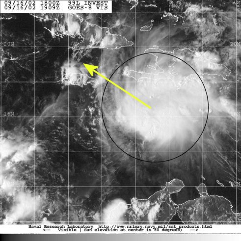
Hi folks...I think we may have Isadore already, just not in the Carribean. The Navy NRL site has put an invest (90L) on the system in the cetral atlantic, and early visibles show a well defined circulation. There's a good chance that our Florida headache from the Carribean will be named Josephine.
| Unregistered User |
| (Unregistered) |
| Tue Sep 17 2002 08:11 AM |
|
|
in the last 4 hours or so...the convection has gotten 50% larger, drifting west, with excellent outflow...can someone link me to a loop showing where you are seeing a possible LLC? I am not seeing one yet. But everything else is taking shape. I'll tell ya, when and if it starts, it will pop up to a cat 3 quickly...
i think it will float into the Gulf, and hit Mobile as a category 6
| clyde w. |
| (Storm Tracker) |
| Tue Sep 17 2002 08:27 AM |
|
|
NHC Goes Floater2 is now showing the system at 32.5N 52.5W. LLC clearly visible on the eastern edge of the convection, looks healthy.
Now its just a race to who gets named Isadore. Has anyone ever met anyone with that name? I'm going with the central atlantic storm being named isadore or TD11 at the 11a.m. advisory, and that TD10 gets reclassified as well...early images show what seems to be a LLC forming just south-southeast of Jamaica.
| Unregistered User |
| (Unregistered) |
| Tue Sep 17 2002 09:33 AM |
|
|
Must have found a closed center. NRL lists it as 10L. Anyone know the coordinates??? Steve H.
| garyb |
| (Weather Guru) |
| Tue Sep 17 2002 09:34 AM |
|
|
URNT12 KNHC 171240
VORTEX DATA MESSAGE
A. 17/1240Z
B. 15 DEG 54 MIN N
77 DEG 09 MIN W
C. NA
D. 15 KT
E. 276 DEG 30 NM
F. 029 DEG 13 KT
G. 276 DEG 030 NM
H. EXTRAP 1009 MB
I. 23 C/ 427 M
J. 23 C/ 431 M
K. 23 C/ NA
L. NA
M. NA
N. 13/1
O. 1 /15 NM
P. AF985 0410A INVEST OB 15
MAX FL WIND 22 KT NW QUAD 1229Z. SLP EXTRAP FROM 1500FT.
| RBL |
| (Verified CFHC User) |
| Tue Sep 17 2002 09:34 AM |
|
|
New data from Recon:
438
URNT12 KNHC 171240
VORTEX DATA MESSAGE
A. 17/1240Z
B. 15 DEG 54 MIN N
77 DEG 09 MIN W
C. NA
D. 15 KT
E. 276 DEG 30 NM
F. 029 DEG 13 KT
G. 276 DEG 030 NM
H. EXTRAP 1009 MB
I. 23 C/ 427 M
J. 23 C/ 431 M
K. 23 C/ NA
L. NA
M. NA
N. 13/1
O. 1 /15 NM
P. AF985 0410A INVEST OB 15
MAX FL WIND 22 KT NW QUAD 1229Z. SLP EXTRAP FROM 1500FT.
| garyb |
| (Weather Guru) |
| Tue Sep 17 2002 09:39 AM |
|
|
DISCLAIMER...NUMERICAL MODELS ARE SUBJECT TO LARGE ERRORS.
PLEASE REFER TO TPC/NHC OFFICIAL FORECASTS FOR TROPICAL CYCLONES.
TROPICAL DEPRESSION TEN (AL102002) ON 20020917 1200 UTC
...00 HRS... ...12 HRS... ...24 HRS...
020917 1200 020918 0000 020918 1200
LAT LON LAT LON LAT LON
BAMD 15.9N 76.8W 16.8N 78.4W 17.5N 79.8W
BAMM 15.9N 76.8W 16.8N 78.5W 17.6N 80.0W
A98E 15.9N 76.8W 16.0N 78.5W 16.6N 80.0W
LBAR 15.9N 76.8W 16.6N 78.5W 17.4N 80.0W
SHIP 30KTS 36KTS 45KTS
DSHP 30KTS 36KTS 45KTS
...36 HRS... ...48 HRS... ...72 HRS...
020919 0000 020919 1200 020920 1200
LAT LON LAT LON LAT LON
BAMD 18.2N 81.2W 18.8N 82.4W 19.6N 84.1W
BAMM 18.6N 81.4W 19.3N 82.6W 20.5N 84.3W
A98E 17.6N 81.5W 18.5N 82.9W 19.8N 85.7W
LBAR 18.5N 81.3W 19.5N 82.5W 21.3N 84.1W
SHIP 55KTS 64KTS 82KTS
DSHP 55KTS 64KTS 82KTS
...INITIAL CONDITIONS...
LATCUR = 15.9N LONCUR = 76.8W DIRCUR = 270DEG SPDCUR = 8KT
LATM12 = 15.8N LONM12 = 75.3W DIRM12 = 274DEG SPDM12 = 8KT
LATM24 = 15.5N LONM24 = 73.2W
WNDCUR = 30KT RMAXWD = 75NM WNDM12 = 30KT
CENPRS = 1009MB OUTPRS = 1011MB OUTRAD = 150NM SDEPTH = D
RD34NE = 0NM RD34SE = 0NM RD34SW = 0NM RD34NW = 0NM
| Unregistered User |
| (Unregistered) |
| Tue Sep 17 2002 09:40 AM |
|
|
Interpreter Please. GFDL now has it at SW Fla at 81 knots on the 6Z model, up from 27. 12Z will have 118 knots. LOL Steve H.
| Unregistered User |
| (Unregistered) |
| Tue Sep 17 2002 09:42 AM |
|
|
Thanks Gary. Steve H. Heading near western Cuba/Yucatan channel at 82 knots. Steve H.
| garyb |
| (Weather Guru) |
| Tue Sep 17 2002 09:44 AM |
|
|
NRL has 10L noname back up. Don't know why. They ran a test then dropped the test and called it 10L don't know why. Help!
| Rich B |
| (British Meteorologist) |
| Tue Sep 17 2002 09:45 AM |
|
|
Recon has posted a Vortex Data Message. If i am correct, these messages are only issued when a closed circulation is found. Winds are estimated at 15 knots in the NW quadrant, but this area has little convective activity. Will be interesting to see what they report from other quads!
Rich B
StormWarn2000
| Rich B |
| (British Meteorologist) |
| Tue Sep 17 2002 09:47 AM |
|
|
Confirmed... NHC re-starting advisories on 35 mph TD Ten. TS Warnings will probably be up for Jamaica soon...
| garyb |
| (Weather Guru) |
| Tue Sep 17 2002 09:49 AM |
|
|
Are you sure Rich 15kt winds max 22 ???
| Mike |
| (Weather Watcher) |
| Tue Sep 17 2002 09:50 AM |
|
|
The following is why:
000
WONT41 KNHC 171319
DSAAT
SPECIAL TROPICAL DISTURBANCE STATEMENT
NATIONAL WEATHER SERVICE MIAMI FL
915 AM EDT TUE SEP 17 2002
AN AIR FORCE RESERVE UNIT HURRICANE HUNTER AIRCRAFT INVESTIGATING
THE TROPICAL WAVE SOUTH OF JAMAICA HAS FOUND THAT THE SYSTEM HAS A
CLOSED CIRCULATION AND IS A TROPICAL DEPRESSION AGAIN. ADVISORIES
WILL THEREFORE BE RESTARTED ON TROPICAL DEPRESSION TEN BEGINNING AT
11 AM EDT. AT 8 AM EDT...THE POORLY ORGANIZED CENTER OF THE
DEPRESSION WAS LOCATED NEAR LATITUDE 15.9 NORTH...LONGITUDE 76.8
WEST. MAXIMUM SUSTAINED WINDS ARE 35 MPH. MOVEMENT IS TOWARD THE
WEST AT 8 MPH.
HEAVY RAINS AND GUSTY WINDS...SOME TO TROPICAL STORM FORCE...WILL BE
SPREADING OVER JAMAICA LATER TODAY AND TONIGHT. THE GOVERNMENT OF
JAMAICA MAY ISSUE A TROPICAL STORM WARNING AT 11 AM.
FORECASTER FRANKLIN
| Unregistered User |
| (Unregistered) |
| Tue Sep 17 2002 09:50 AM |
|
|
Is this heading towards the SW and Honduras?? Tell me my eyes are deceiving me?? I guess we'll wait for the real report.
| garyb |
| (Weather Guru) |
| Tue Sep 17 2002 09:56 AM |
|
|
Good call Rich and Mike TD 10 alive again
| Mike |
| (Weather Watcher) |
| Tue Sep 17 2002 10:02 AM |
|
|
I wonder if they found the true LLC. I think HF is correct there is a possibility of multi LLC, or close to being LLC, in this storm. They probably will all be weak for now. Look for a possible LLC reformation with this guy.
| Southern4sure |
| (Weather Guru) |
| Tue Sep 17 2002 10:04 AM |

|
|
|
where does the models put the storm now? Central GOM?
Southern
| Rasvar |
| (Weather Master) |
| Tue Sep 17 2002 10:47 AM |
|
|
|
|
I wouldn't trust the models until they get a little more data to ingest. 12Z may have some but might have to wait for the next runs at 0Z for something worthwhile.
| Mike |
| (Weather Watcher) |
| Tue Sep 17 2002 10:49 AM |
|
|
This is from the NWS in Melbourne:
RECONNAISSANCE AIRCRAFT THIS MORNING FOUND A CLOSED CIRCULATION IN
THE CLUSTER OF CONVECTION IN THE CENTRAL CARIBBEAN. SO THE HURRICANE
CENTER WILL RESTART ADVISORIES ON T.D. #10 AT 11 AM. SAT IMAGERY
SHOWS THE TROPICAL DEPRESSION HAS SLOWED ITS FORWARD SPEED
CONSIDERABLY. BY PUTTING MORE DISTANCE BETWEEN ITSELF AND THE UPPER
LOW TO ITS WEST (SEEN IN WATER VAPOR IMAGERY)...THE T.D. IS
EXPERIENCING LESS UPPER SHEAR WHICH SHOULD ALLOW IT TO STRENGTHEN
FURTHER. THERE IS A GOOD CHANCE THIS SYSTEM WILL AFFECT OUR WEATHER
LATER THIS WEEK.
It will probably 2 more model runs before we can expect any type of accuracy.
| Rasvar |
| (Weather Master) |
| Tue Sep 17 2002 11:19 AM |
|
|
|
|
Looking at NHC's initial forecast, I find myself hoping it does not verify. 72 hours brings a minor Hurricane to the tip of Cuba but free to continue strenghting and seting up a turn back into the West Florida Coast down the line. Possible Cat 2 or 3 if the 72 hour positions verifies. Best case for Florida appears to be a light TS getting caught up on Yucatan or crossing the worst part of Cuba. If it shoots the gap, Florida could have big problems.
| Unregistered User |
| (Unregistered) |
| Tue Sep 17 2002 11:48 AM |
|
|
Well TD# 10 developes a bit more south than I thought last night. This does change things a bit but in what direction its unsure. The path forcasted should be a bit west of the previous one so western Cuba or eastern Yucatan is a possibility. Latest satellite pictures do show a LLCC with developing thundestorms on its east and north side. By 5pm I do expect T.S. Isidore. So where next? Read this and it will help:
BOTH THE AVN AND CANADIAN MODELS HINT AT
REDEVELOPMENT OF A CENTER ALONG THE NORTH COAST OF CUBA UNDERNEATH
THE MOST FAVORABLE UPPER-ENVIRONMENT. THIS SCENARIO SEEMS UNLIKELY.
THE NOGAPS AND GFDL WANT TO TAKE THE DEPRESSION NORTHWARD OVER
CENTRAL AND WESTERN CUBA...RESPECTIVELY. THE OFFICIAL FORECAST
SHOWS A SOFTER NORTHWESTWARD TURN IN AN ATTEMPT TO BE MORE
CONSISTENT WITH THE 500 MB AVN AND UKMET LARGE SCALE FORECAST
FIELDS. PERHAPS COINCIDENTALLY...THIS FORECAST IS IN GOOD AGREEMENT
WITH THE BAM AND LBAR MODELS.
So I believe the forcast track will change over the next 24 hours to the east and how far will have towait. As for TD#10 moving west I don't think it is its moving w-nw but very slow and thats another problem so read this:
BECAUSE THE CIRCULATION CENTER IS NEW...THE INITIAL MOTION IS VERY
UNCERTAIN...BUT THE BEST ESTIMATE IS 270/8...PERHAPS LESS.
So we will wait and see at 5pm when new more reliable information is out until we get down to exact track.
| Unregistered User |
| (Unregistered) |
| Tue Sep 17 2002 12:10 PM |
|
|
Hey Folks, I believe the NHC intensity forecast is off. That is, I believe (if the shear continues to lessen) this thing is ready to explode. Latest sat images show the area of convection to it's east getting wrapped into the circulation and boundary layers setting up in a big circle. It is also going to be over water further west than was anticipated earlier with no land interaction for 72 hours at least. I see a Major cane outta this. Alright enuf hyping, but this really needs to be taken seriously since the forecast track is for western Cuba at 72 hours, and someone after that. I see nothing ahead of this (albeit some light shear for 24 hours) for the next 3-4 days to inhibit development until the trough approaches. Now is the time to get prepared. Cheers!! Steve H.
| HanKFranK |
| (User) |
| Tue Sep 17 2002 12:18 PM |
|
|
|
|
hey everybody!! im tropical storm isidore. but i should be called invisidore, because im sitting in the middle of the atlantic in broad daylight and the nhc thinks im a non-tropical low!
translation: two active systems at 5pm.
btw, hurricane tomorrow west of jamaica.
HF 1612z17september
| troy2 |
| (Storm Tracker) |
| Tue Sep 17 2002 12:33 PM |
|
|
There is a lot less dry air ahead as well. More moisture to feed more storms to help lower the pressure. The convection needs to build consitantly. By that I mean steady buildning, not just burst here and there, in order for the pressures to drop. The slowing down should help keep it away from the shear ahead and allow for more of that convection to build on the west side. As for where. I am sooo bad at guesstimating that. I try and look at projected path, and then se what lies ahead on the wetaher maps past the projection dates.
This has me thinking that even with its more west biased projection currently, if that holds true, we can still see a FL landfall. The trough should turn it and stir it more n the nnne/ne. Dependng on how sharp and fast the trough pulls her/it will have an impact on the strength. But being a more westward storm there will be less impact form Cuba (what little there would have been from W Cuba which has lower elevations).
so i say if it gets picked up and little shear from the trough, he have landfall at West Coast->state->E Coastanywhere from (Brevard up through St Johns) on sat- sun as a cat 2. if the trough speeds it up like mad(similar to mitch) cat 1 same local on west coast ---> maybe more north ( just Brevard / Voulsuia) on E coast sat night.
wow my first 5-7 day outlook.(I reserve my right to change it 3 hours before landfall)
In reference to a few season ago on here and some commentary If TWC send Jim Cantorie(sp?) to your area, it will hit there!
That guy is always in the worst of it.
| troy2 |
| (Storm Tracker) |
| Tue Sep 17 2002 12:37 PM |
|
|
HF
it would be named Hurricane Sneak Attack!!
| Unregistered User |
| (Unregistered) |
| Tue Sep 17 2002 12:37 PM |
|
|
Invisidore has been denied an immigration visa. Therefore it is a non entity and shall not be allowed the rights and privileges of a U.S. born Hurricane such as Allison, Edourd, Hanna etc.Despite the statistical likelyhood that this Invisidore could and would make a perfect hurricane representative,, its status remains in question due to questions about the circle it hangs in/or around. It has been said that Invisidore has trouble making ends meet and that its behaviors have been a little off center and out of the mainstream. However, it appears to have had some time out to think about its aberrant behaviors and appears to be trying to conform to social norms of other hurricanes and or storms. Tune in to see if Invisidore can get a life, will it grow up to be famous and have a retirement party or will it be reduced to nothing once again and invisible.
| troy2 |
| (Storm Tracker) |
| Tue Sep 17 2002 12:39 PM |
|
|
In reply to:
and that its behaviors have been a little off center and out of the mainstream.
a storm after Ben Franklins heart
| Unregistered User |
| (Unregistered) |
| Tue Sep 17 2002 12:47 PM |
|
|
Mary--
so good to have you back!
IHS,
Bill
| scottsvb |
| (Weather Master) |
| Tue Sep 17 2002 12:54 PM |
|
|
General Conditions of TD is fairly weak. We have recon giving back reports of a still weak 1009mb pressure. No winds right now are as strong as yesterday. Does that mean the system is weaker? Infact NO of course not. Yesterday the system was crusing along near 20K and with the T-storms on its NE side of 20-30mph it relivates to a tropical storm force winds. But overall the structure is alittle better due to the slowing down of the system as it loses the strong driving ridge to its N. Now the TWC mets been talkiing about the T-Storms creating there own enviroment decreasing the sheer. Where did they learn that from? I cant believe they are tell you guys that. Only the most strongest Hurricanes with pressures under 925mb or so will create a strong enough upper flow, and there still is sheer though not as strong in TD10 right now. The only reason there is not as much is due to the TS losing the speed of the ridge while the upper low to its NW continues to the W.
Forcast remains the same. With a weaker system a west movement will happen with the low level flow. When the system gets better organized with pressures around 1005mb or so it will get pulled by the mid level flow which is out of the ESE causing a WNW movement. Currently the system is getting better though Im not sure if it will be upgraded to a TS by 5pm. Waiting on another recon. My forcast is still on track as post sw of Jamaica later today and tonight to near G cayman island on weds. My cross over was near 81 W and will be adjusted slightly W. I dont expect much of a W track into the Yucitan though it might get close if the system doesnt intensify early on it the forcast period. Finally be off the Sw coast of Florida on early Friday as a strong cat 1 or 2. We are all up in the air on intensity. Track is pretty well on, but we have time to see what happens to U.S landfall over the next 48-72 hours to pinpoint. scottsvb HURRICANEUPDATECENTER
| Unregistered User |
| (Unregistered) |
| Tue Sep 17 2002 01:06 PM |
|
|
So Scott, am I correct in my assunption that you see landfall in SW Florida? Steve H.
| troy2 |
| (Storm Tracker) |
| Tue Sep 17 2002 01:09 PM |
|
|
RE: what HF mentioned out in the Atlantic
THE SMALL AREA OF LOW PRESSURE LOCATED ABOUT 700 MILES EAST OF
BERMUDA IS DEVELOPING TROPICAL CHARACTERISTICS. IF THIS TREND
CONTINUES...ADVISORIES ON THIS SYSTEM WOULD BEGIN LATER TODAY. FOR
THE TIME BEING...ADDITIONAL INFORMATION ON THIS SYSTEM CAN BE FOUND
IN HIGH SEAS FORECASTS ISSUED BY THE NATIONAL WEATHER
SERVICE...UNDER AWIPS HEADER NFDHSFAT1 AND WMO HEADER FZNT01 KWBC.
| scottsvb |
| (Weather Master) |
| Tue Sep 17 2002 01:10 PM |
|
|
Right now any landfall can happen
It matters on the Strength,trough, weakness
and other factors. Currently Im forcasting Miami-
north of Tampa. scottsvb
| Rich B |
| (British Meteorologist) |
| Tue Sep 17 2002 01:17 PM |
|
|
Just had a quick look at CI Numbers for both TD Ten and the system in the Atlantic east of Bermuda. The numbers were put out at 1145UTC today, so they are a few hours old...
TD Ten 1.5 / 1.5
90 (System E of Bermuda) 2.0 / 2.0
The url for this data is HERE
Just thought it was interesting to note that the unclassified and much better appearing storm is also stronger than TD Ten. Expect it to be classified today, and possibly be at TS strength within the next 12 hours or so.
Rich B
StormWarn2000
| Unregistered User |
| (Unregistered) |
| Tue Sep 17 2002 01:20 PM |
|
|
I see T.D. 10 reaching T.S. strength at 5pm. Mainly due to the building storms near the center. It will shift to w-nw later today and nw late tommorow. Stength is the big question. I would like to see more development on the west side later today for a better feeling on where it will end up. The stronger it gets the better the chance of a Florida problem. The weaker it remains a more north gulf problem. No matter someone around the Gulf is going to have a busy weekend.
| Unregistered User |
| (Unregistered) |
| Tue Sep 17 2002 01:37 PM |
|
|
I just had a chance to look at visible satellite as of 20min ago and thunderstoms are building nw of the center which is starting to look like banding also a feeder band comming in from the sw. I see develpment and if this continues Isiodore will be born at 5. I would like to see the pressure over the next few hours fall but I have to go to work so I'll be back at 10:30pm.
| andy1tom |
| (Storm Tracker) |
| Tue Sep 17 2002 01:39 PM |

|
|
|
Rich are they saying it has moved north? Is that correct??
| HanKFranK |
| (User) |
| Tue Sep 17 2002 01:44 PM |
|
|
|
|
im not ballsy enough to say who gets this one just yet. will be ready to when its up near the western end of cuba late this week. going to be a big ticket item for somebody.
basically the situation is this: missed the first shortwave that models originally had turning it up east of florida. thats old garbage now. consensus track is western cuba, where i'd sort of had my heart set.. but it isnt there yet. bigger amplification sets up in the middle of the country by late in the week, dragging a front down to the western gulf by the weekend. this is the one that i *THINK* will draw it up somewhere along the eastern gulf coast.. fort walton to fort myers.. somewhere in there, over the weekend or maybe early next week it takes its time. if, however, it misses this trough too.. doesnt get far enough north to be drawn up.. it wobbles westward again and makes a run for the middle gulf coast early/middle of next week.
this will probably be a mature hurricane when it comes ashore. potentially going to get very bad late this week/weekend. not trying to scare monger, just calling it how i see it.
btw, i read the nhc outlook earlier troy, about the central atlantic invest.. sort of poking fun at their cautious approach, thats a 40-50mph tropical storm if i've ever seen one.
HF 1738z17september
| troy2 |
| (Storm Tracker) |
| Tue Sep 17 2002 01:46 PM |
|
|
1145 UTC would be around 6:45am Eastern, I think..may be off an hour there.
If so those numbers are a little old.
actually i checked during daylight savings its minus 4 hours...during good ole eastern its minus 5..
so it was at 7:45 am
| troy2 |
| (Storm Tracker) |
| Tue Sep 17 2002 01:49 PM |
|
|
I agree Hank. Well at least agree that its a nicely formed storm. Not schooled enough to tell its wind speed.
You know what they say about watching a poy boil. Look what happened when all eyes were on Jamaica mon.
thats why I dubbed it "Hurricane Sneak Attack"
| Unregistered User |
| (Unregistered) |
| Tue Sep 17 2002 01:55 PM |
|
|
I'm gonna shut up for awhile and watch. Latest pix show the little LLC dribbling out of the west side away from the convection, and maybe the center redeveloping to the NE of the old position. Anyone else see this?? In that case we have an open wave again. Tell me I'm wrong again!! Scott Miami - north of Tampa??? north like to tallahassee, or just north of Tampa?? Cheers!! Steve H.
| Colleen A. |
| (Moderator) |
| Tue Sep 17 2002 01:57 PM |

|
|
|
I would imagine that the residents in Jamaica are more than a little nervous......looking at TD 10, although its pressures are somewhat high and the winds are not that strong (yet) it does not appear that it is in a huge hurry to go anywhere. Looking at the latest realtime loops, the storm is 2x the size of Jamaica. For one thing, I believe that we've only gotten one? recon report that I've seen anyway, so I think we need to wait for a couple of more before we can say anything and the models are not set in stone right now as they will need more info to get a more reliable track/intensity thing going.
The very fact that the NWS in Melbourne is saying that it may affect their weather by the weekend tells ME that they believe this storm will have an impact on FL; whether or not it's a direct landfall hit or just the outer bands is still to be seen. You never really see them talk about a system that's so far out this early in the week. Which, of course, makes you wonder what they know and what we don't. I think we can safely assume that there is a valid reason why they think it will affect their weather. That being said, I would assume that the SHEAR will lessen (as they have been saying) and this storm has a real chance of exploding on us like Opal. We just never know and we should not try and predict the future (or the past, for that matter) based on one or two loops or recon reports.
Your eyes are your best storytellers....rely on your gut instincts and not some ridiculous "I told you this and I told you that" BS and come to your own conclusions.
And, no, I am NOT a meteorologist, but I did (really) stay at a Holiday Inn Express last night.
| Unregistered User |
| (Unregistered) |
| Tue Sep 17 2002 02:05 PM |
|
|
excellent posts...pleasure to sit back and read them and watch the satellites...
I am no expert, but I sure can see a nice rotation, and believe this is tropical storm status NOW....additionally, I think too it will be a hurricane quickly after that...and depending on the maturation rate, I agree it's track is still open for review. None of us can know where this will go, but my feelings are that it will hang west....nothing to change it's course....remember...an object in motion tends to stay in motion....so here's my VERY NOVICE prediction...but since they are sooo unpredictable...its as good as any other...
isidore or Josephine...depending on timing and all...(the one in the caribbean....) will slick west of the tip of Cuba, and into the Gulf...as a category 3-4....
then....the insurance companies...and ALL EYES...will be watching this one...
| HanKFranK |
| (User) |
| Tue Sep 17 2002 02:09 PM |
|
|
|
|
yeah well i keep getting ahead of myself. in some ways not much has changed from yesterday. the low level center is not under that western bulge of convection like i first guessed.. it is west of that. not moving quickly, but magically the convection is sitting in place and firing fifty to two hundred miles east of the center again. so in spite of it having tons of deep convection and crazy inflow on the east side, on the west side there is but a small low not sharing in the wealth.
this could wreck the short term idea that this will become a hurricane tomorrow, at least.
synoptically this thing is screaming development, it continues to blow impressive convection but none at the surface center.
its kind of like having a million dollars in pennies and not being able to use a coke machine.
HF 1802z17september
| Hurric |
| (Weather Guru) |
| Tue Sep 17 2002 02:20 PM |

|
|
|
Great analogy HF. a lot of people getting ahead of things on this one. It seems to enjoy toying with us. I go along with the general consensus that it will start cranking and probably become a major player for this season. Just have to keep waiting to see. Sitting here on east coast of Florida and thinking yep I will be happy to wait a long time.
Hurric
| Unregistered User |
| (Unregistered) |
| Tue Sep 17 2002 02:21 PM |
|
|
Everyone's eyes are on Isi & Jos...the next candidate seems to has left Africa this morning. Hey Gurus, how are conditions in general in the eastern Trop Atl?
cc
| Joe |
| (Storm Tracker) |
| Tue Sep 17 2002 02:47 PM |
|
|
Center under deep ball of convection. I believe this is currently a TS. Movement slow or nill. Haven't been able to detect any real steady motion with this yet but a faily well organized storm to say the least. Shear pulling out and conditions becoming more favorable. I am also sticking with FL landfall. I think any where from Big Bend south. Also sticking with hurricane not sure if it will be tomorrow but we will see one before US landfall.
| Unregistered User |
| (Unregistered) |
| Tue Sep 17 2002 02:56 PM |
|
|
For those of you who are not familiar with the titles under each persons name. It is just in fun. These titles are generated by the number of posts a registered users posts. Only exception is Administrators, Moderators, Meteorologist and unregistered users.
# post Title
0 Registered User
10 Verified CFHC User
25 Weather Watcher
50 Weather Hobbiest
100 Weather Guru
200 Storm Tracker
400 Weather Master
700 Storm Chaser
1200 Veteran Storm Chaser
1600 Knows everyone at the NHC
2500 Is the weather
| Rasvar |
| (Weather Master) |
| Tue Sep 17 2002 02:58 PM |
|
|
|
|
TS Isadore. Lets giver her a warm welcome.
URNT12 KNHC 171749
VORTEX DATA MESSAGE
A. 17/1749Z
B. 16 DEG 05 MIN N
77 DEG 26 MIN W
C. NA
D. 40 KT
E. 046 DEG 089 NM
F. 097 DEG 36 KT
G. 046 DEG 089 NM
H. EXTRAP 1008 MB
I. 23 C/ 346 M
J. 24 C/ 358 M
K. 23 C/ NA
L. NA
M. NA
N. 1345 /1
O. 1/8 NM
P. AF866 0510A CYCLONE OB 06
MAX FL WIND 36 KT N QUAD 1717Z. SLP EXTRAP FROM 1500FT.
| Rasvar |
| (Weather Master) |
| Tue Sep 17 2002 03:02 PM |
|
|
|
|
I can't even get the name right, Isidore.
| Colleen A. |
| (Moderator) |
| Tue Sep 17 2002 03:02 PM |
|
|
|
|
Don't know if this has been seen by everyone, but here's the latest Recon report I could find....
000
URNT12 KNHC 171749
VORTEX DATA MESSAGE
A. 17/1749Z
B. 16 DEG 05 MIN N
77 DEG 26 MIN W
C. NA
D. 40 KT
E. 046 DEG 089 NM
F. 097 DEG 36 KT
G. 046 DEG 089 NM
H. EXTRAP 1008 MB
I. 23 C/ 346 M
J. 24 C/ 358 M
K. 23 C/ NA
L. NA
M. NA
N. 1345 /1
O. 1/8 NM
P. AF866 0510A CYCLONE OB 06
MAX FL WIND 36 KT N QUAD 1717Z. SLP EXTRAP FROM 1500FT.
I realize that the maximum flight winds are in the northern quadrant, however, it appears that it may already be a TS and may be upgraded at 5. IMHO.
K_____G: got your mail...thanks..I tried to respond but could not. The answer to your last question is "yes". :-)
| Colleen A. |
| (Moderator) |
| Tue Sep 17 2002 03:04 PM |
|
|
|
|
I believe that "Isidore" or"Isadore" is a HE not a she, since the last storm was Hanna. With a name like this one, if I were a guy, I'd have an attitude too.
| Joe |
| (Storm Tracker) |
| Tue Sep 17 2002 03:05 PM |
|
|
Well looks like isidore is on the way.
| Colleen A. |
| (Moderator) |
| Tue Sep 17 2002 03:06 PM |
|
|
|
|
John, one day I believe that I will be The Weather.
| Rasvar |
| (Weather Master) |
| Tue Sep 17 2002 03:07 PM |
|
|
|
|
You are absolutely right, my bad. Kind of fits with our odd little storm to be confused.
| Unregistered User |
| (Unregistered) |
| Tue Sep 17 2002 03:39 PM |
|
|
NRL has change 90L to 11NoName. Two storms classified in one day.
What a rush!
Alan
| HanKFranK |
| (User) |
| Tue Sep 17 2002 03:43 PM |
|
|
|
|
yeah, we've alternated to a male name.. but isidore.. not a very buff name at all. got a drag queen ring to it. i dub this system izzy.. in the same fashion as pat on SNL. all of you guys named isidore, you know where to send the hate mail.
by the way, those are flight level winds. stingy nhc will probably not upgrade unless it has something more robust. with weak systems the conversion factor they use is like 75 or 80% of flight level, it seems.
by the way, system off africa.. has a ways to go. environment fair for now, but the shear monster is a day or two ahead. somebody asked for a guru opinion.. hell im just an enthusiast. but ive got your opinion, right there.
td10 is a jar of pennies. thats my new name for systems with plenty of convective show but nothing in the bank (llc goofy or misplaced). much like a can of corn, in baseball.
HF 1937z17september
| Unregistered User |
| (Unregistered) |
| Tue Sep 17 2002 03:45 PM |
|
|
Colleen and all, thanks for bringing my sanity back, thought I was seeing things before with the vis pix, but I see convection beginning on the west side as shear relaxed for now. Yes Isidore is a HE. IZZY or IZSHE. Like Pat on saturday nite live "It's PAT" no offense to anyone:>). This will get its act together. I believe as a major cane. Cheers. Steve H.
| Cycloneye |
| (Storm Tracker) |
| Tue Sep 17 2002 03:49 PM |
|
|
Well that system in the central atlantic now will be classified but will be all the way a fish system.By the way that wave off africa looks good but the hostil conditions await it ahead.
| Unregistered User |
| (Unregistered) |
| Tue Sep 17 2002 03:51 PM |
|
|
12Z GFDL now has it 100+ miles due west of Key West @ 105 knots. So this is a shift to the west a bit. Now does a trough move it NNE/NE/N/ miss the trough and NW?????? Think the trough will catch it due to the projected latitude. But in the GOM you never know. There I go with the Florida hurricane repellent. Cheers!! Steve H.
| Kevin |
| (Weather Master) |
| Tue Sep 17 2002 04:05 PM |
|
|
|
|
Well, what I thought would happen yesterday has now happened. Td 10 is back. I just looked at an image and the storm is now starting to get that wrapped appearene, this despite the fact the LLC still isn't all that well defined. Probably a TS tonight, but maybe as early as 5.
The big question is, of course, will this effect Florida. The current NHC track looks to be right on target through 72. This thing should take a North turn after 72 hours, then intensifying rapidly. The trough comming down should be sharp, at least. This should turn the system NE towards the west coast of Florida. Given the super-warm GOMEX waters and favorable shear env. in the GOMEX, I'm tempted to think at least a category two coming towards Florida. Could be as high as a category 4. I don't mean to be a wishcaster or an alarmist, but the way I see things coming together now, it looks like Florida will more than likely be in some deep #!@$ by this weekend. Also, if it intensifies to a hurricane before 72 hours it could go more northerly sooner than we think now. Watch it carefully over the next few days. What also bothers me is that it will probably go through the Yucatan Channel...storms love to bomb over that area of water.
If this storm turns northward after 72 hours, and it likely will, my family and I will begin to take some basic precautions. My dad went through Donna when he was 8 and he said it was pure chaos after the storm had passed...he takes GOMEX storms far more seriously than EC storms.
Kevin
| Rich B |
| (British Meteorologist) |
| Tue Sep 17 2002 04:05 PM |
|
|
TS Isidore? well Recon Vortex message shows estimated surface winds (Line D) at 40 knots, making this system a 45 mph Tropical Storm. But will NHC upgrade it at 5? who knows! Where will it go? who knows! and how strong will it be? who knows!
However, i would guess at it skirting to the West of the Caymans as a strong TS or minimal C1 Hurricane. Then on towards the western tip of Cuba, but i think we may see it pass nearer to the Yucatan than Cuba, probably as a good C2 or maybe a C3 Hurricane. Once in the Gulf i think it may well strengthen to become this seasons 'The One', probably landfalling somewhere near Hanna last week, possibly a little to the east. Perhaps it will go like Opal, crank up, then weaken before moving onshore. But hey, thats a long way off!!
Rich B
StormWarn2000
| brew |
| (Registered User) |
| Tue Sep 17 2002 04:30 PM |

|
|
|
Well we were planing on fishing out of Crystal River on Sunday so there is my guess at landfall. Anyone know a good lawyer who specializes in Murphy's Law?
| Unregistered User |
| (Unregistered) |
| Tue Sep 17 2002 04:37 PM |
|
|
Is it just me or does it seem like the storm may in fact go a little further west then what is being predicted? I agree with Rich B This may try an do an Opal on us here. If thats so then I will get my first hurricane here in Pensacola Beach. I'll be watching it though. Very exciting week or so i hope it last. haha
| andy1tom |
| (Storm Tracker) |
| Tue Sep 17 2002 04:44 PM |
|
|
|
|
remember with opal it was going west. then the next morning it was headed toward p.c./ ft.walton. and what was a cat 1 went to a cat 3. the nhc missed the boat on that one. there was a big mess here. thats why if it has a chance you need to prepare for it. while it may not be nice to fool mother nature she sure likes to fool us.
| Rich B |
| (British Meteorologist) |
| Tue Sep 17 2002 04:46 PM |
|
|
Just a side note:
the system that was once Hanna and moved off the NC / VA coast now has a well defined circulation with it. However, most activity is away from the centre.
Rich B
| Unregistered User |
| (Unregistered) |
| Tue Sep 17 2002 04:51 PM |
|
|
getting stronger t.s, soon then hurricane and will be a major one. trof will pull it ne at sw fla..
| Mike |
| (Weather Watcher) |
| Tue Sep 17 2002 04:52 PM |
|
|
Tropical Depression Eleven Discussion Number 1
Statement as of 5:00 PM EDT on September 17, 2002
Satellite images today indicate that the low pressure area about 700
miles east of Bermuda a small but well-defined low-cloud
circulation...with enough deep convection to qualify as a tropical
cyclone. The system is embedded in an upper-level trough and will
be moving over cooler waters in a day or two. Since the environment
does not look to favorable...no strengthening is forecast. The
cyclone is expected to begin merging with a large extratropical low
and associated frontal system by the end of the forecast period.
After meandering over the last 24 hours or so...the cyclone is now
moving slowly northward. It should gradually turn toward the
northeast and accelerate ahead of large deep-layer trough
approaching from the west in a couple of days.
Forecaster pasch
forecast positions and Max winds
initial 17/2100z 33.5n 52.7w 30 kts
12hr VT 18/0600z 35.0n 52.5w 30 kts
24hr VT 18/1800z 37.0n 50.5w 30 kts
36hr VT 19/0600z 39.0n 47.5w 30 kts
48hr VT 19/1800z 42.0n 43.0w 30 kts
72hr VT 20/1800z 47.0n 32.0w 30 kts...extratropical
| Unregistered User |
| (Unregistered) |
| Tue Sep 17 2002 04:55 PM |
|
|
this storm reminds me of opal but this storm shouldnt move so far west over the yucatan. i think it will move west an up the little opening between cuba an the yucatan an move aliitle farther nw then turn staright north an make landfall somewhere between mobile an the big bend. but thats just how i see it. any more opinions? an as of now anymore guesses?
| Unregistered User |
| (Unregistered) |
| Tue Sep 17 2002 04:58 PM |
|
|
Still a td at 5pm today, pressure down to 1006...look for an upgrade at 8 with a special advisory or 11 tonight. Recon found 45mph surface winds, but probably only one report, not enough for TPC to upgrade on. Forecast for movement more ominous for Fl, stay tuned.
IHS,
Bill
| HanKFranK |
| (User) |
| Tue Sep 17 2002 05:00 PM |
|
|
|
|
ten is not upgraded as of 5pm, eleven is developed as a 30kt depression. td 10 central pressure now at 1006mb.. only real change. theyre playing conservative.
discussion on td 11 says they do not expect intensification.. lot of subsidence up there so maybe right.
thats the story at 5pm.
HF 2054z17september
| Joe |
| (Storm Tracker) |
| Tue Sep 17 2002 05:12 PM |
|
|
Just read the discussion on TD#10 and they of coarse bring it to hurricane strength in 72hrs albeit minimum, but they said this may be too low and may need to be raised and said GFDL may not be far off on its possible strength!
| Unregistered User |
| (Unregistered) |
| Tue Sep 17 2002 05:17 PM |
|
|
70 kts is not the 'minimum''== 80 mph. 65 kts= 74 mph. 65 kts is the 'mimimum' for a hurricane. Each advisory trends it upwards, and this path shifts it closer to Florida.
Key West up to 15 on the probability scale.
IHS,
Bill
| Joe |
| (Storm Tracker) |
| Tue Sep 17 2002 05:19 PM |
|
|
I meant Minimum Hurricane 74-95mph.
| Unregistered User |
| (Unregistered) |
| Tue Sep 17 2002 05:48 PM |
|
|
Please note subject to large errors and in this case small ones mean the difference between landfall and a brush with a storm..
hi hurric.. i figured out how to use it...see you are on reading
| Kevin |
| (Weather Master) |
| Tue Sep 17 2002 05:52 PM |
|
|
|
|
I'll note five things about the 5:00 PM advisory:
1. System moving west-northwest as expected. This may seem somewhat trivial at this point but will be important to the future track. Seemingly small flucuations now mean big complications in the future.
2. Track shifted further to the right (east). The official forecast now carries it just over Western Cuba. This now puts the southern and central Florida Peninsula at a greater danger of a direct hit.
3. Intensity upped to 70 knots in 72 hours instead of the 60 knots in 72 hours that was previously forecasted. What is even more concerning is that Franklin said that future itensity forecasts may be "rather higher" than the one that is out now.
4. A Gulfstream plane is going to investigate the system tonight, sampling the environment in around the storm. This will be put into the 00Z models...should be a reality check for the models that are forecasting a weak system moving west.
5. The current burst of convection near the center may be the beginning of an intenisifcation phase.
So, that's the story for this advisory. Have a feeling that things are going to get intersting (to say the least) over the next few days. Local media giving this one much more attention than they did last night.
I've also noticed that the storm has taken on more of a comma-like appearance. This is often a sign of a storm beginning to organize and intensify.
I'm becoming more certain of one thing... wherever this storm goes it should make quite a mess.
Kevin
| Unregistered User |
| (Unregistered) |
| Tue Sep 17 2002 05:58 PM |
|
|
Ok I'm new here I always read all your post. I wish i knew were the storm will be headed. I think it will move west for awhile then head up into the gulf somewhere an hit between Mobile an The Big Bend but i'm young an that is just my opinion.
| Unregistered User |
| (Unregistered) |
| Tue Sep 17 2002 06:19 PM |
|
|
Hey Kevin, what are the local mets saying? I'm in O-Town too, but stuck at work late (grrr!) Can't login from here either.
| Unregistered User |
| (Unregistered) |
| Tue Sep 17 2002 06:51 PM |
|
|
Why do you ssay the advisory for Florida is more ominous?? When I left work at 6 I thought there was more uncertainty....Advise please. Thanks