MikeC
|
| (Admin) |
| Sun Dec 25 2005 04:30 PM |
|
|
A note to all for a Merry Christmas, Happy New Year and a hope that next year is the quietest storm year ever. After this year. In the spirit of giving much help to those who have been affected by this year's storms. We wish everyone the best and hope for the next year.
That said, we'll be ready for next year regardless of what happens. I'm looking forward to adding more new features to the site, and welcome some new meterologists to help out with the blogs as we watch the storm season next year. We focus primarily on the Atlantic Hurricane season just because it can be taxing on all involved. Other weather sites can cover winter storms and other basins, and we wish them the best too. However, we will stick to what we know and hope to increase the knowledge on the storms that more people can be prepared and know more when they come around again.
Next year's Hurricane season runs from June 1st to November 30th. No repeats of the last two years, please.
Clark Evans has an excellent blog series about this year that you can read below (Click his name below to read more parts of the story)
| Random Chaos |
| (Weather Analyst) |
| Mon Dec 26 2005 05:31 PM |

|
|
|
Happy New Year! (since I'm posting after Christmas, I hope everyone had a good one)
Here are the 2006 Atlantic names:
Alberto
Beryl
Chris
Debby
Ernesto
Florence
Gordon
Helene
Isaac
Joyce
Kirk
Leslie
Michael
Nadine
Oscar
Patty
Rafael
Sandy
Tony
Valerie
William
P.S. - will this thread get moved to the 2006 forum when it goes up?
| Clark |
| (Meteorologist) |
| Mon Dec 26 2005 10:42 PM |
|
|
The last two incarnations of Alberto, in 1994 and 2000, have been very pesky storms. In 1994, Alberto moved inland near Destin/Ft. Walton Beach in Florida, stalling out across central Georgia and Alabama thereafter and bringing some very heavy rain totals to the region. In 2000, Alberto formed at a very far east longitude -- 18W -- and performed a loop over the central Atlantic waters after it looked like it'd become extratropical and get out of our hair. It peaked as a major hurricane and ultimately headed toward Iceland as an extratropical low pressure system. It was trackable for 3 weeks, quite some time for an Atlantic system. Here's hoping the 2006 incarnation of Alberto's nothing like those two.
| damejune2 |
| (Storm Tracker) |
| Wed Dec 28 2005 07:44 PM |

|
|
|
A few years back didnt we have a "Gordon" named storm that did all kinds of loops in and around the east coast of Fla? I remember a system that came up the east coast of Fla, made a turn to the atlantic and then came back again and then did yet another loop! Wacky!
| MapMaster |
| (Weather Guru) |
| Wed Dec 28 2005 07:50 PM |

|
|
|
Yep.
Also..take a look at this in the EPAC...plus there is quite a blowup in the same areas where we had other development in Dec....
http://weather.msfc.nasa.gov/GOES
MapMaster
(edited to fix link; that site doesn't allow you to link directly to images -Clark)
| Clark |
| (Meteorologist) |
| Wed Dec 28 2005 08:24 PM |
|
|
Margie brought the E. Atlantic feature to my attention earlier today. In short, those sorts of features are pretty common for this time of year in the central/eastern subtropical Atlantic. It's never really going to get the chance to detach from the upper-level pattern, which is pretty progressive across the US and into the central Atlantic, and shear values are quite high and not likely to get any or much lower. None of the models are calling for any surface development, either, and my feeling is that if anything were to get going it would be highly baroclinic (nontropical) in nature and probably move around the east side of the feature and then get caught up in the strong westerlies. Never say never, but I don't give that much of a shot at all...1% maybe, if that?
Out in the eastern Pacific, strong midlatitude weather systems continually tap what we call "the Pineapple Express," or the subtropical jet stream, oftentimes enhancing convection in the vicinity of the ITCZ where it reaches that far south. That's what's going on now. Convection may periodically flare, but I don't think that's any threat for any development -- again, too much shear, and the waters are quite chilly (relatively speaking as compared to summer) out that way right now.
Just my two cents.
| Random Chaos |
| (Weather Analyst) |
| Wed Dec 28 2005 08:58 PM |
|
|
|
|
Quote:
(edited to fix link; that site doesn't allow you to link directly to images -Clark)
Actually, you can link directly to images, but you have to use another source. I should write some PHP code for Atlantic storms to get that sometime...it's a PAIN to type in manually.
Here is how to do it:
wwwghcc.msfc.nasa.gov/cgi-bin/get-goes?{args}, where args are described on this page: http://weather.msfc.nasa.gov/GOES/getsatellite.html
I usually pull the Lat/Lon off the latest Recon or NHC report. It's unfortunate that you can't just do a conversion from POST to GET to grab the info and make it work, but the POST page sends click coords whereas the GET page requires Lat/Lon, plus the POST page sends everything uppercase (required to work) and the GET page requires everything lowercase (why couldn't they just do a case conversion in their CGI so both work both ways?).
| eduardo sanchez |
| (Registered User) |
| Thu Dec 29 2005 12:08 AM |
|
|
|
FELIZ NAVIDAD A TODOS DESDE ESPAÑA, EUROPA!! soy nuevo en este sitio espero que me permitais de buen grado expresarme en español. Esta fue mi primera temporada de huracanes en el atlantico en que tuvimos dos perturbaciones en mi pais.Desde aqui espero aportaros otra pespectiva desde el otro lado del atlantico. MERRY CHRISTMAS !!
| Clark |
| (Meteorologist) |
| Thu Dec 29 2005 02:18 AM |
|
|
Saludos, Eduardo!
For those not well-versed in Spanish, Eduardo was saying that this is his first time to the website, so he hopes that he is allowed to speak in Spanish. This was his first Atlantic hurricane season, one in which he experienced two storms in his country. Now, he waits for another perspective from the other side of the Atlantic.
Eduardo, I'm not well-versed in Spanish myself though I can pick up a bit from the French I know, so pardon me for speaking in English. It certainly was an interesting hurricane season, the first time any of us have seen anything impact your country. We learned a lot from those storms, though, and hope that your country wasn't negatively impacted by them. I hope you'll stop by on occasion, whether or not you all see another storm next year -- the more the merrier!
| Robert |
| (Weather Analyst) |
| Thu Dec 29 2005 02:44 PM |

|
|
|
Anyone notice the low pressure in the east atlantic looks sub tropical i have been watching it for a few days and it originated off africa and moved nw looks its best right now starting to wrap up. plus water temps are the highest there in the means then anywhere in the atlantic.
| Margie |
| (Senior Storm Chaser) |
| Thu Dec 29 2005 06:08 PM |

|
|
|
Also, in Spain, Dec 28th is Holy Innocents Day...better known as our version of "April Fools Day."
No se váya, Eduardo...maybe we'll have a New Year's surprise as well.
| eduardo sanchez |
| (Registered User) |
| Thu Dec 29 2005 11:50 PM |
|
|
|
|
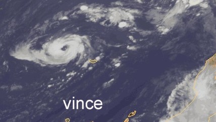
Thanks, Clark and Margie , pardon by my english.I hope that next year he is less hard than the previous. I observes with detail the season of hurricanes from Internet, every year I do it, this year has been impressive.In my coutry Vince and Delta was not very hard, although Delta in the Canary Islands it caused to many material damages.The next year I will be in order to give my vision from this side of the Atlantico. Happy New Year for all, and pardon by my english.
| Clark |
| (Meteorologist) |
| Fri Dec 30 2005 01:27 AM |
|
|
No problem, Eduardo.
Margie -- I had heard about that somewhere, but didn't even think about it here. No worries.
I just posted the last article in the series of the 2005 season-in-review. They aren't nearly as detailed as the NHC preliminary reports, but they are out sooner (except for the 6 that are currently available). With this last one, I tried to add in some more information toward understanding those high-latitude storms, such as Vince, Delta, and Epsilon. I personally liked doing the shorter months better than, say, August and September just because of being able to discuss what happened moreso than having a large number of storms to tackle with each report (and keep them *reasonably* small). I've also gone back and added another paragraph to the October summary at the end of Wilma's discussion, this one touching upon storm size.
Intrigued by what's going on out northwest of the Cape Verdes, certainly moreso than I was, but it has a very short window that is already closing. More of the models are calling for some surface development out there now than before (well, two versus zero), but it still is not a likely candidate for any development.
Happy New Year, everyone!
|
danielw
|
| (Moderator) |
| Fri Dec 30 2005 04:04 AM |

|
|
|
NHC, and others are watching that area too.
...A SURFACE TROUGH LIES ALONG 38W FROM 16N-22N. THERE IS
SOME POTENTIAL FOR THIS TROUGH TO DEVELOP INTO A CLOSED SURFACE
LOW OVER THE NEXT COUPLE OF DAYS.
http://www.nhc.noaa.gov/text/refresh/MIATWDAT+shtml/292344.shtml?
I hope everyone is enjoying the Holidays. Whether it's Christmas, Hanukkah,or Kwanzaa. Here's to hoping 2006 defies the odds in the opposite direction. ?Year of no Hurricanes?...We can always Hope.
Happy New Year, and keep it Safe.
Danny
| HanKFranK |
| (User) |
| Fri Dec 30 2005 09:24 AM |

|
|
|
check out the low near 24/38. it was flashing convection yesterday, but overnight it's burst some deeper stuff and the whole thing has a curved structure. nhc was placing the center sw of the convection, so visibles should confirm that. if there's a low underneath that convection, though... we may be talking about another hybrid.
HF 0924z30december
| Random Chaos |
| (Weather Analyst) |
| Fri Dec 30 2005 02:03 PM |
|
|
|
|
NRL has issued an Invest in the Atlantic (97L) for this thing. It sure looks like a cyclone on visible.
SSD has Dvorak at 2.5 - that's borderline Tropical/Subtropical Storm usually.
NRL:
97L
Visible
Microwave
Edit: fixed links
| Hurricane Dad |
| (Registered User) |
| Fri Dec 30 2005 02:24 PM |

|
|
|
Look at this excerpt from the latest Atlantic Tropical Weather Discussion
FIRST VISIBLE IMAGES SHOW DEEP CONVECTION ORGANIZING IN BANDS AROUND THE CENTER AND IT IS NOT INCONCEIVABLE THAT THIS SYSTEM COULD BECOME "ZETA" BEFORE THE END OF THE YEAR.
Thoughts?
Complete discussion available at:
http://www.nhc.noaa.gov/text/refresh/MIATWDAT+shtml/301108.shtml?
| Random Chaos |
| (Weather Analyst) |
| Fri Dec 30 2005 02:40 PM |
|
|
|
|
This storm's in a hard place to find IR images of it.
NASA GHCC - 6 Frame Animation
NASA GHCC - 12 Frame Animation
PSU
When is SSD going to stick a Floater on it so we can see the Dvorak IR easily?

Anyway, looking at the IR graphics, the convection looks like it has wrapped about 75% around the core now.
| MapMaster |
| (Weather Guru) |
| Fri Dec 30 2005 03:48 PM |
|
|
|
|
Looks like ZETA to me, moving nnw...or maybe it will be Alberto...but, odds are ZETA now and gone by then...if it was the 31st, could be a different story...what a way to end the year......I called this one a few days ago, just had a feeling, but, didn't expect to see what I see today!
MM

http://www.ssd.noaa.gov/PS/TROP/DATA/RT/EATL/IR4/20.jpg
| MapMaster |
| (Weather Guru) |
| Fri Dec 30 2005 03:48 PM |
|
|
|
|
Looks like you were right on NY surprise!
MM
| MapMaster |
| (Weather Guru) |
| Fri Dec 30 2005 03:52 PM |
|
|
|
|
Even has an eye...def a sts, possibly ts, I'd say...hope someone there at NHC will pick up on this....
MM
| Random Chaos |
| (Weather Analyst) |
| Fri Dec 30 2005 03:55 PM |
|
|
|
|
Quote:
Looks like ZETA to me, moving nnw...or maybe it will be Alberto...
That's an interesting question...if a storm spans the change of year, does it get both names?
| MapMaster |
| (Weather Guru) |
| Fri Dec 30 2005 04:00 PM |
|
|
|
|
Nope...if it forms in 2005, ZETA....if in 2006 , Alberto...it'll be one name or the other.
I realy do wonder if the folks at NHC are at work today...they probably are....it should have been classified already, IMHO...hope htis doesn't slip through the cracks....even if it does, I bet it will be post op classified.
MM
| Random Chaos |
| (Weather Analyst) |
| Fri Dec 30 2005 04:14 PM |
|
|
|
|
Special tropical statement just issued! Advisory will be issued in about an hour.
http://www.nhc.noaa.gov/text/refresh/MIADSAAT+shtml/301605.shtml?
| Margie |
| (Senior Storm Chaser) |
| Fri Dec 30 2005 04:22 PM |
|
|
|
|
Well, I am so new at this I didn't want to appear like a wishcaster and post, you know, oh, Zeta, before the end of the year, but I think it was about three days ago, or so, I starting thinking it would be possible, and then they mentioned it the very next day on the TWD, as possible. You know every day I have been trying to read the TWD and learning to spot various weather features on the sat images, and this is not the first cutoff low since that one that formed right after Epsilon that fizzled out; I've been watching all Dec. But it seemed to me that this one had more of a chance because (and this could be absolutely wrong because I am only really starting to understand the big picture) the weather pattern in the US has shifted a bit in the last part of this month.
I am not seeing much shear on the visual, but doesn't convection tend to be more shallow with these systems.
Yesterday you could see the surface low on quickscat to the SW, but couldn't see that on visible or IR (I can't bring up quickscat right now).
It is really pulling together so much faster than I thought possible. Yesterday I was thinking like Clark that time had pretty much run out, and that I'd (once again) made a wrong assumption thinking this one had more of a chance. But there it is. If it does make it to TS status, it would be so completely symmetric, in some abstract way, and appropriate for the season.
| Random Chaos |
| (Weather Analyst) |
| Fri Dec 30 2005 04:22 PM |
|
|
|
|
SSD Floater 1 has been moved to Zeta. Zeta doesn't look as good now as it did an hour ago.
Oh, this means that we can now say we've had every storm from A to Z

| Margie |
| (Senior Storm Chaser) |
| Fri Dec 30 2005 04:24 PM |
|
|
|
|
Quote:
Special tropical statement just issued! Advisory will be issued in about an hour.
http://www.nhc.noaa.gov/text/refresh/MIADSAAT+shtml/301605.shtml?
Oh my gosh!
Well now I guess it is ok if I get excited about anticipating this earlier in the week! Whoohoo.
---
RC - I wouldn't say that...convection is migrating towards the center from the bands to the east. Growing pains.
| Random Chaos |
| (Weather Analyst) |
| Fri Dec 30 2005 04:29 PM |
|
|
|
|
You realize it is all MikeC's fault, right? He started this thread with the topic "No hurricanes"
| Clark |
| (Meteorologist) |
| Fri Dec 30 2005 04:38 PM |
|
|
To me, I didn't think it could make the quantum leap (in organization) that it did overnight and sustain it long enough to be classified as a bonafide threat -- yet alone a tropical storm. There's another trough to its west heading toward the vicinity of Zeta, though it looks like the bulk of it may be trying to lift north around the storm. I'll be interested to see what the NHC package has to say; my best guess is about 1-2 days of longevity with a slow motion to the NW at first replaced by a track toward the northeast thereafter.
Shear values were initially pretty bad for development -- 60 or 65kt from 850-200mb -- but as the upper-low "built down" to the surface (or at least helped spawn, in some manner, a surface feature) and started to devleop there, the vertical shear values dropped. They now sit in the vicinity of 20kt, which is much more favorable (and not uncommon). The development of Zeta is similar to the other three out there, with some subtle differences -- perhaps with a taste of the "forming on the NE side in the diffluent region of an upper-low" scenario that we saw with some of the western Atlantic's storms.
Nevertheless, I'm glad I didn't say zero percent chance a few days ago -- turns out to be 100%. I love tropical activity that affects no one as much as the next person, but this is just crazy! I certainly hope that every deep-latitude trough in the eastern Atlantic doesn't continue to spawn these features as we move into 2006; they are pretty common features for winter and spring out that way. I'm still a bit surprised by this development, so I'll try to spend some time figuring out why we've got it later today.
| MapMaster |
| (Weather Guru) |
| Fri Dec 30 2005 04:43 PM |
|
|
|
|
Franklin (junior guy) on the job!
MM
| MapMaster |
| (Weather Guru) |
| Fri Dec 30 2005 04:44 PM |
|
|
|
|
LOL..I thought the same thing!
MM
| Clark |
| (Meteorologist) |
| Fri Dec 30 2005 04:55 PM |
|
|
Went ahead and created a new thread -- this season threw curve balls at us from June 1 all the way through December 31, so given that we're likely going to go near the New Year with a tropical storm, it's worth it to have a new thread for that.
| Margie |
| (Senior Storm Chaser) |
| Fri Dec 30 2005 05:13 PM |
|
|
|
|
Quote:
Franklin (junior guy) on the job!
MM
Hey! He has written a lot of good stuff, and makes the good calls as well.
| HanKFranK |
| (User) |
| Fri Dec 30 2005 06:40 PM |
|
|
|
|
well yeah... but he does have some revision to go see to. the hurricane epsilon post-analysis came out just a few days after the storm went out, and he began the report by calling it the last system of the 2005 season. i remember thinking "man, do you feel safe saying that in 2005?"
checked jeff masters' blog. he thinks that if it can scrape under the first bout of shear that it'll get into a supportive environment in early january and perhaps persist a few days until the next trough comes at it. not much of a way to tell, since these shallow systems are sometimes more shear-resistant than expected, but it can just as easily be ripped asunder in the face of the oncoming shear.
next thing i'm wondering is if we have more in the way of out-of-season activity coming up during the winter. it's almost like the north atlantic and north pacific switched roles this year.
HF 1839z30december