12:00 PM EDT Tue Jul 18 2017 Update
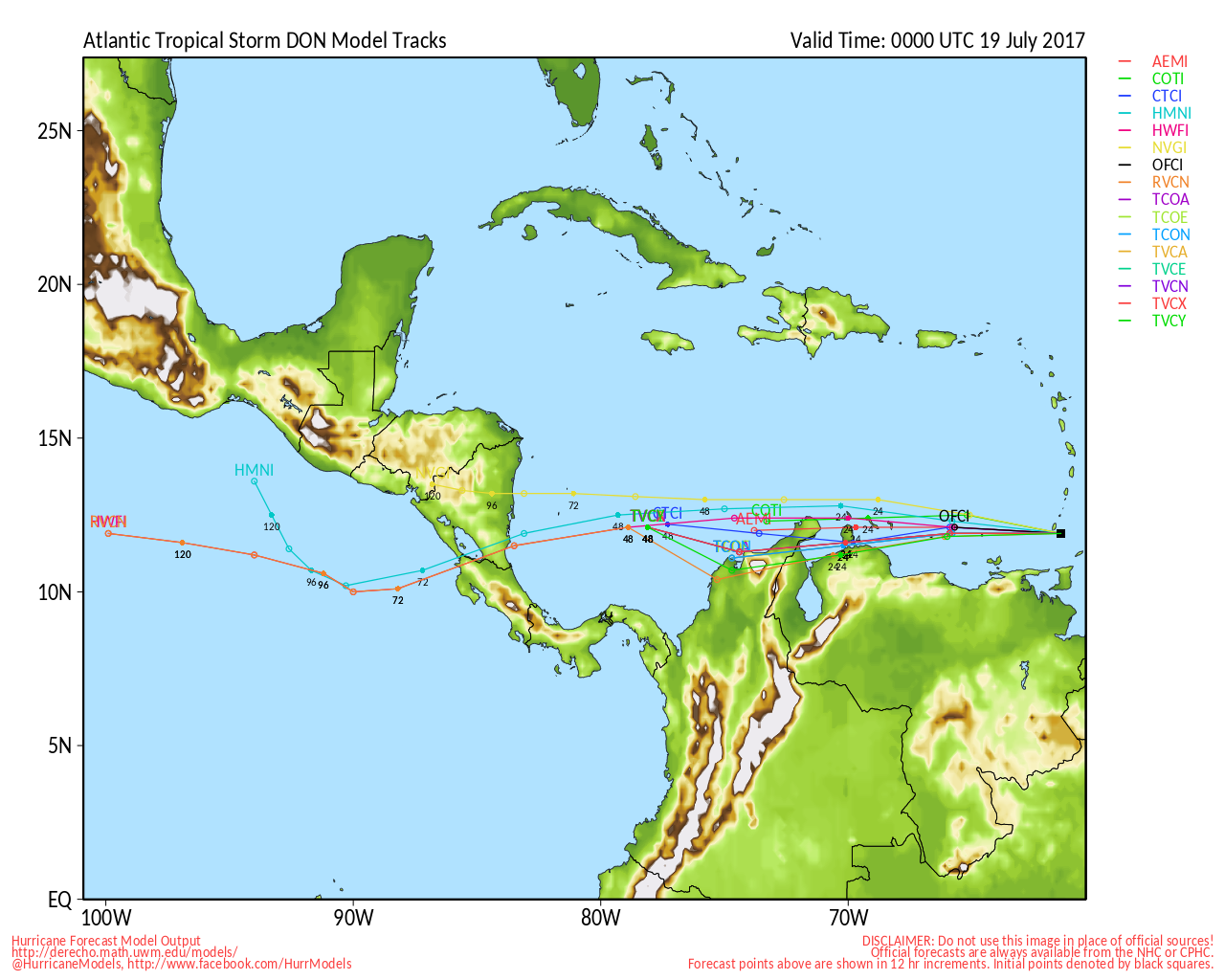
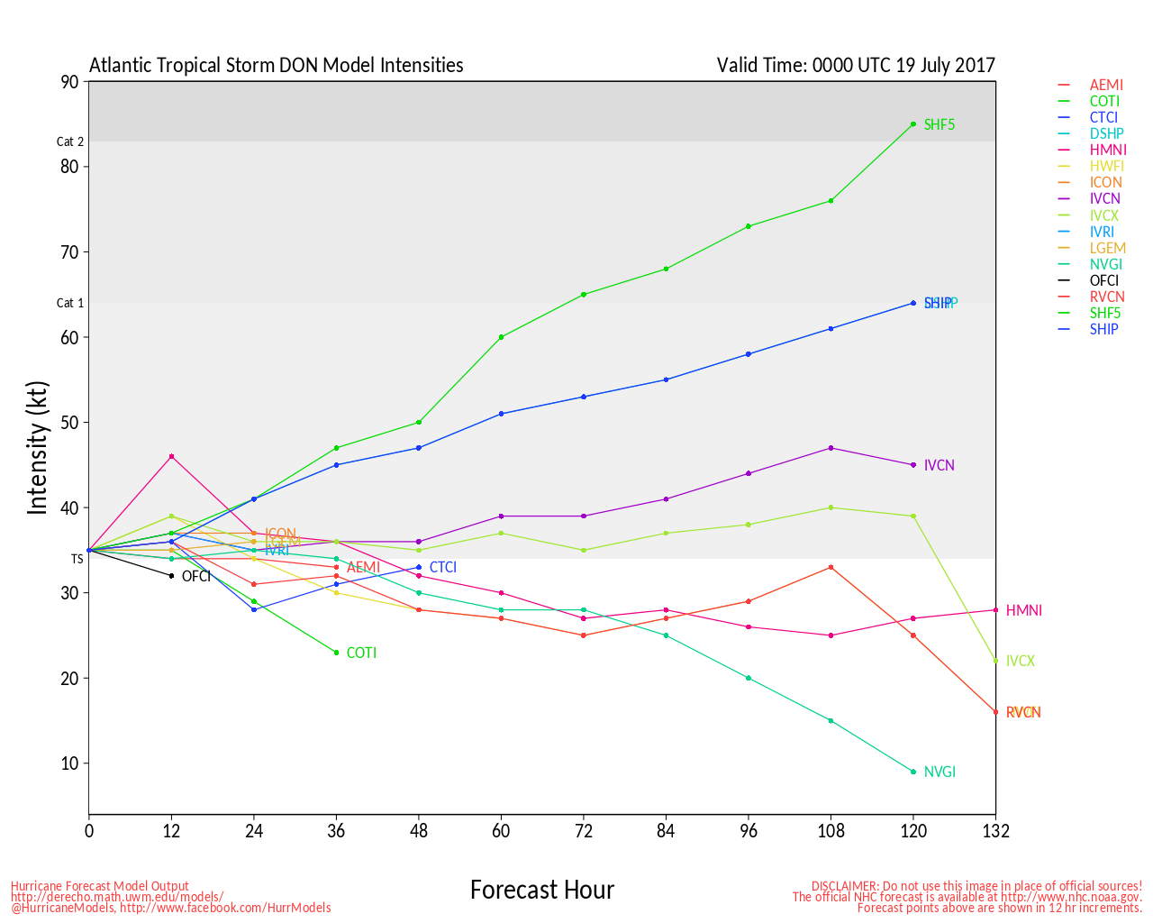
This morning's reconnaissance flight found Don succumbing to increasing shear and the abundance of nearby dry air, and in fact, the official forecast now calls for a continued weakening trend, with outright dissipation in just 36 hours. However, to remind our readers, Don is a small cyclone, susceptible to changes in intensity, and as such, it is possible that Don takes advantage of a more favorable window that could open up tonight, and strengthen some about the time it crosses the southernmost Lesser Antilles.
Elsewhere, Invest 96L is struggling even more so with dry air, and remains out at sea.
-Ciel
5:00 PM EDT Mon Jul 17 2017 Update
Recon has found that Invest 95L has become Tropical Storm Don, the fifth tropical cyclone and fourth named storm of the 2017 Atlantic Hurricane Season.
-Ciel
Original Entry:

The advertised DNA of 2017 favors development of named cyclones in the Main Development Region (A 'box' generally thought of as south of 20°N, and from 70°W to 20°W). We are now watching not one but two new disturbances in this region: Invests 95L and another, TBD.
As of 1:00PM EDT Monday July 17, recon is approaching Invest 95L, which has been looking more organized than yesterday, despite the appearance of struggling with some nearby dry air, as well as what is probably the diurnal convective minimum. Recon will be looking to see if 95L has developed a well-defined surface circulation and sufficient convective structure to be classified as a tropical cyclone.
Interests in the Lesser Antilles should consider watching these. Of note, Invest 95L is a bit of a smaller incipient tropical cyclone, and as such, could intensify faster than a larger system would. Model tracking of 95L (with its moniker updated if and as necessary), is also available in the 95L Forecast Lounge .
E. Carib Radar Recording
Edited by cieldumort (Tue Jul 18 2017 03:46 PM)


 Threaded


