11:A0AM EDT 8 October 2017 Update
Nate made landfall overnight near Biloxi, MS after a brief clip of extreme Southeastern Louisiana. As a category 1 hurricane. Storm surge was seen in areas near the center and east of it, and now it is decaying over Northern Alabama bringing some flooding rains.
Another area in the East Atlantic may develop (91L), but it should remain far away from land areas.
5:30PM CDT 7 October 2017 Update
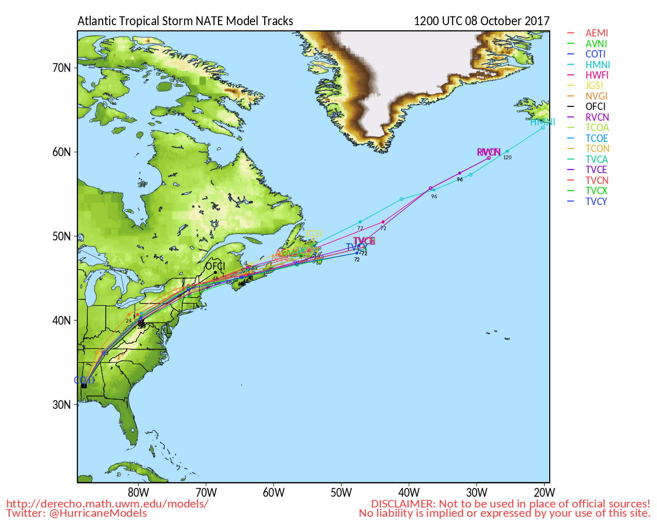
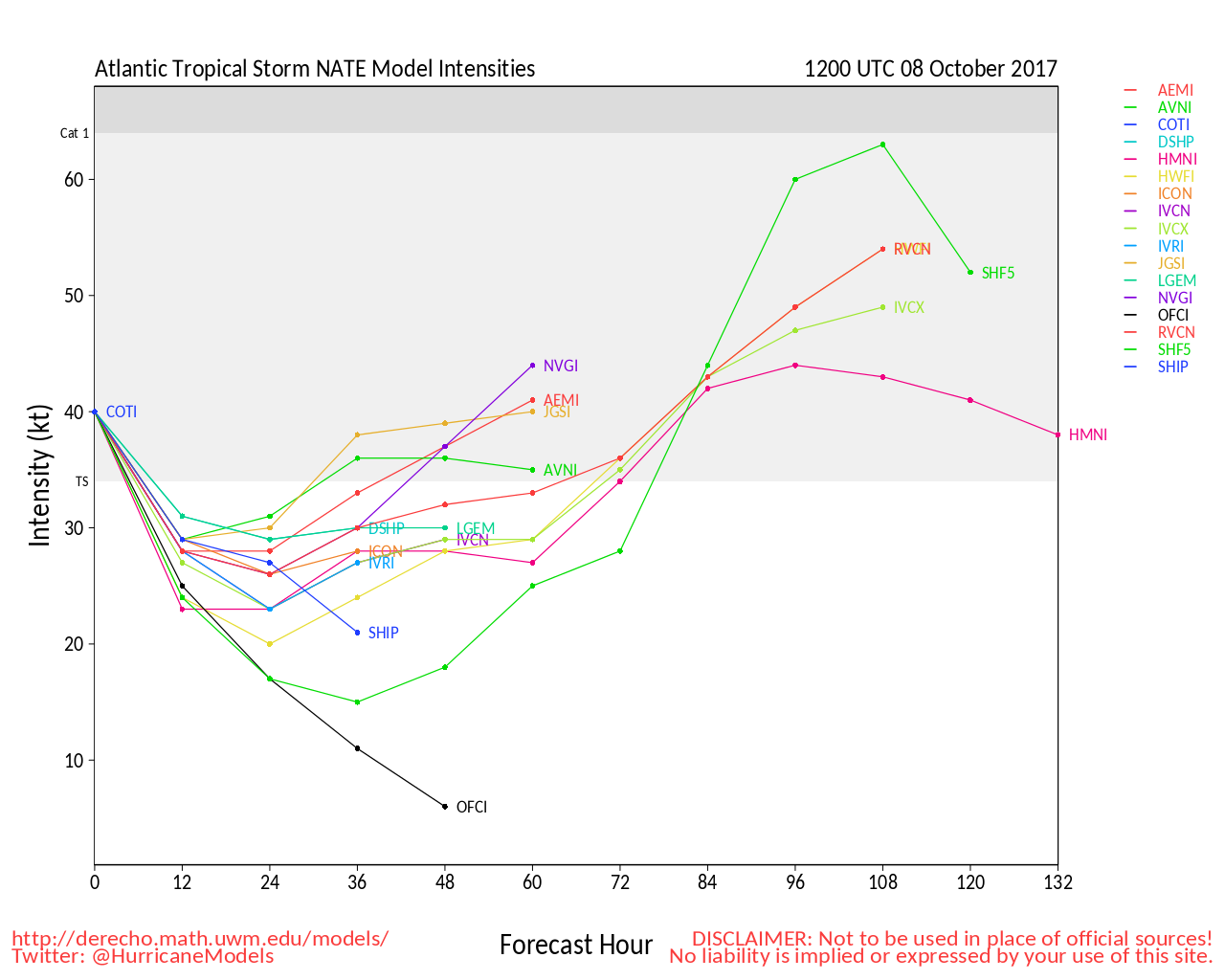
Nate's intensification has leveled off as a cat 1 borderline cat 2, and appears to making a run for the Mississippi Gulf coast.
Original Update
Hurricane Nate is currently an 85MPH category 1 hurricane and is forecast to be a category 2 hurricane by the time it makes landfall near Louisana/Mississipp late tonight. There exists a possibility this afternoon that it could strengthen more than expected, so please prepare as if it were a category 3 hurricane in the area and hope it stays weaker.
Nate should be landfalling in a very storm surge prone area, with 3-10 feet of surge possible in some areas along the Gulf coast. See The storm surge inundation map

For preparations, the problem is time, there's not much of it as rain is already beginning to impact parts of Louisiana, and this will spread east as the day goes on. Those in the area have until early afternoon.
It's worth noting that the eastern side of the storm is very strong, whereas te western side is fairly weak. Those on the west side of nate's eye will see much less impacts from those in to a fair bit east of the center of Nate. Partially due to rapid forward motion, where winds are added and driving surge onshore on the "right" side of the storm, and blowing offshore/weaker on the "left" side of the storm.
Please listen to local officials and media for more information. There are a few links below for some of it.
The flurricane twitter feed also rapid fires out additional information from various sources http://twitter.com/cfhc
Model discussions and more in the Nate Forecast Lounge.
Additionally invest 91L is in the northeast Atlantic and has a 70% chance to develop, likely staying away from land.
Nate Event Related Links

SFWMD Model Plot (Animated Model Plot) SFWMD Hurricane Page
[https://flhurricane.com/floatanimator.php?year=2017&storm=16 Flhurricane Satellite Floater Animation of Nate
GOES Floater
Animated Model Plot of Nate
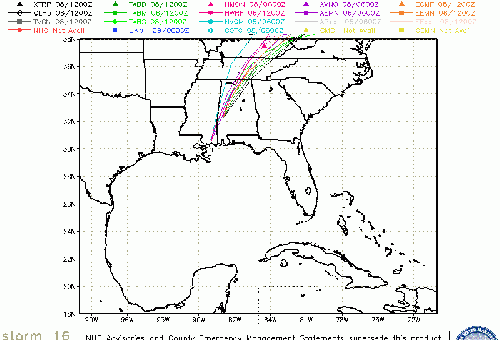
Clark Evans Track Model Plot of Nate
(Animated!) Model Plots in Google Earth - In Google Maps
Clark Evans Intensity Model Plot of Nate (Animated!)
Clark Evans Track Plot of Nate
Other Model Charts from Clark
Clark Evans Top 10 Analog Storms for Nate
More model runs on from RAL/Jonathan Vigh's page
NRL Info on Nate -- RAMMB Info
COD Atlantic Satellite View
Mississippi/Alabama Gulf Coast Media/Links
WLOX TV 13 (ABC) Biloxi
WXXV TV 25 (Fox)Biloxi
WKRG TV 5 (CBS) Mobile
WPMI TV 15 (NBC) Mobile
WALA TV 10 (Fox) Mobile
WEAR TV 3 (ABC) Pensacola, FL
Newspapers
Mobile Register (Al.com) paper
Biloxi Sun Herald paper
Gulf Live
Radio (some)
News Talk 104.9 Biloxi, MS (Radio)
News talk 106.5 Mobile, AL (Radio)
Power Outage
Louisiana power outage map
Mississippi Power Outage Map
Alabama Power Outage Map
Louisiana Information
Govt/Official Info:
Louisiana Emergency Management
Mississippi Emergency Management
Alabama Emergency Management
Louisiana Dept. of Transportation - Road Closures, Traffic Cams, etc.
Mississippi - Road Closures, Traffic Cams, etc
Alabama Road Conditions and Traffic Cameras
Media Newspapers/TV/Radio:
Nola.com New Orleans Times-Picayune
WWL TV 4 (CBS Affiliate in New Orleans)
ABC 26 TV (ABC Affiliate in New Orleans)
WDSU Channel 6 (NBC Affiliate New Orleans)
Fox 8 (New Orleans)
WTIX 690 News Radio
WWL 870 News Radio
WTOK 11 / Missippii Alabama ABC Affiliate
WKRG 5 in Mobile/Pensacola
WPMI Channel 15 from Mobile
North Gulf Links
North Gulf/Southern Mississippi Valley Composite Radar Loop
(Latest Static)
East to West:
Mobile, AL Radar Radar Loop
(Latest Static)
New Orleans, LA Radar Radar Loop
(Latest Static)
Lake Charles, LA Radar Radar Loop
(Latest Static)
Houston/Galveston, TX Radar Radar Loop
(Latest Static)
Gulf of Mexico Satellite Imagery
Area Forecast Discussions:
Mississippi/Alabama/Pensacola -
New Orleans, LA -
Lake Charles, LA -
Houston/Galveston, TX
Northeast Gulf Links
Southeast Composite Radar Loop
(Latest Static)
Tampa Bay, FL Radar Radar Loop
(Latest Static)
Key West, FL Radar Radar Loop
(Latest Static)
Mobile, AL Radar Radar Loop
(Latest Static)
Tallahassee FL Radar Radar Loop
(Latest Static)
Northwest Florida Radar Radar Loop
(Latest Static)
Gulf of Mexico Satellite Imagery
SFWMD Full Florida Radar (Includes east LA, MS,AL) Loop with Storm Track
Area Forecast Discussions:
New Orleans -
Mississippi/Alabama/Pensacola -
Panhandle/Tallahassee -
Tampa/West Central Florida
Various recordings for Nate
Ophelia Event Related Links

SFWMD Model Plot (Animated Model Plot) SFWMD Hurricane Page
[https://flhurricane.com/floatanimator.php?year=2017&storm=17 Flhurricane Satellite Floater Animation of Ophelia
GOES Floater
Animated Model Plot of Ophelia
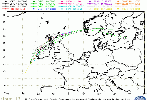
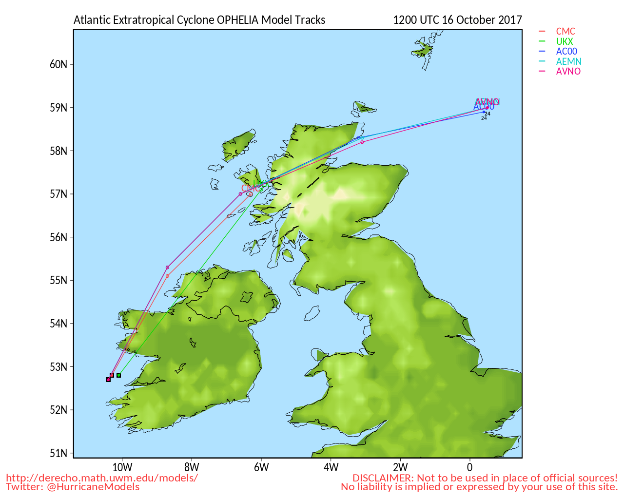
Clark Evans Track Model Plot of Ophelia
(Animated!) Model Plots in Google Earth - In Google Maps
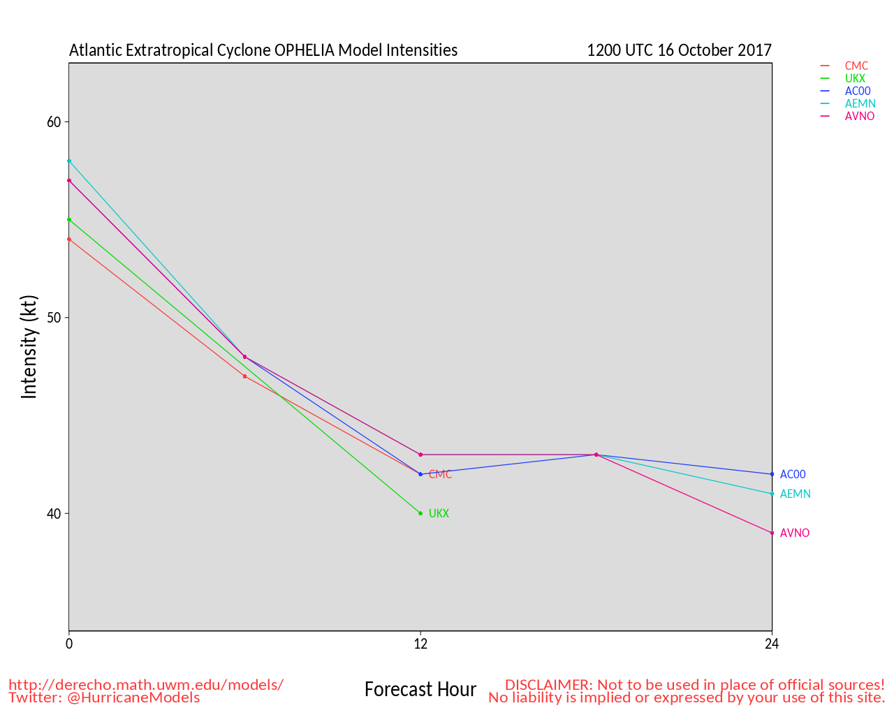
Clark Evans Intensity Model Plot of Ophelia (Animated!)
Clark Evans Track Plot of Ophelia
Other Model Charts from Clark
Clark Evans Top 10 Analog Storms for Ophelia
More model runs on from RAL/Jonathan Vigh's page
NRL Info on Ophelia -- RAMMB Info
COD Atlantic Satellite View


 Threaded


