Anonymous
Unregistered
|
|
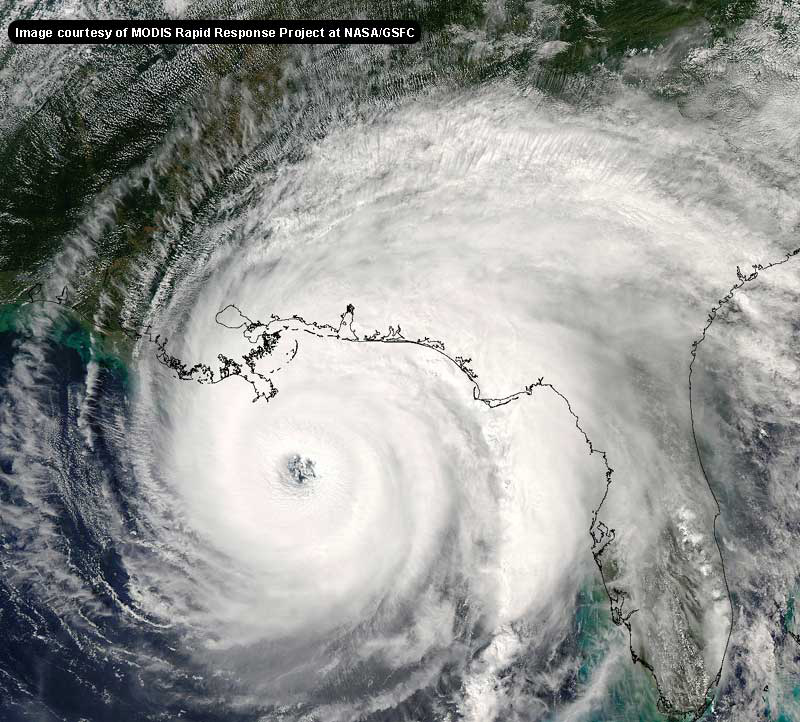
you can finally see an eye starting to show up on visibles. Doesn't look to have moved much.
|
doug
Weather Analyst
Reged:
Posts: 1006
Loc: parrish,fl
|
|
Just flipped through the 72hr model fixes off the Penn State site: NONE OF THEM HAVE IT PAST 90W! this is the 00Z run for all...AVN, , , the two MM's, Canadian and UKMET...
--------------------
doug
|
Colleen A.
Moderator

Reged:
Posts: 1432
Loc: Florida
|
|
It's so hard to look at a satellite picture and actually see just how big or small a storm is...I remember when Floyd came barreling down the pike (or maybe I should say up?) the closer it got the bigger it looked. I also remember looking at Floyd 24-36 hours before it brushed the Florida coastline and thinking, "Holy Sheet!"
By looking at Izzy, I noticed that when it was near Jamaica it looked as though it was 2x the size of that country. I don't know how big Jamaica is, so I can't give an estimate as to how much area the actual system covers.
However, having looked back the Public Advisories I see that yesterday's 11AM Advisory said that the Tropical Storm Force winds extended outward up to 85miles from the center of Isidore. At 5pm they changed it 70 miles; at 11PM and 2AM they were back to 85 miles outward; then at 5AM and 8AM it was 115 miles out, and the new advisory says the TS Force winds extend out 140 miles from the center. I'm sure you can all do your math, but it has pretty much doubled as far as how far out those winds extend in only 24 hours and if that's any indication of how big the storm actually is, well you can draw your own conclusions. That is also very important because it will determine how much Izzy will affect Florida's weather once it gets close. We all know what would happen with a direct hit so I don't need to go into that..but say the storm is only 100 miles offshore someone is gonna feel it. Notice also that the strongest winds were to the north and east of the center....that will make a huge difference on what the Florida coastline will feel depending on how close it gets. When Allison came ashore last year in TX, I was driving back home from GA and I got to Valdosta and had to stop. The feeder bands from Allison were directly over Valdosta, and given the fact that she was not even that strong of a storm, it was a very bad weather situation. Sometimes we got as much as 4" of rain/hour. Not to mention tornadoes, thunderstorms and all the other good stuff that comes with those feeder bands. At one point it rained so much that the water was coming into my hotel room. Not to mention that while I was in the shower the power went off. That was scary also...all I could think of was the movie "Pyscho". 
--------------------
You know you're a hurricane freak when you wake up in the morning and hit "REFRESH" on CFHC instead of the Snooze Button.
|
Rasvar
Weather Master

Reged:
Posts: 571
Loc: Tallahassee, Fl
|
|
The Air Force Reserve flights won't be able to occur while the center is near and over Cuba. Cuba only allows the NOAA craft to fly then, so observations will be limited during that time; but not non-existant.
--------------------
Jim
|
Anonymous
Unregistered
|
|
Colleen...you can't always judge a storm by how far out it's winds extend....sometimes a very strong storm can be very compact, i.e. Camille... or as you said a weak storm can extend out over a large area..i.e. Allison. Size can be irrelevant in the strength of a storm. Let's hope this storm doesn't get it's act together and cause a major disaster.
|
PaulyAce2002
Verified CFHC User
Reged:
Posts: 11
Loc: Largo, Florida, United States
|
|
Im in the Tampa Bay area...a town called Largo, west of Tampa, north of St. Pete, south of Clearwater
|
SirCane
Storm Tracker

Reged:
Posts: 249
Loc: Pensacola, FL
|
|
Isidore may hit the Northern Gulf coast from New Orleans to Apalachicola. When you look at times past (Frederic, Camille, Elena, Georges) Hurricanes that come from just below Cuba and near Jamaica, usually come up to this area this time of year. (Climatology speaking)
Let's just hope that before landfall, Isidore isn't as strong as he could get. I won't get my hopes up. The beaches have already taken a beating from these past storms. Not sure how much more they can take.
--------------------
Direct Hits:
Hurricane Erin (1995) 100 mph
Hurricane Opal (1995) 115 mph
Hurricane Ivan (2004) 130 mph
Hurricane Dennis (2005) 120 mph
http://www.hardcoreweather.com
|
bsnyder
Verified CFHC User
Reged:
Posts: 18
|
|
To exand on what Colleen said - if Izzy comes up the west coast of Florida, and is only 100 miles or so offshore, do ya'll think there will be evacuations regardless of the "official" track? That seems too close for comfort, given the difficulty in forecasting an exact track for these storms? If it's a Cat II by then, I think the local officials will all err on the side of caution.
Seems like we might have to have massive evacuations all the way up the coast...just like with Floyd.
|
Steve
Senior Storm Chaser

Reged:
Posts: 1063
Loc: Metairie, LA
|
|
FWIW, 00Z was 17 hours ago. I still don't know if the storm gets past 90 W, but don't put ANY stock in the 00Z models. I've got a post in the last thread at the top of page 13 explaining my reasoning, but basically it seems like the Northerly relocation of the center yesterday afternoon played big into those ideas. Look at the 06Z run and you'll already notice a change further back to the west - and that would have been data from 1am while the storm was still moving N-NNW because it didn't take that westerly jog until the wee hours. Look for that to show up in the 18Z runs. I just hate that these things are so far behind. Of course it's my own fault for relying on the PSU site rather than going to the official model sources.
Steve
--------------------
MF'n Super Bowl Champions
|
Anonymous
Unregistered
|
|
Andrew is another example of a small compact storm.
|
Rasvar
Weather Master

Reged:
Posts: 571
Loc: Tallahassee, Fl
|
|
Until the storm gets past Cuba. I think we are getting close to the point where we will lose the Air Force recon for a few days and be left with only the upper-air NOAA Gulfstream observations. I don't know how well Cuba land stations are distrubuted, so it may be that the models are going to be going on less data for the next 24-36 hours very soon. Once the Air Force recon can restart on the other side of Cuba, I think the models will reestablish themselves better. For now, might as well roll dice and pick a route. There are good arguments for a lot of cases.
--------------------
Jim
Edited by Rasvar (Thu Sep 19 2002 05:15 PM)
|
Justin in Miami
Storm Tracker
Reged:
Posts: 269
Loc: Ft. Lauderdale, Florida
|
|
Steve
What sites besides the PSU site can we find those models?
|
scottsvb
Weather Master
Reged:
Posts: 1184
Loc: fl
|
|
FINALLY A EYE BEGINNING TO SHOW IN VIS SAT. TOO EARLY AND HARD TO TELL WHERE IT WILL GO AFTER CUBA,CURRENTLY SHE HAS SLOWED A BIT AND SHOULD BE A HURRICANE VERY VERY SOON IF NOT ALREADY. ILL MAKE FULL POST IN A HOUR! SCOTTSVB
|
Anonymous
Unregistered
|
|
Hey Scott, definitely a bit further north than west. Should stay east of the Isle of Youth. Darn close to the 82W benchmark!! Cheers!! Steve H.
|
Steve
Senior Storm Chaser

Reged:
Posts: 1063
Loc: Metairie, LA
|
|
They're all over. You can get them off of this site, you can get them from atwc.org (click "Wx Forecast Models), you can get them from the site of their origin (U.K. Meterology office; Environment Canada; , etc.).
Steve
--------------------
MF'n Super Bowl Champions
|
Colleen A.
Moderator

Reged:
Posts: 1432
Loc: Florida
|
|
In reply to:
"Size can be irrelevant in the strength of a storm. Let's hope this storm doesn't get it's act together and cause a major disaster.
Let me clarify and add something to that...I realize that even a small storm can be as deadly as a big storm i.e., Andrew vs. Floyd. Pretty much the same strength, yet a big difference in size. My point is that the bigger the storm is, the more area it will cover. My own opinion is that the size of the storm is absolutely relevant, especially when you are talking about a major hurricane. If Floyd had come ashore and across Florida, we probably wouldn't be talking right now. Because even in Lakeland, which is a 1 to 1-1/2 hour drive to the east coast of Florida and about a 1 hour drive to the West Coast, we were told to expect hurricane force winds INLAND. Whereas with Andrew, it was small enough (and by no means am I trying to lessen the impact it had) that it only affected a limited area. If Isidore becames a major hurricane and sits 40 miles off the coast, if it's big enough we WILL feel it. Also...if it just sits there and spins, we are looking at some major flooding problems. Just yesterday Polk County (where I live) was being told about a potential for major flooding.
I hope you understand what I mean. 
--------------------
You know you're a hurricane freak when you wake up in the morning and hit "REFRESH" on CFHC instead of the Snooze Button.
|
Anonymous
Unregistered
|
|
I agree w/ Sir Cane. Check out climatology when the models are too divergent. A good track climatology site is http://www.wunderground.com/tropical/ Just click on Isidore and "historical track", and you will see a plot of all similar storms (meaning by month, TD TS or H, and by 300 mile proximity) since 1886. In Isi's case, I see two clusters of climatology tracks. One is AL-MS-FL panhandle as previously stated (about 6-8 tracks). The other cluster is clearly the FL peninsula (6-8 more tracks). Relatively absent is the TX/MX pathway. Right now, I say P' Cola to Appalachicola.
climate history buff - Orlando
|
Steve
Senior Storm Chaser

Reged:
Posts: 1063
Loc: Metairie, LA
|
|
ULL off the NW coast of Yucatan Peninsula is now moving a bit N of NW (see goes 8 water vapor - 30 frames). Mean trof axis getting close to TX/NM border still digging SE. Ridge atop Isidore moving along with with the storm, slowing the progress of the cold front whose tail is near the Austin, TX area.
All players down the line.
Steve
--------------------
MF'n Super Bowl Champions
|
Cocoa beach
Unregistered
|
|
http://www.ssd.noaa.gov/PS/TROP/DATA/RT/float-wv-loop.html
|
ShawnS
Storm Tracker
Reged:
Posts: 226
Loc: Pearland,Tx
|
|
Can you spell out what that means because I'm not as experienced in this as you. How will that effect Izzy?
|


 Threaded


