MikeC
Admin
Reged:
Posts: 4544
Loc: Orlando, FL
|
|
Interesting note
http://bricker.met.psu.edu/trop-cgi/gfdl...;hour=Animation
Latest is back east again.
|
Rasvar
Weather Master

Reged:
Posts: 571
Loc: Tallahassee, Fl
|
|
Looking at the marine advisory, is standing pat on the forecast this time around.
|
doug
Weather Analyst
Reged:
Posts: 1006
Loc: parrish,fl
|
|
That's scary...that is exactly what I predicted a couple of hours ago.
--------------------
doug
|
rmbjoe1954
Weather Master

Reged:
Posts: 427
Loc: Port Saint Lucie, Florida, USA
|
|
What did you predict a couple of hours ago?
--------------------
________2023 Forecast: 20/10/5________
There is little chance that meteorologists can solve the mysteries of weather until they gain an understanding of the mutual attraction of rain and weekends. ~Arnot Sheppard
|
SirCane
Storm Tracker

Reged:
Posts: 249
Loc: Pensacola, FL
|
|
Who knows what's going to happen with ? We'll see once he passes Cuba. It's really strange though. You don't see Hurricanes bend like this toward the Western Florida Peninsula in Early August! 
|
joepub1
Storm Tracker
Reged:
Posts: 240
Loc: Jacksonville,Fla
|
|
Mike, thanks for the link. One point I'd like to make is this: Look at Jacksonville in the latest run and compare it to the 3-4 runs before. For the most part, with the slight shift to the east or west, the end game for Florida stays the same. I would hope that everyone from south of Tampa all the way to JAX keeps in mind that this storm will pack a punch all the way across the state. 4-8 inches of rain and at least TS winds for a wide area in a very short period of time, on top of the water that Bonnie dumps on the northern section of the state today. All of FL was soaked from a wet summer already. The dollar figure could be very high from damage that would not have happened during one of our drier summers. Be Carefull!!!
Edited by joepub1 (Thu Aug 12 2004 03:07 PM)
|
doug
Weather Analyst
Reged:
Posts: 1006
Loc: parrish,fl
|
|
A land fall solution more east of the then current track approx at Charlotte Harbor...almost exactly where now puts it. I am not happy with that because as it goes north it will get 10-15 miles E from my home as it passes by...the west solution was better for me in that regard...but this one is better ue to less water in the tidal river i live oly about 600 yards from. 10 feet of water in there is a big issue for me.
--------------------
doug
|
Steve hirschb.
Unregistered
|
|
Mike, that's the 6z run. Is there a 12Z update?
|
danielw
Moderator

Reged:
Posts: 3525
Loc: Hattiesburg,MS (31.3N 89.3W)
|
|
HURRICANE DISCUSSION NUMBER 13
NWS TPC/NATIONAL HURRICANE CENTER MIAMI FL
11 AM EDT THU AUG 12 2004
RECENT DATA FROM RECONNAISSANCE AIRCRAFT...SATELLITES...AND RADARS
FROM CUBA INDICATE HAS BECOME BETTER ORGANIZED AND HAS
STRENGTHENED. THE PRESSURE HAS DECREASED TO 983 MB AND FLIGHT-LEVEL
WINDS WERE 83 KT IN THE SOUTHEAST QUADRANT AT 700 MB. BASED ON THIS
INFORMATION AND EARLIER RECON WIND REPORTS INDICATING NEAR 80 KT
SURFACE WINDS...THE ADVISORY INTENSITY HAS BEEN INCREASED TO 80 KT.
UPPER-LEVEL OUTFLOW IS GOOD IN THE NORTHEAST SEMICIRCLE AND IS
IMPROVING TO THE SOUTHWEST.
THE INITIAL MOTION IS 310/15. REMAINS BASICALLY ON THE
PREVIOUS FORECAST TRACK. WHILE THE SPREAD IN THE MODEL GUIDANCE
HAS INCREASED SOMEWHAT FOR THIS ADVISORY PACKAGE...THE CONSENSUS OF
THE MODELS REMAINS VERY CLOSE TO THE PREVIOUS FORECAST TRACK. NOAA
GULFSTREAM-IV DROPSONDE DATA ALONG WITH 12Z UPPER-AIR OBSERVATIONS
INDICATE THE SUBTROPICAL RIDGE OVER SOUTH FLORIDA AND THE
SOUTHEASTERN GULF OF MEXICO IS SLOWLY WEAKENING AND ERODING
EASTWARD. THIS SHOULD ALLOW TO MAKE A GRADUAL TURN TO THE
NORTH-NORTHWEST LATER TODAY AND TURN NORTHWARD BY FRIDAY MORNING
WHEN THE HURRICANE IS NORTH OF WESTERN CUBA. AFTER THAT...CHARLEY
WILL COME UNDER THE INFLUENCE OF A STRONG MID- TO UPPER-LEVEL
TROUGH OVER THE CENTRAL GULF...WHICH WILL ACT TO ACCELERATE THE
HURRICANE NORTH AND NORTH-NORTHEASTWARD BY FRIDAY EVENING. THE
OFFICIAL FORECAST TRACK IS CLOSE TO THE PREVIOUS TRACK...ONLY
SLIGHTLY SLOWER.
THE UPPER-LOW TO THE WEST OF CONTINUES TO MOVE WESTWARD AWAY
FROM THE HURRICANE...WHICH IS LESSENING THE SHEAR. SINCE THE
CENTRAL CORE DEEP CONVECTION AND OUTFLOW HAS IMPROVED...AND THERE
IS AN ABUNDANCE OF WARMER WATER AHEAD...CHARLEY SHOULD CONTINUE TO
INTENSIFY AND COULD POSSIBLY REACH MAJOR HURRICANE STRENGTH BEFORE
IT REACHES WESTERN CUBA. AFTER PASSING OVER CUBA...THE INTENSITY
MAY DROP SLIGHTLY...BUT RE-STRENGTHENING APPEARS LIKELY AS THE
SHEAR IS EXPECTED TO REMAIN LOW ALMOST UP UNTIL LANDFALL OCCURS.
THERE IS A DISTINCT POSSIBILITY THAT COULD BE NEAR MAJOR
HURRICANE STRENGTH WHEN IT MAKES LANDFALL ALONG THE FLORIDA WEST
COAST...ESPECIALLY IF IT MAKES LANDFALL FROM THE TAMPA BAY AREA AND
SOUTHWARD WHERE THE VERTICAL SHEAR WILL BE LESS.
FORECASTER STEWART
|
joepub1
Storm Tracker
Reged:
Posts: 240
Loc: Jacksonville,Fla
|
|
THE UPPER-LOW TO THE WEST OF CONTINUES TO MOVE WESTWARD AWAY
FROM THE HURRICANE...WHICH IS LESSENING THE SHEAR. SINCE THE
CENTRAL CORE DEEP CONVECTION AND OUTFLOW HAS IMPROVED...AND THERE
IS AN ABUNDANCE OF WARMER WATER AHEAD...CHARLEY SHOULD CONTINUE TO
INTENSIFY AND COULD POSSIBLY REACH MAJOR HURRICANE STRENGTH BEFORE
IT REACHES WESTERN CUBA. AFTER PASSING OVER CUBA...THE INTENSITY
MAY DROP SLIGHTLY...BUT RE-STRENGTHENING APPEARS LIKELY AS THE
SHEAR IS EXPECTED TO REMAIN LOW ALMOST UP UNTIL LANDFALL OCCURS.
THERE IS A DISTINCT POSSIBILITY THAT COULD BE NEAR MAJOR
HURRICANE STRENGTH WHEN IT MAKES LANDFALL ALONG THE FLORIDA WEST
COAST...ESPECIALLY IF IT MAKES LANDFALL FROM THE TAMPA BAY AREA AND
SOUTHWARD WHERE THE VERTICAL SHEAR WILL BE LESS.
|
Anonymous
Unregistered
|
|
Hello.... I am from Nova Scotia (Canada)...... I was wondering what you guys thought the odds are of hitting us are... i want to know so i can tkae precautions because of hurricane juan last year.... thank you. :?:
|
Lake Toho - Kissimmee
Storm Tracker

Reged:
Posts: 317
Loc: Kissimmee, Florida on Lake Toh...
|
|
THERE IS A DISTINCT POSSIBILITY THAT COULD BE NEAR MAJOR
"HURRICANE STRENGTH WHEN IT MAKES LANDFALL ALONG THE FLORIDA WEST
COAST...ESPECIALLY IF IT MAKES LANDFALL FROM THE TAMPA BAY AREA AND
SOUTHWARD WHERE THE VERTICAL SHEAR WILL BE LESS."
Notice the above statement.

--------------------
Dream like you will live forever.. Live like there is no tommorow.. Darwin Rules !!
|
joepub1
Storm Tracker
Reged:
Posts: 240
Loc: Jacksonville,Fla
|
|
Dan, your fast.....
Feel free to delete my post if you like, Mike. I didn't mean to duplicate the info 
|
doug
Weather Analyst
Reged:
Posts: 1006
Loc: parrish,fl
|
|
GFDL has it as a MAJOR when it puts it on shore. the is also more of a direct hit rather than at the oblique angle we discussed earlier
--------------------
doug
|
joepub1
Storm Tracker
Reged:
Posts: 240
Loc: Jacksonville,Fla
|
|
The eye is begining to clear out straight north of the larger Cayman island....wow
|
hurricane_run
Storm Tracker

Reged:
Posts: 366
Loc: USA
|
|
The is not good with intensity.
|
GaryC
Weather Guru
Reged:
Posts: 109
|
|
O, i have a ? If it says 90knt then why hasnt the wind been raised yet?
|
doug
Weather Analyst
Reged:
Posts: 1006
Loc: parrish,fl
|
|
The discussion infers a major Cat III as it proceeds northward todayand tomorrow...GFDL pegs it at 113 kt or about 130mph. That's major.
--------------------
doug
|
LI Phil
User

Reged:
Posts: 2637
Loc: Long Island (40.7N 73.6W)
|
|
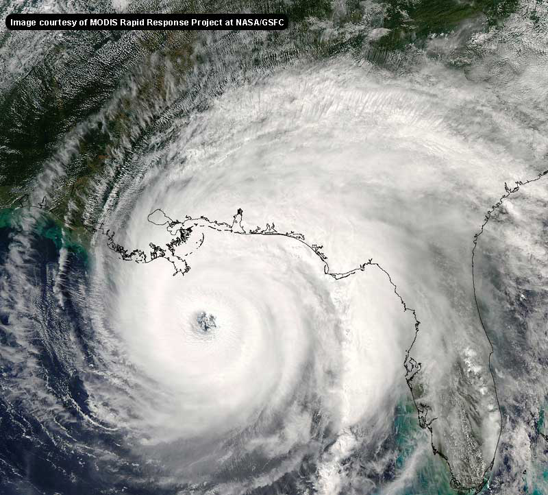
The eye is now clearly visible, as pointed out by joepub1
Charley
Things are starting to really ramp up now...getting serious
--------------------
2005 Forecast: 14/7/4
BUCKLE UP!
"If your topic ain't tropic, your post will be toast"
|
doug
Weather Analyst
Reged:
Posts: 1006
Loc: parrish,fl
|
|
What is the link to your Satellite pics..they seem to be more rel time than what i am able to get today.
--------------------
doug
|


 Threaded


