scott
Unregistered
|
|
yes i was right in the middle of hurricane in orlando life still is not back to normal 2 weeks later .i finally got my power back but there is still no power for some people ...charley did alot of damage to my house and left my neighbor homeless !!thewinds were very scary but there wasnt much rain ih ope gos away but its not looking good
|
Keith234
Storm Chaser

Reged: Thu
Posts: 921
Loc: 40.7N/73.3W Long Island
|
|
Thanks for correcting my mistake, I have much to learn from you guys. I wouldn't say I'm wishcasting (or what you call it) but it's they way I think, reverse psychogly, if I say it's going to happen it doesn't(or something along those lines). But your right, I never really experinced a strong hurricane, expect Gloria so I don't now what it's like, I'm only a beginner at this.
--------------------
"I became insane with horrible periods of sanity"
Edgar Allan Poe
Edited by Jason234 (Fri Aug 27 2004 06:56 PM)
|
GuppieGrouper
Weather Master
Reged: Fri
Posts: 596
Loc: Polk County, Florida
|
|
I think the best we can hope for is that while it is not an immediate threat to land it will go ahead and reach its maximum intensity and then be on the wind down by the time it gets near land. That way any troughiness, cold front, or upperlevel anomaly would have more shearing effect on whats left. I know that the models do not give this information this far in advanced, but no one needs this hurricane to be a CAT 5 unless it is out in the middle of the Pacific Ocean going in circles.
--------------------
God commands. Laymen guess. Scientists record.
|
Maitland, FL
Unregistered
|
|
Charley was scary enough here in Orlando, don't want to think about a possible stronger storm hitting here. 
|
WeatherNLU
Meteorologist

Reged: Sat
Posts: 212
Loc: New Orleans, LA
|
|
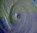
It's obviously way to early to try to pinpoint a landfalling position. The dubious thing is that this will make a US mainland landfall. There is no escaping that at this point. The ridge will certainly be strong enough to bring the storm to east coast if not across Florida and into the Gulf. It's really amazing to me, even after all these years studying canes and meteorology in general, how in awe of these things I am. is just an amazing storm already, and she hasn't even hit 50W. The "buzz-saw" look to it just reminds me so much of Andrew and it's obviously taking a somewhat similar track (generalization, i.e. the upcoming bend back to the west) as its 1992 counterpart. It's looks like it's going to be bad news for someone.
--------------------
I survived Hurricane Katrina, but nothing I owned did!
|
Maitland, FL
Unregistered
|
|
Looks like she's getting more symetrical, I guess that means she's strengthening even more. Maybe it would be a Cat. 4 at 11, or maybe 5 tomorrow morning. Thats not good news to have that strong of a storm still far out there in the Atlantic, hope it doesn't reach Cat. V. 
|
LI Phil
User

Reged: Fri
Posts: 2637
Loc: Long Island (40.7N 73.6W)
|
|
Without the benefit of recon and due to the fact that daytime strengthening will probably have diminished, I would think it highly unlikely there will be any upgrade before tomorrow. It's already strengthened from a TD to a CAT III in 48 hours (give or take). However, if the 's come in high at the 2345Z, it's possible, but unlikely. Add to the fact that, while it is a CAT III, it's just barely a CAT III, so it would take a fairly good amount of strengthening to make the jump. Will be watching it tho...
--------------------
2005 Forecast: 14/7/4
BUCKLE UP!
"If your topic ain't tropic, your post will be toast"
|
Maitland, FL
Unregistered
|
|
That's true, I forgot their not doing recons yet. That is quite a big leap in intensity. 
|
meto
Weather Guru
Reged: Wed
Posts: 140
|
|
latest shows it getting stonger looks like. could be around 125 tomite cat 4 sat.
|
danielw
Moderator

Reged: Wed
Posts: 3525
Loc: Hattiesburg,MS (31.3N 89.3W)
|
|
Has anyone seen or heard mention of the Low located North of and East of TD7. Or have I missed something somewhere?
More specifically located at 28.9N and 65.2W at 0015Z.
Nice low level circulation and convection appears to be firing up. Another problem to reckon with.
What nam,e comes after "Gaston"?
Edited by danielw (Fri Aug 27 2004 08:46 PM)
|
LI Phil
User

Reged: Fri
Posts: 2637
Loc: Long Island (40.7N 73.6W)
|
|
27/2345 UTC 31.3N 78.2W T1.5/1.5 07
27/2345 UTC 16.0N 50.0W T5.0/5.5
As I suspected, not only will not be upgraded at 11:00, it's possible (though not likely) she might even be downgraded. Still a weak CAT III. And that's where she'll be by morning light.
--------------------
2005 Forecast: 14/7/4
BUCKLE UP!
"If your topic ain't tropic, your post will be toast"
|
GuppieGrouper
Weather Master
Reged: Fri
Posts: 596
Loc: Polk County, Florida
|
|
Hermine
--------------------
God commands. Laymen guess. Scientists record.
|
danielw
Moderator

Reged: Wed
Posts: 3525
Loc: Hattiesburg,MS (31.3N 89.3W)
|
|
Thanks Guppygrouper. I see TPC/NHC is keeping an eye on it too! They should be running out of eyes-no pun intended.
I see 4 tropical systems on 1 satellite shot.
|
GuppieGrouper
Weather Master
Reged: Fri
Posts: 596
Loc: Polk County, Florida
|
|
Actually, the more, the better. Then they may start interfering with each other and keep anything from being completely out of control.Besides, I don't really care for the name Hermine, and don't think even a hurricane should get stuck with it.
--------------------
God commands. Laymen guess. Scientists record.
|
HCW
Storm Tracker

Reged: Fri
Posts: 287
Loc: Mobile,AL
|
|
Is it just me or does it look like its about to do the eye wall replacment thing
BTW, take your little advertisement for the $50 out of there or I will ax your next post(s) if I let it get that far...
--------------------
Over 4,000 members and now on a new server
http://www.hardcoreweather.com
Edited by LI Phil (Fri Aug 27 2004 09:59 PM)
|
LI Phil
User

Reged: Fri
Posts: 2637
Loc: Long Island (40.7N 73.6W)
|
|
First off, Hardcore, we've got a new thread. Secondly, what did I say about posting images....don't make me angry. All future replies should be addressed on the new thread!
--------------------
2005 Forecast: 14/7/4
BUCKLE UP!
"If your topic ain't tropic, your post will be toast"
|
HCW
Storm Tracker

Reged: Fri
Posts: 287
Loc: Mobile,AL
|
|
Sorry I just scrolled to the last page in this thread and didn't see that I could not post here or post images.
Have a good night
--------------------
Over 4,000 members and now on a new server
http://www.hardcoreweather.com
|
meto
Weather Guru
Reged: Wed
Posts: 140
|
|
it looks better now than 2 hrs,ago, eye is better, it will ramp up sat. morning.
|
redbird
Unregistered
|
|
Well taking a guess that if hits the east FL coast ............and I say when rather than if that it will cut across the state like did and be backdoor action for the gulf side.
|
Mooshie
Unregistered
|
|
I am watching the current track of and even with the ridge of pressure that is supposed to keep it south of South Carolina what is the likihood of a more northward turn?
I have noticed in the past that a sharp turn to the north is fairly consistent even with the high pressure ridge.
|


 Threaded

 [Re:
[Re: 


