Tazmanian93
Weather Master

Reged: Sun
Posts: 495
Loc: Tampa
|
|
I tell ya, you look at RAMSDIS - 12 4km IR 4 Floater #1 and on the last frame 192, I am wondering when exactly it starts the move W? Being that I am in Tampa
--------------------
Don't knock the weather; nine-tenths of the people couldn't start a conversation if it didn't change once in a while.
Go Bucs!!!!!!!!!
****************
Ed
Edited by Tazmanian93 (Fri Jun 10 2005 10:48 AM)
|
Droop31
Weather Watcher
Reged: Wed
Posts: 32
Loc: Pensacola
|
|
Looks like hurricane watches will go up at the 11am update. Should be interesting to see who will be included and how big of an area it will cover.
|
WXMAN RICHIE
Weather Master

Reged: Mon
Posts: 463
Loc: Boynton Beach, FL
|
|
Yes, needs to get some more of a westerly movement or she will head right in to the panhandle with the worst weather in the Florida Big Bend area.
--------------------
Another typical August:
Hurricane activity is increasing and the Red Sox are choking.
Live weather from my backyard:
http://www.wunderground.com/weatherstation/WXDailyHistory.asp?ID=KFLBOYNT4
|
Artsy Fartsy
Verified CFHC User

Reged: Thu
Posts: 12
Loc: Fernandina Beach, Florida
|
|
I am looking at this WV loop...
http://www.ssd.noaa.gov/PS/TROP/DATA/RT/float-wv-loop.html
I am only looking at the last five frames (sat repositioning).
It appears as though some of the stronger rain bands that were close to the center of circulation are being ejected (toward FL) and that the cetral area of the storm seems to grow more intense very quickly.
Does anyone else see this, or am I too new at this that I am not aware of what I am actually seeing?
Thanks,
Jody T.
|
Heads Up
Unregistered
|
|
Droop--
see my post...that is where the HW/TSW will be...heaviest wx Al and Fl.
HU
|
jth
Storm Tracker
Reged: Mon
Posts: 275
|
|
Correct..Landfall still in the Mobile area. No possibly as a minimal cane.
|
Tazmanian93
Weather Master
Reged: Sun
Posts: 495
Loc: Tampa
|
|
11am is out http://www.nhc.noaa.gov/text/refresh/MIATCPAT1+shtml/101453.shtml
--------------------
Don't knock the weather; nine-tenths of the people couldn't start a conversation if it didn't change once in a while.
Go Bucs!!!!!!!!!
****************
Ed
|
mbfly
Weather Guru

Reged: Mon
Posts: 119
Loc: Mobile, Alabama
|
|
Quote:
Correct..Landfall still in the Mobile area. No possibly as a minimal cane.
Is that "No possibly" or "NOW possibly" ??? 
|
Storm Hunter
Veteran Storm Chaser

Reged: Wed
Posts: 1370
Loc: Panama City Beach, Fl.
|
|
Well now i am under hurricane watch....interesting the "center" reformed a little more north than forcasted.....should move the track a little to the.... i would say to the al/fl line atleast....and i think she should slow down justa little before landfall (forward speed)
also appears in morning sat that the storms to the east are trying to start to wrap around the center
Edited by Storm Hunter (Fri Jun 10 2005 11:16 AM)
|
jth
Storm Tracker
Reged: Mon
Posts: 275
|
|
That is now..
Center formed a little north, but not much and they didn't change the forecast that much either. Still predicting landfall around Mobile.
|
Clark
Meteorologist
Reged: Wed
Posts: 1710
Loc:
|
|
Worst of the weather, despite the landfall point, will be felt across points to the east of where the storm makes landfall -- i.e. Florida. There's not a lot, save for dissipation or a strong jog west, to change that, considering the rainfall bands making their way across nearly the entire state this morning. With the landfall point largely unchanged near Mobile/the MS-AL border, it's going to be from the FL-AL border east to near Marianna/Apalachicola that sees a lot of heavy rain with this storm through Sunday.
There's more of my thoughts on the front page now, in the blog below the main article.
--------------------
Current Tropical Model Output Plots
(or view them on the main page for any active Atlantic storms!)
|
Jenny
Verified CFHC User
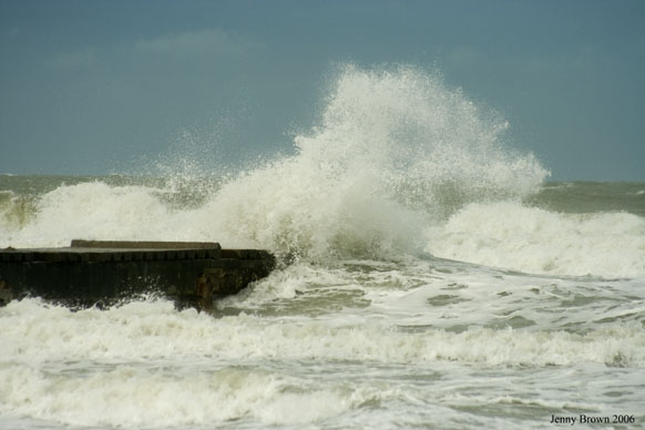
Reged: Fri
Posts: 16
Loc: Bradenton, Florida
|
|
A little to the What???? don't leave us hanging
--------------------
Jenny
www.bbdigitalphoto.com
|
Tazmanian93
Weather Master
Reged: Sun
Posts: 495
Loc: Tampa
|
|
Many models def inched closer to 84W since last run http://flhurricane.com/modelanimator.php
--------------------
Don't knock the weather; nine-tenths of the people couldn't start a conversation if it didn't change once in a while.
Go Bucs!!!!!!!!!
****************
Ed
|
Kandi
Unregistered
|
|
Should move the track in which direction? You didn't finish the thought. I'm in Palm Harbor for a while and wonder what our weather will be like. It has been drizzly and overcast and windy all morning. I'm going to Inverness in the morning and wonder if I should just stay home. What to do?
|
Rick on boat in Mobile
Weather Drama Guru

Reged: Wed
Posts: 161
|
|
the LLC is starting to become overcast, with the cloud wrapping around as well. this storm is getting interesting.
could easily be a minimal hurricane...even a two, maybe?.....not wishcasting..just trying to examine the possiblities...
|
LI Phil
User

Reged: Fri
Posts: 2637
Loc: Long Island (40.7N 73.6W)
|
|
From the 11:00:
A TROPICAL STORM WARNING HAS BEEN ISSUED FOR
THE NORTHERN COAST OF THE GULF OF MEXICO FROM GRAND ISLE LOUISIANA TO ST MARKS FLORIDA...INCLUDING LAKE PONTCHARTRAIN. ALSO AT 11 AM ...A HURRICANE WATCH HAS BEEN ISSUED FROM THE MOUTH OF THE PEARL RIVER TO PANAMA CITY FLORIDA. A TROPICAL STORM WARNING MEANS THAT TROPICAL STORM CONDITIONS ARE EXPECTED WITHIN THE WARNING AREA WITHIN THE NEXT 24 HOURS. A HURRICANE WATCH MEANS THAT HURRICANE CONDITIONS ARE POSSIBLE WITHIN THE WATCH AREA ...GENERALLY WITHIN 36 HOURS.
So...MB...that's "now" and not "no".
i may win that bet with jason yet
Don't count on it.....JK
--------------------
2005 Forecast: 14/7/4
BUCKLE UP!
"If your topic ain't tropic, your post will be toast"
Edited by wxman007 (Fri Jun 10 2005 11:29 AM)
|
cyclone_head
Weather Hobbyist

Reged: Thu
Posts: 74
Loc: Florida
|
|
LI Phil,
You may be getting those same warnings up in your neck of the woods by Tuesday next week. Did you run the animated models?
Rick
|
Colleen A.
Moderator

Reged: Sat
Posts: 1432
Loc: Florida
|
|
In case anyone missed this, the NWS has now included the Tampa Bay area under a flood watch until tomorrow night. 3-5" can be expected with a potential for locally heavier amounts in some areas.
Remember...be careful not to drive over flooded roadways: TURN AROUND, DON'T DROWN.
I'm thinking that this storm may have more of an impact on Florida than previously thought by the .
BayNews9 is still reporting on the 8:00am advisory. ACK!
I'm sorry...but this continued N movement with a "gradual turn to the NNW in the next 24 hours" is starting to peeve me. If it's moving at 13 mph to the N right now it could be closer to Tampa in 4-5 hours than it should have been had it been on the NW track that it was supposed to be on.
Okay, got that off my chest. Now it will probably begin to turn to the NW since I vented.
--------------------
You know you're a hurricane freak when you wake up in the morning and hit "REFRESH" on CFHC instead of the Snooze Button.
|
jth
Storm Tracker
Reged: Mon
Posts: 275
|
|
Someone posted last year a sat that was up to the minute. Could you please post that sat again. Thanks.
|
mbfly
Weather Guru
Reged: Mon
Posts: 119
Loc: Mobile, Alabama
|
|
Quote:
From the 11:00:
So...MB...that's "now" and not "no".
i may win that bet with jason yet
Yeah,,,,, I was afraid of that !
|


 Threaded

 [Re:
[Re: 


