HanKFranK
User

Reged:
Posts: 1841
Loc: Graniteville, SC
|
|
basin should start going active again soon, maybe later this week, maybe the weekend.
ophelia may technically miss the north carolina coast. the models as a group have shifted very close to cape lookout/carteret and hyde counties. with the broad wind field and large eye structure, the hurricane doesn't have to score a direct hit to do its damage... albeit that shouldn't be too dramatic. with how dry the storm looked yesterday nobody was saying/thinking much about flooding, but now that the convection has returned the immediate coastal counties from georgetown to kill devil hills stand to take quite a drenching. those are strong rainbands and they're training like crazy. ophelia should keep pummeling the coast with that sort of jazz all tomorrow and into thursday.
i'm surprised invest 95L was instated.. that's not a terribly impressive wave. usually when a wave has a defined low on it or a strong, sustained convective burst with some sort of cyclonic turning, an invest will be instated.. 95L hasn't reached that point. nevertheless the whole slough of models sees it... a couple keep it as a wave, some take days for a low to develop on it, some develop it over the next day or two. basic movement is, as noted, toward the lesser antilles. usual principle of later development = lower latitude should apply. there's a weakness that should drag on it as it approaches the islands, probably draw it up far enough for a later recurvature, but it could well approach the islands in spite of that. the easterlies are nowhere near as strong as they could be, and there's actually some westerly shear that far down in the basin, which may affect it in coming days... it's not going to move very fast.. maybe approaching the islands in 5-7 days. most of the ensembles are showing a weakness in the ridge north of hispaniola around then, that's why i'd inevitably call for a recurvature of whatever may develop.
different story with the monkey in the middle. the trough in the central atlantic right now is lifting out some, and the energy it's leaving behind is shown by numerous models to induce a surface trough in ophelia's wake. almost all of the globals see it.. and it's precursor is apparent ne of puerto rico right now on satellite. mid level ridging should push it toward the bahamas/cuba over the next few days... it may interact with ophelia's wake trough, may stall, may continue westward... not a great deal of agreement from the models on this. based on the placement, oncoming wave, and pulsing positive index... i'd say it will need to be watched around the weekend.
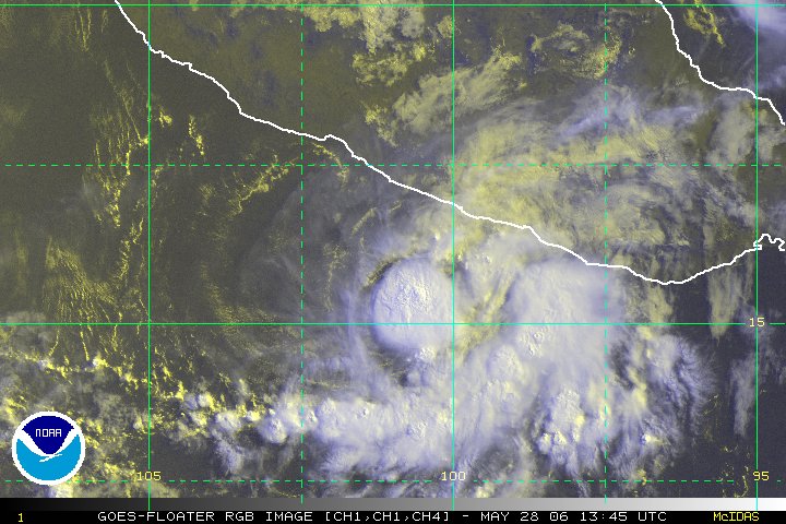
the eastpac is going active.. numerous models are showing systems forming south of mexico over the next few days.. there is also an active depression and a good looking invest at the present time. the atlantic usually responds a few days after the pacific, so by next week we'll probably have another system or two running around our basin. the long range prog is for the ridging in the east to slowly flatten, and for a more zonal profile to develop across the basin. the mean ridge position is still shown around 85-90w... so anything pushed under it will either go into mexico or ride up towards texas or western louisiana if it can catch a passing trough. the weakness off the east coast should be filling and perhaps breaking down as the ridge in the east flattens. it'll still probably be enough to fling anything in the atlantic out, unless it comes in low through the caribbean.
HF 0137z14september
|
prideman
Verified CFHC User
Reged:
Posts: 11
Loc: Darlington, SC
|
|
Quote:
So what is the deal with 95L? Is this anything to be concerned about in the future?
It looks like from radar that it is even nudging a bit west at the moment. Maybe just a wobble or it may be just spreading out more. Don't need a west movement though. It is to close as is.
--------------------
prideman
|
Ryan
Storm Tracker

Reged:
Posts: 281
Loc: Long Island, NY / Stuart, FL
|
|
think its possible to have an even more active season in late sept. HF or is that like imposible or unusual or what, i mean if all went well, we pretty much are sone with peak season?
in agree, 95L doesnt look good, bad for it, good for us..but i mean i dont see howthe seasoin could gt any woerse, after Ophelia..do you see another system affecting us or was this the full swing?
i know what did, so i am sympathetic, especially me..but im jw
--------------------
2006 Atlantic Season Summary:
Bad, But Not AS Bad.
Life's a Storm, Watch Your Back
|
Tazmanian93
Weather Master

Reged:
Posts: 495
Loc: Tampa
|
|
At this point we need to remember that the peak of season was only yesterday, I believe, correct me if I am wrong
--------------------
Don't knock the weather; nine-tenths of the people couldn't start a conversation if it didn't change once in a while.
Go Bucs!!!!!!!!!
****************
Ed
|
Convergence
Weather Watcher
Reged:
Posts: 35
Loc: Ellicott City, Maryland
|
|
Recon reporting 982 mb...
|
NONAME
Weather Guru

Reged:
Posts: 136
|
|
I think that 95L could spin up pretty quickly even with the shear Mainly cause a anticyclone is over it (NHC). Here are reasons why.
Accuweather
"A tropical wave along 37 west south of 17 north is showing some signs of organization. During late Tuesday and Tuesday evening satellite images were starting to show an organized lower level circulation in the cloud motion. Some computer models are suggesting this wave might slowly organize into a tropical system in a couple of days. So, this wave will be closely monitored for possible development."
NHC
"EAST ATLANTIC TROPICAL WAVE IS ALONG 36W S OF 17N MOVING W 10
KT. THE WAVE IS STILL LOW LATITUDE BUT HAS BEGUN TO ACQUIRE A
STRONGER LOW-LEVEL CIRCULATION AS IT BECOMES MORE EMBEDDED IN
THE TRADE WIND FLOW REGIME. SCATTERED MODERATE CONVECTION IS
FROM 10N-14N BETWEEN 36W-40W."
" AN ANTICYCLONIC CIRCULATION HAS DEVELOPED DEEP IN THE TROPICS
NEAR 13N35W AND IS PROVIDING A FAIRLY DECENT ENVIRONMENT ABOVE
THE TROPICAL WAVE ALONG 36W."
--------------------
I am a young Weather enthusiast and really want to get to college in a couple of years for meteorology.
Edited by NONAME (Wed Sep 14 2005 05:22 AM)
|
Bloodstar
Moderator

Reged:
Posts: 462
Loc: Tucson, AZ
|
|
So, Recon is now reporting 980 mb with a 50 Mile wide eye. That's not something you see every day. *whistles* Fairly ragged they say, which you can see on the radar presentation, but. I admit that the 50 mile wide eye sorta raises an eyebrow for me. It's trying to get it's act together, just so long as the eyewall doesn't contract, if it does, there could be problems with unexpected intensification...
-Mark
(Falcons 1-0)
--------------------
M. S. Earth and Atmospheric Sciences, Georgia Tech - May 2020
Brookhaven National Laboratory
U. Arizona PhD Student
|
Random Chaos
Weather Analyst

Reged:
Posts: 1024
Loc: Maryland
|
|
She could strengthen:
303
URNT12 KNHC 140904
VORTEX DATA MESSAGE
A. 14/08:50:00Z
B. 33 deg 07 min N
077 deg 49 min W
C. 700 mb 2930 m
D. NA kt
E. NA deg nm
F. 114 deg 064 kt
G. 025 deg 047 nm
H. 980 mb
I. 9 C/ 3043 m
J. 14 C/ 3049 m
K. 8 C/ NA
L. CLOSED WALL
M. C50
N. 12345/ 7
O. 0.03 / 1 nm
P. AF300 2416A OPHELIA OB 15
MAX FL WIND 77 KT SE QUAD 07:23:10 Z
EYE STILL RAGGED
STADIUM EFFECT VISIBLE IN MOONLIGHT SE QUADRANT
|
Cycloneye11
Weather Hobbyist
Reged:
Posts: 70
Loc: San Juan,Puerto Rico
|
|
URNT12 KNHC 141134
VORTEX DATA MESSAGE
A. 14/11:19:10Z
B. 33 deg 21 min N
077 deg 48 min W
C. 700 mb 2927 m
D. 45 kt
E. 136 deg 104 nm
F. 226 deg 080 kt
G. 129 deg 032 nm
H. 980 mb
I. 9 C/ 3052 m
J. 14 C/ 3048 m
K. 10 C/ NA
L. CLOSED WALL
M. E06/60/50
N. 12345/ 7
O. 0.02 / 1 nm
P. AF300 2416A OPHELIA OB 20
MAX FL WIND 80 KT SE QUAD 11:09:40 Z
EYE STILL SOMEWHAT RAGGED, BUT RADAR PRESENTATION IMPROVED FROM EARLIER FIXES. CENTER IS CLOUD FILLED BELOW FLIGHT LEVEL.
|
zacros
Weather Hobbyist

Reged:
Posts: 57
Loc: Johns Island, SC
|
|
Looks like Ophelia is starting to show some eastward movement and seems to be picking up speed. The 8 AM advisory confirms this. It will be interesting to see if she simply grazes the coast or if the eye actually crosses land at some point. Looks like the forcast track is right on. The floater IR on opening page shows that pretty clearly.
|
Ed in Va
Weather Master
Reged:
Posts: 489
Loc:
|
|
What's with the left hook into NJ on these models (you have to scroll down a ways)..anything to be taken seriously:
http://www.crownweather.com/tropical.html
--------------------
Survived Carol and Edna '54 in Maine. Guess this kind of dates me!
|
Random Chaos
Weather Analyst

Reged:
Posts: 1024
Loc: Maryland
|
|
It isn't a hook into NJ. If you look at the UKMET model run (http://moe.met.fsu.edu/tcgengifs/) you will see exactly what happened. The computer app that takes the UKMET output and finds the low pressure center didn't find the same low for every datapoint.
UKMET track:
Ophelia goes across easter NC and back out to sea, and dissipates quickly. Meanwhile, a 2nd low forms over VA and tracks north across northern NY. The UKMET track on your link skips from Ophelia to this new low that is forming, thus making it appear that Ophelia moves inland.
Edit: It's easier to see on this model animation: http://weather.uwyo.edu/cgi-bin/model?MO...one&C1=pmsl
Edited by Random Chaos (Wed Sep 14 2005 12:35 PM)
|
Wingman51
Weather Guru

Reged:
Posts: 126
Loc: Orlando, FL
|
|
Having just looked at the model runs - I need some "Professional" input on the 4 to 5 day projections from and UKM - - they seem to agree that the new invest spins up to Storm status by this weekend. What can keep this from happening, and why don't the other models pick it up? (Probably stupid question but wopuld really like to know) 
|
Beaumont, TX
Storm Tracker
Reged:
Posts: 318
|
|
Could Ophelia affect Chincoteague Island in any way? Also, what is the average number of storms for September?
|
NewWatcher
Storm Tracker

Reged:
Posts: 388
Loc: Port Orange, FL
|
|
In my opinion the tends to overintensify storms and the UKMET is taking it out to sea so far, so no worries, yet.... will have to wait for more model runs with more model consistentcy.
--------------------
Pam in Volusia County
According to Colleen A ... "I AM A HURRICANE FREAK"
2007 Predictions 16/9/6
|
Ed in Va
Weather Master
Reged:
Posts: 489
Loc:
|
|
Looks like the earlier jog to the east has now stopped and part of the eye/center circulation is making landfall:
http://www.ssd.noaa.gov/PS/TROP/DATA/RT/float-ir4-loop.html
--------------------
Survived Carol and Edna '54 in Maine. Guess this kind of dates me!
|
Ed in Va
Weather Master
Reged:
Posts: 489
Loc:
|
|
New watches and warnings. Kind of curious, as track has not changed. Maybe due to new areas now being in a closer timeframe than before:
http://www.wunderground.com/tropical/at200516.public.html
--------------------
Survived Carol and Edna '54 in Maine. Guess this kind of dates me!
|
TheSkyGuy-in-OZ
Registered User

Reged:
Posts: 6
Loc: Australia
|
|
I think your right ED, it looks like it will make landfall and she's a bit stronger
They may be expecting a NE turn, but the radar loops still seem to show NNW
I guess it will happen soon (hopefully for people in the path)
I would think land should weeken her, but she's a tough one!
Any MET's with updated info?

--------------------
The Eye In The Sky
|
Todd
Weather Watcher
Reged:
Posts: 30
Loc: Havelock, NC(34.89n76.92w)
|
|
Ed.. You might find this interesting..
http://home.earthlink.net/~ctccbc/main.html
|
TheSkyGuy-in-OZ
Registered User

Reged:
Posts: 6
Loc: Australia
|
|
Latest Rain radar has the NW tip of the girl's big eye over land and the Sat pic's seem to confirm this too.
anyone have reports from that area? and is it prone to flooding?
--------------------
The Eye In The Sky
|


 Threaded


