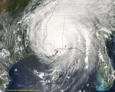
Hurricane Fredrick 1979
Weather Guru

Reged: Sat
Posts: 116
Loc: Mobile,Alabama
|
|
Look like that she took a jog to the SSW and now going more to the NW than WNW
float-vis-loop
|
lunkerhunter
Storm Tracker

Reged: Fri
Posts: 248
Loc: Saint Augustine, FL
|
|
convection has slowed
now
|
Multi-Decadal Signal
Weather Guru
Reged: Thu
Posts: 149
Loc: BROWARD
|
|
All but 3 of the dozen spaghetti models are in very close agreement as of 0600Z
http://euler.atmos.colostate.edu/~vigh/guidance/index.htm
The forecast is looking very good in its agreement but the forecasting bodes very ill for Texas.
With another month left until the historical season usually quiets down and still another until the official end; God only knows what is yet in store.
 Could we take 10 or 15 or 25 more years of this? Could we take 10 or 15 or 25 more years of this?
--------------------
Who you gonna' believe?
Me, or your damn lying eyes?
_Ö_ _ö_
|
lunkerhunter
Storm Tracker

Reged: Fri
Posts: 248
Loc: Saint Augustine, FL
|
|
dry air intrusion?
eyewall replacement?
or colder water?
Water Vapor Loop
|
Hurricane Fredrick 1979
Weather Guru

Reged: Sat
Posts: 116
Loc: Mobile,Alabama
|
|
The is tring to develop something next mid week coming off the conveyor belt off Africa. So who knows 19 in the makings?
|
lunkerhunter
Storm Tracker

Reged: Fri
Posts: 248
Loc: Saint Augustine, FL
|
|
track shifted East of Galveston.
now on Gilchrist.
|
pcola
Storm Tracker

Reged: Wed
Posts: 344
Loc: pensacola/gulf breeze
|
|
that track may make a major difference for houston, but I hope everyone in Beaumont is on their way out of town!
--------------------
Erin 95 , Opal 95, Ivan 04, Dennis 05, and that's enough!!!!
|
lunkerhunter
Storm Tracker

Reged: Fri
Posts: 248
Loc: Saint Augustine, FL
|
|
bumping into a little shear?
shear
|
lunkerhunter
Storm Tracker

Reged: Fri
Posts: 248
Loc: Saint Augustine, FL
|
|
once inland may stall over Northern Texas/Oklahoma/Arkansas.
|
TAZMAN
Weather Watcher

Reged: Fri
Posts: 48
Loc: Clermont, Fl
|
|
What is it that make all storms eventually turn north ?? I understand what is keeping her to the west but uninhibited, it would be going north correct ? Is it a weather thing or an earth thing?
|
Random Chaos
Weather Analyst

Reged: Sat
Posts: 1024
Loc: Maryland
|
|
It looks more like dry air than shear. Shear would have effected the eye, and that is still perfectly round.
Pressure is up to 902mb...that's still -level. The eye has shrunk to 18nm:
989
URNT12 KNHC 220942
VORTEX DATA MESSAGE
A. 22/09:12:20Z
B. 24 deg 55 min N
087 deg 55 min W
C. 700 mb 2245 m
D. NA kt
E. NA deg nm
F. 303 deg 134 kt
G. 228 deg 010 nm
H. 902 mb
I. 14 C/ 3068 m
J. 29 C/ 3057 m
K. 8 C/ NA
L. CLOSED WALL
M. C18
N. 12345/ 7
O. 0.02 / 3 nm
P. AF307 1618A OB 18
MAX FL WIND 165 KT NE QUAD 05:34:00 Z
STADIUM EFFECT LIT BY MOONLIGHT AND BY LIGHTNING WITHIN EYEWALL
|
Random Chaos
Weather Analyst

Reged: Sat
Posts: 1024
Loc: Maryland
|
|
Look at the size of the forcast windfield at landfall!
http://www.nlmoc.navy.mil/center/Tropical/wtnt02.gif
|
Random Chaos
Weather Analyst

Reged: Sat
Posts: 1024
Loc: Maryland
|
|
IR is looking a bit more ragged with every frame. It's lost most of the deep convection.
While there appears to be dry air trying to get in on the western side, it is no where far enough in to affect the deep convection. I'd say we're seeing the results of either cooler water or internal dynamics.
Amazingly the eye still seems perfectly round and is extremely well defined. We are down to a 15 degree difference for the eye-eyewall temps...but the eye itself is still an amazingly high 29C. That the eyewall has pushed itself to 14C is the more interesting part - what's causing it to warm so rapidly?
--RC
|
Hugh
Senior Storm Chaser
Reged: Fri
Posts: 1060
Loc: Okaloosa County, Florida
|
|
Quote:
Amazingly the eye still seems perfectly round and is extremely well defined. We are down to a 15 degree difference for the eye-eyewall temps...but the eye itself is still an amazingly high 29C. That the eyewall has pushed itself to 14C is the more interesting part - what's causing it to warm so rapidly?
Sheer and dry air, but doesn't appear to care a whole lot. My concern is how will whatever is causing the deteriorration fo the west side of the storm effect movement from here on out. The models have shifted to near the TX/LA border already, and the official forecast has nearly done the same. New Orleans is now on the east edge of the cone, and the storm still appears to be moving east of the black line. Everyone in TX/LA needs to watch this monster.
I never thought I'd be pleased to wake up to a hurricane with a 902 pressure and 175 mph winds.... but it could have gotten stronger overnight and it didn't, thankfully.

Weather Channel reporter just said there are reports that 's storm surge could be as high as FIFTY FEET!!!!!!!  :?: :?: 
--------------------
Hugh
Eloise (1975) - Elena and several other near misses (1985) - Erin & Opal (1995) - Ivan (2004)
Edited by Hugh (Thu Sep 22 2005 06:45 AM)
|
ohioaninmiss
Weather Watcher
Reged: Thu
Posts: 32
Loc: Columbus, OH
|
|
Clark mentions in his blog last night that was undergoing an . This could be what is "slowing her down" so to speak. That would also account for a ragged IR appearance. So it will be interesting to see what happens later on, I think there is a chance she might deepen once again.
--------------------
Marie
Back in Ohio from a crazy summer in Mississippi!
|
Hugh
Senior Storm Chaser
Reged: Fri
Posts: 1060
Loc: Okaloosa County, Florida
|
|
Quote:
Clark mentions in his blog last night that was undergoing an . This could be what is "slowing her down" so to speak. That would also account for a ragged IR appearance. So it will be interesting to see what happens later on, I think there is a chance she might deepen once again.
I thought about that (shudder).... but the inner core appears to have remained intact so far. The eye is still as perfect as ever. If it's an ... with absolutely no decrease in wind speed (at least at 5am ET, the winds were still reported as 175)... when it's done, what will the winds be? 185? 200? 225? :?:
--------------------
Hugh
Eloise (1975) - Elena and several other near misses (1985) - Erin & Opal (1995) - Ivan (2004)
|
Random Chaos
Weather Analyst

Reged: Sat
Posts: 1024
Loc: Maryland
|
|
Yeah - that would make sense. I didn't see any sign of an in either recon or IR, but an would explain the weakening and the shrinking eye (barely...but still).
An at this stage isn't good - too early to weaken her much. Should have waited another 12 hours to guarentee weekening.
|
Hugh
Senior Storm Chaser
Reged: Fri
Posts: 1060
Loc: Okaloosa County, Florida
|
|
Quote:
Yeah - that would make sense. I didn't see any sign of an in either recon or IR, but an would explain the weakening and the shrinking eye (barely...but still).
An at this stage isn't good - too early to weaken her much. Should have waited another 12 hours to guarentee weekening.
No kidding. It's also lopsided for an . Looking at the WV loop, dry air is more likely, but I don't like that either because of the direction of outflow on WV... and the slowdown in movement that seems to be happening.
--------------------
Hugh
Eloise (1975) - Elena and several other near misses (1985) - Erin & Opal (1995) - Ivan (2004)
|
Random Chaos
Weather Analyst

Reged: Sat
Posts: 1024
Loc: Maryland
|
|
Has anyone looked closely at the model tracks? They show stalling not long after landfall, and a few even show her possibly recurving back out into the gulf.
One other thing to watch...
http://euler.atmos.colostate.edu/~vigh/guidance/
|
Ormond Suzie
Weather Watcher
Reged: Sun
Posts: 28
Loc: Ormond Beach, Florida
|
|
Does anyone have a good link handy for steering currents map? I thought I'd bookmarked one from the last 24 hours, but can't find it.
The high and low pressure areas seem to have changed significantly since I went to bed.
Edit by Ormond Suzie: Okay, I found the site I was remembering - steering winds
Edited by Ormond Suzie (Thu Sep 22 2005 07:31 AM)
|


 Threaded


 [Re:
[Re: 


 Could we take 10 or 15 or 25 more years of this?


 :?:
:?: 