Cash
Verified CFHC User
Reged: Sat
Posts: 11
Loc: New Orleans, LA
|
|
Lois, your post prompted me to look through the model graphic output. What in the hell is that at hour 144 (CMC at 144 hrs) bearing down on Ft. Lauderdale?
I recognize that models have limited skill in predicting storm formation, but that was just a surprising sight.
Cash
|
WeatherNLU
Meteorologist

Reged: Sat
Posts: 212
Loc: New Orleans, LA
|
|
I believe Gilbert was 135 and pretty much tracked right over Kingston where this is seemingly going to miss to the South at 145. I think that's pretty close.
--------------------
I survived Hurricane Katrina, but nothing I owned did!
|
Storm Hunter
Veteran Storm Chaser

Reged: Wed
Posts: 1370
Loc: Panama City Beach, Fl.
|
|
We all know that the is not a good tropical forecasting model.. but every once in a while it gets lucky... There is not much model support from the others on this system... I think the 11pm mentioned the low that maybe the is picking up on... which right now its to the SE of Barbados....
Low in the Atlantic
Right now i'm not thinking it will make it north of the Islands... just seems to hostile.... but then again some of the globals are weakening the ridge in the atlantic down the road... Something to watch... also there appears to be another good wave about to come off Affrica in the coming days...
--------------------
www.Stormhunter7.com ***see my flight into Hurricane Ike ***
Wx Data: KFLPANAM23 / CW8771
2012== 23/10/9/5 sys/strms/hurr/majh
Edited by Storm Hunter (Sun Aug 19 2007 04:04 PM)
|
rmbjoe1954
Weather Master

Reged: Tue
Posts: 427
Loc: Port Saint Lucie, Florida, USA
|
|
Here are the thoughts of the wave that the is developing...
...TROPICAL WAVES...
THE TROPICAL WAVE THAT WAS PREVIOUSLY ALONG 46W IS ADJUSTED
AHEAD BASED ON SATELLITE IMAGERY...SURFACE DATA AND SSMI-DERIVED
PRECIPITABLE WATER. THIS IS A LARGE TROPICAL WAVE TILTED ALONG
20N49W 15N52W 8N54W. A 101O MB SFC LOW IS ALONG THE WAVE AXIS
NEAR 11N53W. CU LINES DEFINE THE EXPOSED CENTER OF THE LOW.
ASSOCIATED SHOWER AND THUNDERSTORM ACTIVITY IS LIMITED AND
UPPER-LEVEL WINDS ARE CURRENTLY NOT FAVORABLE FOR DEVELOPMENT OF
THIS SYSTEM. SCATTERED MODERATE CONVECTION IS FOUND ON THE
NORTHERN END OF THE WAVE FROM 17N-21N BETWEEN 46W-50W. SIMILAR
CONVECTION IS WITHIN 200 NM WEST OF THE LOW. THIS TROPICAL WAVE
WILL MOVE INTO THE TROPICAL N ATLC WATERS TONIGHT AND INTO THE
NE CARIBBEAN MON.
--------------------
________2024 Forecast: 28/14/8________
There is little chance that meteorologists can solve the mysteries of weather until they gain an understanding of the mutual attraction of rain and weekends. ~Arnot Sheppard
|
WeatherNLU
Meteorologist

Reged: Sat
Posts: 212
Loc: New Orleans, LA
|
|
Yes, they just had someone from the power company on and they have started to lock down the power grid in the six easternmost parishes.
--------------------
I survived Hurricane Katrina, but nothing I owned did!
|
Storm Hunter
Veteran Storm Chaser

Reged: Wed
Posts: 1370
Loc: Panama City Beach, Fl.
|
|
hey clark, (or anyone else) do you have any comments on the fsu from 12Z today? Usually this one of the good models. But its appears to on the north side of the guidance?
Nah, I don't really have any comments on it. I wouldn't put much stock into that precise evolution. -Clark
--------------------
www.Stormhunter7.com ***see my flight into Hurricane Ike ***
Wx Data: KFLPANAM23 / CW8771
2012== 23/10/9/5 sys/strms/hurr/majh
Edited by Clark (Sun Aug 19 2007 04:41 PM)
|
Hugh
Senior Storm Chaser
Reged: Fri
Posts: 1060
Loc: Okaloosa County, Florida
|
|
Looks like the outer eyewall of Dean is just south of the coast - and I do mean *just* south of the coast... just a little more than the diameter of the eye.
Storm Hunter - that model appears to turn Dean NW after it gets by Jamaica, before turning it back to the west. That scenario would, in the short term, be very nerve-racking!
--------------------
Hugh
Eloise (1975) - Elena and several other near misses (1985) - Erin & Opal (1995) - Ivan (2004)
Edited by Hugh (Sun Aug 19 2007 04:26 PM)
|
LoisCane
Veteran Storm Chaser

Reged: Fri
Posts: 1236
Loc: South Florida
|
|
listening to feed with jim williams and i heard they say it was being done in stages so maybe that is the confusion on the power situation...
from listening to the media he is playing you get the feeling they prepare, hunker down and hype less
just have to see how much of the eye wall it will get and where the storms are within the eye wall as that part of the wall hits any specific area
--------------------
http://hurricaneharbor.blogspot.com/
|
LoisCane
Veteran Storm Chaser

Reged: Fri
Posts: 1236
Loc: South Florida
|
|
i believe the is very good at finding future tropical systems.. may not be good on track and isnt but it has been very on the money in being an early indicator of tropical development this year
--------------------
http://hurricaneharbor.blogspot.com/
|
dem05
User
Reged: Wed
Posts: 368
Loc: Port Charlotte, FL
|
|
Well, while the model talk is ongoing...I do find it interesting that when we (or at least in this case) decided to agree with the models...The models have decided to disagree with themselves. They spread in the models seems wider this afternoon that it had been for the last day or so. I'd also like to make particular reference to the 12Z HWRF and runs... I would expect these to carry a bit more agreement with each other than they are now...With specific mention to how the two models handle Dean after the Yucatan landfall. Anybody have any thoughts on their end?
Edited by dem05 (Sun Aug 19 2007 04:51 PM)
|
OUSHAWN
Weather Guru
Reged: Tue
Posts: 101
Loc: Clear Lake,Tx
|
|
Dem, something to add to what you just mentioned. I just noticed that on the 5:00 advisory Texas (all the way up to around Corpus Christi) has been put back in the cone. I find that very interesting to say the least. What do you think of this?
Never mind...it was updated again and it's not showing Texas in it now.
Shawn
Edited by OUSHAWN (Sun Aug 19 2007 05:03 PM)
|
WeatherNLU
Meteorologist

Reged: Sat
Posts: 212
Loc: New Orleans, LA
|
|
Kingston link now showing a pressure of 992 and a SE wind at 81.
http://weather.noaa.gov/weather/current/MKJP.html
--------------------
I survived Hurricane Katrina, but nothing I owned did!
|
LoisCane
Veteran Storm Chaser

Reged: Fri
Posts: 1236
Loc: South Florida
|
|
even the size and shape of the eye and its eye wall makes a difference, not just wobbles
you can see the eye open... with it the storms end up a bit further north
so many factors here
--------------------
http://hurricaneharbor.blogspot.com/
|
anomaly18
Registered User

Reged: Sat
Posts: 9
Loc: Galveston, TX
|
|
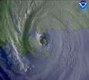
Last frame of the IR brings the eye VERY CLOSE to the coast. Not sure if its a northward wobble or not, but its unfortunate for Jamaica.
Edited by anomaly18 (Sun Aug 19 2007 06:44 PM)
|
Random Chaos
Weather Analyst

Reged: Sat
Posts: 1024
Loc: Maryland
|
|
Quote:
Last frame of the IR brings the eye VERY CLOSE to the coast. Unfortunate wobble for Jamaica.
NBC news reported that the eyewall was 5 miles offshore.
|
OUSHAWN
Weather Guru
Reged: Tue
Posts: 101
Loc: Clear Lake,Tx
|
|
Looking at the latest WV loop it sure looks like Dean may be catching up with the ULL...at least gaining ground some. I know it's not enough to make a difference but I wonder if maybe it might throw a wrench into things and could be what a couple of the models are picking up on and why they have a change in the direction of Dean once it hits the Yucatan.
Shawn
|
GuppieGrouper
Weather Master
Reged: Fri
Posts: 596
Loc: Polk County, Florida
|
|
The models that have been mentioned above remind me of the "pinball" theory. When an entity spins up, and then runs into something at a high rate of speed, it does a glancing blow and changes directions. I hope the pinball machine is fixed so every one becomes winners and the pinball melts.
--------------------
God commands. Laymen guess. Scientists record.
|
Hugh
Senior Storm Chaser
Reged: Fri
Posts: 1060
Loc: Okaloosa County, Florida
|
|
The Cuba radar shows that in my estimation, Dean made its closest approach to Jamaica at around 6:30pm ET, skirting JUST below the extreme southern tip of the island. From the looks of the radar, the extreme edge of the eyewall was on the coastline, but the clear eye was not. I'd say five miles may be about right, if it was that far even.
--------------------
Hugh
Eloise (1975) - Elena and several other near misses (1985) - Erin & Opal (1995) - Ivan (2004)
|
flahurricane
Weather Hobbyist
Reged: Sun
Posts: 55
Loc:
|
|
as a side note, erin's not finished
please refrain from one liner. one sentence post... thanks-danielw
http://www.wunderground.com/hurricane/2007/erin_okc.gif
Edited by danielw (Sun Aug 19 2007 08:11 PM)
|
cieldumort
Moderator

Reged: Mon
Posts: 2305
Loc: Austin, Tx
|
|
TWC is now reporting that Kingston just reported a sustained wind of 114 mph with a gust to 138. The dangerous right-front quadrant is scraping the coastline, with hurricane-force winds likely to be extending over the entire island nation, especially over the south and east-facing beaches and hills. Some of the higher terrain may easily experience winds that are a full category above what is being experienced closer to sea level. Rainfall totals along the south and east facing slopes stand to exceed 5-10 inches, resulting in deadly flash flooding runoffs.
I'm probably not the only one to detect a wobble ever so slightly to the north as Dean is scraping by, generally on a westward course. This untimely wobble looks to lengthen the stretch of the island affected directly by the deadly eyewall, and probably the duration that the most intense portions of the hurricane rake it.
As an aside, please everyone keep the one-liners and chat room style discussion off the board during active weather.
|


 Threaded

 [Re:
[Re: 


