2:00PM Update September 4 2019
Dorian has made landfall on Hatteras, NC, flooding the outer banks from Ocracoke to Rodanthe and then some. The Canadian Hurricane Center has issued a Hurricane Warning for eastern Nova Scotia from Hubbards to Avonport.
11:00PM Update September 4 2019
Dorian has regained Category 3 hurricane strength.
9:30PM Update September 3 2019
Dorian continues NNW to NW tonight, tracking offshore and usually parallel to the east coast of Florida. This should continue until a couple of shortwaves recurve Dorian to the northeast by Thursday, putting the southeast, and in particular North Carolina, at risk for a direct hit.
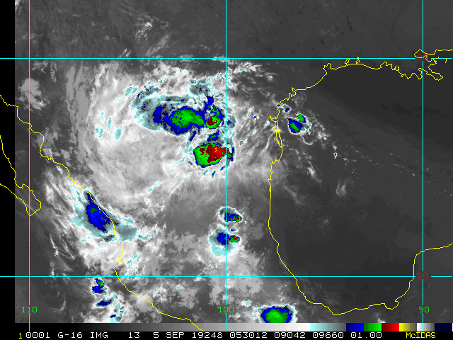
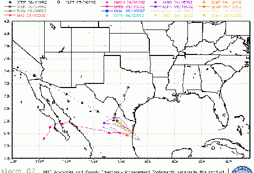
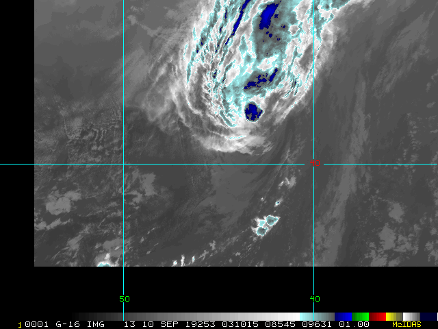
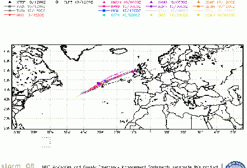
The heart of the season continues with no less than three simultaneous Tropical Cyclones in the Atlantic: Fernand (W Gulf), TD8 (eastern Atlantic), and last but not least Dorian. By this time Thursday there could also be a fourth, as we are keeping an eye out on a new Tropical Wave expected to develop in the far eastern Atlantic and head west.
As a reminder, you can also follow along with more in-depth model discussions and more in the Forecast Lounge. If you can't find a Lounge you are looking for on the main page, simply look for the "Forums" tab (often in a bar on the left or right side of the main page), where you can usually find the very thread you are looking for. If posting to a Lounge, we ask that one refrain from going off-topic, or using unnecessary words. The idea is for us all to stay on point for a given Lounge, and not to delve into hype or wishcasting.
-Ciel
Current Forecast Lounges
Invest 94L Lounge , Tropical Storm Fernand Lounge (E MX/S TX) , Invest 92L Lounge (Bermuda Threat), Hurricane Dorian Lounge
Original Update
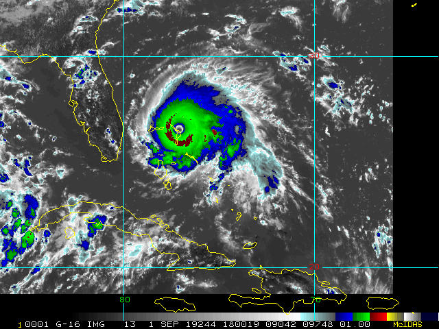
At the 8am advisory slow motion of Dorian to the Northwest has begun at 1mph, shown on the Florida radar, The same slow movement in Bahamas followed by a track close to but offshore of Florida has been forecast since Saturday morning.
Dorian is still impacting Grand Bahama and stationary but expected to begin to move toward the North Northwest later today, meanwhile, Tropical Storm Warnings are up along the northeast coast of Mexico The from La Pesca northward to Barra El Mezquital for newly designated Potential Tropical Cyclone 7 in the Gulf which may landfall as a Tropical Storm in Mexico tomorrow night.
Dorian's lack of forward motion has caused the water beneath it to cool enough to weaken it to a category 3, which is still a major hurricane, and still has the momentum in the waves and surge from being a much stronger storm which increases the storm surge impact along the coast. Dorian's weaker side is on the west, so that is in our favor, but it likely will get close enough to still bring plenty of Tropical Storm force winds and some hurricane force winds to parts of Florida. The size of the windfield has generally expanded.
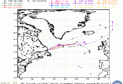
Dorian's motion based on the forecast track should take it closest to Florida overnight tonight into tomorrow and be up near South Carolina by Thursday, and by North Carolina by early Friday morning. The National Hurricane Center Although the official forecast does not show Dorian making landfall along the Florida east coast, users are reminded not to forecast on the exact forecast track. A relatively small deviation to the left of this track could bring the core of the hurricane near or over the coastline.
Canadian Hurricane Centre
> Bahamas Media
Bahamas Radar
Television & Radio:
ZNS Bahamas, Radio & TV
More 94 FM Bahamas
Newspapers:
Bahamas Tribune
Nassau Guardian
Bahamas B2B
The Abaconian - Abaco Island News
Freeport News
http://www.FloridaDisaster.org - Florida Emergency Management Page
Dorian Event Related Links
SFWMD Model Plot (Animated Model Plot) SFWMD Hurricane Page
[https://flhurricane.com/floatanimator.php?year=2019&storm=5 Flhurricane Satellite Floater Animation of Dorian
GOES Floater
Animated Model Plot of Dorian
Clark Evans Track Model Plot of Dorian
(Animated!) Model Plots in Google Earth - In Google Maps
Clark Evans Intensity Model Plot of Dorian (Animated!)
Clark Evans Track Plot of Dorian
Other Model Charts from Clark
Clark Evans Top 10 Analog Storms for Dorian
More model runs on from RAL/Jonathan Vigh's page
NRL Info on Dorian -- RAMMB Info
COD Atlantic Satellite View
Bahamas Radar
East Florida Links
Southeast Composite Radar Loop
(Latest Static)
South to North:
Key West, FL Radar Radar Loop
(Latest Static)
Miami, FL Radar Radar Loop
(Latest Static)
Melbourne, FL Radar Radar Loop
(Latest Static)
Jacksonville, FL Radar Radar Loop
(Latest Static)
Caribbean/South East Coast Satellite Imagery
SFWMD Radar Loop of South Florida with storm Track
SFWMD Full Florida Radar Loop with Storm Track
Area Forecast Discussions:
FLorida Keys -
Miami/South Florida -
Melbourne/East Central Florida -
Jacksonville/Northeast Florida -
Mid-Atlantic/Carolina Links
Southeast Composite Radar Loop
(Latest Static)
Charleston, SC Radar Radar Loop
(Latest Static)
Wilmington, NC Radar Radar Loop
(Latest Static)
Morehead City, NC Radar Radar Loop
(Latest Static)
Norfolk/Wakefield, VA Radar Radar Loop
(Latest Static)
Area Forecast Discussions:
Charleston, SC -
Wilmington, NC -
Morehead City, NC -
Norfolk/Virginia Beach/Hampton Roads, VA
Power Outage Maps:
South Carolina Power Outage Map
North Carolina Power Outage Map
Virginia Power Outage Map
Caribbean Radar Recording
Invest 98L Lounge W Gulf Trof Lounge
Coastal South Carolina Media:
Myrtle Beach Sun News
Charleston Post and Courier
94.3 WSC Charleston News Radio
Power Outage Map: South Carolina Power Outage Map
Eastern NC/OBX/Hampton Roads Media:
North Carolina Power Outage Map
North Carolina Flood Inundation and Mapping Network
Star News Online (Wilmington)
Outer Banks Sentinel
Hampton Roads Pilot
WWAY TV 3 Wilmington, NC (ABC)
WECT TV 6 Wilmington, NC (NBC)
Fox Wilmington (FOX)
WILM TV 10 Wilmington, NC (CBS)
WITN 7 - Eastern North Carolina TV (NBC)
WCTI 12 - Eastern North Carolina (ABC)
WNCT TV 9 - Eastern North Carolina (CBS)
Wavy 10 (NBC) - Hampton Roads/VA Beach, VA TV
WTKR 3 (CBS) - Hampton Roads/VA Beach, VA
WVEC 13 (ABC) - Hampton Roads/VA Beach, VA
Jacksonville, FL Area Media:


 Threaded


