5PM EDT Update 14 August 2020
Tropical Storm Kyle has formed, and along with Josephine there are two active named storms in the Atlantic right now. This one is also not a threat to the US, however Josephine may get close to Bermuda as a weak wave or extra tropical depression on Wednesday. Kyle is the earliest K storm to form in the Atlantic, it beats from 2005 by 10 days.
Beyond that, no immediate areas, but there are indications that starting late next week things may start to move very quickly in the tropics
Original Update
The Atlantic remains mostly quiet into Friday, but there is a new low chance development area being watched in the main development region (MDR) of the Atlantic between the Caribbean and Africa.
This wave only has a 10% chance for development right now. Of note though, it has strong rotation in some of the updraft towers along the northwest side, so it may be more resilient to hostile conditions than most waves, it'll be interesting to see if it persists. As of now, it has no invest designation.
Another wave east of this, currently around 29.1W is also worth watching longer term and may ultimately prove more interesting.
The typical season forecasts, CSU, NOAA, etc have adjusted upwards to an extremely active season. The most likely period of high activity starts around August 20-25th through about the same time in September, at that time the Atlantic likely will be unusually ideal for tropical systems. This is aligning with the traditional climatological peak of hurricane season also, which enhances the probability. So effectively conditions are extremely ripe, it does not mean they will happen, but most of the environmental conditions are in the positive for it to happen, so there's a chance basically any wave that shows up develops in that time period, and it could mean multiple tropical storms at once.
On top of this long range forecasts suggest that a strong high pressure ridge is likely to form in the last week or two of August, these typically block storms from recurving, and force them further west which means the chance for land impacts is also greater. This is for awareness to be vigilant this year, but trying to avoid hyping the situation. It's just the typical negative factors that reduce activity or land impact aren't as much of an issue this year.
This article will cover post-Isaias until the next major system that may arrives.
Josephine Event Related Links

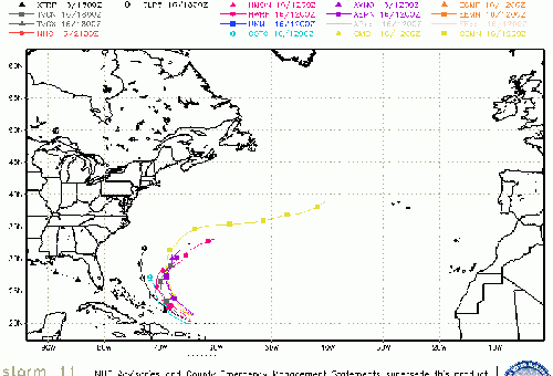
SFWMD Model Plot (Animated Model Plot) SFWMD Hurricane Page
[https://flhurricane.com/floatanimator.php?year=2020&storm=11 Flhurricane Satellite Floater Animation of Josephine
GOES Floater
Animated Model Plot of Josephine
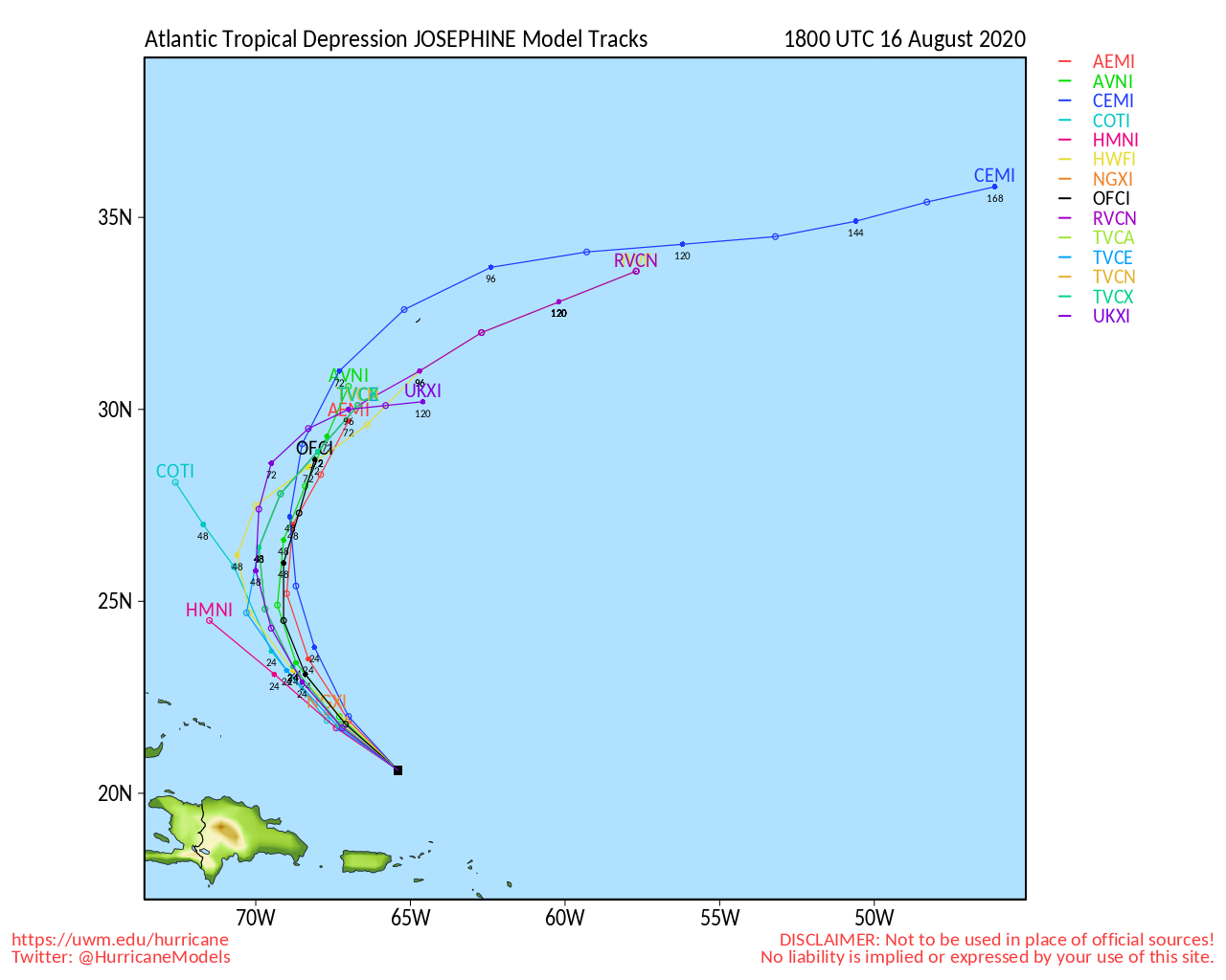
Clark Evans Track Model Plot of Josephine
(Animated!) Model Plots in Google Earth - In Google Maps
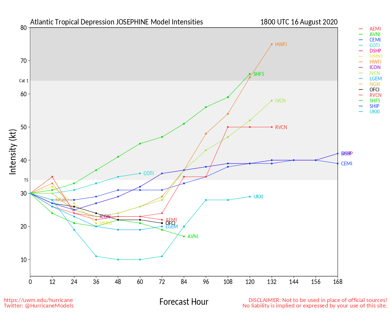
Clark Evans Intensity Model Plot of Josephine (Animated!)
Clark Evans Track Plot of Josephine
Other Model Charts from Clark
Clark Evans Top 10 Analog Storms for Josephine
More model runs on from RAL/Jonathan Vigh's page
NRL Info on Josephine -- RAMMB Info
COD Atlantic Satellite View
StormCarib Reports from the Caribbean Islands
Caribbean Weather Observations
Barbados Brohav Weather Fax
Full Caribbean Radar Composite
Caribbean Broadcast Corporation (TV/Radio from Antilles)
San Juan, PR NWS Page
Various Caribbean Radio Stations
DR1 Dominican Republic Hurricanes
Kyle Event Related Links

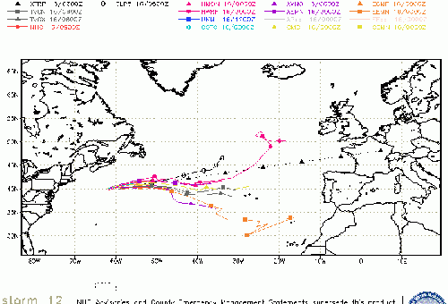
SFWMD Model Plot (Animated Model Plot) SFWMD Hurricane Page
[https://flhurricane.com/floatanimator.php?year=2020&storm=12 Flhurricane Satellite Floater Animation of Kyle
GOES Floater
Animated Model Plot of Kyle
Clark Evans Track Model Plot of Kyle
(Animated!) Model Plots in Google Earth - In Google Maps
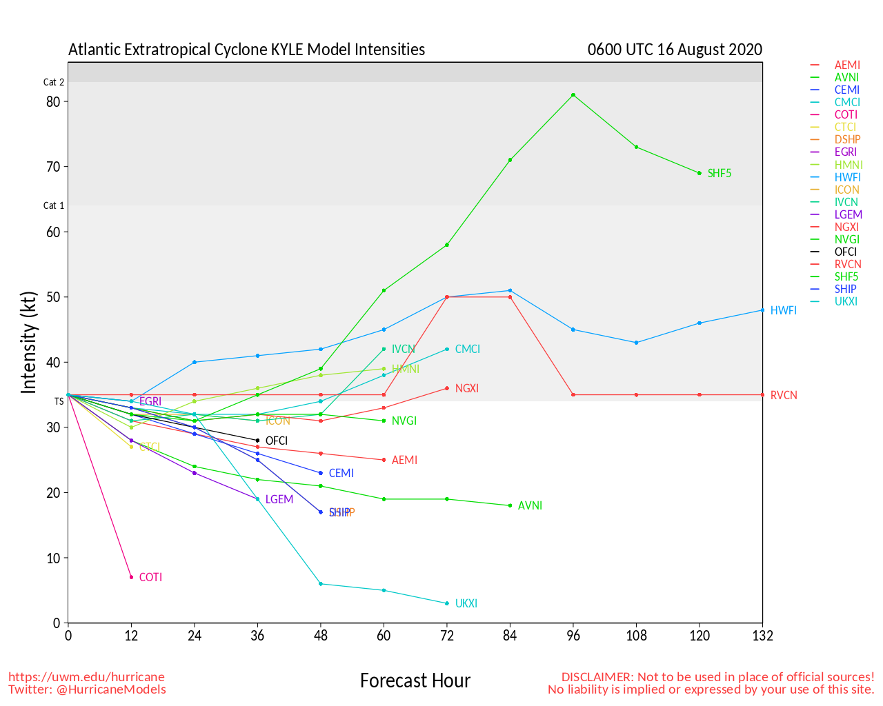
Clark Evans Intensity Model Plot of Kyle (Animated!)
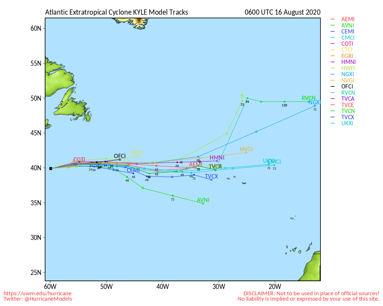
Clark Evans Track Plot of Kyle
Other Model Charts from Clark
Clark Evans Top 10 Analog Storms for Kyle
More model runs on from RAL/Jonathan Vigh's page
NRL Info on Kyle -- RAMMB Info
COD Atlantic Satellite View


 Threaded


