MikeC
Admin
Reged: Sun
Posts: 4543
Loc: Orlando, FL
|
|
TD#2 arise!
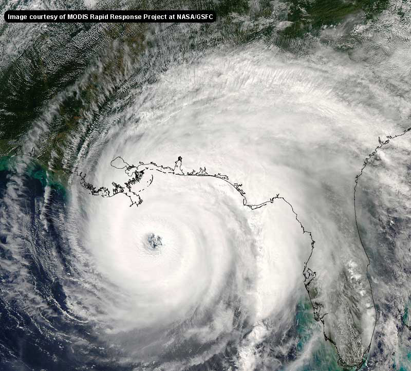
Amazingly, The storm formely known as tropical depression #2 has spun up into Tropical Storm Bonnie, nearly a week after it fell apart. in the eastern Caribbean.
IBeing disorganized it managed to slip more westward and now is in the Southeast gulf of Mexico as a small tight storm. It's still disorganized so it could easily spin up as well as as it could spin down.
However, if it says compact and persists, the fluctuations in strength could be great, and eyes in the Nrothern Gulf and Florida coastlines will definitely want to watch this one.
Because of this storms small size and nature I sense a high "hype" factor coming. But it's best avoided, the key here is to watch for persistence, and be prepared to be surprised. (either way)

Event Related Links
More later...
Martinique Radar
The Caribbean Hurricane Page - updates from the islands
Caribbean Island Weather Reports
General Links
Current Aircraft Recon Info
NRL Monterey Marine Meteorology Division Forecast Track of Active Systems (Good Forecast Track Graphic and Satellite Photos)
Check the Storm Forum from time to time for comments on any new developing system.
Follow worldwide SST evolution here:
Global SST Animation
NASA GHCC Interactive Satellite images at:
North Atlantic Visible (Daytime Only), Infrared, Water Vapor
LSU Sat images
Some forecast models:
NGM, AVN, MRF, ETA ECMWF
AVN, , , JMA, , UKMET
DoD Weather Models (NOGAPS, AVN, MRF)
Multi-model plots from WREL
Other commentary at Independentwx.com, Robert Lightbown/Crown Weather Tropical Update Accuweather's Joe Bastardi (now subcriber only unfortunately), Hurricane Alley North Atlantic Page, Cyclomax (Rich B.), Hurricane City , mpittweather , Gary Gray's Millennium Weather, storm2k, Barometer Bob's Hurricane Hollow, Snonut,
Even more on the links page.
|
BugsBunny
Weather Watcher

Reged: Thu
Posts: 42
Loc: Florida
|
|
This is quite a surprise
I was actually expecting TD3 to be Bonnie, and this system to be a weak (30 mph) depression
--------------------
forecast: 17/14/9/5
to date: 3/3/2/1
|
SirCane
Storm Tracker

Reged: Tue
Posts: 249
Loc: Pensacola, FL
|
|
Good grief. We're really in for quite a ride here on the Northern Gulf Coast for the next week! Just a couple days ago there was NOTHING. Time to prepare I guess.  Reminding me a little of 1995 when Opal and Erin smashed through here. Reminding me a little of 1995 when Opal and Erin smashed through here. 
--------------------
Direct Hits:
Hurricane Erin (1995) 100 mph
Hurricane Opal (1995) 115 mph
Hurricane Ivan (2004) 130 mph
Hurricane Dennis (2005) 120 mph
http://www.hardcoreweather.com
|
WXMAN RICHIE
Weather Master

Reged: Mon
Posts: 463
Loc: Boynton Beach, FL
|
|
Bonnie's winds up to 60 according to aircraft recon.
--------------------
Another typical August:
Hurricane activity is increasing and the Red Sox are choking.
Live weather from my backyard:
http://www.wunderground.com/weatherstation/WXDailyHistory.asp?ID=KFLBOYNT4
|
Clark
Meteorologist
Reged: Wed
Posts: 1710
Loc:
|
|
Recon's also reporting an 8 mi. wide circular eye on the latest vortex report...
L. CLOSED WALL
M. C8
(full report: http://www.nhc.noaa.gov/text/MIAREPNT2.shtml?)
--------------------
Current Tropical Model Output Plots
(or view them on the main page for any active Atlantic storms!)
|
Anonymous
Unregistered
|
|
You folks are scaring me 
|
LI Phil
User

Reged: Fri
Posts: 2637
Loc: Long Island (40.7N 73.6W)
|
|
You're not SandiaFlower are you?
--------------------
2005 Forecast: 14/7/4
BUCKLE UP!
"If your topic ain't tropic, your post will be toast"
|
LoisCane
Veteran Storm Chaser

Reged: Fri
Posts: 1236
Loc: South Florida
|
|
Looked to me like 3 had more going for it than 2 especially when you consider that the place where they plotted Bonnie isn't where the strongest convection was.. since they named her she has looked pretty crummy to me. If she's splitting and the strong stuff is west bound and she's NW bound.. well I don't think that center is all that strong. Could be they will relocate the center or it will slowly reform around the one that is officially Bonnie.
Gulf tropical storms are notorious for looking sloppy until they pull themselves together. If they do. It probably will.
Nice to have Bonnie but its more of a roll your eyes thing.
Charlie looks good.. lets see what the planes say as they have the final word.
Agree with you though and well..not going to really argue on it other than to state the facts.
Either way advisories are out and the tracking begins and nice to have something official to play with..
--------------------
http://hurricaneharbor.blogspot.com/
|
LI Phil
User

Reged: Fri
Posts: 2637
Loc: Long Island (40.7N 73.6W)
|
|
not CHARLIE
--------------------
2005 Forecast: 14/7/4
BUCKLE UP!
"If your topic ain't tropic, your post will be toast"
|
wxman007
Meteorologist
Reged: Sat
Posts: 617
Loc: Tuscaloosa, AL
|
|
Tonight could be be a REAAAAL interesting night in the southern Gulf.
--------------------
Jason Kelley
|
BugsBunny
Weather Watcher

Reged: Thu
Posts: 42
Loc: Florida
|
|
Lyons said it could be a hurricane in a few hours
--------------------
forecast: 17/14/9/5
to date: 3/3/2/1
|
LI Phil
User

Reged: Fri
Posts: 2637
Loc: Long Island (40.7N 73.6W)
|
|
Thanks for posting JK. When someone of your caliber (professional met) says something like that, the whole board needs to take heed. Not that we don't anyway, but you lend a tad more creedence to things.
Cheers,
LI Phil
--------------------
2005 Forecast: 14/7/4
BUCKLE UP!
"If your topic ain't tropic, your post will be toast"
|
rickonboat
Weather Hobbyist
Reged: Wed
Posts: 90
|
|
I remember her. It went from Nuttin...to a category 5 hurricane....same area...same path...somewhat. When it finally landed, it veered away from Mobile, and came into Pensacola as a category 3. There we were...thinking that evening late we would get nailed with a 5...and the next day we barely felt the effects...as it went inland 70 miles to the east of us....from uh-oh to nuttin...
This one is gonna suck all the energy from the front...and get big...quick.. it hasn't wrapped heavy convection around it..but is sure getting it's act together quick...
|
HanKFranK
User

Reged: Mon
Posts: 1841
Loc: Graniteville, SC
|
|
i've gone from gung ho, to doubtful, to cautious.. ready to return to gung ho... all in a week. go check out the t.d. challenge forum later, as i'm going to post the results this evening.. and from the posts i've spent the last half hour reading through.. steve has added a new leg to it.
if i was in the florida panhandle over to the miss delta i'd be paying attention. it's only natural that the summer after i finish undergrad stuff and move away from tallahassee that something like this happens. clark, enjoy this one for me.
bonnie has a twofold nature. it is a house of cards, and it is already well structured.. at the same time. having such a well-defined core, while being so compact.. suggests that it could either rapidly intensify or go through coughing fits if the convection cuts off. there is a good deal of dry air in the region, but the system has a history of spawning decent convection.. so i'm going to err on the side of growth. folks mentioning Opal should keep two things in mind. Opal was large and resilient, and Opal was a late season storm. this one will have a fairly sharp shortwave coming to get it later this week and may go through that sort of deepening.. if it can hold steady or intensify over the next few days. such rapid organization with mediocre presentation can signify either clay feet or a capacity to supercharge. if this thing reaches hurricane strength by tomorrow evening it is going to end up hurting somebody badly.
td 3.. likely . it's independent of the and broad.. and rapidly moving. it won't take much shear to knock it for a loop, but not much shear is around to cause trouble. there's a very good outflow signature and healthy convection aplenty.. it should steadily strengthen as per forecast. won't get close enough to bonnie to interact.. before it goes into the northern gulf coast.. probably. the official looks good on this one.. i have nothing to add right now.
the evolving longwave pattern and how future interacts with the environment bonnie leaves will determine whether it recurves around peninsular florida or goes barreling across the gulf.. or even hangs in it as the ridge is forecast to solidify to the north after the late week shortwave pulls out. it may even stay further south if it strengthens slowly.. at this point the official really looks best.
may be a 94L invest east of florida on the base of the trough next day or two. globals providing some evidence of cyclogenesis on the old front.. the one near the miss delta is close to land and weak and not likely to do much with bonnie close by.. but a fish spinner of nontropical origin is a possibility.
the wave the just came off africa looks weak, but with a good area of convergence near 40w loitering. there may be another disturbance developing out there as the two interact.. modeling suggests more activity in the mdr with subsequent waves as well. with a good bit of ridging near the east coast next week anything potentially coming out of this region would be a concern.
nuff for now. things are interesting and they're going to get even more interesting this week.
HF 2320z09august
|
Kal
Weather Hobbyist

Reged: Sat
Posts: 50
Loc: Space Coast
|
|
Is it wrong that I find what's going on in the tropics more interesting than my own wedding plans? Hee hee. It's just amazing how we've gone from famine to feast in such a short time! Thanks yet again to those more learned than myself (everyone here) for the educational experience..
|
Joe
Storm Tracker
Reged: Mon
Posts: 216
Loc: St.Petersburg,FL
|
|
Anybody have the site to Numerical Hurricane guidence numbers?
Thanks
Joe
|
LI Phil
User

Reged: Fri
Posts: 2637
Loc: Long Island (40.7N 73.6W)
|
|
I'd paid a tad more attention to the weather than my wedding plans...hell, I might be bringing you the weather from PCB (just kidding JK).
>> Is it wrong that I find what's going on in the tropics more interesting than my own wedding plans? Hee hee
Not on these boards  BTW, does your fiance "enjoy" the weather? Make sure you know...it's not too late BTW, does your fiance "enjoy" the weather? Make sure you know...it's not too late
EDIT: For Joe...I think this is what you are looking for:
http://www.ssd.noaa.gov/PS/TROP/positions.html
--------------------
2005 Forecast: 14/7/4
BUCKLE UP!
"If your topic ain't tropic, your post will be toast"
Edited by LI Phil (Mon Aug 09 2004 07:48 PM)
|
danielw
Moderator

Reged: Wed
Posts: 3525
Loc: Hattiesburg,MS (31.3N 89.3W)
|
|
This link updates every 6 hours or so. Check the second line from the top. WHXX01 KWBC 091903, is 9th day of the month and 1903Z-1503EDT. Then check the Storm name on line 8.
Here's the 1800Z fcst positions for A91L-pre- bonnie.
http://www.srh.noaa.gov/productview.php?pil=WBCCHGHUR&version=2
*Please refer to TPC/NHC forecasts for Tropical Cyclones*
Edited by danielw (Mon Aug 09 2004 08:02 PM)
|
Joe
Storm Tracker
Reged: Mon
Posts: 216
Loc: St.Petersburg,FL
|
|
Thanks guys just what i was looking for.
Edited by Joe (Mon Aug 09 2004 07:56 PM)
|
Kal
Weather Hobbyist

Reged: Sat
Posts: 50
Loc: Space Coast
|
|
(off-topic post removed)
Edited by Ed Dunham (Mon Aug 09 2004 08:16 PM)
|


 Threaded


 Reminding me a little of 1995 when


 BTW, does your fiance "enjoy" the weather? Make sure you know...it's not too late

