spook
Unregistered
|
|
You can replace supplies, not lives,I think its great we can watch this,these people do the best they can ,if they are wrong consider yourself lucky,If they are right thank god you had a chance to prepare,people a hundred years ago thought a thunderstorm was coming and maybe died thinking!
|
mp3reed
Verified CFHC User

Reged: Mon
Posts: 16
Loc: Abilene, Texas USA
|
|
I have family in Ormond, New Smyrna, and Cocoa. Should they evacuate? I hope they are tuned in. I know John and Mike are. Cuz call me.
|
Hurricaned
Verified CFHC User
Reged: Thu
Posts: 14
|
|
The red area shows the hurricane winds. The blue area shows the tropical storm/winds.
The red area is shown to be a decreasing cone. I assume that's because once it hits land, it looses strength and consequently gets smaller?
The map shows the winds for the red area at certain times and locations. What are the winds for the blue area at certain times and locations?
|
Karen
Registered User
Reged: Sun
Posts: 3
Loc: Space Coast
|
|
Thanks, spook. I needed that!  I'm finishing up securing the house where I live (I'm not the owner, thankfully; I'm pretty sure this roof is gonna go!) before joining my family in Malabar tomorrow. I almost wish I could stay put, because they live closer to the projected location of landfall than I do. But I guess 30 miles won't make much difference in the grand scheme of things, and I'd rather be with my loved ones than be alone when this thing hits. I'm finishing up securing the house where I live (I'm not the owner, thankfully; I'm pretty sure this roof is gonna go!) before joining my family in Malabar tomorrow. I almost wish I could stay put, because they live closer to the projected location of landfall than I do. But I guess 30 miles won't make much difference in the grand scheme of things, and I'd rather be with my loved ones than be alone when this thing hits.
Y'all, please keep Brevard county in your thoughts and prayers!
|
Cathy
Verified CFHC User
Reged: Mon
Posts: 16
Loc: Florida Native - Bartow (Polk ...
|
|
Schools are frequently closed in uneffected areas (or less effected areas) to provide shelter for folks evauating from other counties.
|
spook
Unregistered
|
|
Good for you karen,been through several storms in La.,and misses,always liked the misses better,nothing worse than no elect.,water and cleaning up and whineing kids after the excitement wears off!
|
Hawdon Supreme
Unregistered
|
|
Just wondering what effect the gulf stream will have on . Specifically in terms of steering (northward?) and strengthening. Thanks
|
WeatherNLU
Meteorologist

Reged: Sat
Posts: 212
Loc: New Orleans, LA
|
|
Yep. Sure looks like the eye is re-opening at nearly the same position as the 4PM advisory. I would not be surprised to see little to no movement on this upcoming 7PM advisory.
--------------------
I survived Hurricane Katrina, but nothing I owned did!
|
MIAMIFL
Unregistered
|
|
MY GUESS ABOUT THE GULFSTREAM -- IT BLOWS UP TO 150-160 JUST BEFORE LANDFALL
|
4192
Unregistered
|
|
we live in jacksonville would you say we are out of the woods ???
i still feel like daytona landfall ???
|
Pam was in Vero
Unregistered
|
|
Let me ask you a question, did the temp drop there before the turn. I met a man in Port Charlot who claims a front came through and the temp dropped but no one seemed to notice.
|
Hawdon Supreme
Unregistered
|
|
my guess as well, in addition to northerly push for a Cape Carnival land fall.
|
luki
Verified CFHC User

Reged: Tue
Posts: 17
Loc: palm beach county
|
|
im also in JAX local mets here are saying not to let our guard down yet things can change in a second,i think key here is which way it will decide to track through the state,as of the 5 pm update we were told to expect tropical storm conditions,but again to not let our guard down yet.
|
Clark
Meteorologist
Reged: Wed
Posts: 1710
Loc:
|
|
The Gulf Stream will not impact the track of . It may have an impact on its intensity, depending on interactions with the Bahamas and other factors, but should at least allow the storm to maintain itself.
Today, I just think the inflow's gotten all messed up with those islands and Cuba to the south and west. The outflow is excellent and the air is no drier around the storm than it has been -- and with strong storms, due to subsidence compensating for the large rising motion in the storm itself, you'd expect quite a bit of dry air immediately around the storm.
The Southwest Florida area and Florida Keys have probably been spared the worst, though parts of them may still see tropical storm (40-50mph) winds before all is said and done. The Jacksonville and Daytona Beach areas are by no means out of the woods, especially for tropical storm force winds, but a direct landfall is likely to be further south.
Interesting note -- during the 4pm conference call from the , Jacksonville NWS asked if they wanted to hoist tropical storm watches for the rest of the Florida east coast (as had apparently been previously discussed). The (Avila) said no, that the forward motion and track of the storm did not warrant it at this time. He also said that he prefers hurricane watches (and likely t.s. warnings) in that situation as opposed to tropical storm watches. Just a little aside to the topic here.
--------------------
Current Tropical Model Output Plots
(or view them on the main page for any active Atlantic storms!)
|
spook
Unregistered
|
|
Why do call cat 5 typhoons super,and no thurricanes super hurricanes?Also dothey have tornados in the eastern hemis.?never hear much news about tornados there.
spook, friendly moderator advice: this post belongs in another forum. if it had a sentence w/o errors i'd be less compelled to remark, but we don't want lazy/offtopic posts clogging the board. -HF
Edited by HanKFranK (Thu Sep 02 2004 08:57 PM)
|
Waiting
Unregistered
|
|
Noon today my area in Highlands County was going to be in the direct path, now more north. Was to be sustained high winds, now it's weaker. This back and forth waiting game is driving me crazy. I respect Mother Nature and know that when she wants something, she'll come get it. We are as prepared as we will get, but is anyone else feeling almost bored and complacent at this point? It's a bad feeling...
|
Hurricaned
Verified CFHC User
Reged: Thu
Posts: 14
|
|
Quote:
...but a direct landfall is likely to be further south.
Clark, I live in Orlando, how much further south are you predicting?
|
Clark
Meteorologist
Reged: Wed
Posts: 1710
Loc:
|
|
There are no fronts currently in the Florida region. A drop in temperature may be realized, however, with an outflow boundary from a thunderstorm complex. This happens when cool air rushes fastly out of a thunderstorm and spreads out in one/all directions, leading to an increase in wind speed and a drop in temperature. This was likely due to the east coast seabreeze (another example of something that is not a true front but can produce a slight cooling effect) and thunderstorms associated with it and not anything with .
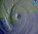
It should be noted that the 5-minute rapid scan visible imagery of did show an outflow boundary earlier today with the storm itself. Such a boundary is usually a sign of weakening convection and an overall weakening of the storm -- this may have been either a result of or a factor into the weakening of the storm earlier today. It raced out of the west side of the storm towards the west & Florida, but was only really detecable with high-resolution satellite.
One last bit: if you use that same highres visible imagery (link in the first post of the thread) and look at the eastern bands of over time, you'll see these little undulations that appear to radiate outward but remain stationary. These are examples of atmospheric phenomena called gravity waves. They are nothing to worry about and lead moreso to minor internal undulations in the pressure and wind fields, but are cool to look at.
--------------------
Current Tropical Model Output Plots
(or view them on the main page for any active Atlantic storms!)
|
WeatherNLU
Meteorologist

Reged: Sat
Posts: 212
Loc: New Orleans, LA
|
|
Clark, tell Travis that I am pissed at him. He needs to check his e-mail.
--------------------
I survived Hurricane Katrina, but nothing I owned did!
|
WXMAN RICHIE
Weather Master

Reged: Mon
Posts: 463
Loc: Boynton Beach, FL
|
|
Most counties along the treasure coast(Martin, St.Lucie, Indian River) now have 8 pm to 7 am curfews and no alcohol sales after 8 pm. News also said that 85% of Florida's 14 million people could expect a hurricane warning or watch at sometime during this storm. WOW!!
--------------------
Another typical August:
Hurricane activity is increasing and the Red Sox are choking.
Live weather from my backyard:
http://www.wunderground.com/weatherstation/WXDailyHistory.asp?ID=KFLBOYNT4
|


 Threaded

 [Re:
[Re: 


 I'm finishing up securing the house where I live (I'm not the owner, thankfully; I'm pretty sure this roof is gonna go!) before joining my family in Malabar tomorrow. I almost wish I could stay put, because they live closer to the projected location of landfall than I do. But I guess 30 miles won't make much difference in the grand scheme of things, and I'd rather be with my loved ones than be alone when this thing hits.

