Bruce
Weather Guru
Reged:
Posts: 139
Loc: Palm Bay, Florida
|
|
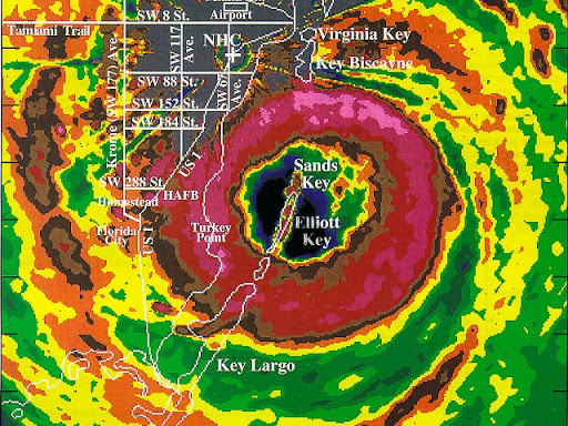
I have only seen Erin 95. Winds so strong at 90mph . If someone would have told me the wind could blow stronger, I would have said , "No Way".
|
57497479
Weather Master

Reged:
Posts: 414
Loc: W. Central Florida
|
|
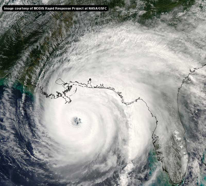
Hana looks like she is still drifting /moving in a ENE direction. On the last frame of the loop it looks like the E side of the big ball of convection is being pulled toward the E. I know that her path is all up in the air and I suppose with her history, just about anything is possible especially if she continues to intensify. Please elaborate more on possible direction and how this will effect estimated time of landfall.
I have been following eveyones post and you all are doing a great job ! Toni
--------------------
TONI
All of us could take a lesson from the weather:
It pays no attention to criticism
My 2003 Hurricane guess 13-9-3
|
Wes
Unregistered
|
|
Jason Kelly, is there any way this storm could meander its way to north central florida?
|
Anonymous
Unregistered
|
|
hmmm... the winds have been raised to 50mph now 65 mph gust the only problem now is the big convective burst is warming now. i think it will last but early saturday morning there will be another burst probably this will strngthen the storm right before it comes ashore. kinda like barry last year might make it to min. cat 1 if it can crank out another burst of convection. well thats my prediction i'll be here in gulf breeze near pensacola waiting on her
|
wxman007
Meteorologist
Reged:
Posts: 617
Loc: Tuscaloosa, AL
|
|
Highly doubtful, although you might get some trailing winds and rains...the synoptics of it just aren't going to allow it to go that far east.
--------------------
Jason Kelley
|
Anonymous
Unregistered
|
|
IT LOOKED NICE FOR A WHILE NOW HERE COMES THE SOUTH WIND TO KILL HER THIS WILL BE IT FOR HANNA
|
SirCane
Storm Tracker

Reged:
Posts: 249
Loc: Pensacola, FL
|
|
Very windy. Gusts to around 30mph and it's not even here yet! You can go outside and just sense something is brewing. Bad part is, Hanna is looking more and more better organized. Wouldn't be surprised to see a 75mph Hurricane by tomorrow morning.
--------------------
Direct Hits:
Hurricane Erin (1995) 100 mph
Hurricane Opal (1995) 115 mph
Hurricane Ivan (2004) 130 mph
Hurricane Dennis (2005) 120 mph
http://www.hardcoreweather.com
|
HanKFranK
User

Reged:
Posts: 1841
Loc: Graniteville, SC
|
|
center has jerked nnw since the last fix. pressure stable around 1002. they upped the winds based on flight level winds found well southeast of the center, but the highest buoy obs near the center are only 25kt or so. i dont get it.. center ricochets off the convection whenever it starts to line up. okay, last time i'm changing this.. alabama/mississippi border tomorrow 10am. 50mph tropical storm. pressure probably around 1002mb. hanna just doesnt seem to deepen like a normal system when it bursts convection. maybe its all that subsidence.
anyway 99L probably just an open trough, but convection is healthy. whatever gets over into the western carib from this next week can start brewing us up another storm.
noticed the outlook mentioned a wave further back.. there is one at very low latitude around 35w. i wasnt paying any attention to it.. but they are.. so maybe i should too.
anyhow just another tropical storm, drawing a sideways S track in the gulf and not really changing its profile.
HF 0337z14september
|
Anonymous
Unregistered
|
|
Okay Okay Ok. Sorry all been at work all evening working on this system and i just got in to post on here. I dont need to progress on the strength of hanna as she is where we and the expected though he slow move to the NNE is just that. I expected a early morning landfall around 6-9am eastern saturday morning and I will stay with that and my panama city to pensacola area forcast. Now 2 things could happen here and i feel the later of the 2 will. 1 Hanna gets another burst of convection and finds its way NE into the convection on its southern side and pressure drops to near 998mb winds go up to 60mph pushing the system to around pensacola area by mid morning Sat., or 2 she stays near the same or even weakens some to around 1006 mbs and gets pushed off ENE by the turning of the flow and moves in just south of Panama city giving apolachacola to Cedar Key the worst affects and a minimal TS. Im sticking with my above forcast feeling that she just cant get that move off to the NNE at 8-10mph as was expected this evening and will go with the mid level flow out of the sw and move NE with wobbles to the ENE at times. My timing then is late morning but who knows. She has been a pestering system in movements due to the weak flow and everything around her nudging her. With a weaker system if her presure rises alittle as i expect, then she will bring alot of rain to panama city and points east, but even as far west as Pensacola should continue to get bands. All in all next system will be coming from the carribean early next week. Sunday should be a day of development on this and mid week coming up will be interesting on the carribean system on where it wants to go. scottsvb hurricaneupdatecenter. Any questions feel free to ask.
|
Anonymous
Unregistered
|
|
The center - which is very evident on the shortwave IR is now over the Plaquimines Parish, LA (MS River Delta) between Boothville/Venice and Pilotown.
http://www.ssd.noaa.gov/PS/TROP/DATA/RT/float-ir2-loop.html
1 landfall down. For a circulation center this close to me < 100 miles, winds are less than 5mph. Next landfall should be in a few hours. I'm still thinking it's going to be west of the MS/AL border. I've been on that skateboard for 2 days, I'm not about to jump off of it now. We've gotten a couple of rainbands, but nothing amounting to more than a half inch or so. Last night about 8:30pm, Metairie saw some brief, heavy downpours. We might get one or two more bands (tops) to move on through today. Still, the call for the bulk of the precip in NW FL and eastward seems like a good call.
Steve
|
HanKFranK
User

Reged:
Posts: 1841
Loc: Graniteville, SC
|
|
well then.. pascagoula it is. be interesting to see if this system actually produces any gale force winds as it comes ashore. then beyond this, monday it could be redeveloping off the mid atlantic coast, if enough of the circulation survives crossing the southeast. due to orographic lifting the southern appalachians stand to pick up locally heavy rainfall amounts. since theres a five year/five foot rainfall deficit up there they stand to gain overall.
99L.. convection is very deep this morning east of trinidad. recon will be there within six hours to tell if there is a vortex somewhere in there. for those of you who like to drool over unlikely but scary runs, check the 00Z. also notice the sharp, slow moving trough in the middle of the nation. globals have this thing negatively tilting over the east late next week.. THAT is a bad omen for landfall. better hope this thing doesnt develop.
back near 35w, low latitude.. strong, persistent convective burst. analysis has a low with this feature.. if it keeps going like that we'll have another invest before long.
random thought: bahamas to florida, to eastern gulf. energy left behind from what split off the bottom of the amplification earlier this week.. backing up in hanna's wake.
just popped in my head.
why am i up so early? some jackass smoked things up downstairs and we had a dorm evacuation.. then the firemen went room to room and spent almost an hour getting sleepers out. not my idea of fun. but the outer rainband from hanna is just arriving, so not as bad as it could have been.
HF 1100z14september
|
Anonymous
Unregistered
|
|
Hanna is finally going to make landfa;;, but the convection is off to the esat and the panhandle & big bend may see more rain and wind than where she comes in. TD # 10 is now getting close IMO. Early vis loops shows a center beginning to form at about 11N/56W. Very low latitude for this , but it seems to be moving WNW...280? Lots of convection building on the west side of this so if it continues in this fashion, we could have Izzy by late tomorrow, maybe sooner. This one has me concerned for the SE coast or the GOM. This could develop progressively and be on the upswing as (if) it passes 75W (which I believe it will). Going to check the models for 6Z. Cheers!! Steve H.
|
Jeanine
Weather Watcher

Reged:
Posts: 36
Loc: Hollywood, FL
|
|
HF, took a look at the and it does not look to good for South Florida. and UKMET also bring it up through the islands but further east over Haiti than through Cuba and up. Will have to wait, it is still early! 
|
Cycloneye
Storm Tracker
Reged:
Posts: 373
Loc: Puerto Rico
|
|
Looks like it is organizing but my question is if it is far south will the coast of SA affect it's intensification?Models are showing it going to the western caribbean but after that it is to early to speculate where it will go.
--------------------
My 2004 hurricane season forecast=13/8/3
|
Kevin
Weather Master

Reged:
Posts: 524
Loc: EC Florida
|
|
Hanna: Circulation looks slightly elongated from w-e this morning, Florida Panhandle and eastern Alabama Coast should get quite a weather day. Strong gusty winds, some isolated flooding along with tropical downpours, and isolated tornadoes/waterspouts are a good bet for this one.
99L: This one's is ready to pop and it probably already has. Convection is extremely vigorous this morning and a low level circulation may be forming just west of the heaviest convection. Model runs have me concerned...they all have a formidable system coming through the Caribbean. I'd have to think that if this one take a westerly route and curves northward over Cuba we'd have a major hurricane to deal late next week, but this is major speculation at this point. When Hanna finaly get out of our hair and we finally get 99L classified I'll take a more serious look at things though. I can say one thing for sure though: Look out if 99L continues to develop when it moves through the Eastern Caribbean Sea. Whenever you have a storm developing in a typical "dead zone" you know it's for real. We still need one major storm to make this season "balanced" and I think we may have one in the cards here.
Wave midway between Africa and Islands slowly trying to improve. Much less important than the front runner already near the islands. May develop slowly anyways.
Weather here in C. Florida is sort of weird. Breezy, the clouds are thin and milky and are allowing some nice sun to get through. Type of weather that would make you suspect a tropical entity was somewhere.
Kevin 
|
Ed Dunham
Former Meteorologist & CFHC Forum Moderator (Ed Passed Away on May 14, 2017)
Reged:
Posts: 2565
Loc: Melbourne, FL
|
|
Here is a good link to bookmark for (near?) future reference.
Current Caribbean Weather
Cheers,
ED
|
57497479
Weather Master

Reged:
Posts: 414
Loc: W. Central Florida
|
|
Thanks ED that is a great site. I agree, I believe we will need this site in the next several days. Invest 99 has me concerned will need to keep close tabs on this one!
Toni
--------------------
TONI
All of us could take a lesson from the weather:
It pays no attention to criticism
My 2003 Hurricane guess 13-9-3
|
Frank P
Veteran Storm Chaser
Reged:
Posts: 1299
|
|
Hanna had very little effect for the Biloxi/Gulfport MS area... we had a couple of feeder bands over the night, and some minor flooding on HWY 90 due to the 3-4 foot high tides... but overall what you'd expect from being on the west side of a weak TS... looks like the center is passing off to the east of Pascagoula, and headed towards the MS/AL line
the thing that always amazes me is that you could still sense the potential power of even a weak tropical system.... Mobile taking the brunt of the very heavy rains this morning..
lowest pressure we had was around 29.70 or so, with some gusts maybe in the upper 20s...
actually Hanna looks better on the radar loop right now as it goes inland than any time prior....
Edited by Frank P (Sat Sep 14 2002 02:48 PM)
|
Robert
Weather Analyst

Reged:
Posts: 364
Loc: Southeast, FL
|
|
it looks like its a depression or storm now but to far south what looks to be the center is at 9 n and making landfall in NE Venezula. check it out on goes sat loops nice dense cloud structure with banding and a small .
|
Southern4sure
Weather Guru

Reged:
Posts: 121
Loc: Land O Lakes, FL
|
|
well the 10 am cooridinates have Hanna just about sitting on my house. It is very breezy, raining, very tropical looking. But is not bad....just rain.
|


 Threaded


