HumanCookie
Verified CFHC User

Reged:
Posts: 17
|
|
http://www.chron.com/cs/CDA/ssistory.mpl/front/3257501
Quote:

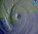
High waves crash the shoreline of the Guantanamo Bay Naval Station, Cuba, as Hurricane slams into the island. The Category 4 storm is expected to hit the main island today and is on a path to threaten Florida this weekend, where evacuations are under way.
Quote:
GUANTANAMO BAY NAVAL STATION, Cuba — Packing devastating 135 mph winds, Hurricane tore down a guard tower at the U.S. detention camp for terror suspects as it stalked Cuba's south coast and prepared today to strike into the heart of the largest Caribbean island.
Thousands of residents and tourists fled the Florida Keys, fearing would skirt the island chain or hit it on its way to the Gulf of Mexico, on a path that raised fears of further disruption to U.S. oil operations.
A Category 4 storm with 135-mph winds, killed five people, collapsed a bridge and blocked roads with downed power lines and trees in Haiti and Jamaica on Thursday.
The eye was taking aim at central Cuba this morning from 60 miles at sea, a few miles short of the storm's most dangerous winds, the U.S. National Hurricane Center said.
"It's right off the coast, they'll be getting hurricane-force winds before long if they haven't already," meteorologist Trisha Wallace told The Associated Press by telephone from the center in Miami.
Hurricane-force winds extended 50 miles with tropical storm force winds stretching another 140 miles. was moving northwest near 12 mph.
The first hurricane of the season sideswiped Haiti and Jamaica on Thursday, then overnight crossed a sparsely populated Cuban cape at Cabo Cruz that juts out far west of the island, Wallace said.
Dennis was expected to strike again tonight and cross central and western Cuba, including Havana.
Forecasters predict the storm will intensify and hit the United States anywhere from Florida to Louisiana by Sunday or Monday, the fourth storm in as many weeks to disrupt oil production.
The Florida Keys were on hurricane warning and the rest of the peninsula on tropical storm watch.
Thunderstorms swept over the Dominican Republic, southern Haiti and northeast Jamaica on Thursday.
Today, the Cayman Islands downgraded its hurricane warning to a tropical storm watch, spared from a direct hit by the storm's overnight turn to the west.
Also spared overnight was the U.S. detention camp on Cuba's extreme southeast end, holding some 520 terror suspects.
Heaving surf tore away a lifeguard tower at Windmill Beach and storm force winds reaching 40 mph destroyed a bus shelter. A few power lines and tree branches were knocked down and there was minor flooding.
"Actually, everybody fared real well," said Navy Cmdr. Anne Reese.
On Thursday, troops watched from a cliff as the churning Atlantic Ocean threw up massive waves of salt spray that towered over the razor wire fence surrounding the camp at Guantanamo Bay.
The troops fixed metal shutters over the steel mesh windows of some prison cells overlooking the sea at Camp Delta, which is just 150 yards from the ocean.
Hurricane Center forecasters warned Cuba's southeast Sierra Maestra Mountains could get up to 15 inches of rain, with about 10 inches falling on Jamaica's coffee-producing Blue Mountains.
In the southwest Haitian town of Grand Goave, an Associated Press Television News reporter saw at least four people die when a wood and metal bridge collapsed.
Witnesses said the river suddenly came rushing over the bridge. That cut off Haiti's southwest peninsula from the rest of the country.
Elsewhere on the dangerously deforested island, wind gusts uprooted a palm tree and flung it into a mud hut, killing a fifth person in the southern town of Les Cayes, the Red Cross said.
Floodwaters rose to waist level in an abandoned church in Les Cayes and nearly reached a table where 63-year-old Eloge Larame lay down, ill. His family of five stood on chairs, their feet still in water.
Wind gusts ripped tin roofs from homes and whipped sheets of rain that flooded roads.
In Jamaica, floods and debris blocked the road leading from the capital, Kingston, to the storm-battered east.
A man there narrowly escaped from a car swept away by fast-flowing floodwater on Wednesday night, a day before the hurricane passed.
Cuba evacuated more than 100,000 people from the southeast on Thursday, civil defense officials said on state television. Hundreds of tourists were taken to hotels in Havana and northern Varadero beach resort.
Thousands of students at government boarding schools were being sent home, and livestock was moved to higher ground.
The largest and most populous Caribbean island with 11.2 million people, Cuba suffers few hurricane casualties because the government cautiously evacuates people en masse, sometimes forcefully.
Dennis came right behind Tropical Storm Cindy, which made landfall late Tuesday in Louisiana and hindered oil production and refining. On Thursday, remnants of Cindy dumped heavy rain on parts of the Carolinas, prompting flash flood and tornado watches.
The hurricane center's lead forecaster, Martin Nelson, said it was the first time the Atlantic hurricane season had four named storms this early since record-keeping began in 1851. The season runs from June 1 to Nov. 30.
Last year, three catastrophic hurricanes — , and Jeanne — tore through the Caribbean with a collective ferocity not seen in years, causing hundreds of deaths and billions of dollars in damage.
|
D3m3NT3DVoRT3X
Weather Watcher

Reged:
Posts: 48
Loc: The Burg < FL
|
|
Thanks Clark for your insite =D 
|
adogg76
Weather Hobbyist
Reged:
Posts: 53
|
|
Seems like "wants" to miss those mountains in Cuba!!
|
msmith43
Verified CFHC User
Reged:
Posts: 18
Loc: South Tampa
|
|
Agreed. I always anticipate comments from Clark.
|
rmbjoe1954
Weather Master

Reged:
Posts: 427
Loc: Port Saint Lucie, Florida, USA
|
|
I understand that there is that chance of the jet stream forcing a curve toward the north, but we are dealing with a powerful (who knows what category in the open gulf) hurricane that wouldn't follow conventional wisdom and allow the jet stream to turn it towards the west-central coast. Also, that trough may yet be a factor when the system gets into the SE GOM. The has taken these events into account in determining the impact they will have in 48 hours.
I would wait to see what the models' solutions will look like when enters the GOM.
--------------------
________2023 Forecast: 20/10/5________
There is little chance that meteorologists can solve the mysteries of weather until they gain an understanding of the mutual attraction of rain and weekends. ~Arnot Sheppard
|
Rick on boat in Mobile
Weather Drama Guru

Reged:
Posts: 161
|
|
it will miss the mountains....because they are resistance...it will feel its way around the mountains...and cross the mainland of Cuba where it is more flat....
worst case scenario....
enter the GOM as a major hurricane...and vascillate between category 4-5.....
and totally aggravate everyone from New Orleans to Tampa....
still think a Mississippi/AL state line hit...but I wouldn't discount Joe Bastardi's thoughts....
anyone have a connection to his thoughts this morning?
|
VandyBrad
Weather Hobbyist

Reged:
Posts: 80
Loc: Bryan, TX
|
|
This morning JB was saying much of what he has been saying all week. He is bashing the models for initializing too far north or east of its current position and this initilization resulting in a more eastward biased track. He still firmly believes in a doomsday scenario for New Orleans.
--------------------
Brad Shumbera
|
GuppieGrouper
Weather Master
Reged:
Posts: 596
Loc: Polk County, Florida
|
|
Channel 9 out of Orlando just announced that the Space Shuttle will stay on the pad. The NASA officials do not believe the weather will be severe enough to move the shuttle. I am not doubting anything except the timeline that it takes to move it in the first place. But, if this is a signal that the bulk of the storm will miss Central Florida and we will just get Tropical force winds, rain and isolated tornados, that is good sleeping weather. However, I have family in the direction they are loosely describing just west of Pensacola. I am not a happy Camper and may attempt to drive up there since they are elderly and my dad is on oxygen24/7. I really do not know what decision to make yet.
--------------------
God commands. Laymen guess. Scientists record.
|
MissBecky
Weather Guru

Reged:
Posts: 112
Loc: Ft. Myers, FL
|
|
Clark, this is not what I wanted to hear. Most people in my office are feeling overconfident about staying far away, and thinking we will only get "some rain" this weekend. I wish the would upgrade our watch to a Hurricane Watch. It might make people pay more attention to what's going on out there. 
|
KN4LF
Unregistered
|
|
#57 Published Friday July 08, 2005 at 10:45 am EDT
At the 11:00 am EDT advisory Hurricane has a sustained wind of 150 mph, a strong CAT 4 cyclone and just short of a CAT 5. It's at position 21.4 N 79.9 W with a minimum barometric pressure of 27.70". He continues on a NW heading or approximately 310 degrees at a speed of 16 mph. During the past 12 hours he has been wobbling on a heading between about 300-320 deg. as he has undergone eyewall reformation cycles and also interacted somewhat with land.
What is interesting to note is that even with the land interaction has continued to strengthen to just short of CAT 5, much like did last summer. As he comes ashore in west central Cuba today his heading should shift more north of west due to speed divergence and appear to be headed towards the southern Florida peninsula but then shift back more west of north as he enters the Florida Straits. is a small cyclone like so is more easily pushed around so to speak. It was speed divergence that caused CAT 4 to abruptly turn right and go ashore in the Charlotte Harbor area of SW Florida. I don't think that will get close enough to the land mass of Florida to pull another .
Where is he headed? The models have shifted left and right during the last 12 hours and the TPC forecast track has done the same. At the latest advisory the track has shifted a little to the right again with official landfall forecasted at Pensacola at approximately 2:00 pm EDT on Sunday.
It does now appear that the southern Florida Keys will experience hurricane conditions on Saturday. The whole of the west "coast" of Florida be in the most dangerous NE quadrant of the cyclone and will experience at least gale force wind conditions, storm surge of 3-5 feet, heavy rainfall and waterspouts. Inland areas of the western peninsula will experience wind gusts to gale force, very heavy rainfall and tornadoes in feeder bands. A track a little further west and the impact is less, a track a little further east and the impact is more.
Actual intensity of as it passes over or just west of Key West is a tough call. It will enter Cuba as a CAT 4 and exit a CAT 3. It all depends on how long the cyclone stays over land.
Bottom line? The Bermuda high pressure ridge over and east of Florida shows no further signs of weakening at this time. So no change in my forecast, it's still a landfall window between Pensacola and Fort Walton Beach on Sunday afternoon. Once in the Gulf Of Mexico will reach CAT 4 status again and maybe even flirt with CAT 5 status but should weaken to a CAT 3 by landfall due to less favorable conditions.
Take Care,
Thomas F. Giella, KN4LF
Retired Meteorologist & Space Plasma Physicist
Plant City, FL, USA
kn4lf@arrl.net
NWS Tampa Bay, FL SKYWARN Observer #HIL-249
Plant City, FL NWS CWOP Weather Station #AR692 Live Data: http://www.kn4lf.com/index1.html
Plant City, FL NWS CWOP Weather Station #AR692 3 Minute Data: http://www.kn4lf.com/index.html
Plant City, FL Daily Climatological Weather Data Archive Blog: http://www.kn4lf.com/kn4lf22.htm
Florida Daily Weather Discussion Blog: http://www.kn4lf.com/flwx1.htm
Florida Raw Weather Forecasting Product Links: http://www.kn4lf.com/kn4lf13.htm
Global Warming Refuted: http://www.kn4lf.com/kn4lf42.htm
|
WeatherNLU
Meteorologist

Reged:
Posts: 212
Loc: New Orleans, LA
|
|
Clark......I don't know about you but I am having a hard time buying the since it can't even seem to nail the 6 and 12 hour forecasts. It seems to me to be too far north into Cuba right off of the bat. Maybe that's just me.
--------------------
I survived Hurricane Katrina, but nothing I owned did!
|
Wingman51
Weather Guru

Reged:
Posts: 126
Loc: Orlando, FL
|
|
OK - - My Entire Office freaked out over the picture that "Was" posted with this story - - Wave or Clouds???? :?:
|
Ricreig
User

Reged:
Posts: 431
Loc: Orlando, Fl
|
|
Quote:
really do not know what decision to make yet.
Here is I think, a win-win piece of advice. Drive now while you can. Take care of your parents. If the storm misses, you've visited family that may not be here forever, and if it does hit you will be able to evacuate them in time. Waiting may prevent both of those options. Ask yourself; "Can they do it withou my help?" Unless the answer is a resounding YES, Put a 5 gallon jerry can of gas in the car, refuel every 1/3 tank (in case stations in the destination are out of gas or lines robbing valuable time, and drive there like a life might depend on it.
--------------------
Richard
A forecast is NOT a promise!
|
Colleen A.
Moderator

Reged:
Posts: 1432
Loc: Florida
|
|
Thank you for the update on Gitmo. I'm glad to hear our soldiers are safe. I have to say, though, when I saw that picture, it really hit home how strong this storm is. Unbelievable...God Bless anyone in it's path.
--------------------
You know you're a hurricane freak when you wake up in the morning and hit "REFRESH" on CFHC instead of the Snooze Button.
|
Tazmanian93
Weather Master

Reged:
Posts: 495
Loc: Tampa
|
|
Cuba has three major mountain ranges. In the west the Sierra de los Órganos range rises to the height of 800 m (2,500 ft) above sea level. In the south central region, the Sierra de Trinidad, or the Escambray mountains, tower 1,150 m (3,800 ft) above sea level and overlook the colonial city of Trinidad. In the east, Cuba’s tallest mountains are in the Sierra Maestra, topped by Real de Turquino peak at 2,005 m (6,578 ft) above sea level. The Sierra Maestra soar near the Caribbean’s Windward Passage, a strip of water that separates Cuba and Haiti. Cuba has several other prominent mountains and hills. Lying north of the Sierra Maestra are the Baracoa Highlands, which climb to 1,230 m (4,050 ft) above sea level. In the far western end of the island are large, haystack-shaped eruptions called mogotes in Spanish. These unique hills form the Sierra de los Órganos, which rise steeply from flat, lush valleys to heights of more than 300 m (1,000 ft).
On the southern shore are coral islands, reefs, and swamps. The largest harbors are Havana, Matanzas, Cienfuegos, Nuevitas, Guantánamo, and Santiago de Cuba. My wife is from Camaguey and has family there.
--------------------
Don't knock the weather; nine-tenths of the people couldn't start a conversation if it didn't change once in a while.
Go Bucs!!!!!!!!!
****************
Ed
|
VandyBrad
Weather Hobbyist

Reged:
Posts: 80
Loc: Bryan, TX
|
|
Quote:
God Bless anyone in it's path.
Except maybe Castro...
--------------------
Brad Shumbera
|
WeatherNLU
Meteorologist

Reged:
Posts: 212
Loc: New Orleans, LA
|
|
By the way per the 11AM press conferences:
Orleans Parish and most outlying parishes: Not requesting residents to do anything at this time except to make a plan and have it ready to execute if necessary.
Jefferson Parish: Asking residents who have the means to get out now to avoid to main rush. Asked state police to implement contraflow and they declined at this point. They have about five hours left to decide before the new 50 hour rule kicks in.
Should be an interesting afternoon.......they usually do these things together but they had seperate press conferences and seem to be on different pages regarding .
--------------------
I survived Hurricane Katrina, but nothing I owned did!
|
D3m3NT3DVoRT3X
Weather Watcher

Reged:
Posts: 48
Loc: The Burg < FL
|
|
looks to be with in the next 1 or 2 hours .. lookin @ the latest IR http://www.ssd.noaa.gov/PS/TROP/DATA/RT/float-ir2-loop.html
|
Justin in Miami
Storm Tracker
Reged:
Posts: 269
Loc: Ft. Lauderdale, Florida
|
|
I am not sure if all of you are aware of this new program by Google. Download and take a look at Cuba aerial photography. It's free and VERY COOL.
http://earth.google.com/
Enjoy!
|
Lysis
User

Reged:
Posts: 451
Loc: Hong Kong
|
|
Except maybe Castro
Ha! You know our relief budget for Cuba after was laughable (I think it was something absurd like $30,000, and the Cuban government refused to accept it). I hope it isn't the same deal with .
--------------------
cheers
|


 Threaded


