Clark
Meteorologist
Reged:
Posts: 1710
Loc:
|
|
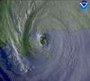
Big convective blowup recently in S Alabama...any impact on the track of the storm remains to be seen, but a slight wobble west is not out of the question. This storm looks like it is going directly up Escambia Bay, where damage is going to be catastrophic. This will take the eyewall near or over downtown Pensacola.
Areas from Panama City to Cape San Blas should see their storm surge really kicking up as the center makes landfall and winds begin to come perpedicular to shore in that area. Regions all across the SE from Mississippi to SE Georgia are seeing torrential rains -- here in Tallahassee, we are now well over 5" storm total with much more to come. The FL panhandle, except for perhaps the areas between Apalachicola and Panacea, is bearing the brunt of the heavy rainfall at this time, with S. Alabama next in line as the storm moves north.
--------------------
Current Tropical Model Output Plots
(or view them on the main page for any active Atlantic storms!)
|
Clark
Meteorologist
Reged:
Posts: 1710
Loc:
|
|
The radar loop confirms a northward or north-northwestward movement, but not an eastward movement. Surely an eastward movement would be beneficial to Pensacola, but it would doom quite a few other areas just to the east as well. There is the possibility for either an eastward or a westward jog at landfall, but neither is showing up right now. Satellite can be rather deceiving over short intervals, especially if the satellite "jumps" suddenly; radar data is much better to use and offers better resolution at this point in time.
--------------------
Current Tropical Model Output Plots
(or view them on the main page for any active Atlantic storms!)
|
scottsvb
Weather Master
Reged:
Posts: 1184
Loc: fl
|
|
Its a shame you need to bash me mrsmith. As I said I hope everyone is indoors with this. Your conserns are ours also. Leave it at that.
|
Ron Basso
Storm Tracker

Reged:
Posts: 267
Loc: hernando beach, FL
|
|
Quote:
that jog north actually looks northeast jog
Maybe God is sparing the good people of P'cola from the worst of the rath..if this N or N-NE trend continues much longer the city will be spared. But Ft Walton Beach looks to be severely damaged.
--------------------
RJB
|
Ron Basso
Storm Tracker

Reged:
Posts: 267
Loc: hernando beach, FL
|
|
Clark, I agree its a northward movement, but at this longitude if it holds, will come in east of P'cola - I'm glued to the short range radar.
--------------------
RJB
|
jr928
Weather Guru
Reged:
Posts: 101
|
|
this large blow up north and west could drag it a bit. what's the mets thinking on motion after landfall?
|
AndyG
Weather Watcher
Reged:
Posts: 35
Loc: Bradenton, FL
|
|
I'm simultaneously watching radar out of Mobile and Tallahassee with both of them zoomed. It refreshes about every minute or so. I agree that I think it is just a northward movement at this time.
|
cjzydeco
Weather Guru

Reged:
Posts: 120
Loc: Sebastian, FL
|
|
It certainly looks like a jog north. Maybe northeast, but too soon to tell. And this late in the game, every jog counts. Last night I was praying east of Mobile. This morning I've been praying east of Pensacola. But with all the thin, vulnerable barrier islands and great communities in this area, there's nowhere good for this thing to go. UGH!
|
Clark
Meteorologist
Reged:
Posts: 1710
Loc:
|
|
Don't disagree with that, Ron, but I do think it'll still come in very near Escambia Bay. Pensacola, IIRC, is on the west side of the bay, but will likely still end up in the eyewall.
After landfall, the storm should continue on its general motion up into the Ohio/Mississippi River valley before stalling out, leading to some heavy rainfall amounts over the next 5 days across the region.
--------------------
Current Tropical Model Output Plots
(or view them on the main page for any active Atlantic storms!)
|
scottsvb
Weather Master
Reged:
Posts: 1184
Loc: fl
|
|
Yeah our main concern is the lives. Homes and Businesses are 2nd. I hope everyone is safe in this storm.
|
Doombot!
Weather Guru

Reged:
Posts: 160
Loc: Lakeland, Fl.
|
|
Looks like still a little westward componant. It seems to be dead on course for Escambia Bay.
|
jr928
Weather Guru
Reged:
Posts: 101
|
|
dirty eye? cloud fill in?
http://www.ssd.noaa.gov/PS/TROP/DATA/RT/float2-vis-loop.html
|
HanKFranK
User

Reged:
Posts: 1841
Loc: Graniteville, SC
|
|
hats off to the ... they've never offered up a track far from the western panhandle and that's just where has gone. everybody who should have gotten out has had ample, exemplary warning. the ugly part is about to start. gulf breeze over to navarre, warrington across pensacola to milton... lots of stuff is about to break. for the people who chose to stay... be safe, don't take risks, stay secure in sturdy places. protect your lives.
HF 1906z10july
|
cjzydeco
Weather Guru

Reged:
Posts: 120
Loc: Sebastian, FL
|
|
I would think, and this is just my opinion, that a path right up the middle of Escambia Bay would at least be better than if this thing lined up a little farther west. Right now and up until landfall, winds are blowing from the east. If were farther west, winds would be blowing straight up the bay the whole time, piling up the water and increasing storm surge.
|
WeatherNLU
Meteorologist

Reged:
Posts: 212
Loc: New Orleans, LA
|
|
Indeed moving NNW again, and the eye looks like it will pass right over Pensacola Beach and into Escambia Bay. Downtown Pensacola will be in on the western eyewall along with Perdido Key. Navarre Beach, Destin and Fort Walton Beach will all be in the NE quadrant and will feel the true brunt of .
My prayers are with you guys!
--------------------
I survived Hurricane Katrina, but nothing I owned did!
|
Ron Basso
Storm Tracker

Reged:
Posts: 267
Loc: hernando beach, FL
|
|
Clark, you're correct it will be very close - Looks like I may be wrong - latest radar shows a slight N-NW movement - looking like a direct hit on P'cola. I'm sorry for the good folks of Pensacola - hopefully most have found safe shelter. I'm guessing we might see an extensive tornado outbreak to the east of the center when it makes landfall too.
--------------------
RJB
|
BLTizzle
Verified CFHC User

Reged:
Posts: 13
Loc: Eufaula, AL
|
|
does anyone know how to get to Jason Kelly's live streaming video on his site?
--------------------
Brandon in Eufaula, AL - experienced TS Alberto ('93) Opal ('95), Georges ('98), Ivan ('04), Katrina ('05) (I was in Tuscaloosa AL roughly 70 miles SSE of Columbus, MS)
|
Lisa NC
Weather Guru
Reged:
Posts: 102
Loc: North Carolina
|
|
The eye looks, at this point, like it will pass just west of Escambia Bay, but won't that also bring in the flooding on the back side of the eye. When is high tide? isn't in about an hour?
--------------------
<img src="/hahn/images/graemlins/wink.gif" alt="" />
|
pcola
Storm Tracker

Reged:
Posts: 344
Loc: pensacola/gulf breeze
|
|
ok...for the second time in my life I will go thru the eye of a hurricane..I live between Pensacola and Navarre near the bGarcon Bridge and we are ground zero..amazingly we still have power..compliments to and the new infrustructure..its loud..and scary..wish me luck guys
--------------------
Erin 95 , Opal 95, Ivan 04, Dennis 05, and that's enough!!!!
|
Doombot!
Weather Guru

Reged:
Posts: 160
Loc: Lakeland, Fl.
|
|
In the last frames (short range Composite Reflectivity) the eye seems to be collapsing. ?
|


 Threaded


