ShanaTX
Storm Tracker
Reged: Mon
Posts: 226
Loc: Texas
|
|
Taiwan actually gets hit pretty frequently.
|
Margie
Senior Storm Chaser

Reged: Fri
Posts: 1191
Loc: Twin Cities
|
|
Quote:
Taiwan actually gets hit pretty frequently.
Well this is interesting because the population is high. Every time a hurricane approaches a major city here it is like a nightmare. They don't have anywhere to go on Taiwan. So what do they do over there with a Cat 5 direct hit? Maybe there is something we could learn from Taiwan.
--------------------
Katrina's Surge: http://www.wunderground.com/hurricane/Katrinas_surge_contents.asp
|
ShanaTX
Storm Tracker
Reged: Mon
Posts: 226
Loc: Texas
|
|
There are mountains in Taiwan, They have mudslides.
In 2001 they had 2 typhoons hit in a month, they had hundreds of casualties.
2000-2001 I think they had 11. Not all Cat 5 thank goodness, but Cat 5s are less rare in the Pacific.
|
Margie
Senior Storm Chaser

Reged: Fri
Posts: 1191
Loc: Twin Cities
|
|
I found a site that has a boatload of live cams for both Cancun and Taiwan. I had to load an Active X control to see the Taiwan cams but it works really well.
http://www.independentwx.com/
--------------------
Katrina's Surge: http://www.wunderground.com/hurricane/Katrinas_surge_contents.asp
|
Margie
Senior Storm Chaser

Reged: Fri
Posts: 1191
Loc: Twin Cities
|
|
Latest recon shows pressure increased to 946mb.
Surprised the max winds for the advisory are still as high as 150mph. She picked up speed to 20mph.
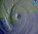
Sat images are looking different starting at 13:15 UTC.
--------------------
Katrina's Surge: http://www.wunderground.com/hurricane/Katrinas_surge_contents.asp
|
WeatherNLU
Meteorologist

Reged: Sat
Posts: 212
Loc: New Orleans, LA
|
|
Cancun might be spared the brunt of Emily if this track continues. It looks like Emily might come in well south of the area. Looks like Chetumal might be closer to the landfall point than Cancun.
--------------------
I survived Hurricane Katrina, but nothing I owned did!
|
ftlaudbob
Storm Chaser

Reged: Tue
Posts: 828
Loc: Valladolid,Mx
|
|
Quote:
Cancun might be spared the brunt of Emily if this track continues. It looks like Emily might come in well south of the area.
I agree,but that puts Playa Del Carmen in worse shape.Looks like Cozumel and Playa will be on the worse side of Emily.
--------------------
Survived: 10 hurricanes in Rhode Island,Florida and the Yucatan of Mexico .
|
B.C.Francis
Storm Tracker
Reged: Sat
Posts: 330
Loc: Indiatlantic Florida
|
|
Its going to be interesting to follow the data that comes from moored bouy 42056 in the Yucatan Basin area of the West Caribbean over the next 24 hours. Emily should come very close to its postion I believe....Weatherchef...
|
Margie
Senior Storm Chaser

Reged: Fri
Posts: 1191
Loc: Twin Cities
|
|
OK. Taking into account the latest recon, and looking at the sat images, at first I thought what a mess, Emily is falling apart. Then I looked at the visual, and it seems to me that the tight inner core, now smaller, is still looking organized and good. Before, when Emily reorganized, she left a lot of the stuff on the edges behind, and the inner core emerged and grew into a nice round clean storm. I think this is what is happening now. However it is looking like she won't get more than 12 more hours to reorganize with the higher speed. So it will be interesting to see how soon it takes her to start getting her act together again and how fast she may intensify before landfall.
It is interesting to try to understand what is happening, but of course I have no technical background in meteorology so it will be helpful if any of the moderators can provide the technical detail about what is happening now and what we can expect to see in the next 12 hours.
--------------------
Katrina's Surge: http://www.wunderground.com/hurricane/Katrinas_surge_contents.asp
|
Margie
Senior Storm Chaser

Reged: Fri
Posts: 1191
Loc: Twin Cities
|
|
Quote:
Its going to be interesting to follow the data that comes from moored bouy 42056 in the Yucatan Basin area of the West Caribbean over the next 24 hours. Emily should come very close to its postion I believe....Weatherchef...
42057 is adrift and from the data it looks like Emily went by her last night. No impressive readings; the SW side of the storm wasn't very strong at that time.
42056 is at 20N 85W. By the time Emily gets to 85W she is probably not going to be any further north than 19.3N.
So how many miles in 0.7 lat? I don't think the inner core of strong winds will make it close enough to the buoy to see any readings like the ones of the Dauphin Island buoy last year before hit.
--------------------
Katrina's Surge: http://www.wunderground.com/hurricane/Katrinas_surge_contents.asp
Edited by Margie (Sun Jul 17 2005 12:00 PM)
|
HanKFranK
User

Reged: Mon
Posts: 1841
Loc: Graniteville, SC
|
|
emily's cloud pattern got jarbled later this morning. recon says it isn't an ... probably some subsidence intake near the end of the last overnight is my reckoning. emily was approaching the detritus of a weak upper low the other day, so maybe the remnant vorticity at the upper levels mixed up the outflow pattern or something. speculation.. either way the pressure is up to 946 which is typically a 3/4 borderline. the winds supported are a little higher according to recon.. i'd expect this to dip back down.
path today should take emily in a little south of cozumel around midnight, back offshore near merida/progreso late tomorrow. spindpwn/spinup will probably resemble crossing cuba about a week ago. think the left track bend prior to second landfall is slightly overdone, and that the storm will come in closer to the tx/mex border.. but not by much. cameron/willacy counties might get a few peripheral gales and a t.s. warning out of it... pretty sure it doesn't come close enough for significant damage, though. think second landfall intensity will be 3/4 borderline area.
haven't given up on 99L. the low level vorticity is moving under the upper trough axis right now.. two maxes i can see. the southern max is weaker and moving mostly w near 23/58.. spotty convection out in front. the more formidable max is near 28/57 and moving wnw, with convection closer by. most of the convection associated with the wave is being forced near the exit region on the ne flank of that upper trough max near 20/60. as the wave axis passes the upper trough axis, it should start to generate a more conducive convective pattern for organization than the sheared pattern it's had for three days. if none of this happens in the next 36 hrs, or so... the whole thing is probably gone. if enough made it through the upper trough, though... it'll do some interesting things.
SAL seems to have killed the wave action for now in the eastern atlantic. they may act up as they near the caribbean.. globals continue to forecast a wave-friendly environment for whatever regenerates when it gets back across... nothing showing right now to speak of. is showing distant interest in a wave that comes off africa in about 9 days... tracking it as a discrete feature through day 16. nao has been mostly positive and as well.. oscillations in both can lead to more energetic mid-latitude breakaways and backing at low-latitudes... until they twitch again, it's up to the more energetic of the african waves to trigger disturbances. there is weak action at play as well, so some time in august we may see a flash of that as well.
HF 1656z17july
|
HCW
Storm Tracker

Reged: Fri
Posts: 287
Loc: Mobile,AL
|
|
Emily on radar
http://www.met.inf.cu/Radar/00Pinar%20del%20Rio/Maximos(Animacion).gif
http://smn.cna.gob.mx/radares/rad-canc.jpg
Edited by HCW (Sun Jul 17 2005 12:01 PM)
|
MikeC
Admin
Reged: Sun
Posts: 4543
Loc: Orlando, FL
|
|
Mirroring the cancun radar now since it is so slow to load:
http://flhurricane.com/imageanimator.php
|
B.C.Francis
Storm Tracker
Reged: Sat
Posts: 330
Loc: Indiatlantic Florida
|
|
Bouy 42056 is postioned at 19.87 N and 85.06 W. With the present postion of Emily at 18.6 N and 83.6 W its going to be a close one. The next 24 hours should reveal some impressive information in that vicinity. Watch the wind direction and speed, wave heights, and pressure. Almost as real time as you can get ....Weatherchef
|
superfly
Weather Watcher
Reged: Sat
Posts: 33
Loc: New Orleans
|
|
This storm really looks like a mess right now. I'd be really surprised if the winds didn't fall to ~135MPH at the next update.
|
MichaelA
Weather Analyst

Reged: Thu
Posts: 945
Loc: Pinellas Park, FL
|
|
Quote:
So how many miles in 0.7 lat? I don't think the inner core of strong winds will make it close enough to the buoy to see any readings like the ones of the Dauphin Island buoy last year before hit.
It's about 42 miles. 1� lat = aprx 60 miles. Someone correct me if that's wrong.
--------------------
Michael
PWS
|
RedingtonBeachGuy
Moderator
Reged: Tue
Posts: 342
Loc: St. Cloud, FL
|
|
Post deleted by danielw
Edited by danielw (Sun Jul 17 2005 08:10 PM)
|
tpratch
Moderator

Reged: Fri
Posts: 339
Loc: Maryland
|
|
Depends largely on the longitude. 1 degree at the equator will be a larger distance than 1 degree at the North Pole.
|
MikeC
Admin
Reged: Sun
Posts: 4543
Loc: Orlando, FL
|
|
Quote:
Mike - did you see this?
----Post Deleted.
Not removed to maintain continuity of the thread.
Please Do Not 'bet' on lives and property.
Someone loses either way.~danielw
----
I posted a link to MAHEM's project at http://mahem.miami.edu.. now, I tend to think his reaction was a bit overkill since it is a scientific project which NOAA is involved in and aimed at risk management projections.
But, that is my take on it.. it's you'alls board..
That's fine for me considering it what it was. What I'm more concerned with is why it wasn't moved to admin area or the graveyard. We shouldn't be deleting posts unless it would cause the thread to break. PM me with stuff like this, though.
|
HCW
Storm Tracker

Reged: Fri
Posts: 287
Loc: Mobile,AL
|
|
coastal flood watch has been issued for the central gulfcoast
Emily will generate waves of a very long period
between crests... which will travel northward across the Gulf and
result in heavy surf and possible coastal flooding along area
beaches late Monday and Monday night. The large waves could also
result in erosion of beaches... including those areas previously
damaged by Hurricane last weekend... and tropical storms
Arlene and Cindy earlier this Summer.
The west end of Dauphin Island Alabama will be particularly
vulnerable to coastal flooding... as similar events have produced
heavy surf and washover there several times over the past couple
of years. Hurricane Mitch... while over the western Caribbean
in October of 1998 as a very strong hurricane... produced long period
swell which propagated northward across the Gulf... inundating parts
of the western end of Dauphin Island. Along the Florida Panhandle
coastline... heavy surf should be expected... but there is no
precedent for extensive coastal flooding with this type of event.
However... with the beaches severely eroded as a result of all the
recent tropical activity... some minor coastal flooding could be
possible late Monday and Monday night.
2 PM EDT position...19.0 N... 84.4 W. Movement
toward...west-northwest near 20 mph. Maximum sustained
winds...145 mph. Minimum central pressure... 948 mb.
The next advisory will be issued by the National
Hurricane Center at 5 PM EDT
--------------------
Over 4,000 members and now on a new server
http://www.hardcoreweather.com
Edited by HCW (Sun Jul 17 2005 01:45 PM)
|


 Threaded

 [Re:
[Re: 


