Black Pearl
Weather Watcher

Reged:
Posts: 32
Loc: Mobile Bay
|
|
I know exactly what you mean Colleen. The attitude I have seen around here has been fairly relaxed, although our local met has said that if stays on the forecasted path and makes landfall near New Orleans, our area will still experience hurricane force winds and a storm surge of 7 - 9 ft.
Edited by Black Pearl (Sun Aug 28 2005 01:44 AM)
|
MichaelA
Weather Analyst

Reged:
Posts: 944
Loc: Pinellas Park, FL
|
|
Quote:
I think it starting to feel the affect of the trough to the north this is why it made that early turn in my guss.
Not quite yet:
ConUS WV Loop
--------------------
Michael
PWS
|
DebbiePSL
Weather Guru
Reged:
Posts: 151
Loc: Saint Marys Georgia
|
|
Anyone in the cone should take heed. has a mind of her own and there is still alot of uncertainty about where she will make landfall.. hopefully we will know more with the next update. Also I heard Cantore say she is already one for the history books----- first time since 1916 that 3 major hurricanes will make landfall in the Gulf in one season 
|
Hugh
Senior Storm Chaser
Reged:
Posts: 1060
Loc: Okaloosa County, Florida
|
|
Quote:
Anyone in the cone should take heed. has a mind of her own and there is still alot of uncertainty about where she will make landfall.. hopefully we will know more with the next update. Also I heard Cantore say she is already one for the history books----- first time since 1916 that 3 major hurricanes will make landfall in the Gulf in one season 
Maybe will fall apart and be a cat 1/2 at landfall. Hey, don't laugh, I've seen it happen before.
Anyway, I think even the cone will need to be expanded in the next update if the turn trend continues - although the last recon seemed to indicate it was not continuing, so who knows? If it does appear to be turning early, the forecast track will likely shift, and with it, the cone.
No one is out of danger yet.
--------------------
Hugh
Eloise (1975) - Elena and several other near misses (1985) - Erin & Opal (1995) - Ivan (2004)
|
Margie
Senior Storm Chaser

Reged:
Posts: 1191
Loc: Twin Cities
|
|
OK I guess I wasn't being clear. I already saw the recon data you posted because I went to the site and as you could see, I put some of the info in my post, that you responded to. I don't cut and past the recon data in full because the mods request that we don't do it. As Mike also pointed out it is right here on the board as well. What I was asking was since that was 90 min old (and now about 2 hours old) is there any other recon data? I wasn't asking to see the data that I already saw and commented on in my post.
More specifically I'm looking for information about other runs that might have found stronger winds. I realize the storm grew when it reorganized but still I was surprised at the low intensities. If you went by the recon data it looks like a Cat 2 with a Cat 4 pressure. If you look on the sat images, it is looking pretty impressive. So I am trying to reconcile this info.
--------------------
Katrina's Surge: http://www.wunderground.com/hurricane/Katrinas_surge_contents.asp
|
Colleen A.
Moderator

Reged:
Posts: 1432
Loc: Florida
|
|
In the many years that I have been watching these storms, I would not expect to see a track shift at 11pm. They will wait to see if this trend continues for another 6 hours (basically until 5am). However, if you see the hurricane watch expand further east, you may get an inkling of what they are thinking. I would expect to see TS Watches/Warnings go up in the watch area and further east.
**Sidenote: everytime I try to predict what the will/will not do, I am usually wrong. So take this with a grain (or shaker) of salt. 
--------------------
You know you're a hurricane freak when you wake up in the morning and hit "REFRESH" on CFHC instead of the Snooze Button.
|
JG
Weather Hobbyist
Reged:
Posts: 55
|
|
Quote:
OK I guess I wasn't being clear. I already saw the recon data you posted because I went to the site and as you could see, I put some of the info in my post, that you responded to. I don't cut and past the recon data in full because the mods request that we don't do it. As Mike also pointed out it is right here on the board as well. What I was asking was since that was 90 min old (and now about 2 hours old) is there any other recon data? I wasn't asking to see the data that I already saw and commented on in my post.
More specifically I'm looking for information about other runs that might have found stronger winds. I realize the storm grew when it reorganized but still I was surprised at the low intensities. If you went by the recon data it looks like a Cat 2 with a Cat 4 pressure. If you look on the sat images, it is looking pretty impressive. So I am trying to reconcile this info.
Click on the RECCO obs and use the legend to translate. That's my best suggestion. I'm afraid that by morning, we'll wake up to something stronger and the recon data will support it. Just be patient as all of the good hurricane sites (like this one) are very slow now, at least at my location (and I'm on 5 mb cable!).
Even the is slowing down and I'm sure it's because many are anticipating this to be a storm of historic proportions.
|
hurricane expert
Really Not an Expert
Reged:
Posts: 105
Loc: florida
|
|
This is the tricky part of the uncertain track of .If she keeps moving this slow at 7 MPH am pretty sure the trough is going to arive and pick her up to the N/NE. If she decide to speed up then she will start to beat the trough to the north.
|
Baudelaire
Registered User
Reged:
Posts: 8
|
|
Quote:
Maybe will fall apart and be a cat 1/2 at landfall. Hey, don't laugh, I've seen it happen before.
Anyway, I think even the cone will need to be expanded in the next update if the turn trend continues - although the last recon seemed to indicate it was not continuing, so who knows? If it does appear to be turning early, the forecast track will likely shift, and with it, the cone.
No one is out of danger yet.
Agh! This is even more frustrating than and ! At least we knew they were coming at us, you know?
We evacuate to Alabama only about 75mi north, so I'm not even sure if it's worth it to go. Plus, it seems they get more tornadoes there. I just don't know what to do.
-K in Okaloosa
|
MichaelA
Weather Analyst

Reged:
Posts: 944
Loc: Pinellas Park, FL
|
|
The corresponding wind speed increase lags behind the pressure drop. Should show in the 10PM CDT advisory.
--------------------
Michael
PWS
|
Margie
Senior Storm Chaser

Reged:
Posts: 1191
Loc: Twin Cities
|
|
CNN online has this headline, "Katrina Drives People Away from Gulf Coast." Just below the headline is a picture of herself behind the wheel of a very large bus on I-10, filled with a lot of crazed French Quarter partygoers, hanging out from the windows. I can just make out grafitti spray painted on the side of the bus, "The Big Easy Welcomes The Big Splash."
--------------------
Katrina's Surge: http://www.wunderground.com/hurricane/Katrinas_surge_contents.asp
|
Hugh
Senior Storm Chaser
Reged:
Posts: 1060
Loc: Okaloosa County, Florida
|
|
Quote:
This is the tricky part of the uncertain track of .If she keeps moving this slow at 7 MPH am pretty sure the trough is going to arive and pick her up to the N/NE. If she decide to speed up then she will start to beat the trough to the north.
I believe you're right. It looks to me like she is speeding up and moving NW, but again you can't make anything of temporary jogs. The longer times goes by, the more likely a track east of N.O. is looking based upon what you indicate, though - which would be great news for N.O. but devastating for someone else.

--------------------
Hugh
Eloise (1975) - Elena and several other near misses (1985) - Erin & Opal (1995) - Ivan (2004)
|
MadDog
Weather Hobbyist
Reged:
Posts: 51
Loc: DeBary, Florida
|
|
http://www.sfwmd.gov/org/omd/ops/weather/vortex.html
I like the track comparison but what I would like to know is timing. Does this track reflect the slowness of ?
|
hurricane expert
Really Not an Expert
Reged:
Posts: 105
Loc: florida
|
|
This sound crazy but everyone from just north of tampa to new orleans need to watch this system. It been real hard tracking this hurricane.
|
Kal
Weather Hobbyist

Reged:
Posts: 50
Loc: Space Coast
|
|
FYI - Local Met (NBC 15 - Mobile) reporting that current watch area will be upgraded to a warning in the next advisory, with areas east of that warning to Destin, FL placed under a Hurricane Watch/TS Warning.
|
bn765
Weather Hobbyist
Reged:
Posts: 60
|
|
What does everyone think the winds will be at the 11:00 advisory?
|
WeatherNLU
Meteorologist

Reged:
Posts: 212
Loc: New Orleans, LA
|
|
10PM will basically be an update of the 4PM advisory.
Hurricane Warnings will be issued from Morgan City to the AL/FL line and there will be Tropical Storm Warnings and Hurricane Watches from west of Morgan City to Intracoastal City and from east of the AL/FL line to Destin.
--------------------
I survived Hurricane Katrina, but nothing I owned did!
|
Margie
Senior Storm Chaser

Reged:
Posts: 1191
Loc: Twin Cities
|
|
Quote:
The corresponding wind speed increase lags behind the pressure drop. Should show in the 10PM CDT advisory.
Well it will only show in the advis if recon actually found higher winds.
From the one recon that I saw, I still remains mysteriously lacking the expected windfield and a well-formed eye, yet has impressive organization, lower-than-expected pressure, a high temp differential at the eyewall. This is a very strange storm.
--------------------
Katrina's Surge: http://www.wunderground.com/hurricane/Katrinas_surge_contents.asp
|
Hugh
Senior Storm Chaser
Reged:
Posts: 1060
Loc: Okaloosa County, Florida
|
|
Quote:
What does everyone think the winds will be at the 11:00 advisory?
Somewhere between 115 and 150. I suspect 120, but that's just a hunch based upon the pressure.
--------------------
Hugh
Eloise (1975) - Elena and several other near misses (1985) - Erin & Opal (1995) - Ivan (2004)
|
lunkerhunter
Storm Tracker

Reged:
Posts: 248
Loc: Saint Augustine, FL
|
|
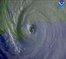
the last few frames of the IR really show her tightening up.
starting to get that symmetrical look.
but the winds probably haven't caught up yet. I'll say 115 or 120.
the next 12 hours may be explosive deepening.
--------------------
Matthew '16, Hermine '16, Colin '16, Bonnie '10, Fay '08, Wilma, '05, Katrina '05, Jeanne '04, Frances '04, Charley '04 in FTM (drove behind it), Bertha '96, Bob '91, The Blizzard of '78 in NH
|


 Threaded


