Thunderbird12
Meteorologist
Reged:
Posts: 644
Loc: Oklahoma
|
|
As Hank mentioned, there is a lot of cyclonic turning evident in the VIS loop on the western side of the system. It almost looks like there is a circulation trying to sneak off to the west, with new convection flaring on the west side of the overall system. Further to the east, Grand Cayman recently reported sustained winds of 20 knots out of the ESE in a rain shower.
|
Big Kahuna
Weather Hobbyist

Reged:
Posts: 52
Loc: DeLand, Florida
|
|
are you talking about the system around 60w 20n ?
http://www.ssd.noaa.gov/PS/TROP/DATA/RT/watl-wv-loop.html
I know it doesnt mean much but even the ukm picked up on it on ther 850mb.
http://moe.met.fsu.edu/tcgengifs/
|
MapMaster
Weather Guru

Reged:
Posts: 138
|
|
Thats an upper low...don't use WV to determine of you have a system or not! It doesn't work.
Hey, what is that out by the Canary Islands??? There is an upper low immediately to the sw, but, this looks like an organized, tropical system.
Looks like we will have (at least) a TD at 5, in the central atlantic.
http://weather.msfc.nasa.gov/GOES/metsat7ir.html
|
scottsvb
Weather Master
Reged:
Posts: 1184
Loc: fl
|
|
Gotta laugh at my friends at the for saying the same thing for the last 3 days and cancelling the recon the last 2. Currently the NW carribean system is the same as about 3 days ago. Weak circulation around 1008mbs but finally should become a dep later tomorrow. Movement will be towards the NE mexico coastline. I would like to agree with the on developing another system near Jamaica by early next week but it could be further N over the SE Bahamas. Movement will be NW and could bring needed rainfall to parts of florida by next weekend.
|
Bloodstar
Moderator

Reged:
Posts: 462
Loc: Tucson, AZ
|
|
Well... a quick run down from what I see out there....
99L: Is going to have that sheared look for a bit, but there is a definite low pressure. If the trend contineus, it will probably be classified in the next 36 hours. it's moving slowly, which is probably bad news if you don't want it to develop....
90L: Hey, where'd this come from? It's certainly looking pretty good for a late season Cape Verde storm, Nice little fish spinner most likely
Other features that catch my eye:
GOM spin: It's pretty, and it's harmless.... yay!
There's a pretty strong ULL(?) sitting at 25N 25W, it looks like it could go hybrid, but it's hard to tell at this point. I'm guessing it'll lift north and east soon enough, but you never know until it's gone.
22N 60W, I'd give a heads up there, as the thunderstorms are starting to increase even though it looks like an ULL, it has some pretty strong potential to drill down....
That's my two cents 
-Mark.
--------------------
M. S. Earth and Atmospheric Sciences, Georgia Tech - May 2020
Brookhaven National Laboratory
U. Arizona PhD Student
|
Clark
Meteorologist
Reged:
Posts: 1710
Loc:
|
|
QuikScat suggests the making of a low-level center with that disturbance along 25N/W with some pretty strong rain-flagged winds, but it's mainly aloft right now. Not out of the realm of possibility that it develops -- it has good model support for some type of development, whether hybrid or tropical -- but probably will go out to sea in the long run. Ditto 90L...which is pretty close to being classified.
--------------------
Current Tropical Model Output Plots
(or view them on the main page for any active Atlantic storms!)
|
Ron Basso
Storm Tracker

Reged:
Posts: 267
Loc: hernando beach, FL
|
|
The ULL interacting with a tropical wave NE of the LA islands shows some increased convection today. All of the models have picked up on a T-Wave or Cyclone moving from around 20N-60W into the SE Bahamas, across FL and exiting into the GOM over the next 3-5 days. Afterward, the then stalls this feature in the eastern GOM. The globals have been predicting this scenario for days. The /UKMET develop the system into a cyclone while the others /NOGAPS retain an open wave. Since this system may not be truly warm core (i.e. tropical), the models may be picking up on baroclinic forcing to develop this storm. In that sense, this wave/ULL may become sub-tropical rather than purely tropical - or it may start off subtropical and transition to a tropical system in the Bahamas or GOM. Since this feature has strong global model support - it bears watching. At the very least, looks like some wet and windy weather for FL next week - we could sure use it in Tampa with the driest September on record.
http://www.ssd.noaa.gov/PS/TROP/DATA/RT/watl-ir4-loop.html
--------------------
RJB
|
NONAME
Weather Guru

Reged:
Posts: 136
|
|
FNMOC (I think is a Conterpart to Navy) now Labels 90L as 19L
Can some one see if navy says it 19L though also cause my computer wont let me on it sometimes
If it is True expect a Special Tropical Disturbance Statement Soon
FNMOC web page
--------------------
I am a young Weather enthusiast and really want to get to college in a couple of years for meteorology.
|
Thunderbird12
Meteorologist
Reged:
Posts: 644
Loc: Oklahoma
|
|
According to the site, 90L is now T.D. 19.
Meanwhile, 99L continues to be a big, disorganized mess. The WV loop seems to indicate some sort of mid-level vort max over the Yucatan Channel, imparting some SWerly shear over the western portion of the system, with northerly shear continuing to the east. Surface pressures are low and there is plenty of low-level curvature evident in the VIS, so one big flare-up of convection somewhere near the center of the system could result in a depression forming. Time may be running out in the short term, as the center of the system will be approaching the Yucatan in another day or so.
|
Ed in Va
Weather Master
Reged:
Posts: 489
Loc:
|
|
Early guidance on 90L...outta here!
http://euler.atmos.colostate.edu/~vigh/guidance/atlantic/early1.png
--------------------
Survived Carol and Edna '54 in Maine. Guess this kind of dates me!
|
Thunderbird12
Meteorologist
Reged:
Posts: 644
Loc: Oklahoma
|
|
TD 19 looks like a fish-spinner, and, in this potentially record season, a stat-padder.
|
NONAME
Weather Guru

Reged:
Posts: 136
|
|
I Think there is spose to be a ridge biuld later in the forcast period in it might turn more westward so just wait tilnhc get it adviosory out. Well I catch up on this later tonight cause I am go to play in a football agains the easiest team maybe the freshman will get to play later ppl
what are you, like, typing with your tongue? honestly you can do better. anyhow, enjoy crashing into people.. -HF
Edited by HanKFranK (Sat Oct 01 2005 03:40 AM)
|
MapMaster
Weather Guru

Reged:
Posts: 138
|
|
Take a look at this in the S. Atlantic....
http://weather.msfc.nasa.gov/GOES/goeseastfullir.html
Looks like we might be about to go into the oddball season, north and south of the equator.
MM
Link edited to go to satellite page -- the GHCC website doesn't allow you to directly link to a part of an image. --Clark
Edited by Clark (Fri Sep 30 2005 09:10 PM)
|
Clark
Meteorologist
Reged:
Posts: 1710
Loc:
|
|
Not sure what you're seeing there in the SAtlantic...I see a frontal wave coming off of the coast of southern Brazil that'll capture the weak vort max to its east. Nothing really tropical or close to it, though.
--------------------
Current Tropical Model Output Plots
(or view them on the main page for any active Atlantic storms!)
|
Margie
Senior Storm Chaser

Reged:
Posts: 1191
Loc: Twin Cities
|
|
Since I don't know much about this stuff...please tell me that the low, 99L, is not sliding far enough north this aft that it will miss the Yucatan, and go right over Cuba and into the GOM.
--------------------
Katrina's Surge: http://www.wunderground.com/hurricane/Katrinas_surge_contents.asp
|
GuppieGrouper
Weather Master
Reged:
Posts: 596
Loc: Polk County, Florida
|
|
Ok, the 99L is a model faux pas.
--------------------
God commands. Laymen guess. Scientists record.
|
Susan in Jupiter, FL
Verified CFHC User
Reged:
Posts: 18
|
|
Wonder why the Navy web site is showing TD 19 going north into Mobile? I think their site may be messed up........at least I sure hope so.......
http://tcweb.fnmoc.navy.mil/tc-bin/tc_home.cgi
--------------------
Susan in Jupiter, FL Survived:
Andrew, Irene, Charley, Francis,
Ivan, Jeanne, Katrina, Wilma
|
andy1tom
Storm Tracker

Reged:
Posts: 309
Loc: Callaway, Florida
|
|
that is . it is a old model. don't know whats up with that.
|
weatherwatcher999
Verified CFHC User
Reged:
Posts: 20
Loc: Southwestern Ontario, Canada.
|
|
I'd say this will be Stan soon, and give or take a few days, the tropical wave in the caribbean sea will probably eventually develop...
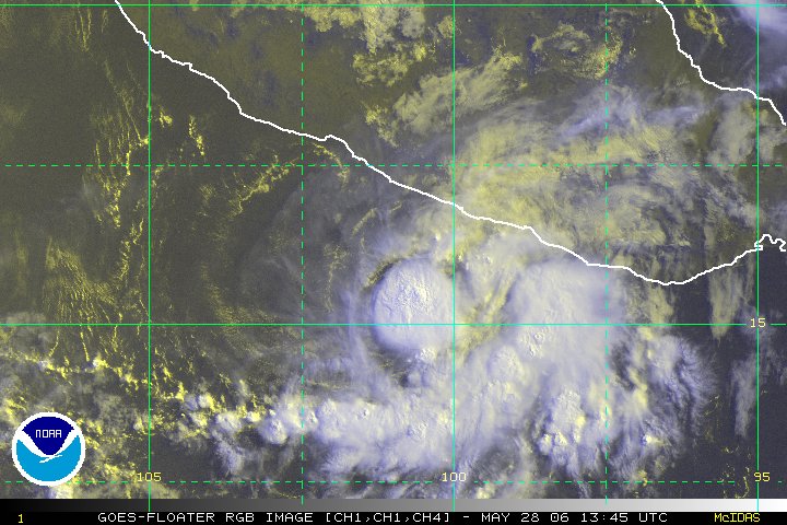
Btw if anyone wanted to know (you probably do) there's a hurricane in the eastern pacific (otis), and it's churning towards baja california, and mexico-I know it's off topic, but just wanted to post it 
This is my first post on flhurricane! 
|
HanKFranK
User

Reged:
Posts: 1841
Loc: Graniteville, SC
|
|
99L can't seem to get it together. after the impressive, sort-of-banding convection it had on its eastern side today the stuff puffed out again (that's what, four times now?) and has since been replaced by a blow up near the not-so-tight center. will that puff finally get the ball rolling down the hill? who knows? it's going to move over the yucatan either late tomorrow or tomorrow night, and be inland for a day or two. then i guess it gets a turn with the gulf if there's anything left.
so much for wannabe stan--the real thing appears to be in TD 19 out in the eastern atlantic. hard to tell much about that system at night as it's still relatively formless on IR, just a persistent spot of deep convection. will probably wait for unequivocal proof before upgrading this system.... maybe a second t-2.5 or a really convincing scatterometer pass. sometime tomorrow this ought to happen, unless it continues to look like an overzealous thunderstorm on color IR.
the trough/low out in front of it strung from the at 40w up to the nw actually has a decent blow-up on it tonight... as elongated as it is i doubt it could do much very fast. there's that upper low between the canaries and azores that seems to be tunneling to the surface, which may go tropical given a couple of days to rethink its purpose. then there's the mess in the western atlantic which is supposedly going to coalesce into a something meaningful near/east of the bahamas over the next day or three. the shortwave has already sped away and snipped off some disturbed weather west of bermuda... more is firing on the north side of the upper low just north of puerto rico. as the heights rise to the north the pressures should fall in this area and give us something.... maybe just an easterly wave mock-up in the subtropics or maybe something more nefarious. i'm of the latter school of thought, but will freely admit that more globals show nothing than something.
anyhow, things are less busy than i was thinking they'd be earlier in the week, but there is stuff going on. 99L can still develop.. and there's a fish spinner depression revving up out beyond where they normally develop this time of year.
starting on october. three normal names left, which in a typical year would be enough.
HF 0400z01october
|


 Threaded


