There is an of concern between the Southeast coast and Bermuda. There are thunderstorms clustered along a stationary front in this area, and there is an upper-level low over the region as well. The computer models suggest that low pressure forming in this area could acquire tropical characteristics over the next few days. The waters are easily warm enough to support development in this area, and there is not too much wind shear. So, this is an area to watch carefully.
There is a tropical wave in the western Caribbean and over Central America that stretches from around 10 north, 87 west to 24 north, 78 west. There are spotty thunderstorms along the southern part of this wave, and there appears to be a broad area of cyclonic turning in the atmosphere along and west of the southern part of the wave. While no development can occur along the wave with it over land, it could organize further once it reaches the Pacific in a day or two. The northern end of the wave will brush South Florida tomorrow and bring an increase in shower and thunderstorm activity.
And last, if the large tropical wave mentioned in my earlier post was to persist in convection and organization, then it might be of a concern for development, but as for now it will just be watch.
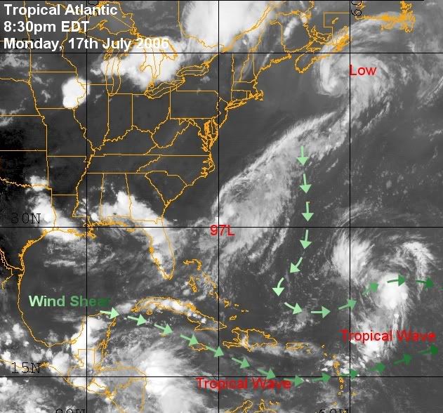
Image 1 : Tropical Setup Around 97L
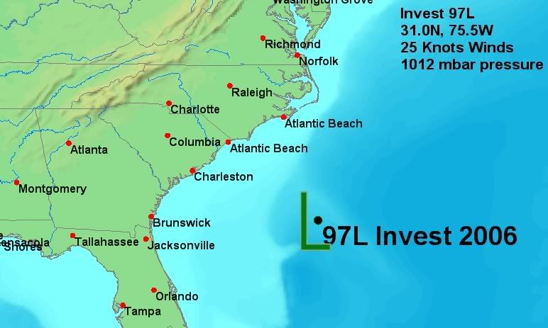
Figure 2: 97L Tracking Map
Tropical Storm Daniel
On July 16, a tropical disturbance formed far to the south of Baja California and quickly increased in convective activity and organization. The designated it as a tropical depression that night (July 17 UTC). The depression continued to organize and was designated as a tropical storm the next day.
Current Storm Information
As of 2 p.m. PDT on July 17 (1500 UTC), Tropical Storm Daniel was located near 12.4�N, 112.8�W. It had maximum sustained winds of 45 mph (70 km/h), with higher gusts. The storm was moving toward the west at about 12 mph (18 km/h). The minimum central pressure was 1002 mbar (29.58 inHg). The storm is forecast to continue westward and intensify into a hurricane within the next 48 hours. forecasters note that there is the possibility of rapid intensification similar to Hurricane Bud a week earlier.
--------------------
Weather456
Edited by Weather456 (Mon Jul 17 2006 09:29 PM)
|


 Threaded


