WeatherNLU
Meteorologist

Reged: Sat
Posts: 212
Loc: New Orleans, LA
|
|
Quote:
Hmm, there may be a weakness toward the end of the run in the ridge, the latest model run isn't all that great for those in the Gulf, hopefully that isn't a trend.
It seems the Lesser Antilles may get more storm than they bargained for, however. I'm still thinking intensity is underestimated right now.
Mike, I was just looking at this run of the . After a few runs it is seeing some kind of weakness in the ridge and it's a terrible situational thought for me here in New Orleans. They have a 160 mph, CAT 5 bomb in a eerily similar position as and moving in a similar direction.
I would be throwing up if it wasn't so far out and the models weren't flip flopping so badly.
I am attaching a pic for those who want to see.
--------------------
I survived Hurricane Katrina, but nothing I owned did!
|
Thunderbird12
Meteorologist
Reged: Thu
Posts: 644
Loc: Oklahoma
|
|
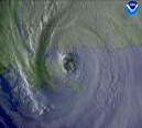
It will be interesting to see what the plane finds when it gets to Dean this afternoon. If anything, the apparent eye on the satellite images is actually less than 10 mi. across, since the images don't seem to be fully resolving it (assuming that it is a clear, "pinhole" eye). The convection is somewhat asymmetric and not super intense, so that would suggest it didn't go too crazy overnight.
The major player in the track of Dean still appears to be the upper low that is forecast to traverse the Gulf of Mexico from east to west ahead of Dean. Such things tend to throw a monkey wrench into the track forecasts of tropical systems. The intensity could be affected by the upper low as well, since it could enhancing the outflow of Dean, depending on the eventual orientation of the systems.
I am a little confused by some of the comments re: the on its latest forecast. It does indeed tug Dean northward into the Gulf of Mexico, but it also depicts a very strong system (cat 4 intensity), not a relatively weak one.
|
Random Chaos
Weather Analyst

Reged: Sat
Posts: 1024
Loc: Maryland
|
|
I think the comments on is that it doesn't develop dean for the first couple of days, then explodes it. I would tend to think that, given what we have seen the last couple days, Dean will continue to slowly strengthen rather than stagnate for a few days.
|
nl
Storm Tracker

Reged: Tue
Posts: 207
Loc: nsb,fl
|
|
guys is it me or does the ridge look likes its weakening a lot. there is a big gap now in the ridge now. could this change the track?
http://www.ssd.noaa.gov/goes/east/tatl/loop-wv.html if you click on the mslp box it will show a weaking in the ridge near florida. looks like there is a small something trying to develope in front of dean too.
Edited by nl (Thu Aug 16 2007 11:08 AM)
|
Random Chaos
Weather Analyst

Reged: Sat
Posts: 1024
Loc: Maryland
|
|
NHC 11am discussion mentioned buoy 41010. Seems that's a typo, as that buoy is near Cape Canaveral. Looking at the storm location and the buoys in the area, I think they meant 41040.
http://www.ndbc.noaa.gov/station_page.php?station=41040
|
nl
Storm Tracker

Reged: Tue
Posts: 207
Loc: nsb,fl
|
|
looks like the ULL is really cutting that ridge open. does anyone have any thoughts im looking at the wv loop on wide atl and its not looking like a ridge anymore.
|
LisaC
Weather Watcher
Reged: Wed
Posts: 39
|
|
Interesting observation with the current warning and watches that are up. Hurricane Warnings are up for St. Lucia and Dominica (both independant islands) however Hurricane watches are up for Martinique and Guadeloupe (french departments). As I recall my caribbean geography counting from south to north on the island chain, its St. Lucia, Martinique, Dominica then Guadelope. Why are the french not issuing warnings?
|
rmbjoe1954
Weather Master

Reged: Tue
Posts: 427
Loc: Port Saint Lucie, Florida, USA
|
|
I guess Dean is going to track through the Hebert box as a major hurricane by tomorrow evening. This, coupled with a weakening ridge, makes me feel that the coast isn't clear for anyone anywhere in the Carribean and SE US and the Gulf Coast. 
--------------------
________2024 Forecast: 28/14/8________
There is little chance that meteorologists can solve the mysteries of weather until they gain an understanding of the mutual attraction of rain and weekends. ~Arnot Sheppard
|
StrmTrckrMiami
Weather Guru

Reged: Mon
Posts: 148
Loc: Manchester, NH
|
|
From the looks of the chart on the left, Dean is going to be a Cat 4 outside of Cuba in the Carribean, and then make landfall in Mexico and be a Cat 1. I am wondering if it is a possibility that when Dean becomes a Cat 1, when he goes out to the warm waters of the Gulf, could he strenghthen again and make a curve back to Florida? Or is he going to follow the path ridge of the air?
--------------------
Tracking Storms Since 2004
Miami, Cocoa, Fort Myers and Jacksonville
Currently Reside in New England
|
OUSHAWN
Weather Guru
Reged: Tue
Posts: 101
Loc: Clear Lake,Tx
|
|
It's really way too early to start thinking about which part of the GOM Dean will go or if it will make a funky turn and go to Florida. I've seen these storms so many times in the past be predicted to become monsters in the Caribbean and end up falling apart because they pretty much outrun themselves. Remember, Dean is traveling at a very speedy clip and if it continues that than there is that chance of this happening. Let's not worry too much right now about exact locations until a few more days pass and we get a better understanding of what Dean will be...if anything.
Shawn
|
twizted sizter
Weather Guru
Reged: Tue
Posts: 184
|
|
Remember the states in their advisory that the margin of error is 225NM on day 4 & 300NM on day 5 in regards to track. Intensity averages 20kt each day. Based on that don't focus on any track past Saturday really. Personally I go by 24hr tracks...so many things can change.
Recon will give better data to be inputed into the models & specific areas that will be affected in the future can be narrowed down. The main concern is to those in the islands right now.
|
SeaMule
Weather Hobbyist

Reged: Wed
Posts: 64
Loc: Fairhope, Al...on the coast
|
|
Let's worry a LOT about what this storm might do. It has more of a chance of being a cat 5 than it does of being nothing. It's august, and when the is forecasting a category 3, it's only because they don't understand the forces at play that bring it to a cat 4 or cat 5. it is certainly NOT too early to begin wondering if it will affect the GOM or not. IT WILL....
I have only seen a few hurricanes that headed due west...or wnw...until they hit land. Gilbert was the most notable in my mind. MOST will curve....
never mind that the current models are projecting past 5 days....NO ONE can predict what might happen except this one thing....
we will have a cat 3-4-5 storm in the western Caribbean in August....absolutely NO chance of not amounting to anything....
|
Lee-Delray
Weather Master

Reged: Thu
Posts: 429
|
|
Herbert's box is not an absolute, almost 90% but not an absolute. Also, Dean has not passed through it yet, it could go slightly under it. It is true that the GDFL is swinging this storm into the central gulf next week, but one run on one model does not make a trend. I notice that the , which if I am not mistaken is in the same ensamble still shows the storm going into the Yukatan.
We need to see what happens after they fly it and input the data.
|
OUSHAWN
Weather Guru
Reged: Tue
Posts: 101
Loc: Clear Lake,Tx
|
|
All I know is we are getting slammed here in the Houston/Galveston area right now with some very heavy rain. The local mets are saying 3"/hr. on the rainfall rates and it seems to be training.
Shawn
|
charlottefl
Weather Hobbyist
Reged: Mon
Posts: 94
|
|
Just to give an example of how fluid the atmosphere is I can go back to 2005. Newly upgraded
hurricane was approaching Ft. Lauderdale and predicted to move W to WNW across FL.
Then something funny happened. High Pressure nuged south and forced the storm on a WSW heading
into the FL keys. Nothing is 100% certian in tropical systems. Just have to wait and see what Dean
decides to do. Let the wait begin!
|
scottsvb
Weather Master
Reged: Mon
Posts: 1184
Loc: fl
|
|
it wasnt predicted to go WNW it was expected to go WSW (ala model) some of the lesser models did show a WNW pattern though.
|
saluki
Weather Hobbyist
Reged: Sun
Posts: 57
Loc: Fort Lauderdale, FL
|
|
At the risk of having this post moved elsewhere ... it seems there is some confusion regarding Hebert's box. If a hurricane passes through box No. 1, it does NOT mean that the storm has a 90 percent chance of hitting South Florida (or any other specific location) as a major hurricane. What it DOES mean -- at least the way I'm interpreting it on various Web sites -- is that 90 percent of major hurricanes that have hit Miami-Dade, Broward or Palm Beach since 1900 have passed through the box. Repeat -- it does not mean that 90 percent of all hurricanes that pass through the box hit South Florida as major hurricanes. So yes, South Florida should watch anything that passes through Hebert's box, but I feel that way about anything that heads in our general direction, Hebert's box or not.
|
scottsvb
Weather Master
Reged: Mon
Posts: 1184
Loc: fl
|
|
that box is soo false anyways. It just matters on conditions in the atmosphere when there is a current system out there. How about you expand Herberts box to say the whole western atlantic...I say most get into it while some curve north before 60W. We can call that... Scotts box. Anyways to me...herberts box is just a joke.
|
allan
Weather Master

Reged: Thu
Posts: 468
Loc: Palm Coast, Florida
|
|
First and foremost, the models are going everywhere! heads it to Mexico, heads it to Luisiana (around Lake Charles), heads it towards Texas... All in all, we don't know where Dean will head. Models can't grasp the fact that it is already a strong Hurricane and as it head sin teh Carribean, it can do anything.. like , it can make it's own projected path because the storm will be soo strong. So lets not put at least the Panhandle of FL out of the scene. It is safe to say though that the East Coast will be spared. Though folks all over the GOM needs to moniter Dean as weird things will happen. Remember , It was forecast to track into the GOM, instead it did it's own thing accompanied by an ULL and barely went up the East Coast.. remember hurricanes have minds of there own.
--------------------
Allan Reed - 18,9,5
|
scottsvb
Weather Master
Reged: Mon
Posts: 1184
Loc: fl
|
|
Actually Hurricanes dont have a mind of their own. They are steered by the flow in the atmosphere. A hurricane can have a pressure of 898mb but still be pulled north by a strong trough. They do enhance a ridge by pumping more heat above but they dont crash thru fronts. Im sure you didnt mean that, but just saying hurricanes are controlled by ridges and troughs and strength is affected many other ways... windshear,ssts, etc...
Dean should continue a W-WNW path for 3 days and near the south coast of haiti. By then we will see if the Upper low just NE of the bahamas is moving quick enough into the eastern gulf or models might adjust in time...but this is almost 60-72hrs out. Models adjust from run to run. Anything more then 3 days can change...and even before that.
|


 Threaded


 [Re:
[Re: 


