LoisCane
Veteran Storm Chaser

Reged: Fri
Posts: 1236
Loc: South Florida
|
|
http://www.ssd.noaa.gov/goes/flt/t1/loop-rb.html
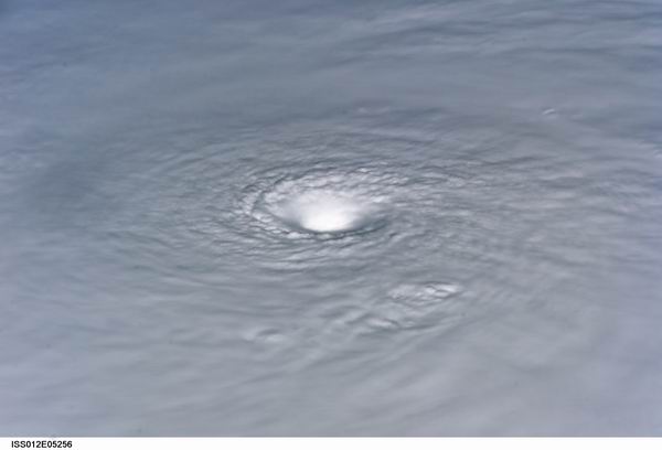
use any sat of your choice, this storm is well... not bombing but putting on quite a show
how low can the barometer go
http://www.ssd.noaa.gov/goes/flt/t1/loop-rb.html
--------------------
http://hurricaneharbor.blogspot.com/
|
ltpat228
Storm Tracker

Reged: Tue
Posts: 201
Loc: Port Saint Lucie FL
|
|
Below is a link to my County's EOC page where I found a different kind of model for Noel.
I live in Saint Lucie County, 2 counties north of West Palm Beach, and would like to share this visual with you.
(BTW, Jupiter Inlet is about 25 minutes south of me.)
http://co.st-lucie.fl.us/eoc/hurrtrak_maps/map.asp?StormID=219
|
mikethewreck
Weather Hobbyist

Reged: Wed
Posts: 52
Loc: Treasure Coast FL
|
|
0500 update: tropical storm warnings issued up to Deerfield Beach (coastal areas of Miami-Dade and Broward counties).
--------------------
Earliest memory Hurricane Cleo!
Went under Hurricane Gloria!
|
weathernet
Storm Tracker
Reged: Sat
Posts: 296
Loc: Elsewhere
|
|
jeeezzzz, just woke up after a post traumatic Halloween chocolate and wine binge!
What "is" that at 23N and 79W? Best viewed on one of several different sat. resolutions, preferably IR2/Shortwave. Looks like what would appear as a low level center, but could be an vort. max. rotating aournd a broader center?
|
craigm
Storm Tracker

Reged: Wed
Posts: 327
Loc: Palm City, Florida
|
|
Good Morning! Looks like everything is status Quo. Vapor loop about sums up any questions regarding Noel- not that there were any left. Take care in the bahamas. See Y-all next season!!
http://www.ssd.noaa.gov/goes/east/nwatl/loop-wv.html
--------------------
Why I'm here:
Weather hobbyist
|
doug
Weather Analyst
Reged: Mon
Posts: 1006
Loc: parrish,fl
|
|
Structurally this storm continues to evolve...thecnicaly the LLC is still SW of Andros but it is increasingly becoming diffuse. It seems the cooler dry air from the west may now be the real fuel source for the Mid level which is clearly ENE of Andros. In other words the extra tropical transition is very close now. that is how I see it any way.
EDS
--------------------
doug
|
Lee-Delray
Weather Master

Reged: Thu
Posts: 429
|
|
As of 11AM, all watches and warnings have been dropped for Palm Beach County. Looks like the COC jumped 30 miles east and Noel is chugging along at 9 mph in a NNE direction now. They also said all other Watches and Warning will be dropped for the rest of South Florida this PM.
A lot of nay sayers for the on this one, but looks like they've been pretty much on the money.
|
Storm Hobbyist
Registered User
Reged: Tue
Posts: 5
Loc: Ft. Lauderdale, Florida
|
|
It has begun turning to the northeast, as said by the at 11am. See everyone next season!
|
ftlaudbob
Storm Chaser

Reged: Tue
Posts: 828
Loc: Valladolid,Mx
|
|
Looks like we can say good bye to hopefully our last storm of the season.It could cause some problems for the ships out the in the Atlantic.Interesting system.As far as the 's job on this one,just go back and look at their projected path over the last couple days,you will see that they were NOT right on the money.But it was a tough one.
--------------------
Survived: 10 hurricanes in Rhode Island,Florida and the Yucatan of Mexico .
|
scottsvb
Weather Master
Reged: Mon
Posts: 1184
Loc: fl
|
|
NHC did a fine Job.....at times they were slightly off cause the was alittle too quick on this going N....but overall did what most of the globals said it was going todo. This system was actually easy to forecast.
|
Lee-Delray
Weather Master
Reged: Thu
Posts: 429
|
|
I think my choice of "right on the money" wasn't correct. Let's say they did a real good job on it.
We're getting some clouds, wind and very, very quick moving rain bands here now.
|
allan
Weather Master

Reged: Thu
Posts: 468
Loc: Palm Coast, Florida
|
|
The did an "ok" job, I mean Noel was really not that easy to predict. Seems like Noel might ramp up into a Hurricane before it goes . With how deep the convection is with Noel, you could say this resembled a Western Pacific system. Noel should continue the NNE motion for a while until it really starts to feel the trough which is swinging through the Northeast fo the USA right now. You can really see it on water vapor.
http://www.ssd.noaa.gov/goes/east/nwatl/wv-l.jpg
Here's the current steering map for Noel (990- 999 MLB)
http://cimss.ssec.wisc.edu/tropic/real-time/atlantic/winds/wg8dlm2.html
This is why I see a NNE motion for the afternoon.. still needs to catch that trough.. wouldn't be surprised if the 2 p.m. has it moving back to the north. We'll see what happens with Noel as it should recurve either tonight or tommorow morning.
lasly, I want to note that there is a moderate Anticyclone over the storm, the same one that we saw in the Western Carribean..
http://cimss.ssec.wisc.edu/tropic/real-time/atlantic/winds/wg8shr.html
You can see the strong clockwise motion.. This is a good reason why shear isn't destroying it 
--------------------
Allan Reed - 18,9,5
Edited by allan (Thu Nov 01 2007 12:50 PM)
|
doug
Weather Analyst
Reged: Mon
Posts: 1006
Loc: parrish,fl
|
|
Out side of the two days spent in Cuba the system performed as expected...just about 36 hours behind the initial estimates.
EDS
--------------------
doug
|
sailor
Verified CFHC User
Reged: Wed
Posts: 11
Loc: cape cod
|
|
Don't say goodbye yet! If this storm strenghtens in the mid atlantic it could be drawn a little farther to the left and phase with the front which could spread tropical force winds towards Nantucket and the Cape. Look out on George's Bank and the Nova Scotia
|
sailor
Verified CFHC User
Reged: Wed
Posts: 11
Loc: cape cod
|
|
Here comes that track to the West
has it in their 5PM discussion and NWS Boston has started the ealy warning
322 PM EDT THU NOV 1 2007
...HIGH WIND WATCH IN EFFECT FROM SATURDAY MORNING THROUGH
SATURDAY EVENING...
THE NATIONAL WEATHER SERVICE IN TAUNTON HAS ISSUED A HIGH WIND
WATCH...WHICH IS IN EFFECT FROM SATURDAY MORNING THROUGH SATURDAY
EVENING. THIS WATCH INCLUDES RHODE ISLAND AND EASTERN MASSACHUSETTS.
DAMAGING NORTH TO NORTHEAST WINDS ARE POSSIBLE SATURDAY...ESPECIALLY
DURING THE AFTERNOON.
THE GREATEST THREAT FOR DAMAGING WINDS IS ON CAPE COD AND THE
ISLANDS. SUSTAINED WINDS OF 40 TO 50 MPH ARE POSSIBLE WITH GUSTS UP
TO 70 MPH.
ALONG THE COAST FROM PROVIDENCE TO BOSTON...SUSTAINED WINDS OF 30 TO
40 MPH ARE POSSIBLE WITH GUSTS AS HIGH AS 60 MPH.
FARTHER INLAND INTO THE INTERSTATE 495 CORRIDOR...WINDS MAY BE A BIT
WEAKER WITH SUSTAINED WINDS TO 30 MPH AND GUSTS TO 50 MPH. HOWEVER...
THESE LOCATIONS MAY EXPERIENCE DAMAGE TO TREES AND POWER LINES SINCE
MANY TREES STILL HAVE THEIR LEAVES.
|
allan
Weather Master
Reged: Thu
Posts: 468
Loc: Palm Coast, Florida
|
|
Hurricane Noel it is! Yet the question is why??? the Anticyclone that was over it is back in the Carribean and Noel is strengthening in 30-50 knots of shear? Anyways, they should issue Hurricane Watches for Cape Cod (how weird that sounds). It's looking more and more like Noel may do some damage in the northeast like Cape Cod, MA, Long Island, NY.. places like that. I just don't understand why it is strengthening under VERY hostile conditions. Kudos to Noel!
--------------------
Allan Reed - 18,9,5
|
scottsvb
Weather Master
Reged: Mon
Posts: 1184
Loc: fl
|
|
Noel is a hurricane as forecasted by several models...reason it's a hurricane in this shear is cause its moving in tandom (almost) with the shear blowing NE... Reason N.E. will get gusty winds is from the strong high pressure behind the front and Extra Tropical Noel later on Friday... Kinda simular to what the Florida experienced.
Edited by Ed Dunham (Thu Nov 01 2007 11:25 PM)
|
allan
Weather Master
Reged: Thu
Posts: 468
Loc: Palm Coast, Florida
|
|
Noel should be soon, possibly late tommorrow. I give credit to Hugh for seeing the Cuba landfall, kudos to him.. I didn't see that coming and most people didn't see it coming. I'm looking for Hurricane Noel to come extremely close to the Northeast..
Edited by Ed Dunham (Thu Nov 01 2007 11:28 PM)
|
allan
Weather Master
Reged: Thu
Posts: 468
Loc: Palm Coast, Florida
|
|
I'm hearing about Noel becoming a category 2 by 11 p.m. I kind of figured that due to the pressure dropping and convection increasing. Looks much like a Western Pacific storm with all of the moisture.. Cape Cod may not just get brushed, but it appears as the trough strengthens more, it may nearly hit Cape Cod which means the worst case scenario.. the question now is Tropical or ... Lets wait and see, time will tell.
Edited by Ed Dunham (Thu Nov 01 2007 11:24 PM)
|
cieldumort
Moderator

Reged: Mon
Posts: 2305
Loc: Austin, Tx
|
|
In light of Noel's projected path and the anticipated addition of a new area of High pressure to his west strengthening the gradient winds along the western semicircle, the latest recon finds some interesting data to ponder for those along the eastern seaboard from roughly the Carolinas up through Main this Friday & Saturday
Storm NOEL: Observed by AF #306
Date/Time of Recon Report: November 02, 2007 05:15:20 Zulu
Other Information:
1: Maximum Flight Level Winds Were 89 KT E Quadrant at 02:16:00 Z
2: Maximum SFC WIND OUTBOUND 70 KT W QUAD 05:18:30 Z
|


 Threaded

 [Re:
[Re: 


