Ed Dunham
Former Meteorologist & CFHC Forum Moderator (Ed Passed Away on May 14, 2017)
Reged: Sun
Posts: 2565
Loc: Melbourne, FL
|
|
4:00 PM 14-July-2008 Update
The government of Bermuda has issued a Hurricane Watch. Recent reconnaissance mission has detected wind just below hurricane strength in a rain ban arcing around the southwest semi-circle. That rain band is expected to pass over the island over the next several hours. It is possible that Bertha will reach minimal hurricane strength.

John (typhoon_tip)
2:54 PM 14-July-2008 Update
Satellite estimates for 94L are at (SSD / t#s) are 2.0 now, which is probably enough to start considering it a candidate for a depression, possibly late tonight or more likely tomorrow only if it holds like this for a while.
2:20 PM 14-July-2008 Update
Bertha is due east of Bermuda right now, and the outer eye type feature is onshore causing issues there.

The wave east of the lesser Antilles (94L) has improved slowly during the day and may form into a depression sometime tomorrow or so if it persists. It still lacks a good organized flow and convection and Satellite Estimes (Dvorak T-Numbers) still do not suggest a depression (look for T numbers 2 or higher)
9:30 AM 14-July-2008 Update
Bertha is near the island of Bermuda, causing Tropical Storm conditions on the island right now. Bermuda is under a Tropical Storm Warning currently.
East of the Lesser Antilles, the wave (94L) is looking not quite so good this morning. It has moved away from the Intra Tropical Convergence Zone, and is starting to see some circulation, but the convection is not there.

That said, if it persists (it may not) it will likely form into a depression either late today or more likely tomorrow.
The lesser Antilles will want to watch this one. Because of lack of good initialization in models (IE, the UKMet doesn't develop this at all), any real prediction of future track or intensity of this system is pure speculation.
7:30 PM 13-July-2008 Update
Tropical Storm watches remain up for Bermuda, as Bertha slowly moves along.
Nothing too much new to report, 94L (Wave east of the islands) is having more model runs come in, which suggests that the Leeward Islands (And all of the Lesser Antilles) need to watch it.
It is fairly active, but not overly so, for mid July, and this system is likely the next depression.
If it stays organized overnight (it may fall apart), it could develop by or on Tuesday into a depression.
The low off Charleston has fallen apart today, and is not being watched anymore.
8:30 AM 13-July-2008 Update
Bertha has weakened to a Tropical Storm, and the eye that has been visible the last few days has disappeared. It will likely meander for a bit.

Two new things are worth watching this morning, first the wave in the Central Atlantic (further south and west from where Bertha formed) is worth watching over the next several days to see if it forms, it is more likely this would track further westward if shear or dry air does not keep it from development.
The Windward islands in the Caribbean will want to watch this one, actually all the Lesser Antilles. Track wise a generally westward movement should occur. Again, it will be important to watch over the next several days.
East Atlantic (94L) Wave Chances of Development in the next 24 hours
Code:
(forget it) 0 1 2 3 4 5 6 7 8 9 10 (sure thing)

            [------*-------------]
94L Event Related Links


SFWMD Model Plot (Animated Model Plot) SFWMD Hurricane Page
[https://flhurricane.com/floatanimator.php?year=2008&storm=3 Flhurricane Satellite Floater Animation of 94L
GOES Floater
Animated Model Plot of 94L
Clark Evans Track Model Plot of 94L
(Animated!) Model Plots in Google Earth - In Google Maps
Clark Evans Intensity Model Plot of 94L (Animated!)
Clark Evans Track Plot of 94L
Other Model Charts from Clark
Clark Evans Top 10 Analog Storms for 94L
More model runs on from RAL/Jonathan Vigh's page
NRL Info on 94L -- RAMMB Info
COD Atlantic Satellite View
---
Also southeast of Charleston, SC is a low pressure area that will have to be watched. Right now Shear would prevent any development, but if that lessens it is possible for something to form there.
Charleston Low Developmetn Chances in Next 24 hours
Code:
(forget it) 0 1 2 3 4 5 6 7 8 9 10 (sure thing)

            [---*----------------]
More to come on both soon.
Original Update
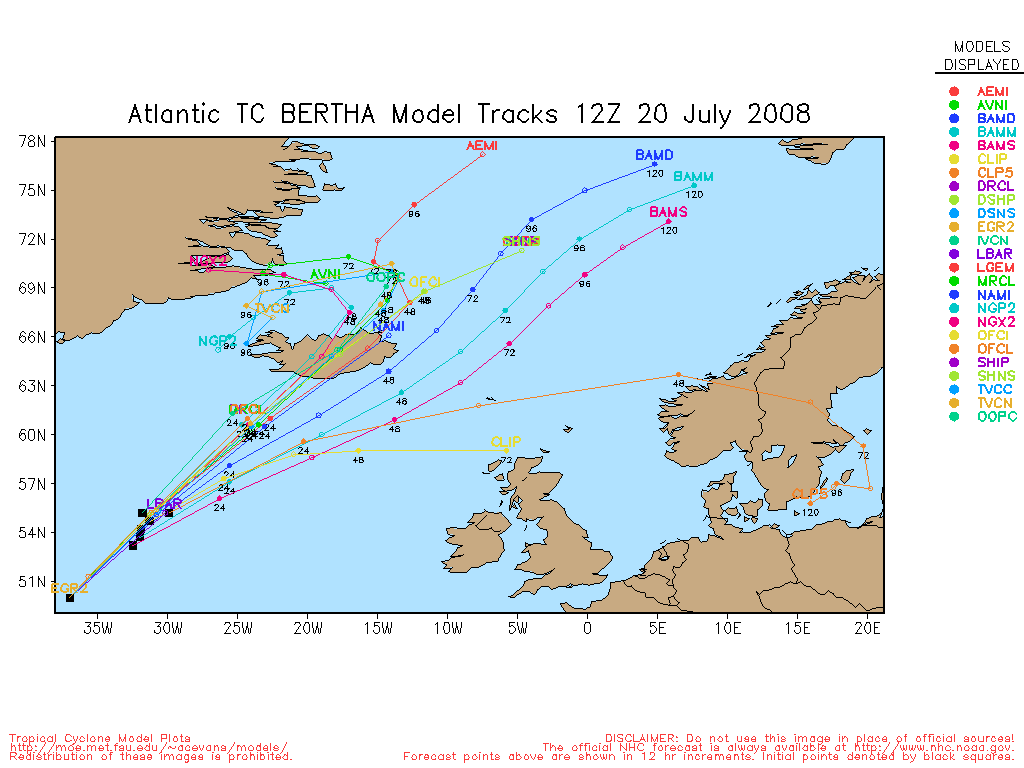
Hurricane Bertha has been stationary, about 220 miles to the south southeast of Bermuda, for the past few hours. She has a nice circular presentation again as the shearing influence in the northwest quadrant has ceased. Sustained winds are now 85mph with gusts to 105mph and the central pressure, as reported by the hurricane hunters is 976MB. There is likely to be very little motion for the next day or two - Bertha is stuck in an area of negligible steering currents as the trough to her northwest is not expected to 'capture' the hurricane and move her off to the northeast in the open Atlantic. A stronger trough well to the northwest of Bertha, currently extending from the Great Lakes to Texas, is moving slowly eastward, but there is still some uncertainty as to whether that trough will be strong enough to move Bertha away from Bermuda early next week.
High pressure is likely to build to the north of Bertha as the first trough moves off to the northeast of the storm. Under the influence of that buildup in higher pressure to the north, Bertha's movement will be erratic - and slow for a few days, with a general northerly drift expected. Any additional jog to the west of north would bring the hurricane closer to Bermuda, and the Tropical Storm Watch for Bermuda has now been elevated to a Tropical Storm Warning.
Regarding intensity, Bertha is not likely to get any stronger - and in fact she has a much better chance of weakening. With the expectation for just a slow meander, I'm a bit surprised that the concept of 'upwelling' has not yet been mentioned in the intensity forecast. When a storm remains relatively stationary for an extended period of time, deeper - and colder - water is churned up in and around the eye of the storm and the system will slowly weaken as the SSTs cool down.
(Well, scratch that - Dr Avila just mentioned the likelyhood of upwelling in the latest Discussion bulletin.)
In addition to Bertha, an active tropical wave near 10N 50W at 12/15Z is moving westward into an area of lighter wind shear.
ED
Update - Saturday 07/12 11:30AM ET
Tropical Storm Warning is now in effect for the island of Bermuda.
Bertha is a ragged looking tropical cyclone. Like much of yesterday, Bertha is composed of a massive eye and outer band of moderate convection, with a remnant inner eye and occasional attempts at eye-wall rattling around inside. Her movement has been virtually stationary over the last 6 hours. numbers have eased by 5kts and her intensity is being officiated at 75kts. The stationary nature of Bertha may mean that SSTs are beginning to cool due to upwelling, and if so this would also begin to contribute to weakening.
The forecast essentially is unchanged. There seems to somewhat better agreement among the models that she will stagnate for another 2 days, but then slowly...ever so slowly begin to move north and eventually northeast or east.
John (typhoon_tip)
Event Related Links
StormCarib Reports from the Caribbean Islands
Caribbean Weather Observations
Barbados Brohav Weather Fax
Full Caribbean Radar Composite
Caribbean Broadcast Corporation (TV/Radio from Antilles)
San Juan, PR NWS Page
Various Caribbean Radio Stations
DR1 Dominican Republic Hurricanes
Bermuda Newspapers/Media:
BerNews
Royal Gazette (Bermuda)
Bermuda Sun
Hott 107.5 Bermuda Radio
Storm Carib Bermuda Reports
Bermuda Weather Service
Use this link to monitor the current weather conditions at Hamilton, Bermuda:
Bermuda Weather
Bertha Event Related Links


SFWMD Model Plot (Animated Model Plot) SFWMD Hurricane Page
[https://flhurricane.com/floatanimator.php?year=2008&storm=2 Flhurricane Satellite Floater Animation of Bertha
GOES Floater
Animated Model Plot of Bertha
Clark Evans Track Model Plot of Bertha
(Animated!) Model Plots in Google Earth - In Google Maps
Clark Evans Intensity Model Plot of Bertha (Animated!)
Clark Evans Track Plot of Bertha
Other Model Charts from Clark
Clark Evans Top 10 Analog Storms for Bertha
More model runs on from RAL/Jonathan Vigh's page
NRL Info on Bertha -- RAMMB Info
COD Atlantic Satellite View
94L Event Related Links
SFWMD Model Plot (Animated Model Plot) SFWMD Hurricane Page
[https://flhurricane.com/floatanimator.php?year=2008&storm=3 Flhurricane Satellite Floater Animation of 94L
GOES Floater
Animated Model Plot of 94L
Clark Evans Track Model Plot of 94L
(Animated!) Model Plots in Google Earth - In Google Maps
Clark Evans Intensity Model Plot of 94L (Animated!)
Clark Evans Track Plot of 94L
Other Model Charts from Clark
Clark Evans Top 10 Analog Storms for 94L
More model runs on from RAL/Jonathan Vigh's page
NRL Info on 94L -- RAMMB Info
COD Atlantic Satellite View
Edited by MikeC (Mon Jul 14 2008 07:05 PM)
|
Sophie
Unregistered
|
|
Well i see that Bertha is finally making that northward turn now. Bertha has been an interesting storm and has given us all a suprise so far, It's kinda like tuning into a soap opera "stay tuned for tomorrow's episode....." Might be we may see this all year round.
|
typhoon_tip
Meteorologist
Reged: Wed
Posts: 576
|
|
I don't think so just yet... She's been essentially motionless during the day; confirms this observation in their 5pm update. If anything, to these eyes she's wobble SW a tiny bit.
John
|
stormchazer
Storm Tracker

Reged: Tue
Posts: 315
Loc: Central Florida
|
|
According to , 94L has now joined the party. Invest 94L
--------------------
Jara
*************************************************************
|
HanKFranK
User

Reged: Mon
Posts: 1841
Loc: Graniteville, SC
|
|
no reason to believe any one of the features currently trying to develop and accompany bertha aren't going to give it a try. the eastpac has been coughing up one storm after another since boris... and the shear in much of the atlantic basin has been ridiculously low for much of july (especially in the mdr east of the islands).
case by case..
current active storm bertha is unlikely to stop being bertha anytime soon. every one of the forecast models maintains the storm through d5... aside from other development confusing the evolution further, the current track appears to have enough blanket support to be believable. expect an erratic track that eventually ends in a surge to the northeast... next weekend perhaps. bertha is an already a long-lived system for july. i haven't exhaustively researched what the record for that is, but i'm fairly sure bertha will have it when all is said and done.
94L is likely our next named storm. shouldn't be a lightning fast development, but i'd be surprised if it wasn't TD 3 by tuesday. the embryo for this storm is the diffuse area of vorticity near 9/38. an approaching tropical wave with more low-level vorticity should sort of 'sync-up' with it overnight/tomorrow and get the ball rolling. it's going to start out big and broad, so probably won't strengthen quickly or start trucking along very fast until mid-week or so, when it should have a decent degree of separation and a steady easterly current to ride. models imply a threat to the northern leeward islands at the end of next week, and (gfs/ecmwf) eventual recurvature near the bahamas in around ten days. that far out it's hard to know if the models have future amplifications timed or the speed/profile of shortwaves right... not to mention our other area of concern.
that would be the frontal tail and cut-off area of mid-level energy, the frequent source of july activity, in the H50 break near the southeast coast. is already honed in on the small vortmax/slightly sheared thunderstorm area due east of savannah by 150 miles or so. other models have different variations of this evolution... as the weakness troughs out and fills in, in spite of modest shear, the persistent disturbed weather may start to consolidate into yet another system somewhere between florida and the coastal carolina waters. this is in an area of vacillating/weak steering currents, and close enough to bertha to feel the tug maybe... so anything that does go will likely wander about also. this is still fairly low probability of a full development, though, per . expect little movement and possible slow development (but fairly rapid development for anything that gets established).
this year is starting to have the look of a blockbuster to me. sure, it could easily reverse... but those persistent easterly upper anomalies over much of the tropical atlantic are going to start paying huge dividends in august, if they stay around.
HF 1341z13july
|
LoisCane
Veteran Storm Chaser

Reged: Fri
Posts: 1236
Loc: South Florida
|
|
How does the new wave off of Africa play into this set up and specifically with relation to 94L
http://oiswww.eumetsat.org/SDDI/cgi/listImages.pl?m=prod,sa=9,pr=RGB,c=AIR
Looks like a strong wave and has kept its signature through most of it's continental trek much like Bertha did though perhaps not as strong a signal.
http://www.ssd.noaa.gov/eumet/eatl/loop-bd.html
http://www.ssd.noaa.gov/eumet/eatl/rb-l.jpg
Great write up on the Trifecta and would imagine depending on what Bertha does and how soon she leaves could seriously affect any wave coming off Africa let alone at mid-ocean.
--------------------
http://hurricaneharbor.blogspot.com/
|
scottsvb
Weather Master
Reged: Mon
Posts: 1184
Loc: fl
|
|
I couldnt get enough info and sat fix-data missed a area around 11N and 51W that I been watching over the last 36hrs. I feel this has a decent chance to be slipping under the radar for a quick upgraded to Tropical Storm status in the next day or 2. The convection has been persistant over this area since 41W or 36 hrs ago, and I'm afraid we might have a tight circulation in there. Until Sat gets a fix (hopefully the next pass) we wont know forsure or until it gets better organized. I'm not sure there is alot of W-NW winds. Bouys nearby do show N-E-SW winds in a broader area.
Model runs try to pick up on this area first as it races it towards the Jamaica area by Weds-Thurs timeframe.
|
Hugh
Senior Storm Chaser
Reged: Fri
Posts: 1060
Loc: Okaloosa County, Florida
|
|
94L definately looks large and impressive right now, but it's extremely far to the south to be a threat to the NORTHERN islands, isn't it? Maybe I'm missing something, but it looks like more of a threat to Trinidad and Tobago. The run has now backed off saying that a major hurricane was going to be knocking on my back door in 13 days. Convection with 94L is rather disorganized too, so it'll be an interesting couple of days to watch it develop.
Bertha appears to be fizzling, convection-wise at least... still a solid spin to it, but it appears to be buckling under itself.
--------------------
Hugh
Eloise (1975) - Elena and several other near misses (1985) - Erin & Opal (1995) - Ivan (2004)
|
danielw
Moderator

Reged: Wed
Posts: 3525
Loc: Hattiesburg,MS (31.3N 89.3W)
|
|
Despite the visible presentation of Tropical Storm Bertha the Hurricane Hunters are finding that she still has some hurricane force wind speeds in the NW quadrant.
Storm BERTHA: Observed By Air Force #307
Storm #02 in Atlantic Ocean
Maximum Flight Level Winds Were 68KT (78.2mph 125.9km/h) In NW Quadrant At 16:17:30 Z
Estimated Max Surface Winds 61.2KT (70.4mph 113.3km/h) *
Date/Time of Recon Report: Sunday, July 13, 2008 11:36:00 AM (Sun, 13 Jul 2008 16:36:00 UTC)
Position of the center: 29° 53' N 062° 50' W (29.9°N 62.8°W) [See Map]
Minimum Height Measured At Standard Level Of 700mb: 2981m (Normal: 3011)
Surface Winds Were Estimated At: 47KT (54.05MPH 87.0km/h)
Estimated Surface Winds Were Measured 66nm (75.9miles) From Center At Bearing 309°
Maximum Flight Level Winds Near Center Were 68KT (78.2mph 125.9km/h) From 043°
Maximum Flight Level Winds Were Measured 66nm (75.9 miles) From Center At Bearing 309°
Minimum pressure: 991mb (29.26in)
Eye Wall Characterization Not Reported
Eye Did Not Have A Definable Form or was not reported
Center Fix Established Using: Penetration Radar Wind Pressure Temperature
Center Fix Established At Level(s): 700mb
Navigational Accuracy Measured At 0.02nm
Meteorological Accuracy Measured At 1nm
* = Estimated Surface Winds are assumed 90% of Max Flight Level Winds
Edited by danielw (Sun Jul 13 2008 01:32 PM)
|
Hugh
Senior Storm Chaser
Reged: Fri
Posts: 1060
Loc: Okaloosa County, Florida
|
|
That's only at Flight Level, that they are finding hurricane-force winds, though, and if you use an 80% reduction, it only leaves winds of 62.5mph at the surface. Not sure how they determine whether to use 90% or 80% reduction from the flight level.
--------------------
Hugh
Eloise (1975) - Elena and several other near misses (1985) - Erin & Opal (1995) - Ivan (2004)
Edited by Hugh (Sun Jul 13 2008 01:47 PM)
|
danielw
Moderator
Reged: Wed
Posts: 3525
Loc: Hattiesburg,MS (31.3N 89.3W)
|
|
That is correct. Hurricane force winds at flight level.
I was slightly surprised at the wind speed due to the satellite presentation. However, Bertha is sandwiched between high pressure to the west and low pressure to the east. Which would seem to assist in accelerating the winds. Much in the same way that you can keep a ball spinning on the ground. One hand pulling and the other hand pushing.
|
danielw
Moderator
Reged: Wed
Posts: 3525
Loc: Hattiesburg,MS (31.3N 89.3W)
|
|
Quote:
That's only at Flight Level, that they are finding hurricane-force winds, though, and if you use an 80% reduction, it only leaves winds of 62.5mph at the surface. Not sure how they determine whether to use 90% or 80% reduction from the flight level.
Currently, 2008, they use 90% for most of the 700mb or 10,000 foot level winds.
The other adjustments are for the 1000mb and 850mb flight levels which are mainly used on INVEST flights for Tropical Depressions and Tropical Storms with low wind speeds.
1000mb flight level is rarely used as it's usually too close to the water for Safety purposes.
|
Rich B
British Meteorologist
Reged: Sat
Posts: 498
Loc: Gloucestershire, England, UK
|
|
Well Bertha has done it again, and according to the intermediate advisory, has stalled again! The slow motion has been her downfall, as upper-level conditions have been somewhat favourable. However, the combination of an that never really finished, and the upwelling caused by her lack of motion, has led to her weakening. Satellite imagery shows a well defined sytem, with a vigorous circulation, but not much in the way of deep and strong convection. Still, should be a good rainmaker for Bermuda, which they need at the moment as the island is in the grip of a pretty severe water shortage!
--------------------
Rich B
SkyWarn UK
|
Hugh
Senior Storm Chaser
Reged: Fri
Posts: 1060
Loc: Okaloosa County, Florida
|
|
[quoteCurrently, 2008, they use 90% for most of the 700mb or 10,000 foot level winds.
The other adjustments are for the 1000mb and 850mb flight levels which are mainly used on INVEST flights for Tropical Depressions and Tropical Storms with low wind speeds.
1000mb flight level is rarely used as it's usually too close to the water for Safety purposes.
Cool. Of course, every storm is different and I've seen cases where measured winds were not close to the 90% range. In this case, I'm looking more at satellite presentation in thinking Bertha isn't close to its former self. In fact, it doesn't look like much more than a mid-latitude low/frontal zone. I just loaded the Bermuda radar, and it does still look like a tropical storm there.
--------------------
Hugh
Eloise (1975) - Elena and several other near misses (1985) - Erin & Opal (1995) - Ivan (2004)
|
LoisCane
Veteran Storm Chaser
Reged: Fri
Posts: 1236
Loc: South Florida
|
|
Don't be misled but her sat presentation. She's hung in there all afternoon and has found ways to get more moisture and build back some color.
Sats are great but nothing like having recon in there.
http://cimss.ssec.wisc.edu/tropic/real-time/tpw2/natl/main.html
Avila called it "vigorous" at the 5pm.
--------------------
http://hurricaneharbor.blogspot.com/
|
weathernet
Storm Tracker
Reged: Sat
Posts: 296
Loc: Elsewhere
|
|
As Hank mentioned earlier today, this classified wave continues to slowly take shape. Looks like some consolidation may be starting to occur and given this systems overall size, would assume a primarily westward ( or WNW ) motion would ensue. Would not surprise me to see a slightly faster initial motion once the systems overall organization improves.
Aside from having spent my $500,000 winnings from Bertha / 1st named hurricane contest, I never would have anticipated such a record East Longitude area of formation. That, along with this years impressive tropical waves coming off Africa, I am even more curious as to the seeming lack of July Sahara dust, and the less than typical higher surface pressures in the tropics that is also common in July. Add these other curiosities, along with that which we have already seen this season, and this Atlantic season only continues to suggest a lot of interesting stuff to come. More importantly, Bertha had a recurvature track and will be curious to see if the next Eastern Atlantic tropical storm will follow suit or rather establish a more westward track. Normally when I see storm tracks which recurve, others forming in the same overall region tend to follow. Then again, the season is early and we may only now be seeing what the overall long wave pattern may be setting up to be. Given the overall typical ridging ( low and mid levels ) which is typical to July, I think the Greater Antilles need heed anything approaching from the east.
Having been away for a couple weeks, can anyone pass on what the most current SST's are for 94L, as well as the recent couple weeks trending for the central tropical Atlantic? I know the SST's off Africa were warm, but than cooled quickly.
|
cieldumort
Moderator

Reged: Mon
Posts: 2305
Loc: Austin, Tx
|
|
I find that TCs losing their deep convection tend to have the winds "lift" well above the boundary layer, and as a rule, find that assigning a 60% to 80% reduction ratio from h70 (based mostly on a blend of taking the amount and intensity of convection into consideration, along with persistence, and the surrounding surface pressures) actually works quite well. A cyclone with as weak as convection as Bertha now has could easily be running as low as 70% at the surface, adjusted from 700mb, but 80% is probably as good as any right now, accounting for the nearby location of the shortwave ridge, and overall MSLP.
|
Hugh
Senior Storm Chaser
Reged: Fri
Posts: 1060
Loc: Okaloosa County, Florida
|
|
94L is showing just a HINT of a circulation, I think, but not much of one.. but some very impressive convection. Not sure what's preventing the circulation from getting together.
--------------------
Hugh
Eloise (1975) - Elena and several other near misses (1985) - Erin & Opal (1995) - Ivan (2004)
|
MikeC
Admin
Reged: Sun
Posts: 4543
Loc: Orlando, FL
|
|
It appears 94L may become the first "hype monster" of the season, most likely for its location and model projections. Right now it has no reason to be that.
I have to remind everyone it's still mid July, and this storm has to overcome less than perfect conditions to get organized. I think 94L is worth watching, but not really indicative of an active season yet.
I'll be more curious this time tomorrow to see how well the system has organized. It has a lot of convection, but you have to stretch to see any circulation. And that's why I'm not so sure on it doing much right now.
Tomorrow will be interesting to watch.
I added a new user mapping feature to the site, if you have a flhurricane login, check out this link.
|
Hugh
Senior Storm Chaser
Reged: Fri
Posts: 1060
Loc: Okaloosa County, Florida
|
|
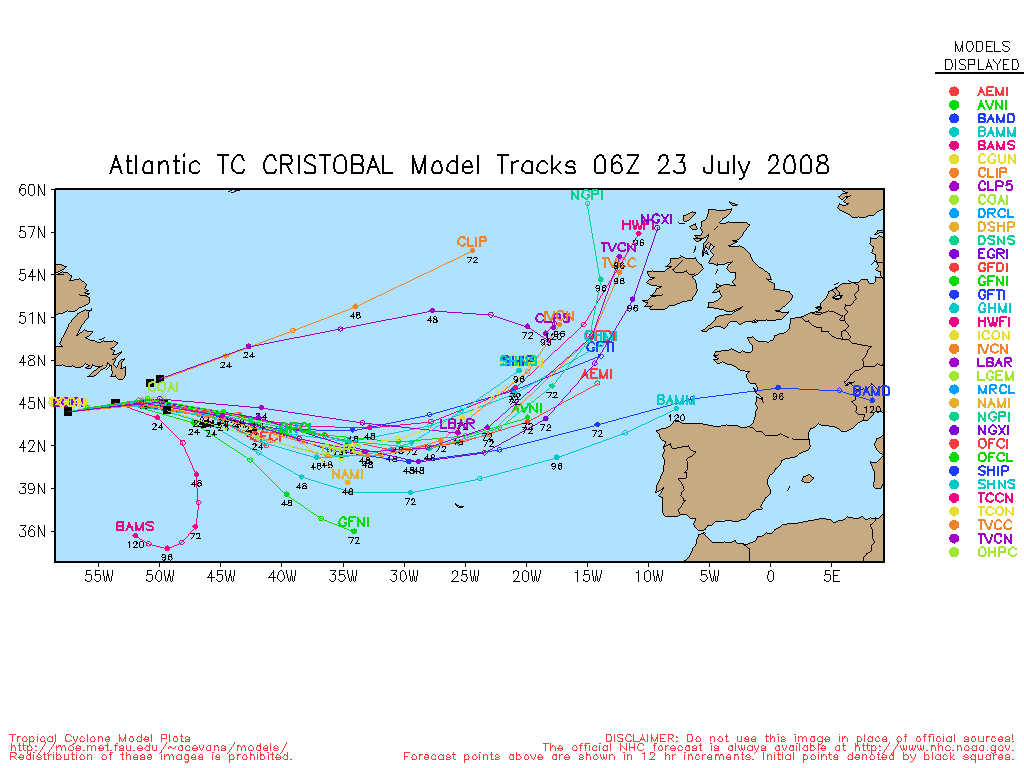
I think you've got a good point, Mike. Even if 94L were to become Cristobal in the next couple of days, it's got to cross the Graveyard (eastern Caribbean). It's interesting to watch, though.
--------------------
Hugh
Eloise (1975) - Elena and several other near misses (1985) - Erin & Opal (1995) - Ivan (2004)
|


 Threaded


