StrmTrckrMiami
Weather Guru

Reged:
Posts: 148
Loc: Manchester, NH
|
|
Quote:
Quote:
Quote:
everything is wishcasting at this point.
a lot of land interaction ahead - Cuba and SW FL.
the acute angle of approach to SW FL throws a massive monkey wrench in the works.
picking landfall points really only confuses the issue for many "watchers" of this website....
and possibly puts others in harms way if they don't pay attention.
The Cone, not the Line.
So in other words we need to watch the cone, not the lines? so that means any one inside of the cone can get impact, and the line is just..the line? I'm confused..
Yes.
The line is nothing more than a center point of a system maybe a hundred miles wide.
and that center point as well as the track is a PREDICTION
It is not "for sure"
Educated guesstimate
So then how are people completely 100% sure Fay is going to strike Fort Myers directly? I'm still confused..As previously stated I've never been through a hurricane in my life, got all my supplies and stuff done, but just unsure as to how and other models like BAMS can predict where she will land, and where to watch it. How sure can we be that Fay is going to be a Cat 1 when she hits Ft Myers? I remember Andrew and on TV, from New Hampshire, and they said then that the hurricanes were unpredictable and could do anything, so how can I be sure that this hurricane will strike me directly? What is the percentage? Why do the graphs keep shifting?
Another thing, you mean to tell me that anyone in the cone will be affected by this storm? So a hurricane is like a massive storm affecting more than one state at a time? This is also confusing to me, because you said the line is the center of the storm, so in essence, the line is the eye? Can someone help? I'm really starting to be confused..
--------------------
Tracking Storms Since 2004
Miami, Cocoa, Fort Myers and Jacksonville
Currently Reside in New England
|
LDH892
Meteorologist
Reged:
Posts: 13
Loc: Carolinas
|
|
So then how are people completely 100% sure Fay is going to strike Fort Myers directly? I'm still confused..As previously stated I've never been through a hurricane in my life, got all my supplies and stuff done, but just unsure as to how and other models like BAMS can predict where she will land, and where to watch it. How sure can we be that Fay is going to be a Cat 1 when she hits Ft Myers? I remember Andrew and on TV, from New Hampshire, and they said then that the hurricanes were unpredictable and could do anything, so how can I be sure that this hurricane will strike me directly? What is the percentage? Why do the graphs keep shifting?
Forecasts by , posters on here, or you local media guys are never 100% sure where a given hurricane is going to make landfall and at what intensity this far out. Thats part of the excitement or anxiety with extreme weather events, tropical systems are chaotic but for the most part we have a fairly good handle on what tropical cyclones will do (that is, their medium-large scale track). Intensity forecasts are more difficult than track, just know that as long as you're in the cone of impact then you need to pay attention, and it seems like you're ready. The model charts you have been looking at change whenever the latest model runs have taken place, and they will shift periodically depending on how the models resolve the forcing features of the storm.
Another thing, you mean to tell me that anyone in the cone will be affected by this storm? So a hurricane is like a massive storm affecting more than one state at a time? This is also confusing to me, because you said the line is the center of the storm, so in essence, the line is the eye? Can someone help? I'm really starting to be confused..
The cone of the track is meant to demonstrate the possible error in track guidance, not necessarily that people located anywhere within the cone will be impacted. Hurricanes usually are pretty large systems that can certainly impact more than one state at a time (ex. if Fay makes a N. FL landfall it will likely impact GA and SC as a tropical storm - which may not be bad but then we have to worry about flooding and tornadoes within the rainbands as the storm moves inland). If you are wondering about the line, its just a line to allow folks to see the current track projection, which as you asked is the predicted track of the center (or eye if so well formed) of the storm. No need to be worried though, you sound prepared and ask good questions.
|
srq
Registered User

Reged:
Posts: 3
Loc: Sarasota, FL
|
|
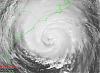
Looks like it came ashore near Naples. As of 8:00 AM, nothing here in Sarasota but wind.
|
|


 Threaded


