MikeC
Admin
Reged: Sun
Posts: 4543
Loc: Orlando, FL
|
|
7:45 AM Update 5 September 2008
Hanna is now east of Florida and continues to be moving Northeast. It has a broad windfield and wind will be felt much earlier than the center arrives in the Carolinas later Today.
The Florida east coast will receive some rain and less than tropical storm force wind until later today as it passes by.

Ike continues to move west and slightly south, and the long range forecast still is suspect either way, it will likely have to be monitored. If you aren't prepared already it wouldn't hurt to get some supplies. But still Ike may go further south or north than the line indicates, do not focus on the exact track line... the entire cone is a possibility.
Ike will enter a less favorable area for development, so it is likely to weaken some today. It is forecast to regain strength later, however.
Original Update
Tropical Storm Hanna, a broad 65MPH Tropical storm, is moving northwest and will likely near and cross the coastal Carolinas tomorrow night. It has a small window to increase in strength, so hurricane WAtches are up
from Edisto Beach in South Carolina, Northward to Currituck Beach Light (Including Pamlico Sound) in North Carolina,
Tropical Storm Warnings are now up from the Savannah river, northward to the border of Virginia and North Carolina.
Tropical Storm watches are now up for points northward into Great Egg Inlet in New Jersey. This watch area also includes the entire Chesapeake Bay. See Local Statements (Top of main page) for more information.
Tropical storm force winds extend pretty far from the center, 315 miles or so, but only on the North and Eastern Sides. This means its likely Florida will see little to nothing from Hanna, but north of Florida conditions will likely worsen, and winds will come well in advance in the landfall area sometime tomorrow.

Hurricane Ike continues to maintain itself as a major Category 4 storm. Ike will likely get into Recon Aircraft range tomorrow.
The forecast track currently tracks it through the Bahamas (those there will need to pay close attention) and eventually near the Florida coastline, although there is a great deal of uncertainty in the track at the 4 + day range, so things may change. Watch model trends and updates as time progresses on this dangerous storm.
Ike will likely weaken some over time (perhaps quite a bit if it gets into areas where Hanna upwelled) as it approaches an area of shear, but if it maintains its relatively small size it will have a chance to restrengthen after the bout with shear.
We'll be watching it very closely also.
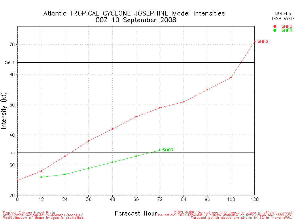
Josephine still is most likely to turn out to sea, but it is by no means a sure thing.
Hanna level 3 radar recording from HCW.
Color Sat of Gulf
RAMSDIS high speed visible Floater of Storms
Spaghetti Style model plots from Colorado State University
Forecast Discussions for (Show All Locations)
Charleston, SC
Wilmington, NC
Morehead City, NC
Hampton Roads Area of Virginia
Washington, DC
Philadelphia, PA
Emergency Management:
North Carolina Emergency Management
South Carolina Emergency Management
Ike Related:
State of Florida Division of Emergency Management/floridadisaster.org
Florida County Emergency Management Websites
Forecast Discussions for (Show All Locations):
Tampa,Miami, Key West, Melbourne
Tallahassee
Southeast Radar Composite (loop)
Jacksonville Radar Radar Loop
(Latest Static)
Melbourne Radar Radar Loop
(Latest Static)
Charleston, SC Radar Radar Loop
(Latest Static)
Wilmington, NC Radar Radar Loop
(Latest Static)
Morehead City, NC Radar Radar Loop
(Latest Static)
Wakefield/ Norfolk/ VA Beach, VA Radar Radar Loop
(Latest Static)
Dover, DE Radar Radar Loop
(Latest Static)
Mount Holly, NJ Radar Radar Loop
(Latest Static)
Google Plot of Hanna, Ike, and Josephine
StormCarib Reports from the Caribbean Islands
Caribbean Weather Observations
Barbados Brohav Weather Fax
Full Caribbean Radar Composite
Caribbean Broadcast Corporation (TV/Radio from Antilles)
San Juan, PR NWS Page
Various Caribbean Radio Stations
DR1 Dominican Republic Hurricanes
Caribbean Islands Weather Reports
Hanna Event Related Links


SFWMD Model Plot (Animated Model Plot) SFWMD Hurricane Page
[https://flhurricane.com/floatanimator.php?year=2008&storm=8 Flhurricane Satellite Floater Animation of Hanna
GOES Floater
Animated Model Plot of Hanna
Clark Evans Track Model Plot of Hanna
(Animated!) Model Plots in Google Earth - In Google Maps
Clark Evans Intensity Model Plot of Hanna (Animated!)
Clark Evans Track Plot of Hanna
Other Model Charts from Clark
Clark Evans Top 10 Analog Storms for Hanna
More model runs on from RAL/Jonathan Vigh's page
NRL Info on Hanna -- RAMMB Info
COD Atlantic Satellite View
Ike Event Related Links


SFWMD Model Plot (Animated Model Plot) SFWMD Hurricane Page
[https://flhurricane.com/floatanimator.php?year=2008&storm=9 Flhurricane Satellite Floater Animation of Ike
GOES Floater
Animated Model Plot of Ike
Clark Evans Track Model Plot of Ike
(Animated!) Model Plots in Google Earth - In Google Maps
Clark Evans Intensity Model Plot of Ike (Animated!)
Clark Evans Track Plot of Ike
Other Model Charts from Clark
Clark Evans Top 10 Analog Storms for Ike
More model runs on from RAL/Jonathan Vigh's page
NRL Info on Ike -- RAMMB Info
COD Atlantic Satellite View
Josephine Event Related Links


SFWMD Model Plot (Animated Model Plot) SFWMD Hurricane Page
[https://flhurricane.com/floatanimator.php?year=2008&storm=10 Flhurricane Satellite Floater Animation of Josephine
GOES Floater
Animated Model Plot of Josephine
Clark Evans Track Model Plot of Josephine
(Animated!) Model Plots in Google Earth - In Google Maps
Clark Evans Intensity Model Plot of Josephine (Animated!)
Clark Evans Track Plot of Josephine
Other Model Charts from Clark
Clark Evans Top 10 Analog Storms for Josephine
More model runs on from RAL/Jonathan Vigh's page
NRL Info on Josephine -- RAMMB Info
COD Atlantic Satellite View
|
Beach
Weather Guru

Reged: Wed
Posts: 187
Loc: Cocoa Beach/Banana River
|
|
Looking at the loop:
http://www.ssd.noaa.gov/goes/flt/t2/loop-wv.html
Is the cold cloud tops in the center of the convection
showing us the center of Hanna?
|
flahurricane
Weather Hobbyist
Reged: Sun
Posts: 55
Loc:
|
|
looks like Hanna is starting to get her act together. Again..
|
hurricane_run
Storm Tracker

Reged: Sun
Posts: 366
Loc: USA
|
|
yea there is convection firing up. but stil alot of dry air and not as much time for Hanna to get organized.
|
rmiller1031
Registered User

Reged: Thu
Posts: 2
Loc: Panama City, FL
|
|
Sorry to ask a rookie question but I can't help myself. I have been "lurking" and reading your insightful posts since came through the panhandle. Thanks for all the info. I know the issues the advisories on theh 5's and 11's and when land is involved an intermediate is on the 8's and 2's. Where is the 8p for Ike? There have already been a few intermdiates and when I got home from work tonight I was hoping for an update and I am still looking at the 5p that I saw forever ago. Thanks again for the info and I will retreat to the shadows....Rick
|
LoisCane
Veteran Storm Chaser

Reged: Fri
Posts: 1236
Loc: South Florida
|
|
Hanna is fighting, on wv imagery her core looks better though she still has a rather strange presentation. Not so much her but the flow around her.
http://www.ssd.noaa.gov/goes/east/carb/loop-wv.html
As for Ike he is moving more west than previously and on the above referenced water vapor loop he might even be a smidgen south of his forecasted point.
If you look at the high to the north of him and even to his nw you can see where he could start moving wsw as the has forecasted. Not that we don't trust them, we do but when we see it happening and why it makes us nod and look further down the line at his track.
The ships model takes him all the way to the Florida coastline, models change but still it's not an easy graphic to look at especially if you live in Miami or Ft. Lauderdale which I do. But... still it can change.
I think that is what we have to think on now... what if scenarios, what do to prepare and wait and see where the cone narrows.
Ike looks amazing. His eye is wide open and very white inside.
We'll see. Cantore on tonight was talking on possibilities of "what ifs" Ike gets into the Gulf. Perhaps a long shot but we'll see where the models take it tomorrow. Just remember they are models and the track is the bottom line, they are doing a great job this season in a year with so many landfalls.
--------------------
http://hurricaneharbor.blogspot.com/
|
TeamJP2002
Registered User
Reged: Sat
Posts: 4
Loc: Daytona Beach, Fla.
|
|
Quote:
Sorry to ask a rookie question but I can't help myself. I have been "lurking" and reading your insightful posts since came through the panhandle. Thanks for all the info. I know the issues the advisories on theh 5's and 11's and when land is involved an intermediate is on the 8's and 2's. Where is the 8p for Ike? There have already been a few intermdiates and when I got home from work tonight I was hoping for an update and I am still looking at the 5p that I saw forever ago. Thanks again for the info and I will retreat to the shadows....Rick
Ike's not close enough to any major land areas to be on the "every 3-hour update" schedule yet.
|
Colleen A.
Moderator

Reged: Sat
Posts: 1432
Loc: Florida
|
|
Rick...that was not a rookie question, it was an excellent question! I was wondering the same thing myself. Someone may be able to help you better than I on this subject, but here are my thoughts: they aren't going to send in recon until tomorrow...when it's closer to land and closer to fly into...so they may be waiting for that info. Right now they are primarily going by the models and the atmosphere surrounding Ike.
Hope that helps!

--------------------
You know you're a hurricane freak when you wake up in the morning and hit "REFRESH" on CFHC instead of the Snooze Button.
|
LoisCane
Veteran Storm Chaser
Reged: Fri
Posts: 1236
Loc: South Florida
|
|
Yes, recon needs to get in there however I would really like to see the Gulfstream Jet fly around a bit and get some good measurements. That would help models a lot.
On the other hand, Ike's eye is so wide open right now you can see deep down inside.
That Gulfstream Jet that measures the atmosphere that Ike is moving in can tell a lot about where any weaknesses are and any subtle changes to the track.
The more information we have the better, so far we have been going on and sat imagery. Rarely have I seen so much white in a solid ball in a image as I did today showing a very intense storm.
--------------------
http://hurricaneharbor.blogspot.com/
|
Clark
Meteorologist
Reged: Wed
Posts: 1710
Loc:
|
|
Quote:
Sorry to ask a rookie question but I can't help myself. I have been "lurking" and reading your insightful posts since came through the panhandle. Thanks for all the info. I know the issues the advisories on theh 5's and 11's and when land is involved an intermediate is on the 8's and 2's. Where is the 8p for Ike? There have already been a few intermdiates and when I got home from work tonight I was hoping for an update and I am still looking at the 5p that I saw forever ago. Thanks again for the info and I will retreat to the shadows....Rick
They only issue intermediate advisories in two cases:
1) Tropical storm or hurricane advisories (watches and/or warnings) have been issued
2) Significant short-term changes in intensity (generally upward) that prompt the issuance of a new advisory package
We had one such instance of the latter with Ike yesterday evening, but alas with no advisories out on Ike right now there are otherwise no intermediate advisories being issued on the storm. That should change tomorrow or so.
--------------------
Current Tropical Model Output Plots
(or view them on the main page for any active Atlantic storms!)
|
MikeC
Admin
Reged: Sun
Posts: 4543
Loc: Orlando, FL
|
|
The 11PM for Ike has the last forecast point just offshore of Ft. Lauderdale/Dania Beach, moving generally northwest. I wanted to mention this because a category 3/4 hurricane approaching the Florida coast like that is more than a little eye opening.
However, it's a compromise forecast between two model plots, one group going much further south and other going north of there, it will be impossible to know more until later in the weekend. It should keep everyone watching, however. The Entire cone! I know it's a broken record!
|
cate
Verified CFHC User
Reged: Thu
Posts: 13
Loc: Florida
|
|
Will SoFL have a pretty good idea of proposed landfall by Sun nite? I live in Martin County and have made basic preparations, but my husband and I are not in very good health, so I don't want to do hard prepping til absolutely necessary. We also have 2 kitties to worry about. My husband is diabetic, I have cancer, and I do NOT want to go to a shelter! I feel guilty about worrying about us, tho, when I read about the horrible conditions for those poor people in Haiti. However, to be practical, I do have to worry and get ready.
|
scottsvb
Weather Master
Reged: Mon
Posts: 1184
Loc: fl
|
|
Right now everyone should just keep a eye on IKE. We wont know forsure where or if he will make landfall till probably sunday night or monday morning. I do have a gut feeling on IKE, but I want to wait also until its 2-3 days out and right now its around 5. IKE will move WSW but how far before a more west turn or WNW turn is in question. I would follow the Model with a blend of the . Lets watch but not make any rational plans until Sunday, if at all.
|
weathernet
Storm Tracker
Reged: Sat
Posts: 296
Loc: Elsewhere
|
|
Cate,
It is only practical that you seek answers now, rather than at the moment of decision. There are multiple things that every homeowner must consider, and when you add to that, the added complication of having pets and being in poor health, you need look into your options now rather than wait till the last moment.
First of all, there is the issue of evacuations. I cannot comment here, as each resident and neighborhood may be mandated to evacuate depending on a case by case scenario. For instance, are you at risk of ocean storm surge ( flooding ). Second, are you on a first floor, or second or higher. Of course, the exact point of a hurricane landfall is critical to any consideration of evacuation. I would think that any landfalling hurricane in Miami-Dade County or the Keys, would likley not cause you to evacuate. In any case, best to listen to officials. These considerations start typically when we are under a Hurricane Watch - typically 36-48 hours ahead of landfall. This might mean that if watches are raised for Ike, this might occur sometime on Sunday. More imminent Warning would then follow shortly if it appear likely that those conditions will impact where you live.
Couple things to keep in mind. Most shelters do not allow pets. Cats however are fairly easy as they can be left with food and a couple fresh liter boxes, and water, and usually can be left for at least days at a time if necessary. Other issue is your health. You need to immediatly take stock of what necessary medicines you or your husband might need. If directly impacted by Hurricane Ike, than it would be possible that electric, communication, and other disruptions could make it difficult to near impossible for many stores or commerce to operate for days or even a couple weeks.
Couple other tips include going to the ATM and getting extra cash out, so that in the event of a several day disruption of communication or electric disruptions, at least you will have some money. Also another smart tip is to fill any/all vehicles with gas. You never know if it may take a few days or longer for streets to clear and electricity to allow gas sales. Charge all cell phones, and bring a cell phone charger with you should you go to a friends home or shelter. Also, before leaving....., make sure that you have a list of family or friends who know of your exact plans regarding waiting out the storm. One very very important thing to do in the event of a direct impact. Go through your home and seek all critical papers, photos, banking info, insurance policies, etc. Take these items and carefully put them into a large garbage bag. Then, insert this garbage bag into another bag. Take a piece of paper and write on it: important papers, and tape it to the outside of this bag. Finally, simply take this bag and place or hide it in what would be the safest and dryest room in your home. The purpose for this, is to protect valuable papers and critical information that would be hard to recover, in the event of excessive water damage to your home. If you choose, you could take such important items and leave them with a trusted family memeber or friend that you might feel offers a safer building structure.
Best thing you can do, so to eleviate undue stress and anxiety, would be to simply make a plan that will include some or all of the above issues, along with any necessary items you might need should you be able to weather the event at your own home ( such as batteries, radio, flashlights, caned foods, manual can opener, at least one 24 box of bottled water, perhaps a fresh can of propane or suppleis for any barbecue you might have, non pearishable foods such as peanut butter, nuts, etc.
The more prepared you are, the less anxiety one will deal with beyond the simple decision of having to leave, or to simply accept mother natures temper tantrums and deal with it the best you can at home.
Best of luck!
Andy
|
TPuppy
Registered User
Reged: Sun
Posts: 9
Loc:
|
|
Another rookie question, can the Doppler radars be ramped up in situations like Hanna to learn more about her make up, she is far off our coast ( further than current radar readings of < 120 km) . I think I remember a time about a month ago when Melborne was under repair and that Tampa seemed to take over a good chunk of CF. Maybe looking at Doppler radar is only entertaining for us lurkers, I read the Doppler tutorial, but still didn’t understand if the readings help the or not. Is it all about the recon, if so why? I do remember hearing about the crappie Cuban radar, so it must mean something. And the (‘drops downs’  do what the radar can’t. You seem pretty excited about airplanes going out to see big bad Ike, tell me why that is so important. Can we learn if the radar ramps up? Did we learn? Is that why is doing better in path, but wants nothing to do with strength. i.e. Ike T.S. puff H3..h4. do what the radar can’t. You seem pretty excited about airplanes going out to see big bad Ike, tell me why that is so important. Can we learn if the radar ramps up? Did we learn? Is that why is doing better in path, but wants nothing to do with strength. i.e. Ike T.S. puff H3..h4.
|
LoisCane
Veteran Storm Chaser
Reged: Fri
Posts: 1236
Loc: South Florida
|
|
Some of the best advice I've seen anywhere online tonight.
Make sure you have prescriptions, batteries fully charged, gas in the tank and money in your pocket.
Having a plan is better than running around in panic mode on Sunday.
The cone is large still on the 5th day..and 4th... yes it's a broken record but one worth playing again and again.
Saw Bill Read before the season started and he emphasized this over and over... have a plan, follow the plan. Do not panic at the last minute based on what neighbors tell you or rumors. Get a plan, stick to the plan. For advice on getting a plan there are sites online, hurricane maps in Publix and talk to old timers who live in your neighborhood if you are new to the area who can tell you how the area takes a strong storm.
This is a shutter event in South Florida if it continues on it's current path... not a buy twinkies and beer sort of tropical storm and a free day off from work. This is serious.
And, yes it is making a turn on the 5th day but where will that turn take it? Up the east coast, across the state to the west coast or though the straits?
By Saturday Morning we should be beyond the wide cone and those of us in the cone zone will need to act fast but with a plan...
Check your shelter for pets policy and condos on top floors have higher winds and they are only as good as the weakest link. If you have a neighbor who was out of town and on the 11th floor didn't lock his balcony sliding glass door before he left town last week it will provide a point of entry for winds that could snake through the condo and create havoc for neighbors in a major cane. If so.. find your hallways or exits and obviously if you are in an evac zone, evacuate.. if not, follow the advice of those in the know and the .
Remember knowledge is power...
--------------------
http://hurricaneharbor.blogspot.com/
|
weathernet
Storm Tracker
Reged: Sat
Posts: 296
Loc: Elsewhere
|
|
All good questions. To be as to the point however, radar is one additional tool that for tropical cyclones, may assist Meteorologists determine overall rotation, or in fact if there is a clear and obvious center. Often times, in a weak system, especially at night time, it is diffucult to determine a "fix" or center point of a low pressure area. Well, with satellite............and given a well developed eye within a hurricane, there is no doubt as to the location and motion of that system. Recon flights offer different diverse information. One being a center fix - pretty much a where is it, how strong is it, barometric pressure, wind speed, and other readings specific to the current state of the storm. Perhaps more importantly however, are observations and samplings done of surface conditions ( sea surface temp, wave heights, etc ) to wind and pressure readings of the different levels of the atmosphere. This data, when fed into computers, further help scientists by providing the necessary information to assist in analyzing steering conditions and influences on future intensity.. The planes are basically flying laboratories that gather information for hundreds of miles around, within, and in advance of an approaching storm.
|
hurricane_run
Storm Tracker
Reged: Sun
Posts: 366
Loc: USA
|
|
Dopplar can't be effective past a certain range. Due to the curvature of the earth are other limiting factors radar can't see past a certain point. Imagine looking out towards the horizon. You know there is more behind there but can't see it. I think the range for most of the NWS products is ~140 miles. You can learn more here. http://www.srh.noaa.gov/srh/jetstream/doppler/radarfaq.htm
As for recon. It can give us many things that satillites can't. Presice temperatures, pressures, dewpoints, wind readings and they also conduct research missons to better understand these storms. Also getting information about the environment gives the models more data for their runs. It is also interesting to see how close the estimates made are to they actual conditions. It gives a check to the accuracy to current determinations that are made remotely.
The advice given earlier on both accounts is very good and would be very wise to heed
|
Storm Hunter
Veteran Storm Chaser

Reged: Wed
Posts: 1370
Loc: Panama City Beach, Fl.
|
|
Recon just went through Hanna from SE to NE and looks like the dropsonde shows surface pressure of 985mb at 27.2N 77.2W at 05:37Z.. thats a 2mb drop from the 11pm.. but hard to tell how much of a drop since last recon fix... noticed that the air temp at surface was 81F with dewpoint 79F
got family in the Brunswick county area... AKA home sweet home for me... I would expect for them to see some major beach erosion up along the SC/NC coast. Hanna should be moving pretty quickly when she makes landfall i think late 2marrow nite.
--------------------
www.Stormhunter7.com ***see my flight into Hurricane Ike ***
Wx Data: KFLPANAM23 / CW8771
2012== 23/10/9/5 sys/strms/hurr/majh
Edited by Storm Hunter (Fri Sep 05 2008 01:48 AM)
|
WPB Ken
Registered User
Reged: Wed
Posts: 2
Loc: WPB FL
|
|
Andy,
Some very good hints. My family and I were considering whether to ride Ike out in my kid's office building and I posed a bunch of questions to him based on what I've learned chasing storms as a newspaper photographer over the years.
To keep from wasting bandwidth, I'll refer you to what is normally my bicycling blog:
http://www.palmbeachbiketours.com/2008/09/04/storm-advice-hide-from-wind-run-from-water/
or http://tinyurl.com/5j6ss8 if that has a bad wrap.
I think this one is worth worrying about.
|


 Threaded


