MikeC
Admin
Reged:
Posts: 4544
Loc: Orlando, FL
|
|
Subtropical Storm Laura forms in the North Central Atlantic, moving northward out to sea.
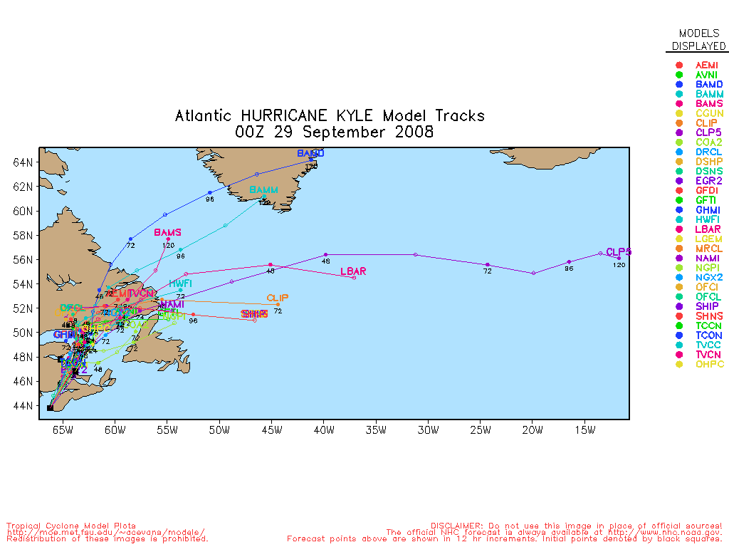
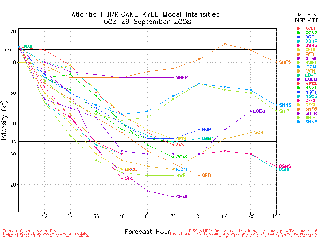
Kyle has made landfall in the Canadian Maritimes as a Tropical Storm.
Not much else is going on in the tropics this week so far.
|
Storm Cooper
User
Reged:
Posts: 1290
Loc: Panama City , FL
|
|
The trough in the GOM probably will never become much but can still spread a ton of rainfall for some in FL.
--------------------
Hurricane Season 2017 13/7/1
|
danielw
Moderator

Reged:
Posts: 3525
Loc: Hattiesburg,MS (31.3N 89.3W)
|
|
With the cool/ cold fronts pushing through the Midwest and Mid Mississippi Valley today we ... should be sealing off the GOM from a great deal of the tropical storm potential.
However... we all remember Hurricane Opal and other October storms over the last decade or so.
Relax but don't let your guard down. And don't eat all of your hurricane supplies yet.
Wait till Thanksgiving !!! 
|
damejune2
Storm Tracker

Reged:
Posts: 237
Loc: Torrington, CT
|
|
I hear you Danny...tomorrow we have a mass of dry air moving into South Florida which will make it some what cooler out, cant wait! If this needs to be moved, please do so, thanks!
--------------------
Gloria 1985 (Eye passed over my house in...get this...northwestern CT!)
|
Lee-Delray
Weather Master

Reged:
Posts: 429
|
|
Dr Grey's team predicted three named storms for October (above average). Two hurricanes; one major. He said that the Atlantic is still warmer than it should be.
|
Beach
Weather Guru

Reged:
Posts: 187
Loc: Cocoa Beach/Banana River
|
|
NHC is watching and area in the Western Car. that has a 20% chance or less of developing.
http://www.ssd.noaa.gov/goes/east/tatl/loop-wv.html
Here is a some bouy data close to the center of the disturbance.
http://www.ndbc.noaa.gov/station_page.php?station=42056
Wind Direction (WDIR): E ( 80 deg true )
Wind Speed (WSPD): 13.6 kts
Wind Gust (GST): 15.5 kts
Wave Height (WVHT): 2.6 ft
Dominant Wave Period (DPD): 6 sec
Average Period (APD): 4.5 sec
Mean Wave Direction (MWD): NE ( 52 deg true )
Atmospheric Pressure (PRES): 29.86 in
Air Temperature (ATMP): 81.1 °F
Water Temperature (WTMP): 84.9 °F
Dew Point (DEWP): 71.1 °F
Heat Index (HEAT): 85.1 °F
|
scyler
Registered User
Reged:
Posts: 1
Loc:
|
|
NHC latest satellte Imagery is showing an invest on the northern carribean disturbance. http://www.nhc.noaa.gov/satellite.shtml
|


 Threaded


