MikeC
Admin
Reged: Sun
Posts: 4543
Loc: Orlando, FL
|
|
13 Oct Update
Tropical Storm Nana has formed from 97L, it is currently moving west northwest and is expected to enter an area extremly hostle for development, and is forecast to dissipate in a few days. It appears it will be no threat to land areas.
Original Update
A wave in the eastern Atlantic, being tracked as Invest 97L, may have a chance at becoming a depression today. Models suggest it will not affect land areas.
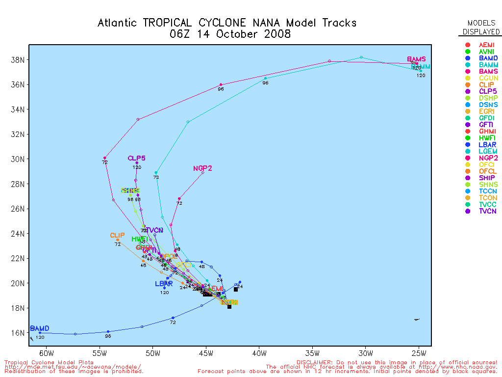
Nana Event Related Links


SFWMD Model Plot (Animated Model Plot) SFWMD Hurricane Page
[https://flhurricane.com/floatanimator.php?year=2008&storm=14 Flhurricane Satellite Floater Animation of Nana
GOES Floater
Animated Model Plot of Nana
Clark Evans Track Model Plot of Nana
(Animated!) Model Plots in Google Earth - In Google Maps
Clark Evans Intensity Model Plot of Nana (Animated!)
Clark Evans Track Plot of Nana
Other Model Charts from Clark
Clark Evans Top 10 Analog Storms for Nana
More model runs on from RAL/Jonathan Vigh's page
NRL Info on Nana -- RAMMB Info
COD Atlantic Satellite View
|
MichaelA
Weather Analyst

Reged: Thu
Posts: 945
Loc: Pinellas Park, FL
|
|
Looking at the vis loop, there appears to be two vortexes in that area. A couple of the models seem to want to develop a storm in the Eastern Caribbean and move it North and NE in a few days. Not to sure I trust that, but it is the time of year to be watching the Caribbean and GOM more than the Central Atlantic. Of course, recent history has had storms in the Atlantic well past the official season.
--------------------
Michael
PWS
|
cieldumort
Moderator

Reged: Mon
Posts: 2305
Loc: Austin, Tx
|
|
"97L" has sort of been made up of one fairly large circulation and a smaller swirl running out ahead of it. The lack of sufficient organization has probably been partially held in check, in part, by the close proximity of these two. It does now appear that the larger circulation center is beginning to show more definitive signs of development, and has been trending on a mostly northwest course, while the smaller swirl, still remaining a distinct feature, pushes farther westward.
NHC is tracking the mean center of the much larger circulation as the center of "97L." As of this reply, I peg it near 13.8N 36W. The trend over the past few hours might be a bit more westerly, but the movement the past few days has been stair-stepping, when smoothed out.
The small swirl southwest of 97L is now just shy of reaching 10N 43W. This feature appears to be weakening at the moment, mostly above the surface, and looks to be battling gust fronts which have been circulating off the fringes of the much larger 97L.
As a practical matter, as 97L develops further, it could continue to pull yet more north of the much smaller circulation, allowing both a better chance, with the small swirl continuing further west. But until then, the small swirl could be snuffed out at any time from an encounter with the outflow boundaries mentioned above. Also, these outflow boundaries suggest that 97L is still trying to work off an abundance of SAL in the region, even though bountiful moisture exists in the middle and upper layers.
|
ltpat228
Storm Tracker

Reged: Tue
Posts: 201
Loc: Port Saint Lucie FL
|
|
http://www.nrlmry.navy.mil/tc-bin/tc_hom...p&TYPE=ssmi
|
weathernet
Storm Tracker
Reged: Sat
Posts: 296
Loc: Elsewhere
|
|
No doubt what is the dominant low in the "blob" called 97L. Interestingly though, the much smaller area of convection farther south and west, seems to be maintaining its own identity. Not too sure of overall conditions in the cenral Atlantic around 10-12N and about 45-50W, but providing that this other feature were to continue to move westward and maintain convective, it would not surprise me if it were to be tagged as an invest itself sometime early tomorrow. This unless of course there were debate on whether or not it was truly seperated from the ITZ as a seperate feature onto itself.
|
cieldumort
Moderator
Reged: Mon
Posts: 2305
Loc: Austin, Tx
|
|
97L has maintained a very well-organized surface low for at least 12 hours now. Upper level winds continue to fan convection, displacing it to within the eastern half of the cyclone. Given 97L's tenacity, it is possible, if not likely, that maximum sustained winds at the surface are already blowing at or above 35 knots.
Upper-level winds are not expected to improve any time soon. In fact, they may even become more hostile in the near-term. There is a chance that deeper convection can maintain closer to the coc long enough to begin the process of deflecting some of this westerly shear. Unfortunately for this cyclone, it is still stair-stepping its way to the northwest, and with every westerly jog (as has been the case the past few hours) it encounters more westerly shear as it travels into and against the prevailing winds in the mid to upper-levels.
All discounts aside, may begin issuing advisories on a tropical depression or tropical storm at any time today, for a sheared, but otherwise well-developed, tropical cyclone.
|
cieldumort
Moderator
Reged: Mon
Posts: 2305
Loc: Austin, Tx
|
|
Ironically, environmental conditions in the near-term are far more favorable for further development of our yet-to-be-tagged-investy feature near 12N 43W, than for either 97L or 98L. Investy appears to me to now be sufficiently separate from both the and 97L.
|
MichaelA
Weather Analyst
Reged: Thu
Posts: 945
Loc: Pinellas Park, FL
|
|
Yes, that one grabs my attention too. 97L's presentation on the floater vis loop is quite interesting with that tiny vortex that appears to be rotating around the broader circulation. 97L is a sheared system, so it doesn't appear too viable to me at the moment. Looks like the models did a good job of picking up on 98L yesterday.
--------------------
Michael
PWS
|
cieldumort
Moderator
Reged: Mon
Posts: 2305
Loc: Austin, Tx
|
|
NHC has upgraded Invest 97L to Tropical Storm Nana.
A large portion of the cyclone's circulation continues to be exposed, having been continuously battered by shearing winds from the west. Nonetheless, expects Nana to sustain for a couple more advisories before finally giving up the ghost and degenerating into a remnant low. Nana is not expected to pose any threats to land.
The center of Invest 98L recently passed very near a buoy in the eastern Caribbean. Pressures dropped to around 1006mb, and winds at that location increased to 27 knots (about 30mph sustained), gusting to about 35mph. 98L continues to get better organized today, and it is becoming obvious that another October tropical cyclone is developing.
|
danielw
Moderator

Reged: Wed
Posts: 3525
Loc: Hattiesburg,MS (31.3N 89.3W)
|
|
First glance at the latest satellite imagery this morning reveals at least two convective hot towers in a north to south configuration.
Latest AVN Enhancement is nearly peaked out over the center area of the system. (CDO?)
JSL and Funktop enhancements are also showing peak indicators in the center area.
AVN Loop showing what appears to be a bit of west to east shear. Low level circulation is west of the highest cloud top circulation, in the loops.
RECON is scheduled for an 15Z, or 11AM EDT departure with a center fix assigned at 20Z, or 4PM EDT.
|
Thunderbird12
Meteorologist
Reged: Thu
Posts: 644
Loc: Oklahoma
|
|
Looks like 98L has been upgraded to a depression, based on information at the site and the most recent suite of SHIPS model runs. It also looks like Invest 99L has been tagged in the far SW Caribbean, east of Nicaragua.
The way it looks right now, both of these systems are unlikely to threaten the U.S. at any point.
|


 Threaded


