Ed Dunham
Former Meteorologist & CFHC Forum Moderator (Ed Passed Away on May 14, 2017)
Reged: Sun
Posts: 2565
Loc: Melbourne, FL
|
|
Update - 1130PM EDT Tuesday, Sept 7, 2010
Just a quick note to mention that Ex-Gaston has weakened again and that recent movement north of due west is likely to drive what remains of the wave into Haiti on Wednesday.
The wave off of Africa looks a little better this evening (Invest 91L) but its still going to take a couple of days for the system to organize.
ED
Update - 8PM EDT Tuesday, Sept 7, 2010
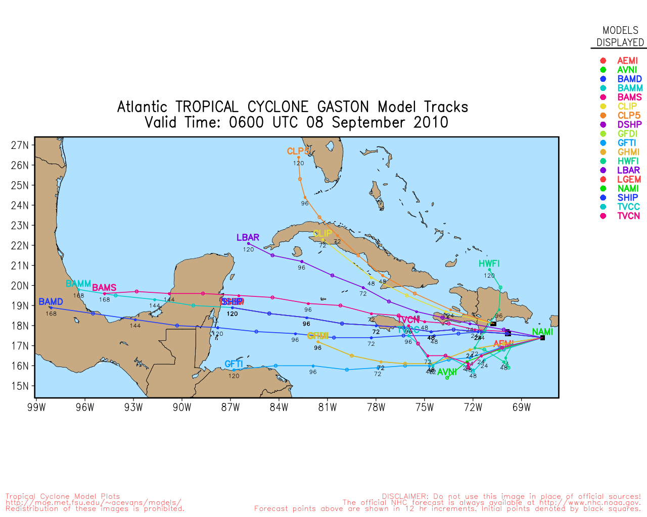
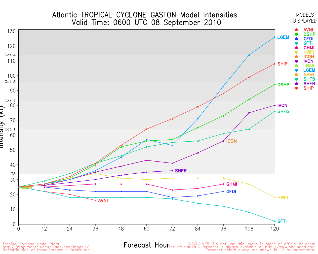
Ex-Gaston system located about 65 miles south of Puerto Rico at 08/00Z moving west at 18 knots with sustained winds of 25 to 30 knots and a central pressure of 1009MB. It was at this point in time that some of the model runs about 4 days ago suggested that the system would enter an environment a little more suited to development – and the convective activity this evening is the best that the wave has mustered in quite some time. Its hard to recall that this system was actually a tropical storm six days ago when it was barely off the African coast. Most of the intensity models still develop the system into a hurricane in three days while moving it generally westward through the northern Caribbean – and a potential threat to Jamaica after that. Bottom line is that the Ex-Gaston system still has potential for redevelopment.
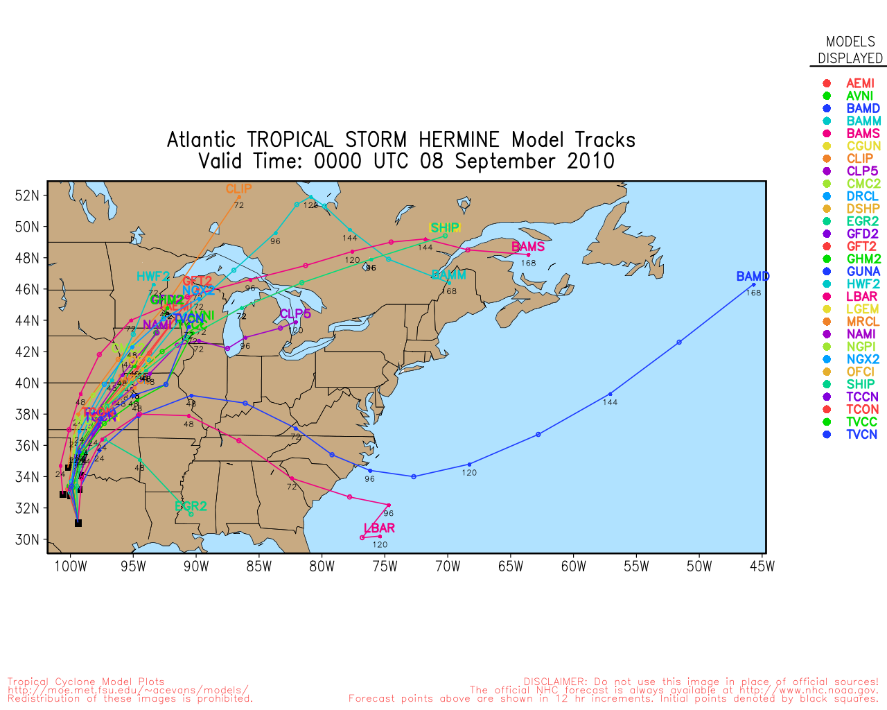
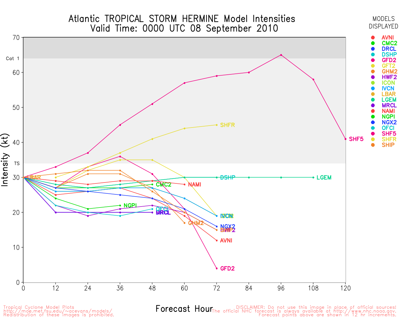
Hermine is now well inland near Brady, Texas, at 08/00Z as a Tropical Depression moving north at 16 knots with sustained wind of 30 knots. Although Hermine will soon become extra-tropical in nature, the storm will continue to bring heavy rains to central and eastern Texas and Oklahoma and to points north and northeast over the next few days. Significant flooding is likely in those areas.
Invest 91L is a large active wave located near the southeastern Cape Verde Islands moving west at 10 knots with potential for slow development in a few days
ED
Update - 11AM EDT Tuesday, Sept 7, 2010
Hermine is still a minimal Tropical Storm south of San Antonio, Texas, moving north with heavy rainfall expected in large portions of central and eastern Texas and Oklahoma and extra-tropical transition expected soon.
The remnants of former Gaston are moving through the northern Caribbean Sea – still flaring convection from time to time but current chances for regeneration are low.
A strong tropical wave located just off the west African coast will have a better chance for additional development when it moves westward away from the coast – a process that will take a few days.
ED
Update - 10PM EDT Monday, Sept 6, 2010
From :
"DATA FROM THE NOAA DOPPLER RADAR IN BROWNSVILLE TEXAS INDICATE THAT
TROPICAL STORM HERMINE MADE LANDFALL AROUND 830 PM CDT...0130 UTC
...ALONG THE COAST OF NORTHEASTERN MEXICO ABOUT 40 MILES...65 KM
...SOUTH OF BROWNSVILLE TEXAS. MAXIMUM SUSTAINED WINDS AT LANDFALL
WERE ESTIMATED TO BE 65 MPH"
A TROPICAL STORM WARNING IS IN EFFECT FOR...
* BAHIA ALGODONES MEXICO NORTHWARD TO PORT OCONNOR TEXAS
Recon investigation of Ex-Gaston found that the tropical wave was poorly organized and that the environment has become a little less favorable for redevelopment.
ED
Update - 8PM EDT Monday, Sept 6, 2010
Hermine now located about 80 miles south southeast of Brownsville, Texas. Sustained winds have increased to 65mph and recon reports central pressure down to 991MB. No changes in Watches/Warnings. Forward speed is a bit of a problem in that states a movement to the northwest at 14mph but Brownsville radar shows that the eye has been stationary for at least an hour. No doubt the uncertainty will all be resolved before the next full advisory at 11PM.
ED
Update - 3PM EDT Monday, Sept 6, 2010
Satellite presentation suggests that Hermine has continued to intensify and Recon will arrive at the center soon to determine if the storm has reached hurricane strength. Hermine continues to move to the north northwest although the forward speed seems to have picked up - landfall likely this evening in the Mexico/Texas border area. Residents in that area should prepare for hurricane conditions this evening. As the storm expands after landfall, torrential rainfall and flash flooding are likely in northeast Mexico and south Texas.
ED
Update - 10AM EDT Monday, Sept 6, 2010
Earlier this morning TD Ten intensified and was upgraded to Tropical Storm Hermine, the eighth storm of the season. Hermine is currently located about 275 miles south southeast of Brownsville, Texas, moving to the north at 10mph with sustained winds of 45mph and a central pressure of 999MB. Tropical Storm Warnings are posted for northeast Mexico and southern Texas as follows:
UPDATE: 06/15Z
A HURRICANE WATCH IS IN EFFECT FOR...
* RIO SAN FERNANDO MEXICO NORTHWARD TO BAFFIN BAY TEXAS
A TROPICAL STORM WARNING IS IN EFFECT FOR...
* LA CRUZ MEXICO NORTHWARD TO PORT OCONNOR TEXAS
Hermine should move north to north northwest toward the Mexico/Texas border area while continuing to intensify. SSTs are a toasty 31C and, except for some northerly windshear to the east, conditions are excellent for additional development - perhaps more than currently projected. Considerable rainfall is likely in the northeast Mexico and south Texas coastal areas.
Matamoros, Mexico, Weather Reports
The remnant low of former Gaston was located at 17.5N 56.0W at 06/14Z or about 400 miles east of the northern Leeward Islands. The disorganized system should continue to move generally westward for the next couple of days and should bring showers and gusty winds to the northern Islands tonight and Tuesday. Conditions are still somewhat favorable for re-development of this system which may ultimately meet its final demise over the mountains of Hispaniola on Wednesday.
Caribbean Weather Reports
A strong tropical wave moved off the coast of western Africa this morning and it should be watched for additional development later this week.
ED
Update - 12AM EDT Monday, Sept 6, 2010
At 06/03Z Invest 90L was upgraded to Tropical Depression 10. The TD was located about 200 miles east southeast of Tampico, Mexico, moving slowly to the north. An eventual turn to the north northwest is likely and the cyclone could reach tropical storm strength before landfall in northeast Mexico Tuesday morning.
THE GOVERNMENT OF MEXICO HAS ISSUED A TROPICAL STORM WARNING FOR THE
COAST OF MEXICO FROM TAMPICO TO THE MOUTH OF THE RIO GRANDE.
ED
Original Post
At 8PM EDT this Sunday evening, the tropical wave associated with the former Gaston was located about 450 nautical miles east of Guadeloupe in the Leeward Islands. INVEST 09L has been moving to the west and sometimes just south of due west at 15mph. For the past two days the system has sporadically shown signs of redevelopment but it has also sporadically succumbed to shear and dry air. There is still a high chance that Ex-Gaston will redevelop so folks in the Leeward Islands should monitor this system as it moves west to west southwest over the next few days
A disturbance in the far southwest Gulf of Mexico at the tail end of a trough also has a high chance of development although the system is situated very close to land and was located just offshore northeast of Veracruz, Mexico, at 06/00Z. Veracruz was reporting light rain and a pressure of 1006MB – but the wind has remained calm there for the past few hours. The disturbance is expected to move north northwest for the next couple of days and bring heavy rain to northeast Mexico.
Tampico, Mexico, Weather Conditions
Another strong tropical wave will exit the west coast of Africa on Monday and it has moderate potential for future development.
ED
Texas Gulf Coast Links
[http://moe.met.fsu.edu/~mnissenbaum/radar.html Mark Nissenbaum's radar page}
East to West:
Houston/Galveston, TX Radar Radar Loop
(Latest Static)
Corpus Christi, TX Radar Radar Loop
(Latest Static)
Brownsville, TX Radar Radar Loop
(Latest Static)
Gulf of Mexico Satellite Imagery
Area Forecast Discussions:
Houston/Galveston, TX
- Corpus Christi, TX - Browsnville/South Padre Island, TX
Texas Hourly Weather Reports
Ex-Gaston Event Related Links


SFWMD Model Plot (Animated Model Plot) SFWMD Hurricane Page
[https://flhurricane.com/floatanimator.php?year=2010&storm=9 Flhurricane Satellite Floater Animation of Ex-Gaston
GOES Floater
Animated Model Plot of Ex-Gaston
Clark Evans Track Model Plot of Ex-Gaston
(Animated!) Model Plots in Google Earth - In Google Maps
Clark Evans Intensity Model Plot of Ex-Gaston (Animated!)
Clark Evans Track Plot of Ex-Gaston
Other Model Charts from Clark
Clark Evans Top 10 Analog Storms for Ex-Gaston
More model runs on from RAL/Jonathan Vigh's page
NRL Info on Ex-Gaston -- RAMMB Info
COD Atlantic Satellite View
Hermine Event Related Links


SFWMD Model Plot (Animated Model Plot) SFWMD Hurricane Page
[https://flhurricane.com/floatanimator.php?year=2010&storm=10 Flhurricane Satellite Floater Animation of Hermine
GOES Floater
Animated Model Plot of Hermine
Clark Evans Track Model Plot of Hermine
(Animated!) Model Plots in Google Earth - In Google Maps
Clark Evans Intensity Model Plot of Hermine (Animated!)
Clark Evans Track Plot of Hermine
Other Model Charts from Clark
Clark Evans Top 10 Analog Storms for Hermine
More model runs on from RAL/Jonathan Vigh's page
NRL Info on Hermine -- RAMMB Info
COD Atlantic Satellite View
91L Event Related Links


SFWMD Model Plot (Animated Model Plot) SFWMD Hurricane Page
[https://flhurricane.com/floatanimator.php?year=2010&storm=11 Flhurricane Satellite Floater Animation of 91L
GOES Floater
Animated Model Plot of 91L
Clark Evans Track Model Plot of 91L
(Animated!) Model Plots in Google Earth - In Google Maps
Clark Evans Intensity Model Plot of 91L (Animated!)
Clark Evans Track Plot of 91L
Other Model Charts from Clark
Clark Evans Top 10 Analog Storms for 91L
More model runs on from RAL/Jonathan Vigh's page
NRL Info on 91L -- RAMMB Info
COD Atlantic Satellite View
Edited by Ed Dunham (Tue Sep 07 2010 11:46 PM)
|
Random Chaos
Weather Analyst

Reged: Sat
Posts: 1024
Loc: Maryland
|
|
Not a long lull. Tropical Depression #10 declared at 11pm off the coast of Mexico.
|
Storm Hunter
Veteran Storm Chaser

Reged: Wed
Posts: 1370
Loc: Panama City Beach, Fl.
|
|
system is looking better tonight then this afternoon. window is still open for it to make too TS status before a turn to the left and landfall in Mx.

--------------------
www.Stormhunter7.com ***see my flight into Hurricane Ike ***
Wx Data: KFLPANAM23 / CW8771
2012== 23/10/9/5 sys/strms/hurr/majh
|
cieldumort
Moderator

Reged: Mon
Posts: 2305
Loc: Austin, Tx
|
|
TD10 is currently in a favorable thermo-atmospheric environment for further strengthening, and is forecast to become our next named storm. However, working against Ten is its very close proximity to land. Additionally, the air to its north and northwest is exceptionally dry, and this could potentially also work against the cyclone, especially should it track to the right (north) of current guidance.
Nonetheless, the greatest threat with Ten looks to be the risk of life-threatening flooding, upon approach, and once inland. In addition to forming in a region of high moisture content, the cyclone is also benefiting from tapping even more tropical moisture out of the eastern Pacific. Also, the stationary front separating the very dry continental airmass to the north from the high moisture content over the Gulf looks to give ground as Ten approaches, and as such, there may actually be relatively little dry air entrainment, when all is said and done.
While currently considered mainly a flood threat for old Mexico, with up to twenty plus inches of rainfall possible in some locations there, just a slight deviation of track to the north could bring tropical storm force conditions and very copious tropical rains to several parts of Texas early to mid week, and perhaps even longer, should the system, or even just its remnants, stall.
--------------------
Fully vaccinated as of May 2021
(Moderna x2)
|
JoshuaK
Weather Guru
Reged: Mon
Posts: 159
Loc: Lakeland, FL
|
|
Tropical Storm Hermine it is now, with winds of 45 mph as of the 7AM Intermediate. Visible and IR Rainbow shows a good solid inner core firing up with banding also showing up very well. I wouldn't be suprised if we see rapid intensification, ala Humberto, the way this thing is rapidly getting its act together this morning.
|
Jasonch
Weather Watcher
Reged: Mon
Posts: 42
Loc: Texas
|
|
Hermine does look decent this morning but with her being so close to land I do not expect rapid strengthening.
Edited by Jasonch (Mon Sep 06 2010 09:24 AM)
|
WeatherNut
Weather Master
Reged: Wed
Posts: 412
Loc: Atlanta, GA
|
|
Hurricane watches and warnings on the 11am:
CHANGES WITH THIS ADVISORY...
THE GOVERNMENT OF MEXICO HAS ISSUED A HURRICANE WATCH FROM RIO SAN
FERNANDO NORTHWARD TO THE MOUTH OF THE RIO GRANDE...AND A HURRICANE
WATCH HAS BEEN ISSUED FROM THE MOUTH OF THE RIO GRANDE NORTHWARD TO
BAFFIN BAY TEXAS.
THE TROPICAL STORM WARNING HAS BEEN EXTENDED NORTHWARD TO PORT
OCONNOR.
THE GOVERNMENT OF MEXICO HAS DISCONTINUED THE TROPICAL STORM WARNING
SOUTH OF LA CRUZ.
SUMMARY OF WATCHES AND WARNINGS IN EFFECT...
A HURRICANE WATCH IS IN EFFECT FOR...
* RIO SAN FERNANDO MEXICO NORTHWARD TO BAFFIN BAY TEXAS
A TROPICAL STORM WARNING IS IN EFFECT FOR...
* LA CRUZ MEXICO NORTHWARD TO PORT OCONNOR TEXAS
A HURRICANE WATCH MEANS THAT HURRICANE CONDITIONS ARE POSSIBLE
WITHIN THE WATCH AREA...IN THIS CASE WITHIN ABOUT 24 HOURS.
A TROPICAL STORM WARNING MEANS THAT TROPICAL STORM CONDITIONS ARE
EXPECTED SOMEWHERE WITHIN THE WARNING AREA...IN THIS CASE WITHIN
ABOUT 24 HOURS.
FOR STORM INFORMATION SPECIFIC TO YOUR AREA IN THE UNITED
STATES...INCLUDING POSSIBLE INLAND WATCHES AND WARNINGS...PLEASE
MONITOR PRODUCTS ISSUED BY YOUR LOCAL NATIONAL WEATHER SERVICE
FORECAST OFFICE. FOR STORM INFORMATION SPECIFIC TO YOUR AREA OUTSIDE
THE UNITED STATES...PLEASE MONITOR PRODUCTS ISSUED BY YOUR NATIONAL
METEOROLOGICAL SERVICE.
--------------------
Born into Cleo (64)...been stuck on em ever since
|
WeatherNut
Weather Master
Reged: Wed
Posts: 412
Loc: Atlanta, GA
|
|
Does anyone have any info on why the recon appears to be returning back to base?
--------------------
Born into Cleo (64)...been stuck on em ever since
|
Thunderbird12
Meteorologist
Reged: Thu
Posts: 644
Loc: Oklahoma
|
|
If Hermine had another night to spend over the Gulf, it would probably really get cranked up, but its remaining several hours over water will occur at a time of day when rapid intensification isn't usually observed as frequently. Based on radar, Hermine seems to have turned to the left somewhat, though it remains to be seen if that trend will hold until landfall. Looks like another plane is on the way to investigate the storm.
Hermine has the potential to be a a major heavy rain producer for parts of the U.S. southern plains if the forecast track holds and it doesn't get hung up over the high terrain of NE Mexico. The risk of isolated tornadoes will increase tonight along and east of the track. The remnant low is forecast to continue into north TX and OK, where it may interact with an old frontal boundary and create an enhanced threat of excessive rain and a few tornadoes. If the and are to be believed, ex-Hermine will continue to pose a compact but significant heavy rain threat into parts of the Midwest toward the end of the week.
|
danielw
Moderator

Reged: Wed
Posts: 3525
Loc: Hattiesburg,MS (31.3N 89.3W)
|
|
Can anyone explain the extraordinary increase in wind speed on this dropsonde report? A Low Level Jetstream is the only explanation I can come up with other than equipment failure.
Level Wind Direction Wind Speed
1014mb (Surface) 130° (from the SE) 17 knots (20 mph)
1009mb 135° (from the SE) 22 knots (25 mph)
984mb 130° (from the SE) 23 knots (26 mph)
971mb 130° (from the SE) 22 knots (25 mph)
964mb 185° (from the S) 14 knots (16 mph)
961mb 105° (from the ESE) 47 knots (54 mph)
959mb 95° (from the E) 157 knots (181 mph)
957mb 95° (from the E) 146 knots (168 mph)
954mb 105° (from the ESE) 51 knots (59 mph)
951mb 125° (from the SE) 24 knots (28 mph)
The raw data is consistant with the decoded data. This was from an earlier flight this morning that returned to base before completeing the mission.
Raw data:
55961 10547
66959 09657
77957 09646
Edited by danielw (Mon Sep 06 2010 03:22 PM)
|
Ed Dunham
Former Meteorologist & CFHC Forum Moderator (Ed Passed Away on May 14, 2017)
Reged: Sun
Posts: 2565
Loc: Melbourne, FL
|
|
Its either equipment problems or the data has been misread - in either case though I'm sure that they will release another one. Could also be some position data errors. The storm has really cranked up in a hurry - not an uncommon event in this area.
ED
|
Ed Dunham
Former Meteorologist & CFHC Forum Moderator (Ed Passed Away on May 14, 2017)
Reged: Sun
Posts: 2565
Loc: Melbourne, FL
|
|
Well, not as strong as I thought that they would find.
URNT12 KNHC 061922
VORTEX DATA MESSAGE AL102010
A. 06/19:09:40Z
B. 24 deg 11 min N
096 deg 46 min W
C. 850 mb 1385 m
D. 47 kt
E. 046 deg 26 nm
F. 149 deg 48 kt
G. 045 deg 24 nm
H. EXTRAP 995 mb
|
lunkerhunter
Storm Tracker

Reged: Fri
Posts: 248
Loc: Saint Augustine, FL
|
|
probably just need to drop the extra 1
959mb 95° (from the E) 57 knots
957mb 95° (from the E) 46 knots
|
tropicswatch
Verified CFHC User
Reged: Tue
Posts: 12
|
|
A more distinct eye is now showing on the last few frames of the Brownsville radar http://radar.weather.gov/ridge/radar.php?rid=BRO&product=N0Z&overlay=11101111&loop=yes
|
Thunderbird12
Meteorologist
Reged: Thu
Posts: 644
Loc: Oklahoma
|
|
Recon data indicates that Hermine lacks a well-defined inner core, with a rather broad area of low-end tropical storm force winds but nothing particularly strong near the center. This is supported by radar data, which has shown occasional attempts at partial eyewall formation, but nothing that has taken hold so far. Base velocities from KBRO are increasing somewhat near the center, though (currently maxing out around 60 kts at 12000 ft).
Hermine seems to have resumed a NNW motion after an earlier jog more to the west. It probably does not have time to reach hurricane status before landfall, but it still can't be ruled out if there is another burst of intensification.
|
WesnWylie
Weather Guru
Reged: Sat
Posts: 155
Loc:
|
|
A well-defined eye has been visible on the radar for the last 20-30 minutes. It appears to be wobbling around which is a sign of some organization taking place within. At this rate, I think that TS Hermine may reach hurricane status prior to landfall tonight.
--------------------
2011 Season Forecast: 16/09/04
2011 Systems: 10/01/01
|
Thunderbird12
Meteorologist
Reged: Thu
Posts: 644
Loc: Oklahoma
|
|
Hermine has really slowed down in the last couple of hours. The strongest flight level winds so far have actually been observed about 40-60 miles NE of the center. That is the part of the storm that likely will impact the lower TX coast later tonight, so those folks should be aware that conditions could be fairly intense even if landfall takes place well to the south.
It's still struggling to maintain a coherent eyewall, but it has been getting closer on more recent attempts. It is interesting to see the evolution of a storm like this on radar.
|
Ed Dunham
Former Meteorologist & CFHC Forum Moderator (Ed Passed Away on May 14, 2017)
Reged: Sun
Posts: 2565
Loc: Melbourne, FL
|
|
Latest recon still has the storm at about 50 knots - but pressure now estimated at 991MB.
ED
|
WesnWylie
Weather Guru
Reged: Sat
Posts: 155
Loc:
|
|
Is it just me or does it look like the eye of TS Hermine made a jog to the east?
--------------------
2011 Season Forecast: 16/09/04
2011 Systems: 10/01/01
|
Thunderbird12
Meteorologist
Reged: Thu
Posts: 644
Loc: Oklahoma
|
|
It looks like the center of Hermine did jog east slightly and now seems to moving steadily northward after slowing down for awhile. Recon just found 60 kt flight level winds in the eastern eyewall with 56 kt SFC winds from the SFMR, so it's possible the intensity will be upped slightly in the next advisory.
There has definitely been more consolidation of the wind field in the radar data in the last hour or so.
|


 Threaded


