1:00 PM 23 July 2014 Update
Tropical Depression two has degenerated into only a weak swirl remaining with no deep
convection, and not is just remnants of its former self. Chances of regenerating are extremely low.
4:35 PM 21 July 2014 Update
Tropical Depression Two has formed in the central Atlantic from 92L, which just began being tracked this morning. This is a small system that may increase/decrease in strength relatively quickly. It is currently forecast to weaken as it enters more hostile conditions.
Those in the eastern Caribbean will want to watch, however. But odds favor this being a short lived system.
2:30 PM 21 July 2014 Update
Chances have jumped up to 70%, as the storm is well presented in the Central Atlantic. The Navy has issued a Tropical Cyclone Formation Alert for this system, so it could possibly be upgraded to a depression at 5PM.
Original Update
After most of July being quiet after Arthur, a system that is now in the Central Atlantic, and being tracked as 92L, is now in a position to develop, and is looking quite well this morning for the system. If the current look persists today, chances for development could go way up from the current 20%.
Based on current movement and low level models, those in the Eastern Caribbean will want to watch to see what happens over the next few days.
There will be more to come on this system later today.
Caribbean Weather Reports
Caribbean Radar Mosaic
Tropical Depression Two Event Related Links

SFWMD Model Plot (Animated Model Plot) SFWMD Hurricane Page
[https://flhurricane.com/floatanimator.php?year=2014&storm=2 Flhurricane Satellite Floater Animation of TD#2
GOES Floater
Animated Model Plot of TD#2
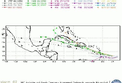
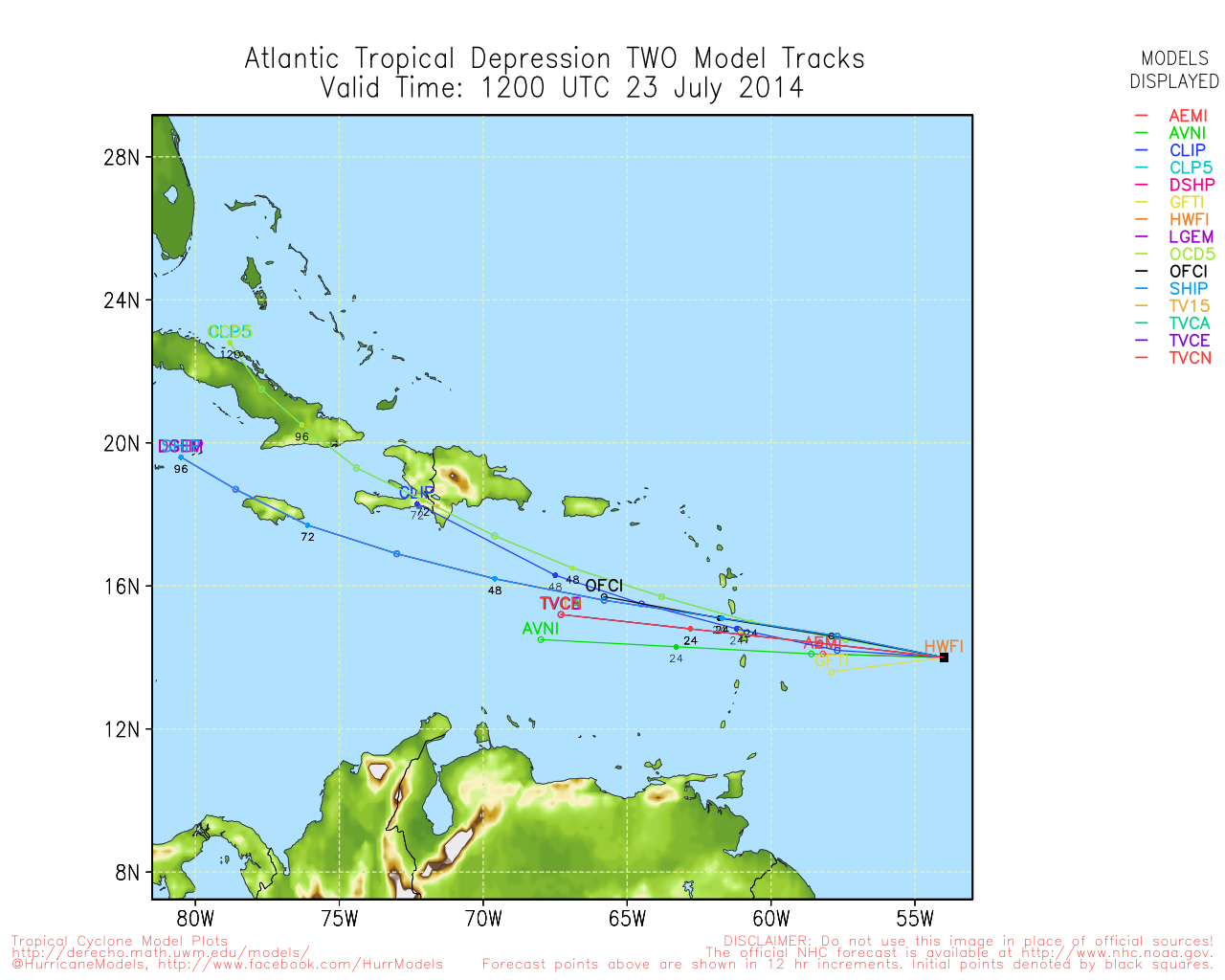
Clark Evans Track Model Plot of TD#2
(Animated!) Model Plots in Google Earth - In Google Maps
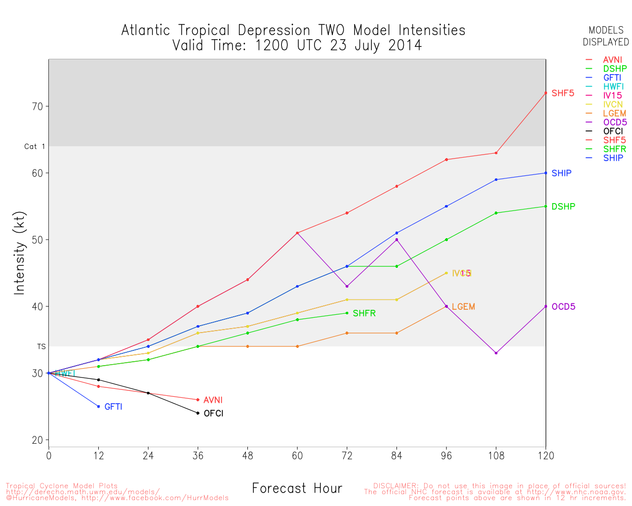
Clark Evans Intensity Model Plot of TD#2 (Animated!)
Clark Evans Track Plot of TD#2
Other Model Charts from Clark
Clark Evans Top 10 Analog Storms for TD#2
More model runs on from RAL/Jonathan Vigh's page
NRL Info on TD#2 -- RAMMB Info
COD Atlantic Satellite View


 Threaded


