7 AM Update EDT 22 June 2017
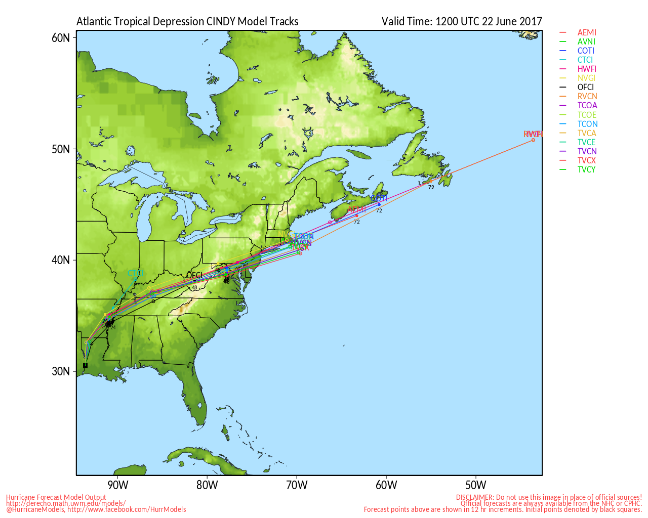
Cindy makes landfall near the Texas and Louisiana border, now moving inland.
Cindy started to develop convection along the northwestern side and it managed to wrap around just as it was making landfall. Shear had let up, but dry air intrusion from the south kept it weak. Rainfall was the biggest story along with numerous small tornadoes and waterspouts.
Rain will continue well inland, however the dry air intrusion made some fairly large pockets where places did not see as much rain, but others such as Alabama and the Panhandle wound up with much more time under rain than areas closer to the center, with the exception of right around the center once it neared land.
The most tragic accident related to Cindy was a 10 year old Missouri boy who died when a log picked up by the heavy surf ran into him in the water and hit him in Fort Morgan, AL while there for a family reunion.
Original Update
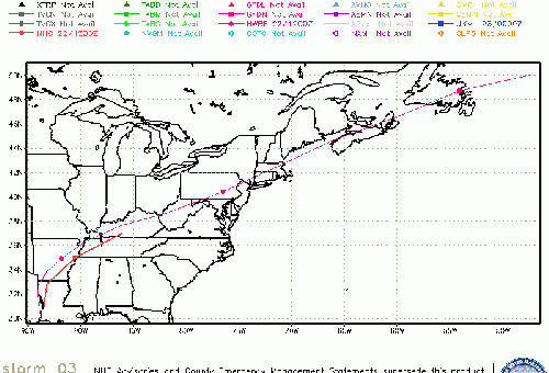
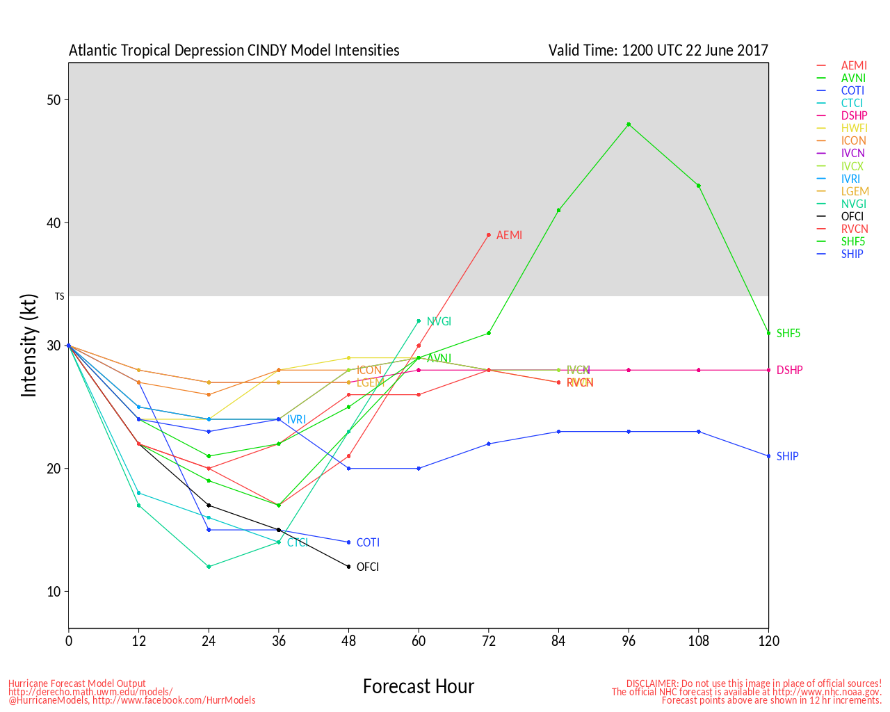
The area being tracked as 93L and Potential Cyclone Three is now, based on recon reports, Tropical Storm Cindy.
Cindy is mostly a flooding rainfall event for areas east of the storm center (As far east as the Florida Panhandle), but may also include coastal rainfall and short-lived tornadoes.
Cindy's Tropical Storm Warnings are in effect for High Island (Just north of Houston/Galveston) to the Mouth of the Pearl River
A Tropical Storm Watch is in effect for... West of High Island to San Luis Pass along the mid-Texas coastline.
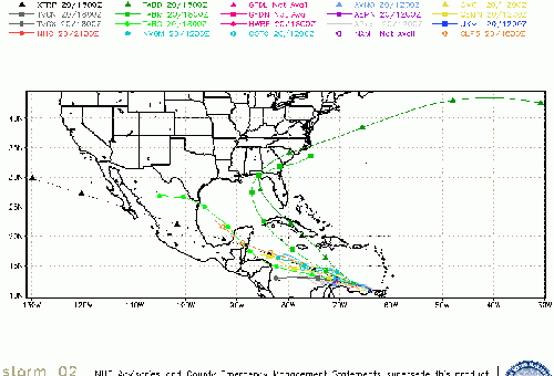
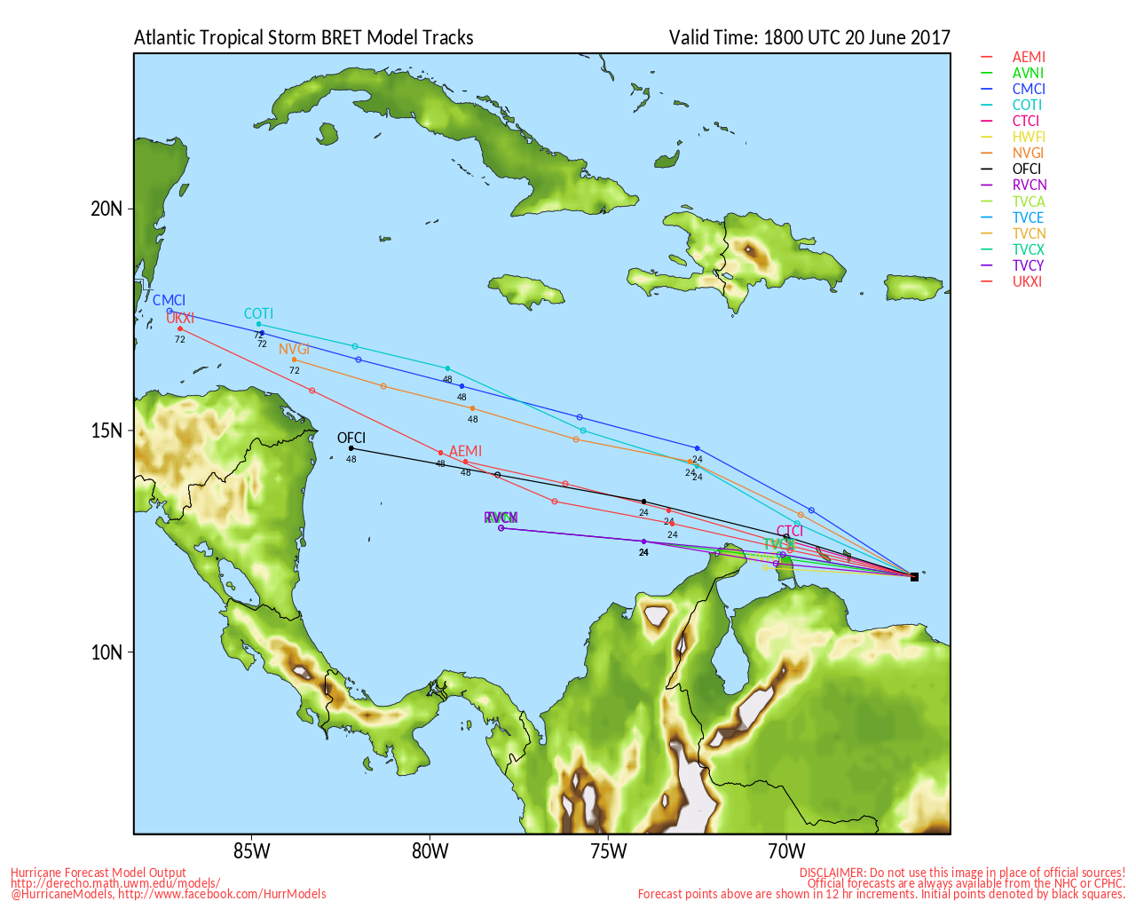
Tropical Storm Bret continues to move through the southern Caribbean,
For Bret, a Tropical Storm Warning is in effect for Venezuela Isla de Margarita and a Tropical Storm Watch is in effect for the islands of Bonaire, Curacao, and Aruba.
more to come soon...
Event Links
Biloxi Lightgouse camera Live Stream:

<a href="http://flhurricane.com/imageanimator.php?252" target="_blank">Flhurricane Recording of Biloxi Lighthouse Cam</a>
Mark Sudduth/Hurricanetrack Video Stream for the system, he's heading toward the Gulf coast
See mark's position on a map <a href="https://www.youtube.com/watch?v=nJEMML0QJF0" target="_blank">here</a>.
Cindy Event Related Links

SFWMD Model Plot (Animated Model Plot) SFWMD Hurricane Page
[https://flhurricane.com/floatanimator.php?year=2017&storm=3 Flhurricane Satellite Floater Animation of Cindy
GOES Floater
Animated Model Plot of Cindy
Clark Evans Track Model Plot of Cindy
(Animated!) Model Plots in Google Earth - In Google Maps
Clark Evans Intensity Model Plot of Cindy (Animated!)
Clark Evans Track Plot of Cindy
Other Model Charts from Clark
Clark Evans Top 10 Analog Storms for Cindy
More model runs on from RAL/Jonathan Vigh's page
NRL Info on Cindy -- RAMMB Info
COD Atlantic Satellite View
Louisiana Coastal Links
North Gulf/Southern Mississippi Valley Composite Radar Loop
(Latest Static)
East to West:
New Orleans, LA Radar Radar Loop
(Latest Static)
Lake Charles, LA Radar Radar Loop
(Latest Static)
Gulf of Mexico Satellite Imagery
Area Forecast Discussions:
New Orleans, LA -
Lake Charles, LA -
Bret) Event Related Links

SFWMD Model Plot (Animated Model Plot) SFWMD Hurricane Page
[https://flhurricane.com/floatanimator.php?year=2017&storm=2 Flhurricane Satellite Floater Animation of Bret
GOES Floater
Animated Model Plot of Bret
Clark Evans Track Model Plot of Bret
(Animated!) Model Plots in Google Earth - In Google Maps
Clark Evans Intensity Model Plot of Bret (Animated!)
Clark Evans Track Plot of Bret
Other Model Charts from Clark
Clark Evans Top 10 Analog Storms for Bret
More model runs on from RAL/Jonathan Vigh's page
NRL Info on Bret -- RAMMB Info
COD Atlantic Satellite View
StormCarib Reports from the Caribbean Islands
Caribbean Weather Observations
Barbados Brohav Weather Fax
Full Caribbean Radar Composite
Caribbean Broadcast Corporation (TV/Radio from Antilles)
San Juan, PR NWS Page
Various Caribbean Radio Stations
DR1 Dominican Republic Hurricanes


 Threaded


