cieldumort
Moderator

Reged: Mon
Posts: 2305
Loc: Austin, Tx
|
|
10AM EDT 28 August 2017 Update
Another Harvey stat for the record books: According to Dr. Klotzbach, with Harvey still a named storm 59 hours after landfall, he has become 'the longest a TX landfalling hurricane remained a NS after landfall on record,' also noting that 'the average Texas landfalling hurricane weakens to a tropical depression in ~27 hours.'
As of 9:50AM CDT this morning, has maintained Harvey as a Named Storm during the latest advisory, despite the lack of ground reports of tropical storm force wind, as it is likely that the storm force winds seen from Houston's WSR-88D radar are mixing down to the surface in the stronger convective downpours, not to mention Harvey's barometric pressure of 997mb, and falling.
With Harvey now interacting with an upper-level trough (which is also responsible for his movement southeast) and becoming more sub-tropical in nature, only some strengthening is forecast even though Harvey's center is now emerging back over water. That said, it is possible that Harvey mixes out more of the dry air that has wrapped around his center from the northwest, and deepens more than anticipated.
Regardless of whether Harvey continues transitioning into a sub-tropical storm over the next few days, or is able to take enough advantage of being back over very warm waters to remain more tropical than not, very heavy rains near the center and in bands even well away from the center will likely persist and possibly intensify, with locations including but not limited to Beaumont, Port Arthur, Lake Charles, and even New Orleans now facing the prospect of having Harvey deliver an increase of flooding heavy rains and tornadoes to their areas.
Key messages from the National Hurricane CenterQuote:
1. Ongoing catastrophic and life-threatening flooding will continue across southeastern Texas. Additional rainfall accumulations of 15 to 25 inches are expected across the upper Texas coast, with isolated storm totals as high as 50 inches. Please heed the advice of local officials. Do not attempt to travel if you are in a safe place, and do not drive into flooded roadways. Refer to products from your local National Weather Service office and the NOAA Weather Prediction Center for more information on the flooding hazard. A summary of rainfall totals compiled by the Weather Prediction Center can be found at: www.wpc.ncep.noaa.gov/discussions/nfdscc1.html
2. The flood threat is spreading farther east into Louisiana. Additional rainfall amounts of 15 to 25 inches are expected in southwestern Louisiana, with rainfall amounts of 5 to 15 inches expected in south-central Louisiana and 5 to 10 inches in southeastern Louisiana. Please heed the advice of local officials and refer to products from your local National Weather Service office and the NOAA Weather Prediction Center for more information on the flooding hazard in these areas.
3. While Tropical Storm Watches and Warnings have been extended eastward to the coast of Louisiana, the impacts of winds and storm surge are expected to be secondary compared to that of the rains.
Elsewhere
PTC TEN (92L) just off the southeast coast with development odds of 90% over the next 48 hour or so. Movement to the north or north-northeast and then northeast later this week is anticipated.
A wave in the central Atlantic that is not yet Invest tagged, but which has become more convectively active today.
A vigorous wave out in the eastern Atlantic, Invest 93L, with development odds of 70% over the next 5 days.
5PM EDT 27 August 2017 Update
Potential Tropical Cyclone Ten forms along of the southeast US coast.
A Tropical Storm Watch is in effect from South Santee River, South Carolina, to Duck, North Carolina.
Original Update
Unfortunately, the devastation and potential for loss of life has only just begun.

"Unlike anything we've seen before" is how many hurricane experts are describing Harvey, having to blend multiple monstrous systems together to come up with some kind of analog.
After coming ashore as the first Texas landfalling Cat 4 since 1961, Harvey is now transitioning into a catastrophic flood event the likes of which the state may have never seen before, when considering area and population affected, as well as duration.
Most model solutions continue to hang Harvey around with only slow or no net movement, while close enough to the Gulf, and while in a very tropical environment over the state of Texas (also known as the 'Brown Ocean' effect), to maintain as a tropical cyclone for a very long time - possibly well into next week - transporting an almost endless supply of rich Gulf and Caribbean moisture into Texas, Louisiana and possibly beyond. And this assumes that Harvey doesn't end up sliding back offshore for another run at re-intensification.
Texans and Louisianans who live in flood plains or not need to pay very close attention over the next several days, as it is likely that potentially life-threatening severe flooding will occur - even in places not usually at risk.
Not to be ignored, Harvey is also an ongoing prolific tornado and waterspout producer.
We are also still watching two other areas of interest: Harvey's thus-far relatively kinder sibling, 92L, and also a new wave out in the central Atlantic with limited model support at this time.


Harvey Event Related Links

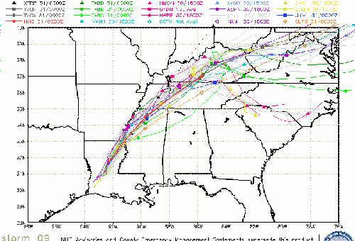
SFWMD Model Plot (Animated Model Plot) SFWMD Hurricane Page
[https://flhurricane.com/floatanimator.php?year=2017&storm=9 Flhurricane Satellite Floater Animation of Harvey
GOES Floater
Animated Model Plot of Harvey
Clark Evans Track Model Plot of Harvey
(Animated!) Model Plots in Google Earth - In Google Maps
Clark Evans Intensity Model Plot of Harvey (Animated!)
Clark Evans Track Plot of Harvey
Other Model Charts from Clark
Clark Evans Top 10 Analog Storms for Harvey
More model runs on from RAL/Jonathan Vigh's page
NRL Info on Harvey -- RAMMB Info
COD Atlantic Satellite View
Potential Tropical Cyclone Ten Event Related Links

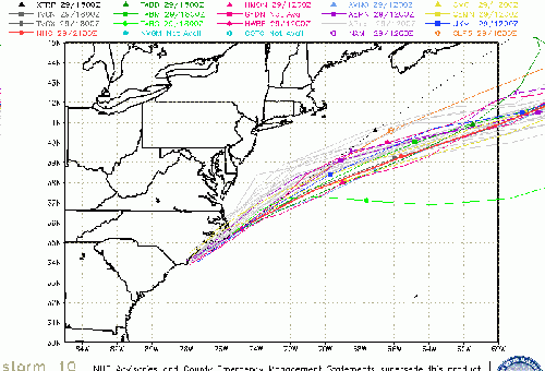
SFWMD Model Plot (Animated Model Plot) SFWMD Hurricane Page
[https://flhurricane.com/floatanimator.php?year=2017&storm=10 Flhurricane Satellite Floater Animation of PTC10
GOES Floater
Animated Model Plot of PTC10
Clark Evans Track Model Plot of PTC10
(Animated!) Model Plots in Google Earth - In Google Maps
Clark Evans Intensity Model Plot of PTC10 (Animated!)
Clark Evans Track Plot of PTC10
Other Model Charts from Clark
Clark Evans Top 10 Analog Storms for PTC10
More model runs on from RAL/Jonathan Vigh's page
NRL Info on PTC10 -- RAMMB Info
COD Atlantic Satellite View
Irma Event Related Links

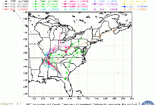
SFWMD Model Plot (Animated Model Plot) SFWMD Hurricane Page
[https://flhurricane.com/floatanimator.php?year=2017&storm=11 Flhurricane Satellite Floater Animation of Irma
GOES Floater
Animated Model Plot of Irma
Clark Evans Track Model Plot of Irma
(Animated!) Model Plots in Google Earth - In Google Maps
Clark Evans Intensity Model Plot of Irma (Animated!)
Clark Evans Track Plot of Irma
Other Model Charts from Clark
Clark Evans Top 10 Analog Storms for Irma
More model runs on from RAL/Jonathan Vigh's page
NRL Info on Irma -- RAMMB Info
COD Atlantic Satellite View
Houston/Galveston Related Links:
Texas Emergency Management
Galveston area Storm Surge Map (pdf)
Webcams:
Surfside Beach Jetty Cam
Octogon View (Surfside Beach, TX)
Matagoria Beach Webcam
North TextVisual WebCam summary Page from HurricaneCity,com
Corpus Christi city Webcams
Media:
Houston Area:
Click2Houston/Local 2
KHOU
Galveston County The Daily News
chron.com
ABC13 KTRK
Houston Press
Corpus Christi:
KRIS NBC 6
KIII TV 3 ABC
MZTV 10 CBS
Corpus Christi Caller Times Paper
Power:
Center Point Energy Power Outages (Houston Area)
AEP Texas Outage map
> - Lake Charles, LA Area Media and Information
kplctv 7 NBC Lake Charles
Fox 29 Lake Charles
American Press Newspaper Lake Charles
Harvey Related flhurricane recordings
Texas Gulf Coast Links
[http://moe.met.fsu.edu/~mnissenbaum/radar.html Mark Nissenbaum's radar page}
East to West:
Houston/Galveston, TX Radar Radar Loop
(Latest Static)
Corpus Christi, TX Radar Radar Loop
(Latest Static)
Brownsville, TX Radar Radar Loop
(Latest Static)
Gulf of Mexico Satellite Imagery
Area Forecast Discussions:
Houston/Galveston, TX
- Corpus Christi, TX - Browsnville/South Padre Island, TX
East Florida Links
Southeast Composite Radar Loop
(Latest Static)
South to North:
Key West, FL Radar Radar Loop
(Latest Static)
Miami, FL Radar Radar Loop
(Latest Static)
Melbourne, FL Radar Radar Loop
(Latest Static)
Jacksonville, FL Radar Radar Loop
(Latest Static)
Caribbean/South East Coast Satellite Imagery
SFWMD Radar Loop of South Florida with storm Track
SFWMD Full Florida Radar Loop with Storm Track
Area Forecast Discussions:
FLorida Keys -
Miami/South Florida -
Melbourne/East Central Florida -
Jacksonville/Northeast Florida -
Mid-Atlantic/Carolina Links
Southeast Composite Radar Loop
(Latest Static)
Charleston, SC Radar Radar Loop
(Latest Static)
Wilmington, NC Radar Radar Loop
(Latest Static)
Morehead City, NC Radar Radar Loop
(Latest Static)
Norfolk/Wakefield, VA Radar Radar Loop
(Latest Static)
Area Forecast Discussions:
Charleston, SC -
Wilmington, NC -
Morehead City, NC -
Norfolk/Virginia Beach/Hampton Roads, VA
Power Outage Maps:
South Carolina Power Outage Map
North Carolina Power Outage Map
Virginia Power Outage Map
North Gulf Links
North Gulf/Southern Mississippi Valley Composite Radar Loop
(Latest Static)
East to West:
Mobile, AL Radar Radar Loop
(Latest Static)
New Orleans, LA Radar Radar Loop
(Latest Static)
Lake Charles, LA Radar Radar Loop
(Latest Static)
Houston/Galveston, TX Radar Radar Loop
(Latest Static)
Gulf of Mexico Satellite Imagery
Area Forecast Discussions:
Mississippi/Alabama/Pensacola -
New Orleans, LA -
Lake Charles, LA -
Houston/Galveston, TX
Edited by MikeC (Wed Aug 30 2017 09:37 AM)
|
Steve C
Verified CFHC User

Reged: Sat
Posts: 17
Loc: Houston TX 77059
|
|
Southeast Houston / Harris County:
It's all about the rain. We had only about 1.5 inches of rain from 10a Sat to 11p Sat. Then we had about 11 inches of rain in the next 3 hours as we were lined up with a northward moving band that moved very slowly to the east. A lot of the bayous in this part of the county are out of their banks and at or just above TS Allison levels. The Clear Lake outlet and the level of Galveston Bay are still fine, so drainage should occur once the band moves east (which basically has at my house; rain is finally intermittent).
Streets here are used to channel rain water and the drain systems are usually sized for about 2-3 inches/hr. The culvert is in front of my house, and water rose as high as about 3 inches above the curb; about halfway between the street and the beginning of the sidewalk. It has already dropped to well below the curb now that the rate of rainfall has dropped to intermittent.
The latest NWS emergency notification stated that water rescues are underway in this part of the county and down toward Galveston and Freeport.
--------------------
Claudette ('79) Danielle ('80) Jeanne ('80) Alicia ('83) Bonnie ('86)
Allison ('89) Chantal ('89) Jerry ('89) Dean ('95) Allison ('01)
Rita ('05) Ike ('08) Harvey ('17) Imelda ('19) Beta ('20) Nicholas ('21)
|
MikeC
Admin
Reged: Sun
Posts: 4543
Loc: Orlando, FL
|
|
Watching reports from Houston and general vicinity come in is crazy, even the KHOU TV newsroom is flooding (they just evactuaded), some 2 story homes are under water, and there's a bit too much to go through. Nothing like it in Houston before, not even the TS allison from years ago comes close.
|
MikeC
Admin
Reged: Sun
Posts: 4543
Loc: Orlando, FL
|
|
Shot of What Brays Bayou looks like normally::

Shot of What Brays Bayou looks like now:

|
M.A.
Weather Guru
Reged: Thu
Posts: 108
Loc: Vero Beach, Fl
|
|
Just looked at the NWS radar estimated rainfall. Seeing a wide swath with 20+ inches of rain. I was thinking of Allison at first. Being that this is still nearly stationary, Allison could be small in comparison. That picture says it all Mike. I would not have believed that was the same place, just an incredible amount of water. It is hard to imaging they are still forecasting upwards of a foot. I heard them say a "once in a hundred years event". I think they might need another zero.
|
Steve C
Verified CFHC User
Reged: Sat
Posts: 17
Loc: Houston TX 77059
|
|
Where we are in SE Houston, Harris Co, Galveston Co, this is worse than TS Allison. We were not in the heaviest path for Allison. This time, based on the last look I got at rain totals, we are in the worst area.
I can't give updated rain totals or bayou levels because the county web site is being blasted, but as of last night around 4:30a, most bayous in my area were about 2-4 ft above top of bank, still slowly rising, but flattening out. There were a couple of places that were 6-8 ft over.
No wind at all, except during the heaviest rain. But there have been a lot of doppler-based tornado warnings including several that we were within. Last night with the last of the squalls, about 4:15a, we had high, swirling winds following a tornado warning in our area.
--------------------
Claudette ('79) Danielle ('80) Jeanne ('80) Alicia ('83) Bonnie ('86)
Allison ('89) Chantal ('89) Jerry ('89) Dean ('95) Allison ('01)
Rita ('05) Ike ('08) Harvey ('17) Imelda ('19) Beta ('20) Nicholas ('21)
|
Steve C
Verified CFHC User
Reged: Sat
Posts: 17
Loc: Houston TX 77059
|
|
Access to Harris County website back.
My hourly rain totals and cumulative total starting Saturday afternoon:
1p-9p ___ 0.00 _ _ 0.00
9p-10p __ 0.12 _ _ 0.12
10p-11p _ 0.44 _ _ 0.56
11p-12a _ 3.44 _ _ 4.00
12a-1a __ 4.52 _ _ 8.52
1a-2a _ _ 2.80 __ 11.32
2a-3a _ _ 0.92 __ 12.24
3a-4a _ _ 1.16 __ 13.40
4a-5a _ _ 1.48 __ 14.88
5a-6a _ _ 0.60 __ 15.48
6a-7a _ _ 0.20 __ 15.68
7a-8a _ _ 0.30 __ 15.98
8a-9a _ _ 0.12 __ 16.10
--------------------
Claudette ('79) Danielle ('80) Jeanne ('80) Alicia ('83) Bonnie ('86)
Allison ('89) Chantal ('89) Jerry ('89) Dean ('95) Allison ('01)
Rita ('05) Ike ('08) Harvey ('17) Imelda ('19) Beta ('20) Nicholas ('21)
|
Littlebit
Weather Watcher

Reged: Fri
Posts: 47
Loc: Plant City, FL
|
|
This is horrible. Watching the coverage around the clock. Stay safe out there.
|
MikeC
Admin
Reged: Sun
Posts: 4543
Loc: Orlando, FL
|
|
Overwhelming amount of reports coming in from southeast texas and Western Louisiana. Harvey is expected to re-emerge into the gulf and hang around a few more days. 92L will likely develop and impact the Carolinas and there is a wave in the East Atlantic we'll need to watch next week also.
|
cieldumort
Moderator
Reged: Mon
Posts: 2305
Loc: Austin, Tx
|
|
24 Hour radar observed rainfall totals out of the NWS Houston site through 10:52 AM CDT this morning are almost beyond comprehension.
Keep in mind that these totals do not include rain that fell before, or has fallen since, and will likely continue falling for several more days to come.

|
MikeC
Admin
Reged: Sun
Posts: 4543
Loc: Orlando, FL
|
|
2PM Up to 70% for 92L, there may be tropical storm watches/warnings up for the NC/SC coastlines later today.
|
Steve C
Verified CFHC User
Reged: Sat
Posts: 17
Loc: Houston TX 77059
|
|
That Bay Area Blvd at Horsepen Bayou sensor is about 2 miles from my house. That's where I got the rainfall numbers I posted above.
Horespen was as much as 3 feet above top of bank last night. Currently about 1 foot below top of bank. Had some guys walk by about an hour ago, out walking the neighborhood. They said Horsepen was running like a mountain river. That's good news, because it suggests there are no significant blockages between us and Galveston Bay.
--------------------
Claudette ('79) Danielle ('80) Jeanne ('80) Alicia ('83) Bonnie ('86)
Allison ('89) Chantal ('89) Jerry ('89) Dean ('95) Allison ('01)
Rita ('05) Ike ('08) Harvey ('17) Imelda ('19) Beta ('20) Nicholas ('21)
|
cieldumort
Moderator
Reged: Mon
Posts: 2305
Loc: Austin, Tx
|
|
Quote:
They said Horsepen was running like a mountain river. That's good news, because it suggests there are no significant blockages between us and Galveston Bay.
That is very good news and hopefully it lasts throughout the event. Thanks for keeping the site posted with local updates from down there and stay safe. The challenge is going to be that this event has unfolded faster, and will likely last longer, and over a far greater area, than Allison ever did. Harvey has already eclipsed Allison.
From WPC:
Quote:
THE AVERAGE RAINFALL WITHIN THE HARRIS COUNTY EMERGENCY MANAGEMENT NETWORK HAS EXCEEDED THAT OF TROPICAL STORM ALLISON (2001) IN ALMOST HALF OF THE TIME (2-3 VERSUS 5 DAYS). HISTORIC FLOODING IS EXPECTED TO CONTINUE IN THE HOUSTON METROPOLITAN AREA THROUGH THE FORESEEABLE FUTURE.
|
MikeC
Admin
Reged: Sun
Posts: 4543
Loc: Orlando, FL
|
|
NHC will be initiating advisories at 5 PM EDT on Potential Tropical Cyclone Ten, located off the southeast U.S. coast.
|
cieldumort
Moderator
Reged: Mon
Posts: 2305
Loc: Austin, Tx
|
|
Harvey and TEN were linked up (literally) from their very inceptions as waves in the far eastern Atlantic. At first, 92L (TEN) was expected to develop, but with Harvey forming first, outflow from Harvey inhibited TEN's potential several times.
Recently both systems have been trapped by very weak steering currents, and have been producing ongoing flooding rains (Harvey's historic) for the past several days.

|
Steve C
Verified CFHC User
Reged: Sat
Posts: 17
Loc: Houston TX 77059
|
|
We had a nice lull in rain Saturday, and Horsepen Bayou at the high school (a sensor on my draining watershed) got a chance to drop below top of bank. But Sunday evening between 10p and 11p we had another really strong 45-60 min squall with a ton of lightning. Hopefully that will be the last bad one for a while.
For those that have been here, Clear Creek and Dickinson Bayou are still over the Gulf Freeway, which is impassible. We've had 24 inches of rain at my house since 10p Friday.
Ft Bend county is going to have a 1:800 year flood of the Brazos River; 59 feet. The 500 yr flood they have experience with is around 54 feet. Bay City is evacuating the entire town as of 1p Monday because they are expecting the Colorado River to fill downtown with 10 ft of flood water.
We feel very fortunate. It is relieving to see that my expectations on drainage for our house has been correct. The biggest issue has been the fear of power loss, because we don’t have a way to get out to, say, Austin and stay with my daughter. Fortunately, we seem to be on a high reliability power supply. There was only a 45 sec blip this time, and we only had blips during Hurricane Ike, whereas my Mom and Dad lost power in a neighboring subdivision—about a mile away—for a week.
--------------------
Claudette ('79) Danielle ('80) Jeanne ('80) Alicia ('83) Bonnie ('86)
Allison ('89) Chantal ('89) Jerry ('89) Dean ('95) Allison ('01)
Rita ('05) Ike ('08) Harvey ('17) Imelda ('19) Beta ('20) Nicholas ('21)
|
M.A.
Weather Guru
Reged: Thu
Posts: 108
Loc: Vero Beach, Fl
|
|
All I can say is WOW. Some one please check the record player cause its stuck! Being through several hurricanes, I can only imagine dealing with it this long. We would have already cleaned up the debris and taken down all the shutters and settling into the hum of our generator. I don't know how the terrain here in Florida would hold up to 50+ inches of rain. I suspect the levee around Okeechobee would be truly tested. Be safe.
|
Steve C
Verified CFHC User
Reged: Sat
Posts: 17
Loc: Houston TX 77059
|
|
Made a run to HEB. They were letting one in when one came out. We were about 5th in line to enter when we got there. By the time we left, the line outside was about 50-60. 😳
We bought veggies and a few cooking ingredient essentials; pasta, olive oil and dijon mustard… We have protiens in the freezer, and we are both cooking hobbyists. So we needed to be sure we had ingredients, not meals. Most people were not buying what appeared to be cooking ingredients. Jars of pasta sauce, peanut butter, snacks and the like.
There were no perishables being sold. Not sure if they had had a power blip or what. Stuff in cases, but not being sold.
Went by Paula’s office and all was well. Were getting about 1/2 inch/hr of rain, and water was stacking up against curbs out into the streets. We had no serious road flooding to ford through, though. Now back home, and rain has picked up.
--------------------
Claudette ('79) Danielle ('80) Jeanne ('80) Alicia ('83) Bonnie ('86)
Allison ('89) Chantal ('89) Jerry ('89) Dean ('95) Allison ('01)
Rita ('05) Ike ('08) Harvey ('17) Imelda ('19) Beta ('20) Nicholas ('21)
|
Bloodstar
Moderator

Reged: Mon
Posts: 462
Loc: Tucson, AZ
|
|
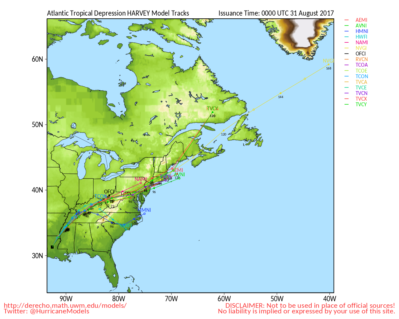
The low level center of Harvey has moved completely offshore but remains devoid of convection. There appears to be some really dry air over the center which is likely keeping any sort redevelopment from occurring. With luck, the dry air will continue to keep Harvey from regenerating a stronger center. Of course that doesn't make things over Texas any less of a disaster. But maybe Harvey won't add insult to injury with intensification.
--------------------
M. S. Earth and Atmospheric Sciences, Georgia Tech - May 2020
Brookhaven National Laboratory
U. Arizona PhD Student
|
MikeC
Admin
Reged: Sun
Posts: 4543
Loc: Orlando, FL
|
|
Tremendous flooding still occuring in Houston and points east, rain from Harvey is even reaching Florida today.
Beaumont and parts of Louisiana are also having tremendous floods. Houston's dams are full and flooding is occurring in places that have never seen flooding in modern times.
Harvey appears to be strengthening again, and moving faster, with an 8mph ne movement now. Radar shows the core trying to get its act together, although it won't have too much time left before it nears the LA coast. This may allow rainfall to build back west a bit to keep the rain going a bit longer in Houston also.
|


 Threaded


