MikeC
Admin
Reged:
Posts: 4544
Loc: Orlando, FL
|
|
3:30 PM EST 22 August 2019 Update
We're now tracking 98L over the Bahamas, with a 30% chance for development. Looks good on satellite today, but hopefully will stay offshore before it develops. Recon may investigate tomorrow.
10:30 PM AST 20 August 2019 Update
Invest 97L rapidly organized throughout the day (and night) while heading east out to sea, and has become the fourth Tropical Cyclone and third named storm of the 2019 Atlantic Hurricane Season. No threat to land for the foreseeable future, if ever.
-Ciel
The 2PM Outlook shows a 20% chance for development in the system in the east Atlantic later this week as it moves toward Hispaniola and later the Bahamas,there is several days to watch as the system develop, which isn't expected until it gets north of the Caribbean islands. This system is being tracked as invest 95L.
It will most likely stay east of Florida, but the forecasting models seem to behind the curve on the current state of this system, so it's wise to monitor it closely. See the forecast lounge for more speculation on this system. The overall pattern suggests any systems that develop in early August will likely curve away from the US.
|
MikeC
Admin
Reged:
Posts: 4544
Loc: Orlando, FL
|
|
Caribbean radar mosaic recording:
http://flhurricane.com/imageanimator.php?455
|
craigm
Storm Tracker

Reged:
Posts: 327
Loc: Palm City, Florida
|
|
Gulfstream IV is sampling eastern Gulf and heading across middle of the State
right now. Helpful Data when or if 95 develops.
--------------------
Why I'm here:
Weather hobbyist
|
craigm
Storm Tracker
Reged:
Posts: 327
Loc: Palm City, Florida
|
|
Convection North of Puerto Rico looking very healthy this morning although the system appears severely tilted to the NE with the broad vorticity center headed off to the southern coast of Hispaniola. Hard to tell, from Satellite if there is any low level spin under the convective blob. Next 24 hours should tell a lot. Shear decreasing closer to the Bahamas.
--------------------
Why I'm here:
Weather hobbyist
|
craigm
Storm Tracker
Reged:
Posts: 327
Loc: Palm City, Florida
|
|
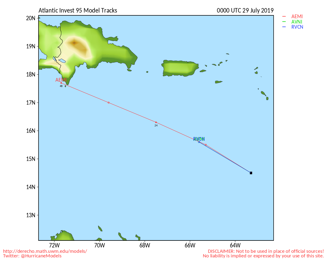
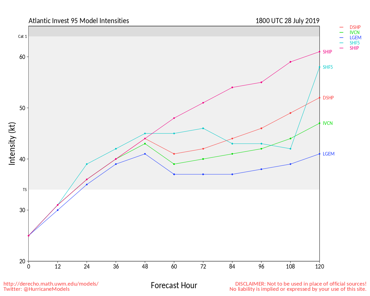
Maybe upgraded at the 2 o'clock. Just pulled this off of South Florida Water Management site: Unless I'm reading this wrong.
Tue Jul 30 11:04:20 EDT 2019
WTNT80 EGRR 300355
MET OFFICE TROPICAL CYCLONE GUIDANCE FOR NORTH-EAST PACIFIC
AND ATLANTIC
GLOBAL MODEL DATA TIME 00UTC 30.07.2019
TROPICAL DEPRESSION 95L ANALYSED POSITION : 13.5N 69.5W
ATCF IDENTIFIER : AL952019
VERIFYING TIME POSITION STRENGTH TENDENCY
-------------- -------- -------- --------
00UTC 30.07.2019 13.5N 69.5W WEAK
12UTC 30.07.2019 BELOW TROPICAL STORM STRENGTH
Looks like I called that one wrong 
--------------------
Why I'm here:
Weather hobbyist
Edited by craigm (Tue Jul 30 2019 05:59 PM)
|
Doombot!
Weather Guru

Reged:
Posts: 160
Loc: Lakeland, Fl.
|
|
Eh. I think sometimes TD is used instead of tropical disturbance.
Hopefully the wave off of Africa will blow. About time for the CV season to kick off.
|
MikeC
Admin
Reged:
Posts: 4544
Loc: Orlando, FL
|
|
set up a recording for the area (A surface trough) Northwest Of Key West. http://flhurricane.com/imageanimator.php?456
|
Doombot!
Weather Guru
Reged:
Posts: 160
Loc: Lakeland, Fl.
|
|
Wow, you made it dissappear! 
|
dolfinatic
Weather Guru
Reged:
Posts: 129
Loc: St. Petersburg, Fl
|
|
www.noaa.gov/media-release/noaa-increases-chance-for-above-normal-hurricane-season NOAA declared El Nino is over. Predicting now that a above normal season for rest of season. 
|
Robert
Weather Analyst

Reged:
Posts: 364
Loc: Southeast, FL
|
|
97L is back up to 40% convection has been firing around a decent circulation, and at times, a small , hope they name it and not let it get away.
|
Robert
Weather Analyst
Reged:
Posts: 364
Loc: Southeast, FL
|
|
000
WTNT34 KNHC 210231
TCPAT4
BULLETIN
Tropical Storm Chantal Advisory Number 1
NWS National Hurricane Center Miami FL AL042019
1100 PM AST Tue Aug 20 2019
...TROPICAL STORM CHANTAL FORMS OVER THE FAR NORTH ATLANTIC...
SUMMARY OF 1100 PM AST...0300 UTC...INFORMATION
-----------------------------------------------
LOCATION...40.2N 56.2W
ABOUT 485 MI...780 KM SE OF HALIFAX NOVA SCOTIA
ABOUT 475 MI...765 KM SSW OF CAPE RACE NEWFOUNDLAND
MAXIMUM SUSTAINED WINDS...40 MPH...65 KM/H
PRESENT MOVEMENT...E OR 85 DEGREES AT 22 MPH...35 KM/H
MINIMUM CENTRAL PRESSURE...1010 MB...29.83 INCHES
WATCHES AND WARNINGS
--------------------
There are no coastal watches or warnings in effect.
DISCUSSION AND OUTLOOK
----------------------
At 1100 PM AST (0300 UTC), the center of newly formed Tropical Storm
Chantal was located near latitude 40.2 North, longitude 56.2 West.
Chantal is moving toward the east near 22 mph (35 km/h) and this
general motion with a gradual decrease in forward speed is expected
through Friday.
Maximum sustained winds are near 40 mph (65 km/h) with higher gusts.
Little change in strength is forecast during the next 48 hours.
Tropical-storm-force winds extend outward up to 45 miles (75 km),
mainly south of the center.
The estimated minimum central pressure is 1010 mb (29.83 inches).
HAZARDS AFFECTING LAND
----------------------
None.
NEXT ADVISORY
-------------
Next complete advisory at 500 AM AST.
$$
Forecaster Stewart
|
Robert
Weather Analyst
Reged:
Posts: 364
Loc: Southeast, FL
|
|
ZCZC MIATWOAT ALL
TTAA00 KNHC DDHHMM
Tropical Weather Outlook
NWS National Hurricane Center Miami FL
200 PM EDT Wed Aug 21 2019
For the North Atlantic...Caribbean Sea and the Gulf of Mexico:
The National Hurricane Center is issuing advisories on Tropical
Storm Chantal, located several hundred miles east-southeast of
Halifax, Nova Scotia.
1. An area of disturbed weather extends over the Central and Northwest
Bahamas and the adjacent waters. Some slow development of this
system is possible over the next several days as it moves toward the
Florida peninsula and then the southeastern United States.
* Formation chance through 48 hours...low...near 0 percent.
* Formation chance through 5 days...low...20 percent.
Public Advisories on Tropical Storm Chantal are issued under WMO
header WTNT34 KNHC and under AWIPS header MIATCPAT4.
Forecast/Advisories on Tropical Storm Chantal are issued under WMO
header WTNT24 KNHC and under AWIPS header MIATCMAT4.
Forecaster Latto/Pasch
|
MikeC
Admin
Reged:
Posts: 4544
Loc: Orlando, FL
|
|
Added radar recording for 98L at https://flhurricane.com/imageanimator.php?458
|
Robert
Weather Analyst
Reged:
Posts: 364
Loc: Southeast, FL
|
|
thanks Mike
|
MikeC
Admin
Reged:
Posts: 4544
Loc: Orlando, FL
|
|
Slider satellite https://rammb-slider.cira.colostate.edu/...768.89990234375
And the 5-minute rapid Mesoscale Variant https://rammb-slider.cira.colostate.edu/...1000&y=1000
|
Robert
Weather Analyst
Reged:
Posts: 364
Loc: Southeast, FL
|
|
The radar recording of the bahamas low, over florida, is cool, i have not watched time lapse of embryo cyclone under shear as it moves along on radar, and near florida. I have watched them on satellite, and looked at radar from NWS and watched time lapse of stronger better put together systems. Set speed to max.
Edited by Robert (Fri Aug 23 2019 05:19 PM)
|
Robert
Weather Analyst
Reged:
Posts: 364
Loc: Southeast, FL
|
|
how about a recording for The system going in near Texas, Louisiana ?? The Yucatan low.
|
Robert
Weather Analyst
Reged:
Posts: 364
Loc: Southeast, FL
|
|
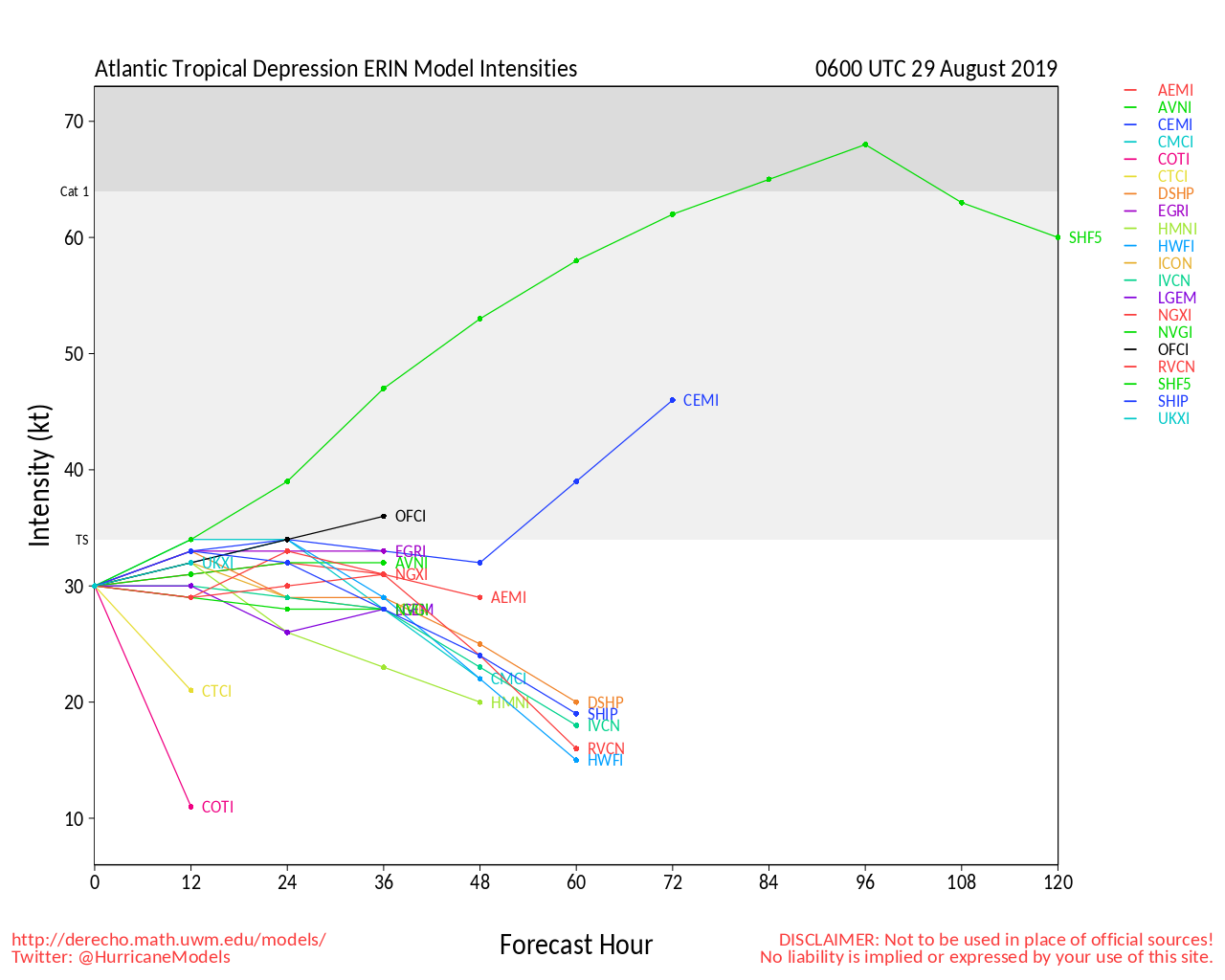
I think the attached photo may be famous soon.
|


 Threaded


