-Ciel
4:30AM EDT Update 27 September 2022 Update
Hurricane Ian has made its first landfall: in the Pinar Del Rio Pr of Cuba at 4:30 AM EDT, at just below Cat 4, with an estimated 125 MPH max sustained winds and a minimum central pressure of 952mb.
-Ciel
2:30AM EDT Update 27 September 2022 Update
Ian has become the second Major Hurricane of the 2022 Atlantic Hurricane Season while on approach to landfall along western Cuba, and has been continuing to intensify heading into this landfall.
The western portion of Cuba is relatively flat without tall mountains seen in the middle of the island and weakening, if any, is likely to be brief as the cyclone tracks over what may amount to not much more than a bump in the road. Additional intensification or re-intensifcation is expected in the southeastern Gulf of Mexico.
-Ciel
1AM EDT Update 27 September 2022 Update
Two factors that are increasing the odds of a worse or worst case scenario for those living along the west coast of Florida have been coming into focus for the past 24 hours. Increasingly, models see a deeper trof approaching the east coast while Ian continues to rapidly strengthen and will likely soon become a Major Hurricane, if not already there as I write this.
This sets off all sorts of alarm bells for Emergency Managers and forecasters: a more intense, sizeable hurricane hooking right sooner rather than later with less time to weaken, and possibly even additional favorable atmospheric conditions heading up to or even into landfall.
To make matters even more dangerous, Ian may have window of slow to very slow forward motion, potentially raking vulnerable coast with otherwordly wind and storm surge, for hours on end, and dumping equator-like torrential rains over the same locations and points inland, for hours on end.
While we avoid hype here, there is no sugar coating that at this time it is with high confidence that those living along the west coast from the Keys to the Big Bend should be preparing as fast as possible for the worst while hoping for the best, as track is likely to continue to be in flux, but wherever Ian goes at this point, it is more likely than not to end up being horrible, more horrible, or most horrible. And this is not limited to those right along the coast where record storm surge is a real possibility. Those inland along the cyclone's track can expect damaging wind gusts, long-duration power outages, and the potential for up to feet or even several feet of rain with attendant potentially life-threatening inland flooding. Tropical waterspouts and tornadoes, also.
For in-depth model analysis and a place for more speculative discussions, join us in the Ian Forecast Lounge
-Ciel
5PM EDT Update 26 September 2022 Update
Hurricane ian is now a category 2 hurricane and forecast to be a major hurricane when it nears Tampa Wednesday afternoon. The track landfall takes place near Crystal River, but the eastern eyewall rakes Tampa bay and points north. Which is a very dangerous surge situation. If you live in an evacuation zone in the western counties, please take their advice. This is an extremely dangerous situation there.
The Tropical Storm Watch has been upgraded to a Tropical Storm
Warning from Englewood southward to Flamingo. A Hurricane Watch has
been issued from Bonita Beach to Englewood.
The Hurricane Watch from Englewood to the Anclote River, including
Tampa Bay, has been upgraded to a Hurricane Warning. A Hurricane
Watch has been issued from the Anclote River to the Suwannee River.
A Tropical Storm Watch has been issued from the Suwannee River to
Indian Pass, and on the eatst coast of Florida from Jupiter Inlet to Altamaha Sound.
Please stay in touch with local officials and media for the best information for your area. We at flhurricane are affected too and updates may be less frequent.
Original Update
Ian is now a hurricane, and Hurricane Watches are now up for the West coast of Florida from Englewood north to the Anclote River, Including all of the Tampa Bay area.
Ian in an environment that should allow it to rapidly become a major hurricane and move over the Western portion of Cuba, which may disrupt it some, but won't be over it long, so the forecast is it to be a major Hurricane very near offshore Tampa. Slight deviations right would bring it onshore of West Central Florida. It will be near enough to cause some surge issues in parts of the West coast, and close enough that any right deviation would send the eye onshore, so evacuations of certain areas along the west coast are likely today. Please consult local media and officials for the latest information there.
Ian Event Related Links
SFWMD Model Plot (Animated Model Plot) SFWMD Hurricane Page
[https://flhurricane.com/floatanimator.php?year=2022&storm=9 Flhurricane Satellite Floater Animation of Ian
GOES Floater
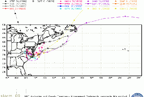
Animated Model Plot of Ian
Clark Evans Track Model Plot of Ian
(Animated!) Model Plots in Google Earth - In Google Maps
Clark Evans Intensity Model Plot of Ian (Animated!)
Clark Evans Track Plot of Ian
Other Model Charts from Clark
Clark Evans Top 10 Analog Storms for Ian
More model runs on from RAL/Jonathan Vigh's page
NRL Info on Ian -- RAMMB Info
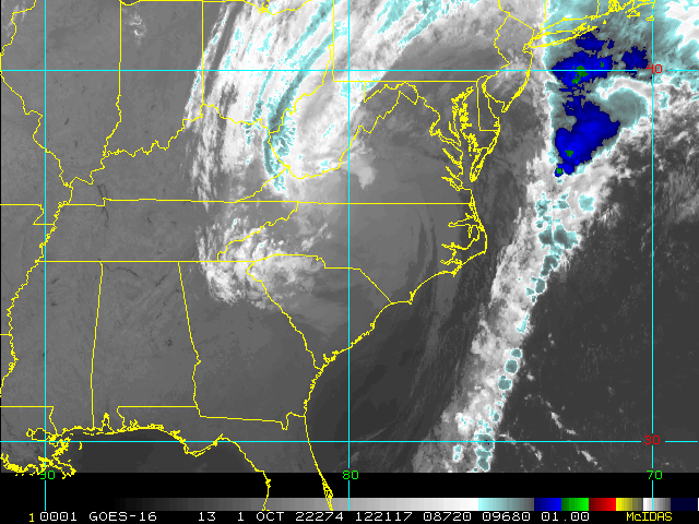
COD Atlantic Satellite View
Florida Emergency Management
Tampa Area Media:
Bay News 9
WFLA News 8 (NBC)
Bay Action News (ABC)
WTSP Channel 10 (CBS)
My Fox Tampa Bay
WWSB ABC 7 Sarasota
Tampa Bay Times
Tampa Bay Online
Sarasota Herald Tribune
970 WFLA Tampa News/Talk Radio
Southwest Florida (Naples/Ft.Myers) Area Media:
WINK News 11 Fort Myers CBS
WBBH NBC 2 Fort Myers NBC
ABC 7 Naples ABC
FOX 4 Florida Cape Coral FOX
WFSX Fox 92.5 News Radio
WCCF News Radio 1580 Port Charlotte
News Press
Naples Daily News
News Media (South Florida):
Television:
Newspapers:
News Radio:
Check local media and officials when a storm is approaching your area.
Northeast Gulf Links
Southeast Composite Radar Loop
(Latest Static)
Tampa Bay, FL Radar Radar Loop
(Latest Static)
Key West, FL Radar Radar Loop
(Latest Static)
Mobile, AL Radar Radar Loop
(Latest Static)
Tallahassee FL Radar Radar Loop
(Latest Static)
Northwest Florida Radar Radar Loop
(Latest Static)
Gulf of Mexico Satellite Imagery
SFWMD Full Florida Radar (Includes east LA, MS,AL) Loop with Storm Track
Area Forecast Discussions:
New Orleans -
Mississippi/Alabama/Pensacola -
Panhandle/Tallahassee -
Tampa/West Central Florida
News Media (East Central Florida):
Television:
Newspapers:
News Radio:
Check local media and officials when a storm is approaching your area.
Florida Power Outage Maps
Duke Energy Florida Outage Map - Most of Central and Northern Florida
Florida Power and Light Outage Map (Much of South Florida)
Orlando Utilities Commision Outage Map
Tampa Electric Outage Map
JEA (Jacksonville) Outage Map
Gulf Power (Western Panhandle)
Clay Electric Outage Map (Gainsville/ North Central Florida area)
Lakeland Electric Outage Map
Peace River Electrical Cooperative outage map south Central Florida from east of Bradenton, north of North Port to West of Palm Bay and Vero Beach
Edited by cieldumort (Tue Sep 27 2022 03:02 PM)


 Threaded


