CFHC Talkback For News Story #47:
Newest Talkback: 06:30 AM 07-01 EDT

Droughtbusters!
09:47 AM EDT - 26 June 2001

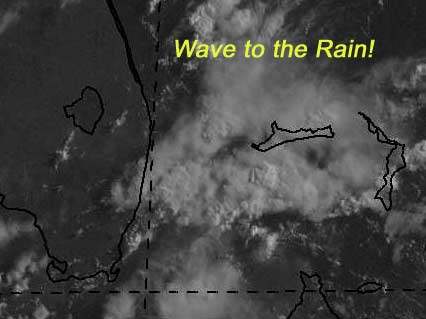
There is a tropical wave approaching south Florida now that will give us more much needed rain, and hopefully less lightning. It will start in south Florida and move northward, hopefully giving us a good soaking. We are still at drought levels despite all the afternoon storms. The storms have been lightning intense also.

My development potential scale for the wave approaching florida:

(forget it) 0 1 2 3 4 5 6 7 8 9 10 (sure thing)
           [-*--------------------]


The wave in the Caribbean is still there, but I doubt it will survive much longer.

My development potential scale for the wave in the Caribbean now:

(forget it) 0 1 2 3 4 5 6 7 8 9 10 (sure thing)
           [--*-------------------]


Let's all wave to our friends the droughbusters.


NASA GHCC Interactive Satellite images at:
[NAtl visible] (visible -- Daytime Only) [NAtl infrared] (infrared), and [NAtl water vapor] (water vapor)--Nasa source.
Defiant Visible Infrared More...
Some Forecast models: (NGM, AVN, MRF, ECMWF, ETA)
DoD weather models (NOGAPS, AVN, MRF)
AVN, ECMWF, GFDL, NOGAPS, UKMET

- [mac]


Show All Comments | Show Next 5 Comments

Displaying Talkbacks #1 - #5 (of 26 total)

TAKE A LOOK (#1)
Posted by: NICK Location: ORLANDO FL
Posted On 01:30PM 27-Jun-2001 with id (RPUNQXXNQYXNQUQ*)


LOOKS LIKE THE SYSTEM IN THE BAHAMAS IS TRYING TO BECOME MORE THAN A WAVE / STORMS ARE BLOWING UP IN A CIRCLE PATTERN / WINDS IN ORLANDO ARE COMING IN FROM THE EAST RIGHT NOW, IF NOTHING OTHER THAN A WAVE , THE RAIN WILL BE GREAT

Bahamas (#2)
Posted by:
Colleen Location: Lakeland, FL
Posted On 01:41PM 27-Jun-2001 with id (QURNQVSNQYTNRPX*)


I agree, Nick...even the NHC is monitoring this system. It hasn't moved all that much. Look up in the sky...do you see the milky white clouds? That reminds me of any other wave/system that has come knocking at our door. We'll have to watch this one carefully.

And yes...if it turn out to be nothing more than a wave..THANKS FOR THE RAIN!!! :-)

Colleen

bahamas (#3)
Posted by:
gary Location: jacksonville
Posted On 02:17PM 27-Jun-2001 with id (RPUNQURNVUNR*)


if you look at the infrared and the water vapor it looks like it is trying to build up into something. Does anyone else think that? Remember I am new so, I need the extra guidance if I am indeed wrong. Thanks: Gary

It's Possible, Gary (#4)
Posted by:
Colleen Location: Lakeland, FL
Posted On 02:45PM 27-Jun-2001 with id (RPUNQXXNRPPNQXR*)


It is possible that it could turn into something more than a wave. However, I am not an expert either, and I wouldn't try to give a percentage at what chance I think it would have at developing. Just remember...TWD at 2:05pm was (and always is) based on the satellite pictures from 12:00 UTC. They just described this as a "mid-level" circulation or low. The fact that it hasn't moved much is a concern, and although the pressures haven't dropped much (according to TWO at 11:30am), that doesn't mean they won't. It is definitely something to keep your eye on, because if it DOES develop...it could be something we are not expecting. Remember the Gulf Stream is not all that far away...
Hope that helps...Colleen :-)

E FL Coast (#5)
Posted by:
Rich Byett (http://www.stormwarn2000.com) Location: Gloucester, England, UK
Posted On 04:21PM 27-Jun-2001 with id (RQSNQRRNVVNRTW*)


Well i agree with you also. The 'wave' is accompanied by a mid level low, but the latest sat pics indicate increasing convection in association with this 'wave'. Will be interestingh to see what the NHC's 5.30pm TWO says shortly. Keep on eye on this area!

Rich

convection (#6)
Posted by: solar
Posted On 04:21PM 27-Jun-2001 with id (QURNQVSNRPWNTW*)


I don't what I'm really talking about but what is that large area of convection in the western Gulf? Is this anything at all?


Show All Comments | Show Next 5 Comments


Return to Central Florida Hurricane Center Main Page