MikeC
Admin
Reged:
Posts: 4544
Loc: Orlando, FL
|
|
7:30AM Update 21 September 2010
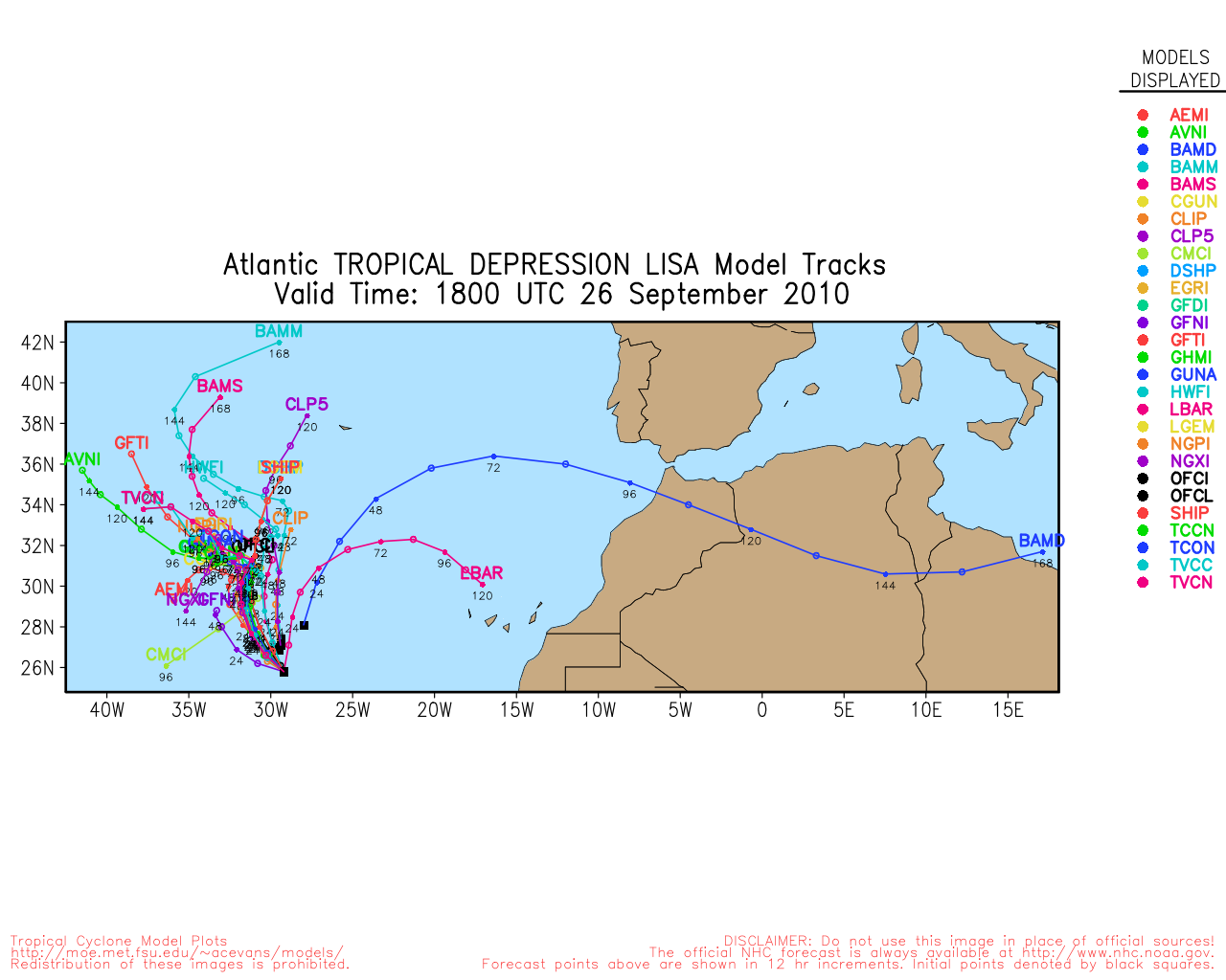
Tropical Depression #14 was upgraded to Tropical Storm Lisa this morning, and is expected to stay that way for the next 4 or so days as it slowly moves around in the East Atlantic. This system likely will be no threat to land.

Another area, not marked as an invest, is worth watching as several long range models (GFS, EMCWF) are trending toward the possibility of a Gulf coast US impact. As it has not formed yet, it's just a general watch area, but it has a good chance to develop later in the week or weekend.
Those in Honduras and Nicaragua will want to watch this system closely.
The odds currently slightly favor it turning more northward into the gulf, and being a possible impact somewhere along the central and eastern half of the gulf, but confidence is only about 60%. It's the first Caribbean developing system of the year that the odds favored that vs going more westerly into the Yucatan (Which is also still a possibility with this). So this area will probably be the story for the next week or two.
Still, as of now it hasn't formed, and until then, just be aware of it and watch the trends.
10:45PM Update 20 September 2010
Tropical Depression 14 forms from 94L in the far eastern Atlantic, the official forecast takes it to tropical storm strength, but not beyound. It is already moving north and likely to stay far out to sea.
Tropical Storm Warnings are up in Newfoundland as Igor will come close enough to bring Tropical Storm Force Winds.
Julia has dissipated, and is no longer being tracked.
Nothing else is likely to form until perhaps the weekend. The area currently over the eastern Caribbean is this next likely spot to watch over the rest of the week.
Original Update
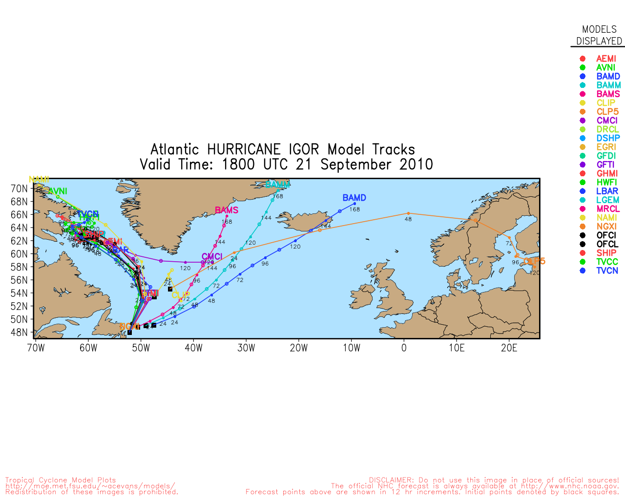
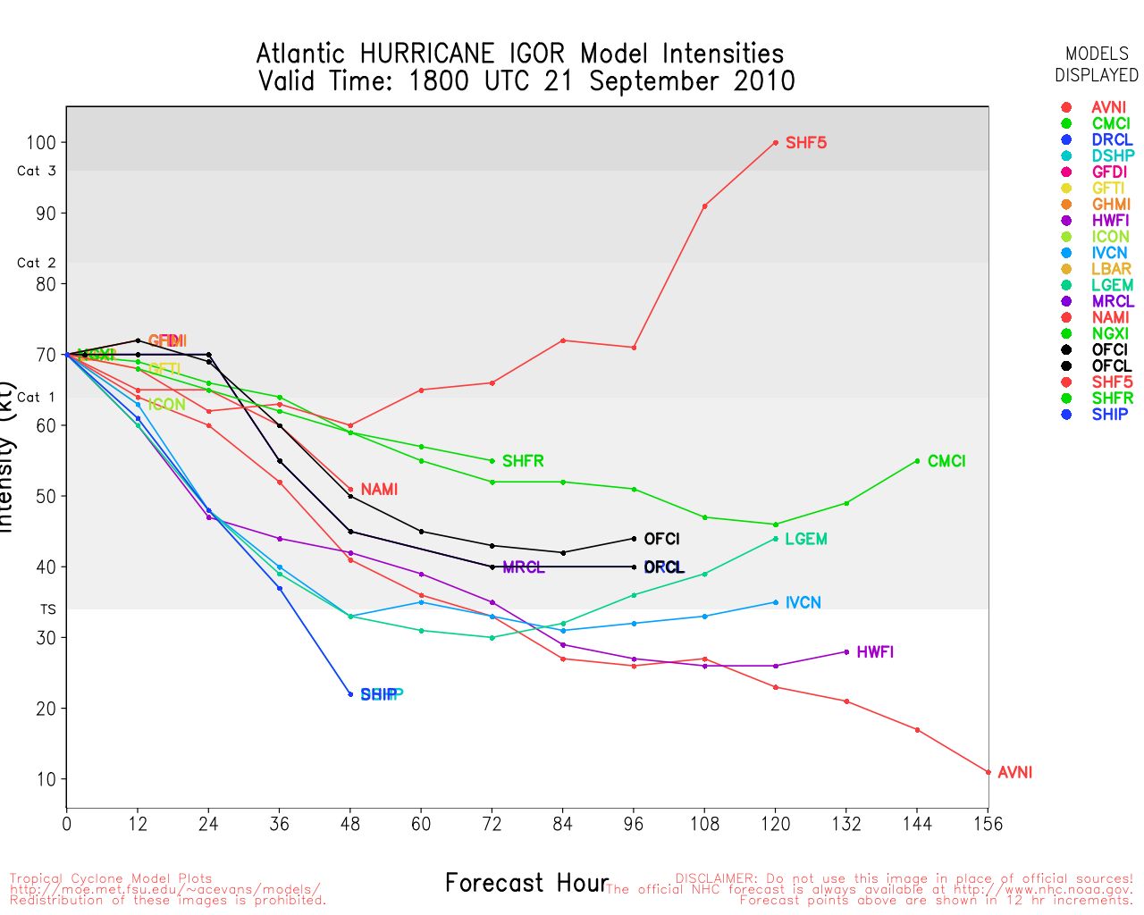
Hurricane Igor moved roughly 70 miles west of Bermuda, sparing the absolute worst, but still causing a great deal of coastal flooding, and a lot of power outages and downed trees across Bermuda. The full extent won't be know until later today.
Igor is now headed for a close approach to Newfoundland in Canada, it should increase winds along the coast there, but avoid a direct landfall. It should weaken down to Tropical Storm strength today, and head to tomorrow.
Julia continues to weaken, and probably will be gone by tomorrow night.
The area in the east Atlantic (94L) has a good chance to develop today, and has a shot to become a hurricane, but should recurve well before any land.
Any other development probably won't happen until late in the week into next week, and the Caribbean is the most likely spot for that.
There will be a short break of no storm threats to land, but October has a larger than normal chance for activity closer to home than usual this year.
Bermuda Radar Recording of Igor Approach (flhurricane)
Mark Sudduth over at hurricanetrack has a video stream from Bermuda
Another live stream from Bermuda
A new wave, in the far eastern Atlantic has been designated 94L and likely will stay out to sea.
|
MikeC
Admin
Reged:
Posts: 4544
Loc: Orlando, FL
|
|
The area in the East Caribbean is now 95L. Bam set is more westward, but the other models such as , , and the Euro are more north. Odds slightly favor more northerly toward the end. Development is still more likely toward the end of the week or weekend, though. See the Lounge for more Model talk:
If you want to talk long range models, please use the Forecast Lounge for 95L.
|
Joeyfl
Weather Guru

Reged:
Posts: 133
Loc: St.Pete,FL
|
|
Yeah I discussed this in the forecast lounge a few days ago as the and others have shown this for about a week now with respect to 95l. They continue to differ in strength from run to run and where it will exactly go as it has not yet got it together quite yet. But would closely watch this especially northwest Caribbean, central, and east Gulf coast as current forecasts from reliable long range models show deep trough developing in the eastern U.S. Its interesting to note as well that early runs of strength from the models show a major hurricane in 4-5 days.
|
Jasonch
Weather Watcher
Reged:
Posts: 42
Loc: Texas
|
|
Could the caribbean storm be a threat for texas down the road.
|
WesnWylie
Weather Guru
Reged:
Posts: 155
Loc:
|
|
Quote:
Could the caribbean storm be a threat for texas down the road.
Only if the trough in the Midwest and eastern states does not drag it to the north late in the period as currently expected. At this time, I think it is mainly a threat for the northern and eastern gulf coasts.
--------------------
2011 Season Forecast: 16/09/04
2011 Systems: 10/01/01
|
Owlguin
Weather Hobbyist
Reged:
Posts: 68
|
|
95L upgraded to Orange and 50%. Models seem to be pointing toward Florida west coast or panhandle. Some bring it into Central America first.
|
DestinFisherman
Registered User
Reged:
Posts: 4
Loc: Destin, FL
|
|
Very interesting comment about the heat content in the Caribbean from Dr. Jeff Masters. . .check it out http://www.wunderground.com/blog/JeffMasters/comment.html?entrynum=1627
Edited by DestinFisherman (Tue Sep 21 2010 08:00 PM)
|
Troy C
Verified CFHC User
Reged:
Posts: 15
Loc: Satellite beach, FL
|
|
Fixed the above link
Edited by Troy C (Tue Sep 21 2010 07:19 PM)
|
scottsvb
Weather Master
Reged:
Posts: 1184
Loc: fl
|
|
Don't go on models past 3 days, lets see first if this makes landfall in the near term.
|
Edski
Verified CFHC User

Reged:
Posts: 18
Loc: Palm Harbor, Florida, USA
|
|
Hi - been lurking since a little before the season started...did graduate met studies a looong time ago, and basically have been following things boot-strap since I moved to the Tampa Bay area 14 years ago.
So I won't say much...
Invest 95L makes me take a little more notice though. Most of the time I get that "feeling" it's nothing. But I'll watch this one closely. And it doesn't hurt to watch things closely, does it? And frequently when one watches things closely, one learns a little bit.
So I will try to learn... 
|
MikeC
Admin
Reged:
Posts: 4544
Loc: Orlando, FL
|
|
Long range Model discussion belongs in the lounge, especially for a system that hasn't formed. However, this wave may be difficult to track and west or north is still a toss up. With a slight edge to north. But even that and especially beyond that is a bit much to say right now. This one is worth watching into the weekend for now.
|


 Threaded


