10PM EDT 29 June Update
Just as soon as we said goodbye to Invest 96L that went on to become a soaking Tropical Storm Danny while over portions of southern SC, and then into Georgia and points west, we say hello to Invest 97L.
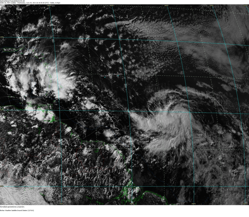
As 97L is getting its act together way out in the Main Development Region (MDR) of the Tropical Atlantic, there will not be the urgency of a PTC "Potential Tropical Cyclone" Watch/Warning feature as we tend to see when systems are likely to develop within 48 hours of impacting land. However, as of this update, the Invest otherwise has two feet firmly planted in the potential TC bin, and it would not surprise to see it go on to become yet another named storm sooner rather than later, and it could become a long-track TC.
The next name on the list of the 2021 Atlantic Hurricane Season is Elsa.
Ciel
7PM EDT 27 June Update
Invest 96L located about 425 or so miles east-southeast of the Georgia-South Carolina border as of this update, has been on the cusp of being classifable as a TD during the afternoon, and has a decent shot of being upgraded as early as later tonight, with perhaps even better odds tomorrow when the low travels across the warm Gulf Stream.
Interests offshore, along the coasts of, and inland of Georgia and South Carolina may want to being taking some precautions for a land-falling wet and blustery depression or storm early in the new week.
Ciel
Original Entry
The strong wave in the far east Atlantic has a 40% chance to develop over the next 5 days with the highest chance for development in the short term in about 2-4 days. Past that windshear increases which would make it much less likely, at least until it crosses the Atlantic, it's still fairly early in the hurricane season. It's unlikely to do much beyond this even further out, but it is still something to watch.
Since convection improved quite a bit with it overnight, it was enough to get this tagged as Invest area 95L. So the best chance for development is in the next 4 days before it hits the shear mentioned above.
The other wave just east of the Caribbean continues to decrease chances for development, hovering around 10%. Not much is expected here other than rain in the Islands.
The system in the far east Atlantic is now being tracked as Invest 95L.


 Threaded


