| metwannabe |
| (Weather Hobbyist) |
| Thu Sep 04 2008 06:32 PM |

|
|
|
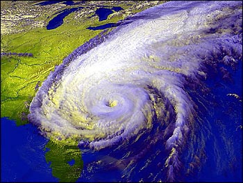
I do not want to write off Hanna just yet. Let's face it, in most years TC's would have dissapated by now in this hostile enviroment and yet she continues to be able to fire off convection. And this statement in the NHC discusion catches my attention...
THE RECONNAISSANCE AIRCRAFT INVESTIGATING HANNA IS FINDING THE
CIRCULATION CENTER AT 850 MB DISPLACED TO THE NORTHWEST OF THE MEAN
CENTER OF ROTATION APPARENT IN THE LOW CLOUD LINES. THERE ARE ALSO
MULTIPLE SWIRLS...BUT IT DOES APPEAR THAT THE LOW-LEVEL CENTER HAS
JUMPED A LITTLE BIT TO THE WEST IN RESPONSE TO THE CONVECTIVE
ASYMMETRY.
Does this mean that the LLC is trying one last time to re-locate under the deep convection? And if so this would mean a slight westward shift in track and I would guess that if convection could maintain there is the warm waters of the gulf stream ahead, there could be a small window of possible strenghtening.
Also something not being mentioned much by NHC or local mets is that the speed of Hanna would bring strong tropical storm force winds well inland and far up the coast line. Projections are for 60 mph winds around NC/VA border several hundred miles from landfall, some cat 2 or 3 hurricanes do not bring much more wind then this inland because they are not moving as fast. Just some thoughts and some things for NC/VA, and others in her path, to keep an eye on.