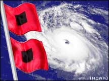
It looks as though we could have Issac rather soon dvorak numbers are 2.0 TAFB and SAB. Satellite presentation looks to be improving some as it moves west at a good clip impacting the islands late tonight and early tomorrow morning. Future track reasoning has changed little since yesterday, agree with NHC track up to this point with their track following closely to GFS which has been rather consistent to this point. Their experimental track through day 7 has this following GFS right up the spine of Florida. I don't think theres any question that there will be a weakness however does it turn up through the western Bahamas, over Florida, or slightly further west (eastern Gulf) is to early to tell. For now I like GFS, of note GFS ensemble members are little more east then yesterday but flip/floping that far out is likely and would expect and much higher confidence in track by end of the work week. I would be on alert in Southern U.S from eastern Gulf to South Carolina.
|
