| Robert |
| (Weather Analyst) |
| Sun Aug 20 2017 03:09 AM |

|
|
|
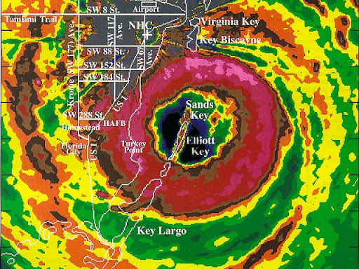
All good info, love the pic of Andrew, not many around from then, even so that picture shows a more robust system with system in carribean barely a wave, not saying this wont move a abit wind but when i expect a category five i like to a see a definitive storm hitting bad shear and coming through the other side north of purto rico.
How ever i noticed some long range out put like cmc, navg gem, gfs, showing a stall and then caught and pullled out before being blocked and possibly heading north north west toward new enlgland, or newfoundland.
Also harvey is suffering, the major that was supposed to be going off in the gulf same day 92L comes ashore, i just dont see both ocupying the same space.
Also apears a trough over the south east may prevent 92L from getting into the gulf, so rain tuesday with northeast winds 20-30knts, maybe gusts to 35knts.
Wednesday southwest or west depending where you are.
Then it pulls out Wednesday night and deepens gets trapped turns north and threatening land north.