| cieldumort |
| (Moderator) |
| Fri Aug 26 2022 06:41 PM |

|
|
|
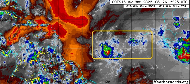
A vigorous and convectively active portion of a broad low pressure with a few embedded smaller-scale vorticity maximas out in the Tropical Atlantic Main Development Region (MDR) has increasing model support, now including both of the primary Globals (GFS and ECMWF) for development, and as such we are starting a Lounge on this feature at this time.
For clarification, as mentioned above and highlighted in the image, this feature actually includes more than one potential center - even more than one potential TD in the making. NHC sort of blends both the two main 'centers' together for tracking, as it does seem likely that one will become dominant, and perhaps also the sole feature.
An Invest number has not yet been issued, but if current trends continue, one could be up as early as this weekend.
More details to come.
The complex area of low pressure we have been tracking has consolidated enough for an Invest tag tonight and is now being tracked as Invest 91L. 8/27/22. Tropical Storm Earl 9/2/22 -Ciel