| cieldumort |
| (Moderator) |
| Sat Aug 27 2022 01:50 AM |

|
|
|
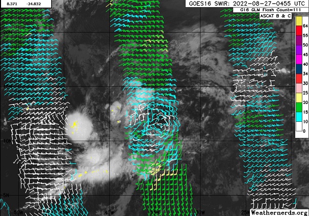
The broad area of low pressure NHC has been tracking continues to consolidate, with a somewhat well defined primary surface low center now presenting itself as can be seen in the above image courtesy Weathernerds.org, and we could see an Invest tag with higher resolution model runs soon.
The apparent primary low is at the moment benefiting from enhanced humidity and instability associated with a convectively active phase of the MJO that is pulling away to the east, and as it continues to do so, consolidation will probably continue as the outer reaches of the broad low begin to evaporate in the unseasonably hostile and dry tropical Atlantic. The big question then, is does whatever remain even survive long enough to become a T.C., and secondly, if so, while in the MDR, or perhaps pops closer to land?
As for the models, most including the Euro seem to develop this one, while the GFS has suddenly backed off.