| cieldumort |
| (Moderator) |
| Mon Sep 19 2022 08:50 PM |

|
|
|

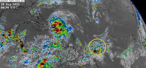
A stout wave presently located several hundred miles east of the Windward Islands is showing signs of sharpening, and based on modeling, will soon be encountering a more favorable region for development, and possibly a much more favorable region for development by week's end. This feature is not yet Invest tagged, but very well may be within the next day or two.
With this being peak season and the western Atlantic closer to land fairly primed for additional development, we are now starting a Forecast Lounge on this wave.
This will likely be given the Invest tag 98 later today or Wednesday. Overnight convection is flaring up well with continued sharpening of the axis.
(Invest 98L as of 9/20 12z) - Ciel
Invest 98L became a tropical depression overnight Sep 22nd and the title has been updated accordingly. Ian at 11PM EDT 9/23- Ciel