| cieldumort |
| (Moderator) |
| Fri Sep 23 2022 02:38 PM |

|
|
|
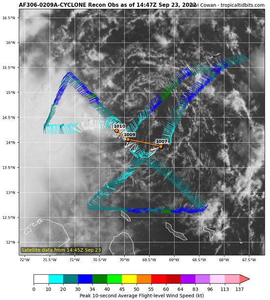
TD9 is not winning the prettiest tropical depression award today. Persistently high northeasterly shear from Fiona's outflow continues to batter the barely-a-td today.
Unfortunately, this is not likely to last much beyond another day or two at most. By the time NINE reaches the western to northwestern Caribbean, shear could go from horribly hostile (present) to phenomenally favorable, just as the cyclone reaches some of the warmest and deeply warmest waters of the entire Atlantic basin for the entire stretch of this season.
There is yet a slim chance that NINE remains so impacted by the shear that it is not able to avail itself of the above mentioned stellar development environment as well and/or quickly as forecast. A slower ramp-up could make it less likely to recurve into the Florida peninsula. For now, modelling and indeed the official NHC forecast do not expect that outcome, keeping the entire state of Florida in the cyclone's path.