Quote:

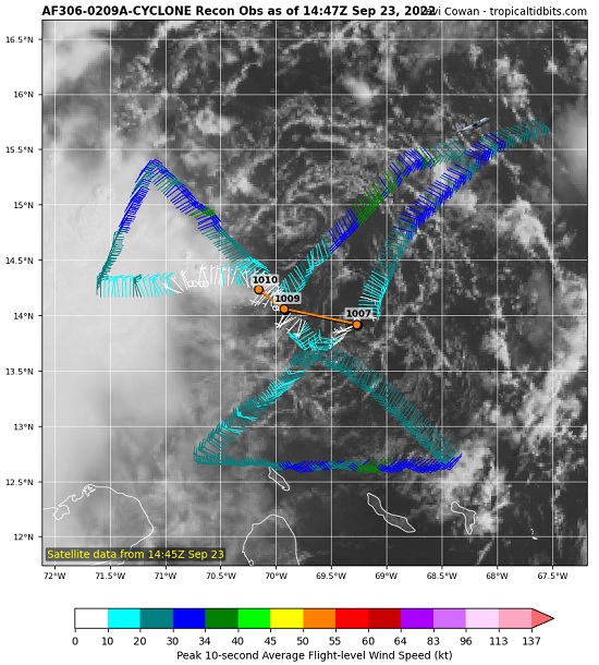
TD9 is not winning the prettiest tropical depression award today. Persistently high northeasterly shear from Fiona's outflow continues to batter the barely-a-td today.
Unfortunately, this is not likely to last much beyond another day or two at most. By the time NINE reaches the western to northwestern Caribbean, shear could go from horribly hostile (present) to phenomenally favorable, just as the cyclone reaches some of the warmest and deeply warmest waters of the entire Atlantic basin for the entire stretch of this season.
There is yet a slim chance that NINE remains so impacted by the shear that it is not able to avail itself of the above mentioned stellar development environment as well and/or quickly as forecast. A slower ramp-up could make it less likely to recurve into the Florida peninsula. For now, modelling and indeed the official NHC forecast do not expect that outcome, keeping the entire state of Florida in the cyclone's path.
A weaker (Cat 1/2) Ian, further west and a bit slower, based on last GFS suggesting the frontal trough will influence but not eject a rapidly intensifying hurricane NE across the peninsula (ala Wilma). A brief slowing, or even stall, over the east/central GOMEX off Tampa Bay allowing SE/S tropical surge to dumping 8-12" will be an issue for many saturated parts of central Florida but isn't an issue for my east central Florida location running a wet season deficit of nearly 7" I'll take a good soaking as long as the feeder spin ups are limited.
|

